The best MTB trails around Navarredonda De La Rinconada
5.0
(9)
264
riders
39
rides
Mountain bike trails around Navarredonda De La Rinconada are set within the Sierra de Francia and Sierra de las Quilamas mountain ranges, offering a diverse and rugged landscape for cycling. The region is characterized by dense forests of oaks, chestnuts, and hollies, alongside numerous streams and natural springs. Prominent features include Pico Cervero, the highest peak in the Sierra de las Quilamas at 1,465 meters, providing significant elevation challenges and panoramic views. The terrain varies from well-maintained forest paths to…
Last updated: July 2, 2026
42
riders
37.1km
03:35
960m
960m
Hard mountain bike ride. Very good fitness required. Advanced riding skills necessary. Some portions of the route may require you to push your bike.
21
riders
42.0km
03:50
1,080m
1,090m
Hard mountain bike ride. Very good fitness required. Advanced riding skills necessary. Some portions of the route may require you to push your bike.

Sign up for free
5.0
(2)
20
riders
53.3km
04:40
1,070m
1,070m
Hard mountain bike ride. Very good fitness required. Advanced riding skills necessary.
9
riders
70.8km
06:31
1,620m
1,620m
Hard mountain bike ride. Very good fitness required. Advanced riding skills necessary. Some portions of the route may require you to push your bike.
5.0
(1)
11
riders
50.5km
04:20
1,050m
1,050m
Hard mountain bike ride. Very good fitness required. Advanced riding skills necessary. Some portions of the route may require you to push your bike.
Get access to more routes and recommendations from other explorers.
Sign up for free
Already have an account?
Our route recommendations are based on thousands of hikes, rides, and runs completed by other people on komoot.
Start today with a free account
Your next adventure awaits.
Login or Signup
Tips from the Community

Located between the municipalities of Navarredonda de la Rinconada and Escurial de la Sierra, in the Sierra de Francia-Quilamas region. A protected natural area within the Natura 2000 network, with oak and chestnut forests and wildlife such as the golden eagle and griffon vulture.
5
0

In the southeastern fringe of the province of Salamanca, the municipal complex of San Miguel de Valero is located, in the middle of the Sierra Quilamas, some 60 kilometers away from the charra capital. At an average altitude of about 950 meters above sea level, the climate is usually characterized by low temperatures and long winters. However, during the summer the days are mild and the nights are cool.
0
0
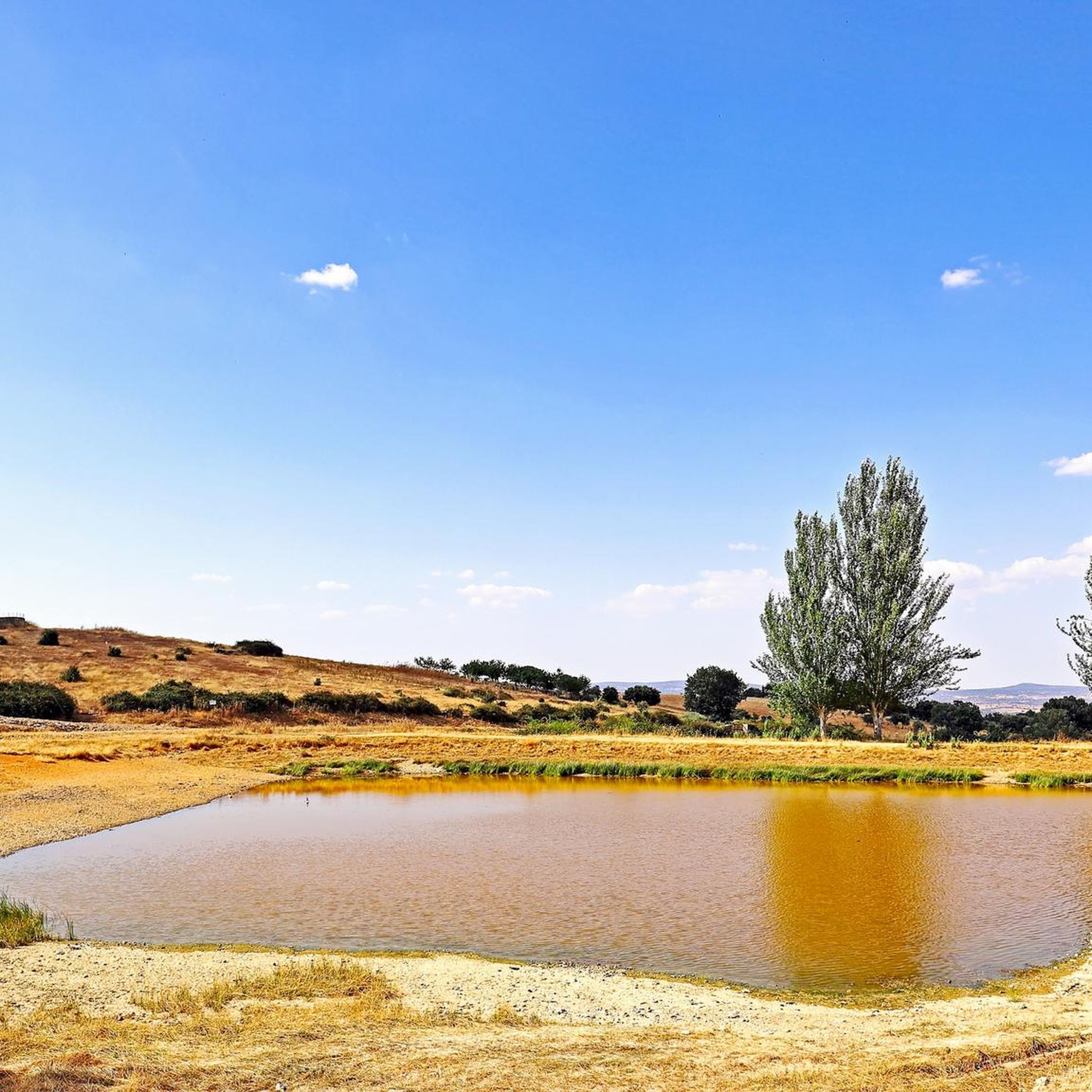
Small lagoon that is located near the town of Navarredonda de la Rinconada and where it offers a quiet space to rest for a few minutes before resuming the march.
0
0

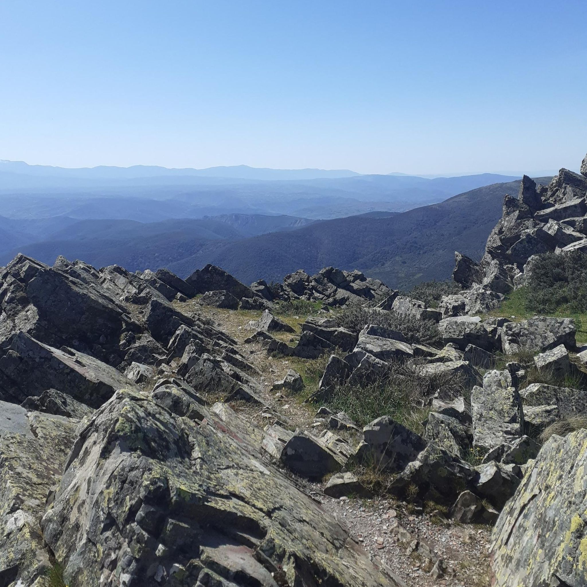
The top of Pico Cervero is located at 1,522 meters above sea level within the wonderful Natural Space of Las Quilamas. The ascent is demanding and depending on where you climb it from, it may have some technical sectors. From Linares de Riofrío you can follow the path through the Honfrías forest, a wonderful and picturesque place.
1
1

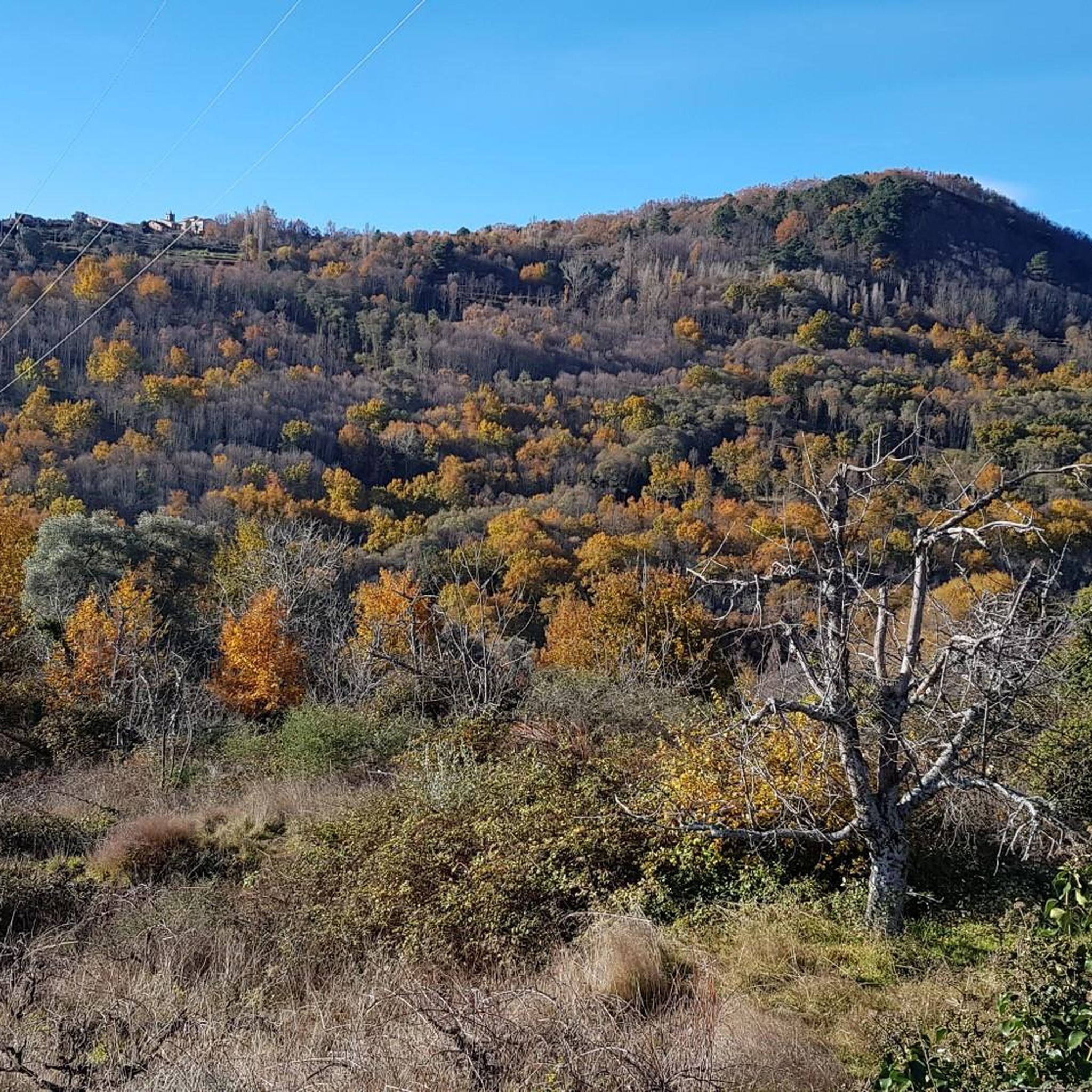
The most recommended times for this route are May, well into spring and autumn. The landscapes of the area with the trees covered with leaves are highly recommended, especially the forest of La Honfría.
1
0

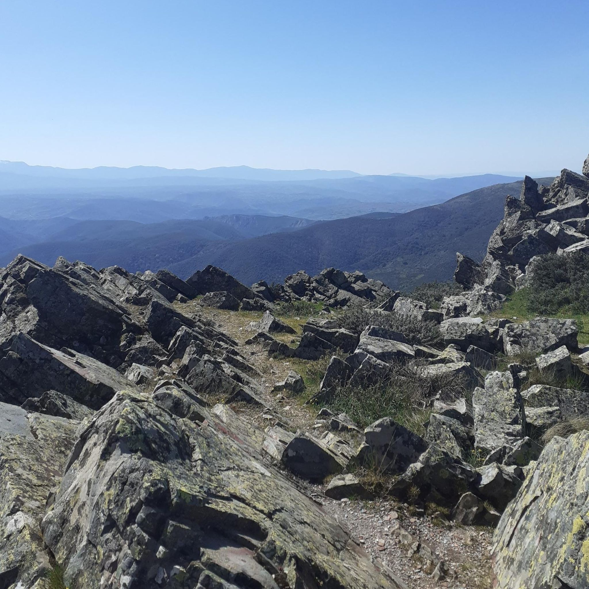
Magical place, excellent 360º views (if it is not cloudy). It is worth the ascent both by mountain bike, gravel or walking.
1
0

Beautiful views on the left side as you go up the Sierra de las Quilamas
0
1

Track connecting the Honfría recreational area from Linares
1
1
Frequently Asked Questions
How many mountain bike trails are available in Navarredonda De La Rinconada?
There are over 30 mountain bike trails around Navarredonda De La Rinconada, offering a diverse range of options for riders. The area is highly rated by the komoot community, with an average score of 5.0 stars from 5 reviews, and has been explored by more than 200 mountain bikers.
What kind of terrain can I expect on the mountain bike trails in this region?
The terrain around Navarredonda De La Rinconada is diverse and rugged, set within the Sierra de Francia and Sierra de las Quilamas mountain ranges. You'll encounter dense forests of oaks, chestnuts, and hollies, alongside numerous streams and natural springs. Trails vary from well-maintained forest paths to technical sections and steep ramps, with significant elevation changes, especially on routes ascending to peaks like Pico Cervero.
Are there mountain bike trails suitable for all skill levels?
Yes, the region offers a mix of trail types. While there are no easy routes listed, you'll find 13 moderate trails and 19 difficult trails. This variety ensures options for both intermediate riders looking for a good workout and experienced mountain bikers seeking demanding ascents and technical challenges.
What are some challenging mountain bike routes for experienced riders?
Experienced riders will find plenty of challenging options, particularly those involving the ascent to Pico Cervero. Routes like La Honfría Recreation Area – Pico de la Cueva de la Mora loop from Linares de Riofrío, covering 47.6 km with over 1,190 meters of elevation gain, offer demanding climbs and technical sections. These routes often reward with spectacular panoramic views.
What natural landmarks or points of interest can I see while mountain biking?
Many trails pass by significant natural landmarks. You can ascend to Cervero Peak, the highest point in the Sierra de las Quilamas, for breathtaking 360-degree views. Other points of interest include the La Dehesa recreational area with its natural pools, and the legendary Cueva de la Mora. You might also encounter ancient flour and fulling mills, and restored lime kilns along various routes.
Are there any circular mountain bike routes available?
Yes, many of the mountain bike trails in the area are designed as loops. For example, the Pico de la Cueva de la Mora – La Honfría Recreation Area loop from Linares de Riofrío is a moderate 27.5 km circular route. These loops allow you to start and finish at the same point, making logistics easier.
What is the best time of year for mountain biking in Navarredonda De La Rinconada?
The region offers vibrant seasonal colors, particularly in autumn when the forests of oaks, chestnuts, and hollies are at their peak. Spring and autumn generally provide the most pleasant temperatures for mountain biking, avoiding the extreme heat of summer and potential winter conditions at higher elevations. Always check local weather conditions before heading out.
Are there any family-friendly mountain bike trails?
While many trails feature significant elevation changes and technical sections, some of the less demanding forest paths might be suitable for families with older, more experienced children. The La Dehesa recreational area, with its picnic spots and natural swimming pool, could serve as a good base for shorter, easier rides on nearby tracks, though dedicated easy trails are not prominent in the data provided.
Can I bring my dog on the mountain bike trails?
The Sierra de Francia and Sierra de las Quilamas are natural environments, and generally, dogs are permitted on trails, especially if kept under control. However, it's always advisable to check specific local regulations or protected area rules, as the region is a Special Protection Area for Birds within the Natura 2000 network. Ensure your dog is well-behaved and doesn't disturb wildlife or other trail users.
Where can I find parking for mountain biking in Navarredonda De La Rinconada?
While specific parking locations for each trail are not detailed, the presence of an RV area in the broader Francia-Quilamas area suggests facilities for visitors bringing their own equipment. Starting points for many routes, such as Linares de Riofrío, typically offer parking options. It's recommended to check the starting point of your chosen route for specific parking information.
Are there any amenities like cafes or pubs near the mountain bike routes?
Navarredonda De La Rinconada and surrounding villages in the Sierra de Francia region offer local amenities. While specific cafes or pubs directly on the trails are rare, you can find places to eat and drink in the villages themselves, such as Navarredonda de la Rinconada, Linares de Riofrío, or nearby settlements like Sequeros and Villanueva del Conde, perfect for a post-ride refreshment.
What is the average duration for a mountain bike ride in this area?
The duration of a mountain bike ride varies significantly depending on the trail's length and difficulty. For example, a moderate route like the Pico de la Cueva de la Mora – La Honfría Recreation Area loop from Linares de Riofrío typically takes around 2 hours 24 minutes, while more challenging routes such as the La Honfría Recreation Area – Cervero Peak loop from Linares de Riofrío can take over 3 hours 50 minutes.
Most popular routes around Navarredonda De La Rinconada
Most popular attractions around Navarredonda De La Rinconada

Get inspired with the komoot mobile app


Explore more
Browse the best MTB trails in other regions.
