The best walks and hikes around Réserve naturelle de Carlaveyron
4.6
(7233)
91,679
hikers
668
hikes
Hiking around Réserve naturelle de Carlaveyron offers diverse landscapes shaped by glacial activity, featuring altitudes ranging from 1,090 to 2,305 meters. The terrain includes dense forests, steep peaks, and an "aquatic garden" of streams, lakes, marshes, and peat bogs. The area is characterized by the Aiguilles Rouges, providing views of the Mont-Blanc massif, and the Gorges de la Diosaz in its lower parts. This natural reserve provides a variety of hiking trails across its varied topography.
Best hiking trails around…
Last updated: September 30, 2026
4.8
(31)
155
hikers
6.61km
02:57
420m
410m
Moderate hike. Good fitness required. Mostly accessible paths. Sure-footedness required.
4.6
(7)
63
hikers
9.52km
04:06
550m
540m
Moderate hike. Good fitness required. Mostly accessible paths. Sure-footedness required.

4.6
(8)
93
hikers
5.02km
02:28
380m
370m
Moderate hike. Good fitness required. Mostly accessible paths. Sure-footedness required.
4.5
(4)
49
hikers
3.03km
01:27
220m
210m
Moderate hike. Great for any fitness level. Mostly accessible paths. Sure-footedness required.
12
hikers
1.41km
00:44
120m
110m
Moderate hike. Great for any fitness level. Mostly accessible paths. Sure-footedness required.
Get access to more routes and recommendations from other explorers.
Already have an account?
Our route recommendations are based on thousands of hikes, rides, and runs completed by other people on komoot.
Start today with a free account
Your next adventure awaits.
Popular around Réserve naturelle de Carlaveyron
Cycling around Réserve naturelle de Carlaveyron
Running Trails around Réserve naturelle de Carlaveyron
Road Cycling Routes around Réserve naturelle de Carlaveyron
MTB Trails around Réserve naturelle de Carlaveyron

Mountain Hikes around Réserve naturelle de Carlaveyron

Gravel biking around Réserve naturelle de Carlaveyron
Tips from the Community

The cable car 🚡 takes you to the mid-station or up to the Brévent. From both stations, you can enjoy beautiful hikes with views of Mont Blanc. Tickets can be booked online in advance or directly at the valley station. There is also a parking garage at the valley station. Further information is available at https://de.chamonix.com/tatichkeiten/praktische-informationen-zu-den-skiliften/seilbahn-le-brevent
1
0

Quite a big climb and not very easy
0
0

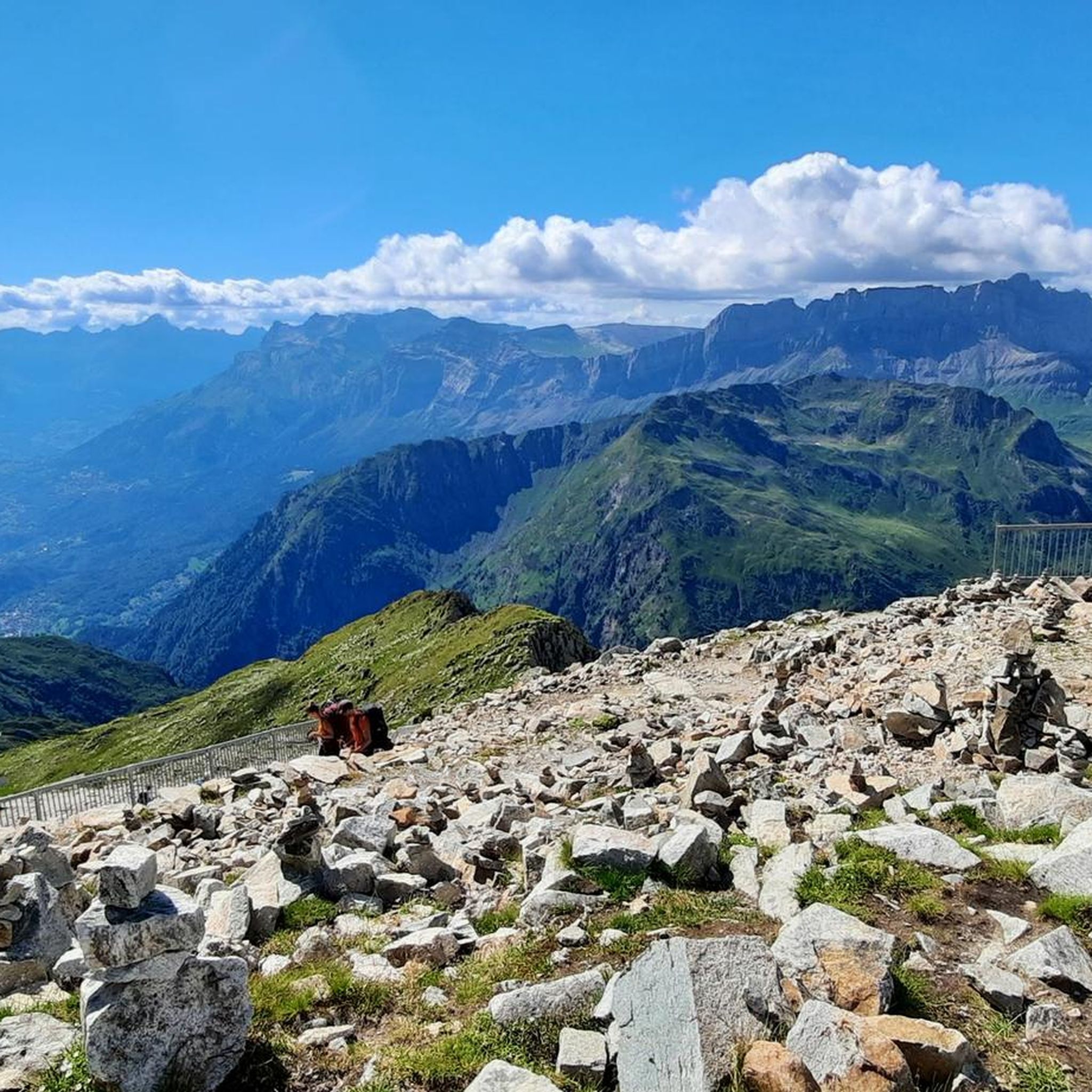
A few meters from the cable car is the summit of Le Brevent, more than 2,500 meters.
2
0
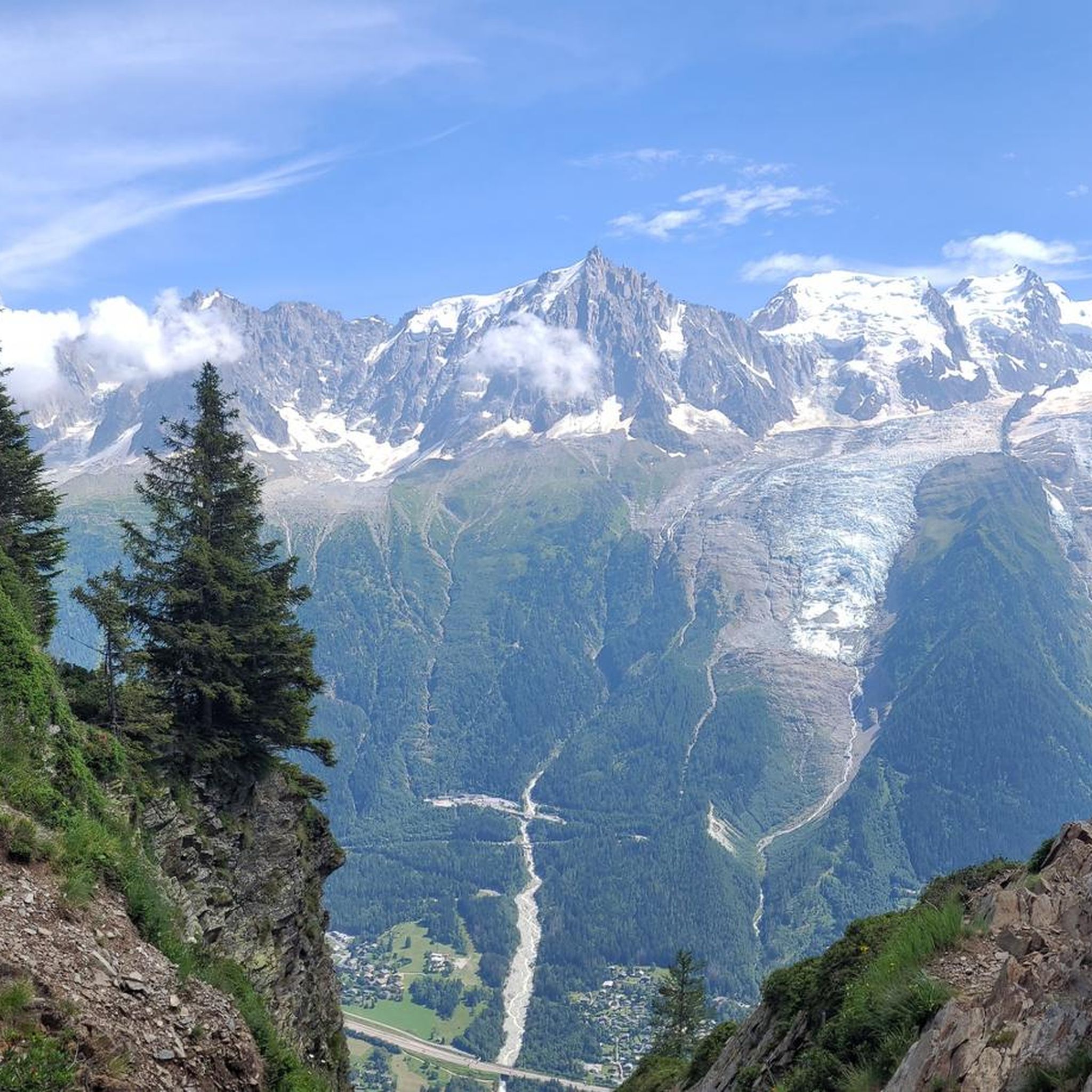
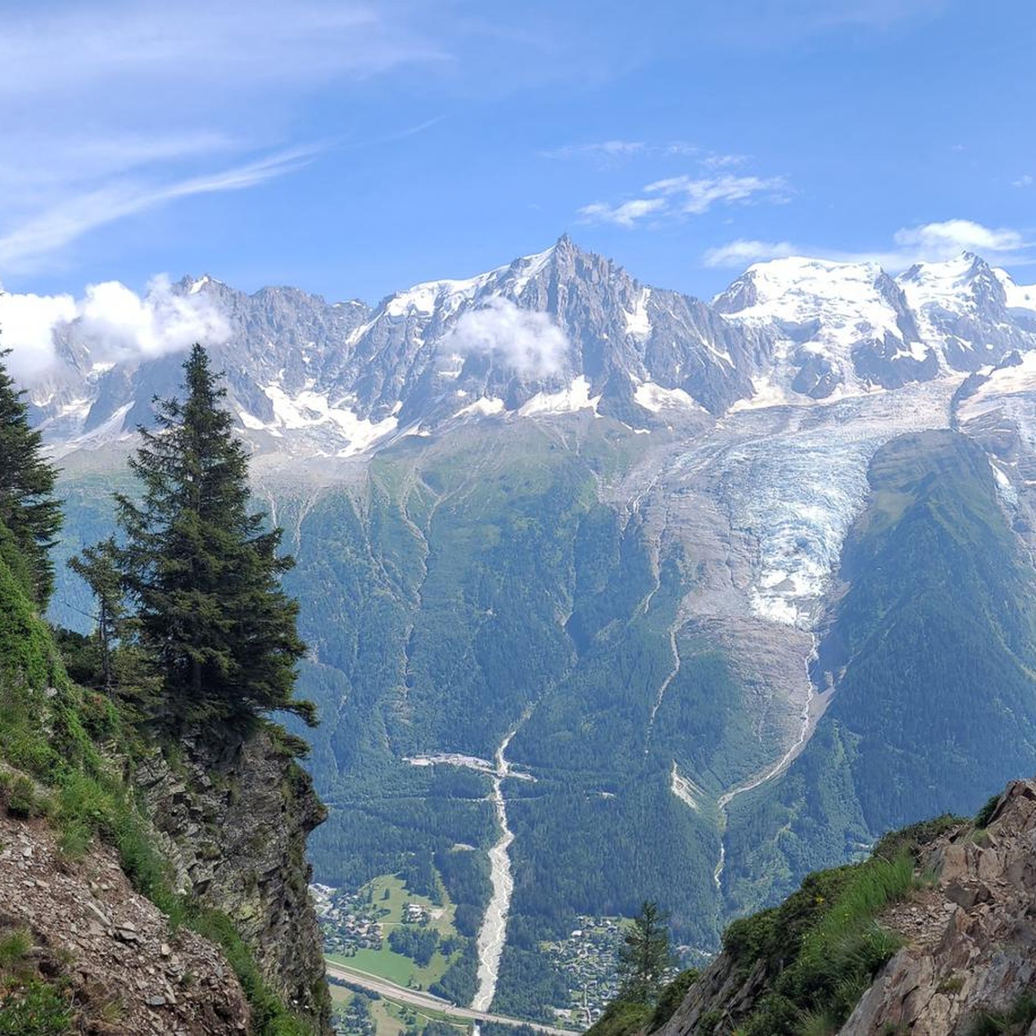
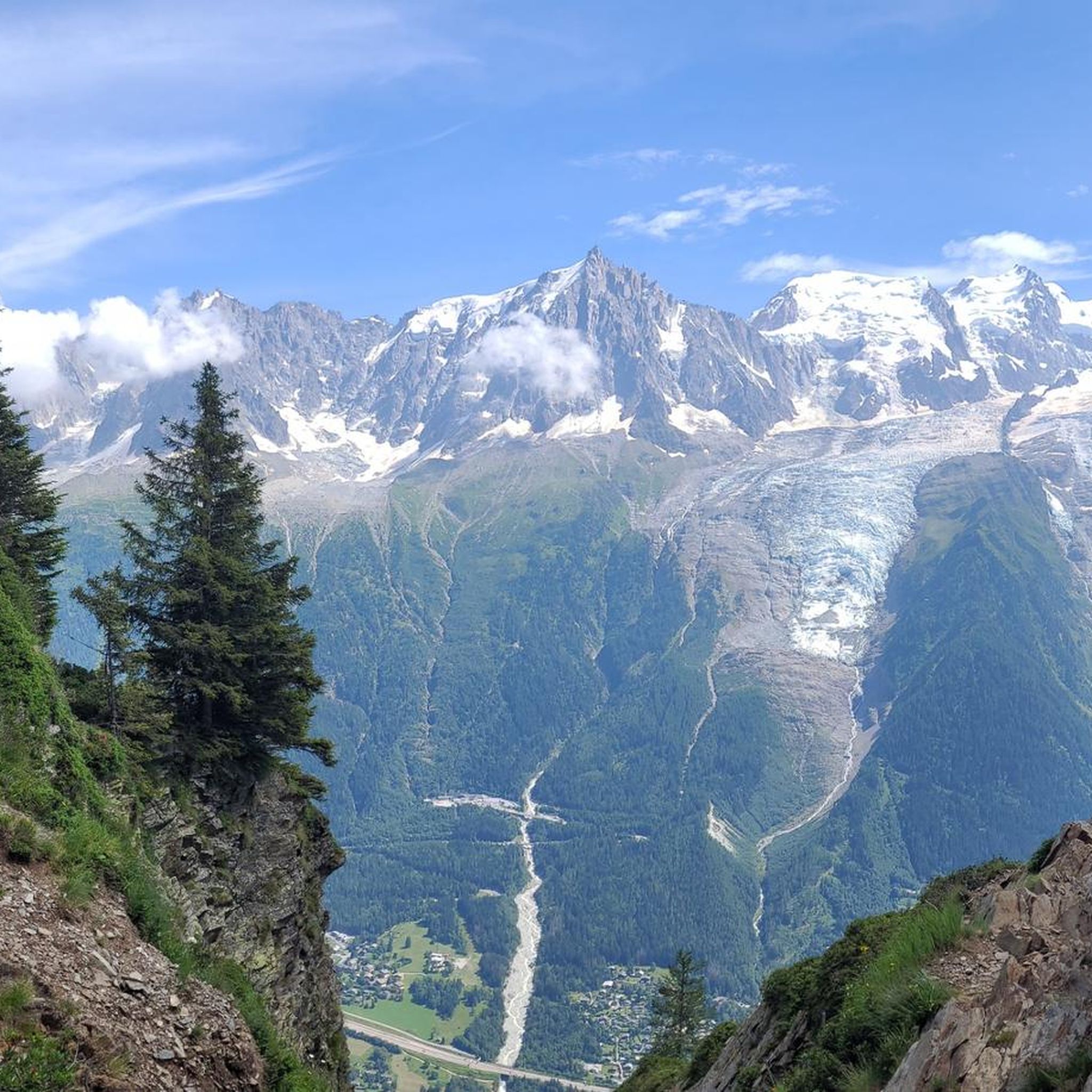
As soon as you exit the cable car you are left speechless at the massif in front of you.
1
0


At an altitude of 2,525 meters, Brévent offers an exceptional panorama of the Mont-Blanc massif. We'll be amazed!
0
0

Bellachat on the Tour du Mont Blanc (TMB): Nestled like a hidden gem along the iconic Tour du Mont Blanc, Bellachat is a refuge for weary hikers and a platform for awe-inspiring views. As you traverse the TMB, the ascent to Bellachat is not just a climb; it's a journey into the heart of the French Alps.
0
0
Chemin Le Brévent on the Tour du Mont Blanc (TMB): A trail that weaves through the rugged beauty of the Mont Blanc massif, Chemin Le Brévent is a highlight of the renowned Tour du Mont Blanc. This path offers a spectacular journey for hikers, showcasing panoramic views of snow-capped peaks, alpine meadows, and the indomitable spirit of the French Alps. As you ascend along Chemin Le Brévent, the air becomes crisper, and the landscape unfolds in a breathtaking display. The trail leads you to the Brévent summit, where the reward is a sweeping vista that stretches across the Chamonix Valley and the majestic Mont Blanc. It's a place where the grandeur of nature meets the determination of those seeking adventure.
3
0
Frequently Asked Questions
How many hiking trails are available in Réserve naturelle de Carlaveyron?
Réserve naturelle de Carlaveyron offers a vast network of hiking trails. You'll find over 650 routes to explore, catering to various skill levels, from easy strolls to challenging alpine ascents.
Are there easy hikes suitable for families in Réserve naturelle de Carlaveyron?
Yes, the reserve features over 120 easy routes perfect for families or those seeking a gentle walk. One excellent option is the CascadaPierreRousse – CascadaDesDanses loop from Servoz, which is just under 2 km long and takes about 45 minutes to complete, offering a pleasant experience through the natural landscape.
Are there challenging hikes for experienced hikers in the reserve?
Absolutely. For experienced hikers, Réserve naturelle de Carlaveyron provides over 200 difficult routes. These trails often involve significant elevation gain and rough terrain, offering expansive views of the Mont-Blanc massif and surrounding alpine landscape. An example is the Aiguilette des Houches – Lake Brévent loop from Le Brévent, a 10.5 km path with considerable ascent.
Can I bring my dog on the trails in Réserve naturelle de Carlaveyron?
No, dogs are generally not permitted within the Réserve naturelle de Carlaveyron. This regulation is in place to protect the sensitive flora and fauna of the reserve. It's always best to check local signage for specific restrictions before heading out.
Are there any circular routes available for hiking?
Yes, many of the trails in Réserve naturelle de Carlaveyron are designed as circular routes, allowing you to start and end at the same point. For instance, the Lac Vert – Green Lake loop from Servoz is a moderate 11.5 km trail that explores the beautiful area around Lac Vert.
What natural features or attractions can I see along the hiking trails?
The reserve is rich in natural beauty. You can explore the impressive The Diosaz Gorges in the lower parts, or discover the unique 'aquatic garden' with numerous streams, lakes, marshes, and peat bogs. Keep an eye out for the diverse flora and fauna, including rare plant species and animals like ibex and chamois, especially around Lac de l'Aiguillette.
What is the best time of year to hike in Réserve naturelle de Carlaveyron?
The best time to hike is typically from late spring to early autumn (May to October) when the trails are clear of snow and the weather is most favorable. During these months, you can fully appreciate the diverse landscapes, from blooming rhododendrons to lush alpine grasslands, and spot wildlife. Conditions can vary significantly with altitude.
Is winter hiking possible in Réserve naturelle de Carlaveyron?
While the reserve is generally accessible, snow cover can significantly impact trail conditions during winter. Some lower-altitude trails might be suitable for snowshoeing, but many higher routes become challenging or inaccessible. Always check local conditions and avalanche warnings before attempting winter hikes.
Where can I find parking for the hiking trails?
Specific parking information varies by trailhead. Generally, you'll find designated parking areas at popular starting points for hikes, such as near Le Brévent or Servoz. It's advisable to research the specific trailhead you plan to use for precise parking locations.
What do other hikers enjoy most about hiking in Réserve naturelle de Carlaveyron?
The area is highly rated by the komoot community, with an average score of 4.6 stars from over 5,600 reviews. Hikers frequently praise the breathtaking panoramas of the Mont-Blanc massif, the diverse landscapes shaped by glaciers, and the serene beauty of the 'aquatic garden' featuring lakes and streams. The variety of trails catering to all levels is also a highlight.
Are there any multi-day hiking options or refuges in the area?
Yes, for those interested in multi-day adventures, the Refuge de Bellachat provides rustic accommodation within the reserve. This allows hikers to extend their exploration and experience the alpine environment more deeply.
Are there trails with good viewpoints of the surrounding mountains?
Absolutely. The reserve is renowned for its spectacular viewpoints. Locations like Le Brévent offer privileged views of the Mont-Blanc massif, the Fiz, and the Aiguilles Rouges. The View of the Chamonix Valley from the Brévent Trail (TMB) is a particularly popular spot for panoramic vistas.
Are there any specific regulations or restrictions I should be aware of when visiting?
Yes, as a natural reserve, there are regulations to protect the environment. Besides the restriction on dogs, bivouacs are permitted only between 7 PM and 9 AM, and open fires are strictly forbidden. Collecting flora, fossils, or disturbing wildlife is also prohibited. Always respect the natural environment and stay on marked trails.
Most popular routes around Réserve naturelle de Carlaveyron
Most popular attractions around Réserve naturelle de Carlaveyron

Get inspired with the komoot mobile app


Explore more
Browse the best Hikes in other regions.
