The best running trails around Villaseca De Uceda
5.0
(2)
73
runners
13
runs
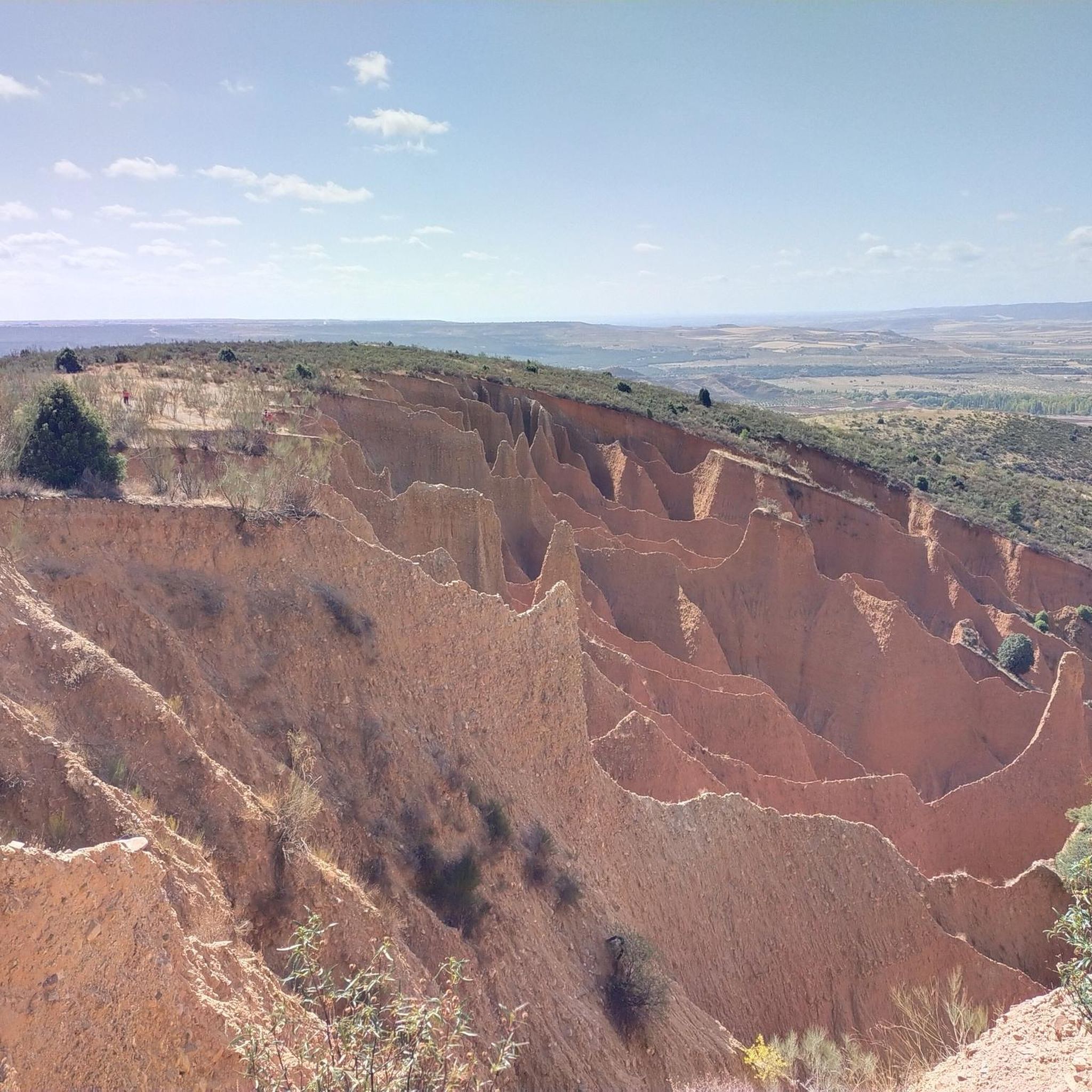
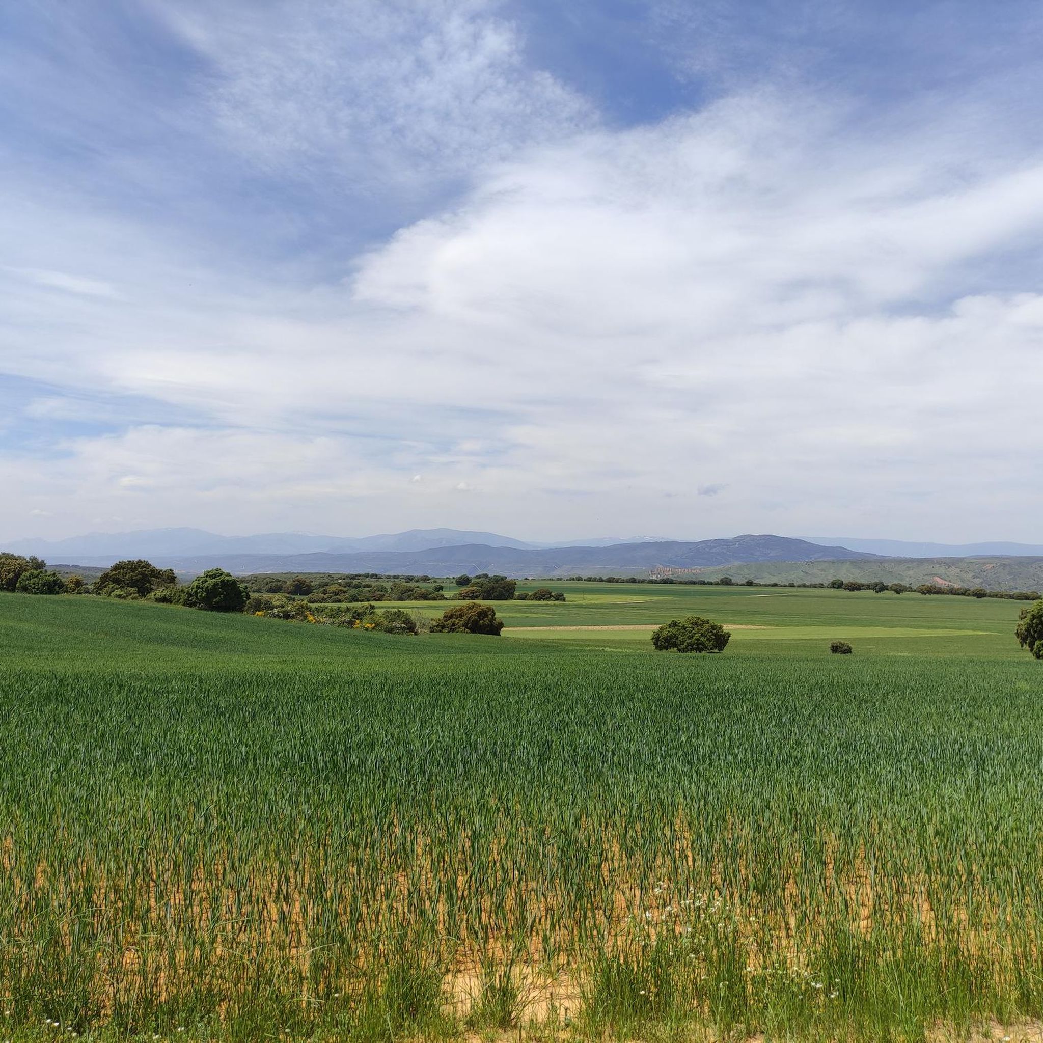
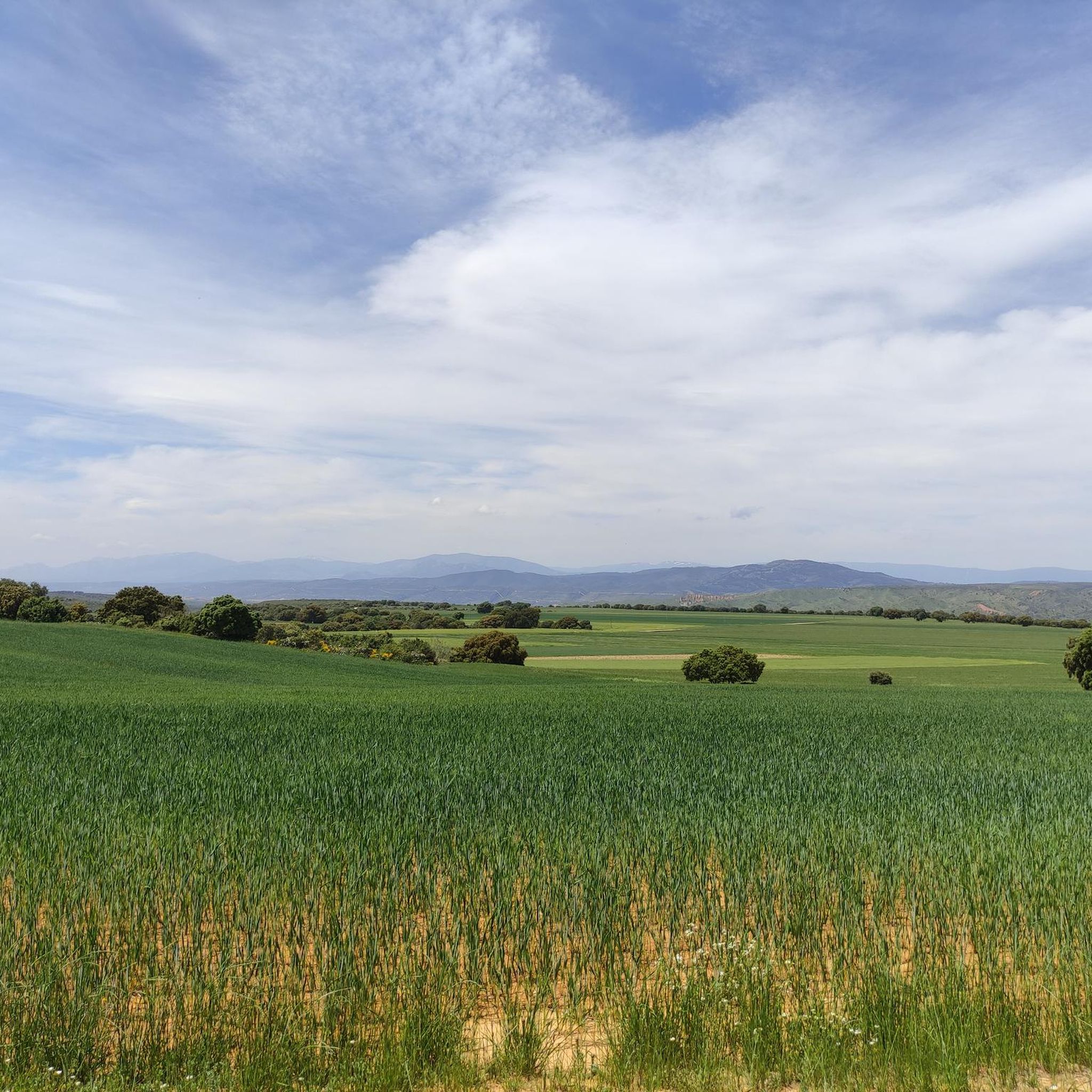
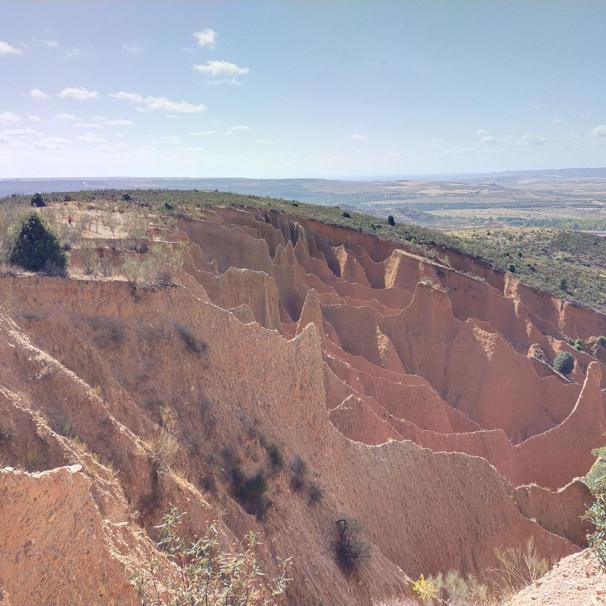
Jogging routes around Villaseca De Uceda offer varied landscapes in Guadalajara, Spain, characterized by distinct topographical zones. The southern area features flat plains known as "rañas" with natural lagoons, providing easier running paths. To the north, the terrain transforms into ravines and gullies, sculpted by water erosion, offering more challenging routes with varying elevations and expansive views. The region also includes holm oak forests and ancient junipers, providing diverse environments for running.
Best jogging routes around Villaseca De Uceda
- The…
Last updated: July 1, 2026
11
runners
Hard run. Very good fitness required. Mostly paved surfaces. Suitable for all skill levels.
4.37km
00:33
80m
80m
Easy run. Great for any fitness level. Mostly paved surfaces. Suitable for all skill levels.

Sign up for free
8
runners
7.86km
00:52
170m
170m
Moderate run. Good fitness required. Mostly paved surfaces. Suitable for all skill levels.
5.0
(1)
9
runners
12.9km
01:39
360m
360m
Hard run. Very good fitness required. Mostly paved surfaces. Suitable for all skill levels.
8
runners
Hard run. Very good fitness required. Sure-footedness, sturdy shoes and alpine experience required.
Get access to more routes and recommendations from other explorers.
Sign up for free
Already have an account?
Our route recommendations are based on thousands of hikes, rides, and runs completed by other people on komoot.
Start today with a free account
Your next adventure awaits.
Login or Signup
Tips from the Community

start from the dam
1
0

Very cool views, key and historic location, stop by for a look
0
0

Beautiful place where people go for a walk or to climb.
1
0

The Pontón de la Oliva is a Spanish dam located in the Ayllón mountain range, northeast of the Community of Madrid and northwest of the province of Guadalajara. It was built in 1857 and is currently disused. This dam is the sixth and last in the course of the Lozoya River, and is the oldest of the entire system of dams and canalizations of the Canal de Isabel II. This canal supplies drinking water to Madrid and a large part of the community. The height of the Pontón de la Oliva Dam is approximately 30 meters. If you are interested in exploring the area, there are routes that take you to the Cárcavas de Pontón de la Oliva, a curious geological formation in the Community of Madrid. In addition, you can enjoy a route along the Pontón de la Oliva to the Lozoya River, which offers impressive views. I hope you find this information interesting! 😊
4
0
Do not confuse Patones de Arriba, the town of black architecture that lives off tourism, with Patones de Abajo. The latter was founded after the Spanish Civil War, and most of the Patoneros moved there. Although Patones de Arriba is practically uninhabited today, some older people still cling to their roots. Before visiting Patones de Arriba, keep in mind that parking there is complicated, so I recommend leaving your car in the Patones de Abajo parking lot.
1
1

Be careful with parking tickets. I won't go back there again. You are warned.
1
1

The La Parra weir is a Spanish reservoir located in the bed of the Lozoya River, in the province of Madrid.
0
0
Patones is a small municipality located in the center of Spain, in the northeast of Madrid. A path through olive groves leads to the medieval town of Patones de Arriba, famous for its black slate houses and winding streets. The mountain is full of stone ruins of old shepherds' huts. Near the town are the Reguerillo cave, an archaeological site, and the ruins of the Pontón de la Oliva and the hermitage of the Virgen de la Oliva.
0
0
Frequently Asked Questions
How many running routes are available in Villaseca de Uceda?
There are over 10 dedicated jogging routes around Villaseca de Uceda, offering a variety of distances and difficulty levels to suit different preferences.
What kind of terrain can I expect on the jogging trails around Villaseca de Uceda?
The region offers diverse terrain. You'll find flat 'rañas' in the south, characterized by surface pebbles and seasonal lagoons, ideal for easier runs. The northern part features dramatic ravines (cárcavas) with varying elevations for more challenging routes. Eastern areas boast forests of holm oaks and rebollos, providing shaded paths.
Are there easy jogging routes suitable for beginners in Villaseca de Uceda?
Yes, there is at least one easy jogging route. For a gentle run, consider the Molino de Viñuelas — circular from Viñuelas, which is 2.7 miles (4.4 km) long and can be completed in about 33 minutes.
Are there challenging trail running options in the Villaseca de Uceda area?
Absolutely. The northern part of the region, with its dramatic ravines, offers more challenging routes. An example is the Presa de la Parra from Pontón de la Oliva — circular trailrunning through the Cañada de la Caleriza, a difficult 10.3-mile (16.6 km) route with significant elevation changes.
What natural features or landmarks can I see while running in Villaseca de Uceda?
You can encounter unique geological formations like the 'rañas' and striking red ravines. The area also features natural lagoons such as Laguna de las Eras and Laguna el Pozo, offering peaceful scenery and birdwatching opportunities. Additionally, you might pass by the Pontón de la Oliva Dam and Cliffside Pathways or the Las Cárcavas - Pontón de la Oliva gorge.
Are there any historical or cultural points of interest along the running paths?
Yes, the region's network of ancient paths and 'Campiñeando' routes often connect small municipalities, allowing you to explore the local heritage. You might encounter structures like the Viñuelas Mill or the Medieval Bridge over the Jarama River, offering glimpses into the area's history.
Can I find circular running routes in Villaseca de Uceda?
Many of the running routes in Villaseca de Uceda are circular, providing convenient starting and ending points. For example, the Molino de Viñuelas — circular from Viñuelas is an easy circular option, while the Presa de la Parra from Pontón de la Oliva offers a more challenging circular trailrunning experience.
What is the best time of year for running in Villaseca de Uceda?
The pleasant climate during autumn and spring makes these seasons ideal for jogging and exploring the natural and historical landscapes of Villaseca de Uceda. During spring, the ground is also vibrant with wildflowers.
Are there shaded running paths for warmer days in Villaseca de Uceda?
Yes, the eastern part of Villaseca de Uceda features forests predominantly with holm oaks and rebollos, along with ancient junipers. These wooded areas provide welcome shaded paths, especially pleasant during warmer months.
What do other runners say about the trails in Villaseca de Uceda?
The area is highly rated by the komoot community, with an average score of 5.0 stars. Runners often praise the varied terrain, from flat 'rañas' to challenging ravines, and the scenic beauty of the natural lagoons and forests.
Is parking available near the running routes in Villaseca de Uceda?
While specific parking details vary by route, many trailheads in the region, especially those connecting to villages or popular natural areas, typically offer designated or informal parking spaces. It's advisable to check the route details on komoot for specific starting points.
Where can I find longer running routes for endurance training?
For longer endurance runs, consider routes like the La Parra Dam and Weir – Cancho de la Cabeza loop from Valdepeñas de la Sierra. This challenging trail covers 34.4 miles (55.3 km) and leads through varied terrain, often taking over 7 hours to complete.
Are the running trails in Villaseca de Uceda family-friendly?
Yes, some routes are suitable for families, particularly the flatter sections in the southern 'rañas' area or the easier circular paths. The 'Campiñeando' routes are generally of moderate difficulty, making them accessible for a range of fitness levels, including active families.
Most popular attractions around Villaseca De Uceda

Get inspired with the komoot mobile app


Explore more
Browse the best Running Trails & Routes in other regions.
