The 5 Most Amazing Peaks around Villaciervos
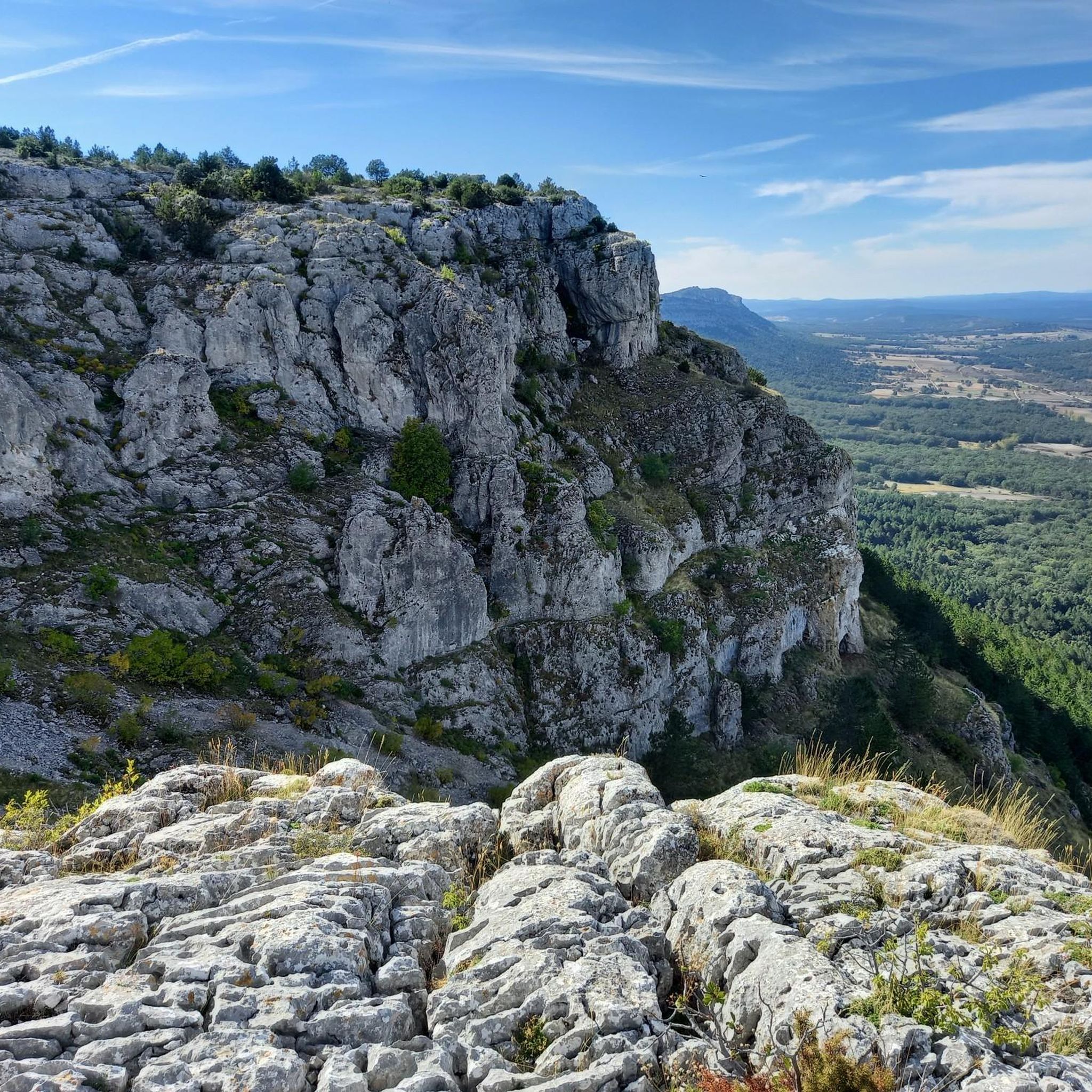
Best mountain peaks around Villaciervos are situated in the Soria region of Spain, offering access to notable peaks and hiking opportunities. The area provides impressive views and a chance to explore the natural landscape. Prominent features include the Sierra de Cabrejas, home to several significant summits. These peaks offer diverse experiences for those seeking natural exploration.
Best mountain peaks around Villaciervos
- The most popular mountain peaks is Pico Frentes, a summit that stands at 1,382 meters above sea level…
Last updated: June 29, 2026
Pico Frentes
Highlight • Summit
The easiest option to go up is …
Translated by Google •
Tip by

Alto de la Risca Summit
Highlight • Summit
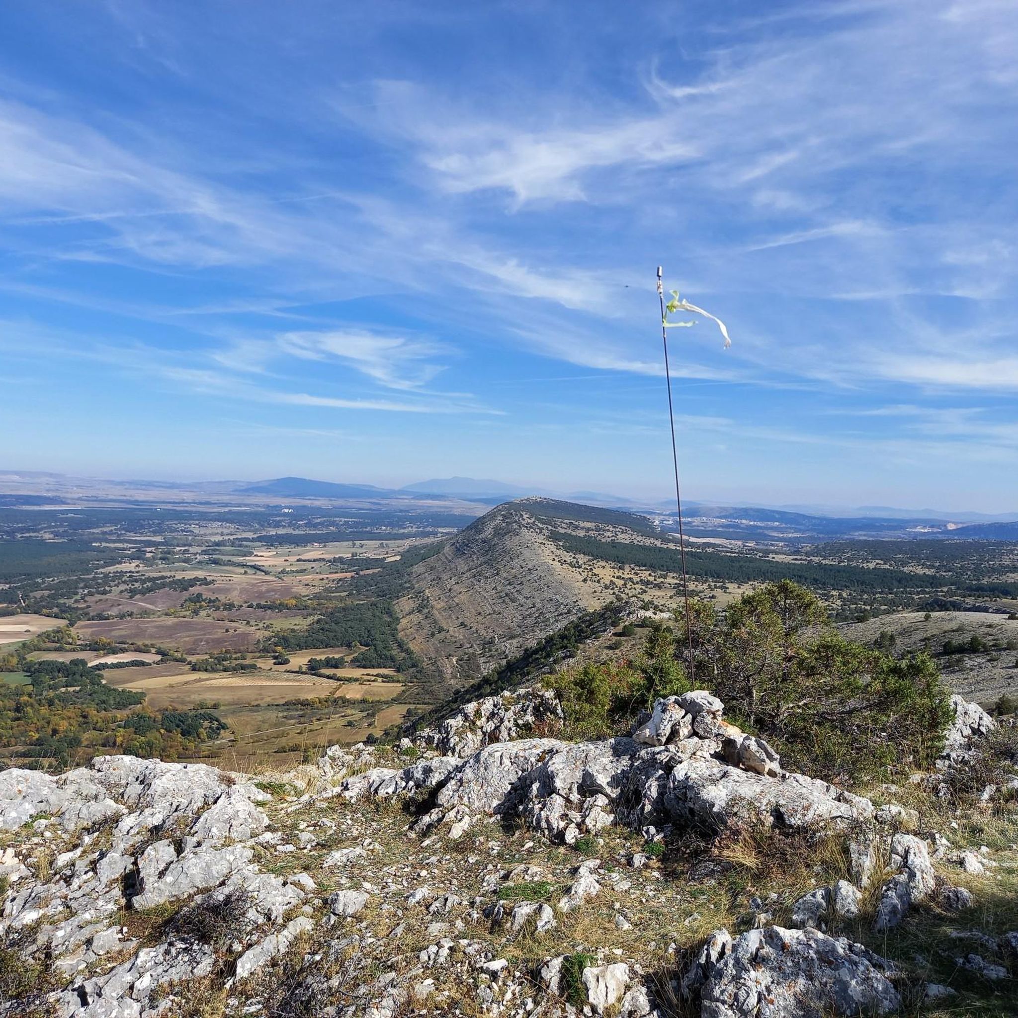
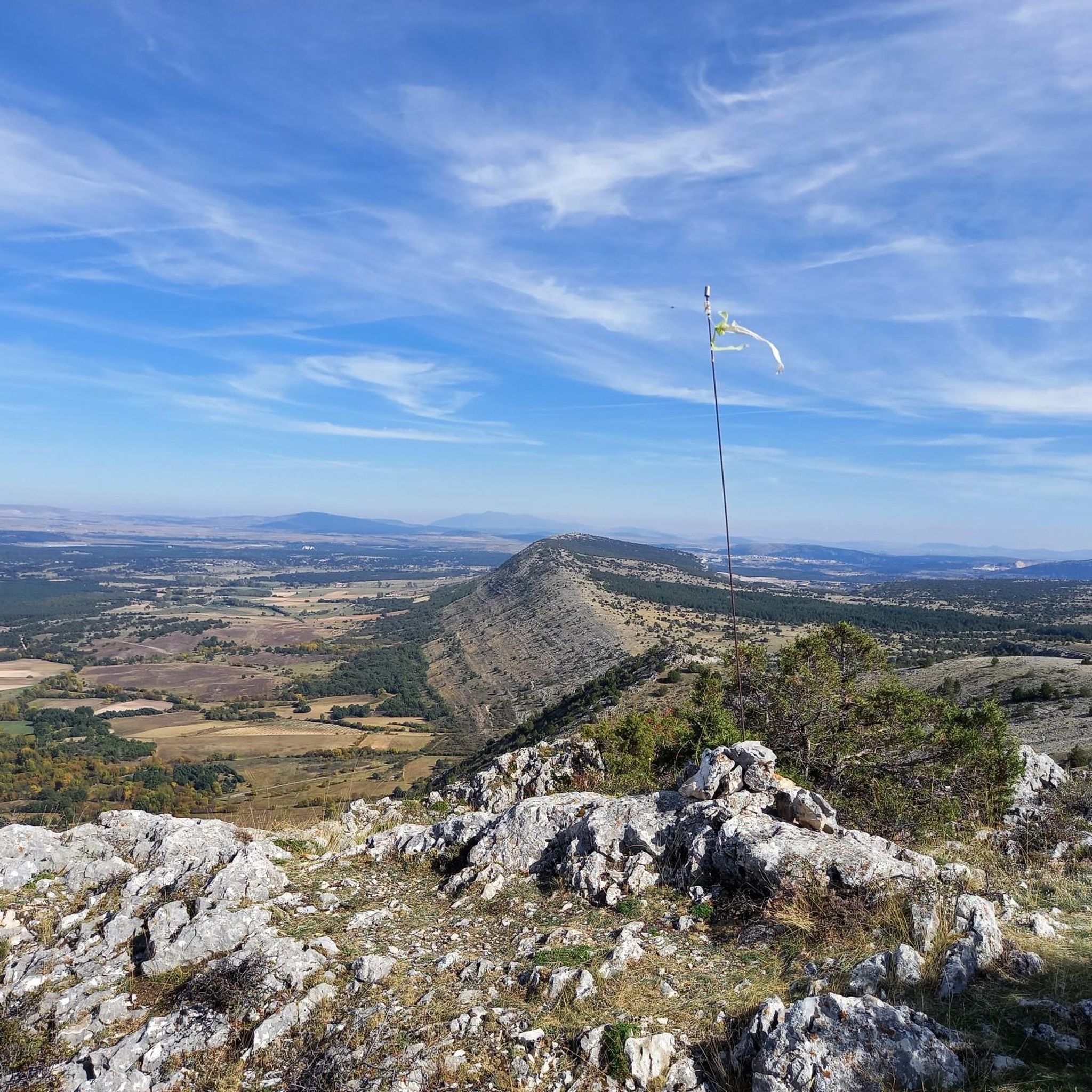
From its summit there is a spectacular view from the Cuerda del Pozo reservoir to Soria to …
Translated by Google •
Tip by
Sign up now to discover places like this
Get recommendations on the best single tracks, peaks, & plenty of other exciting outdoor places.
Sign up for free
Peña de la Sierpe
Highlight • Summit
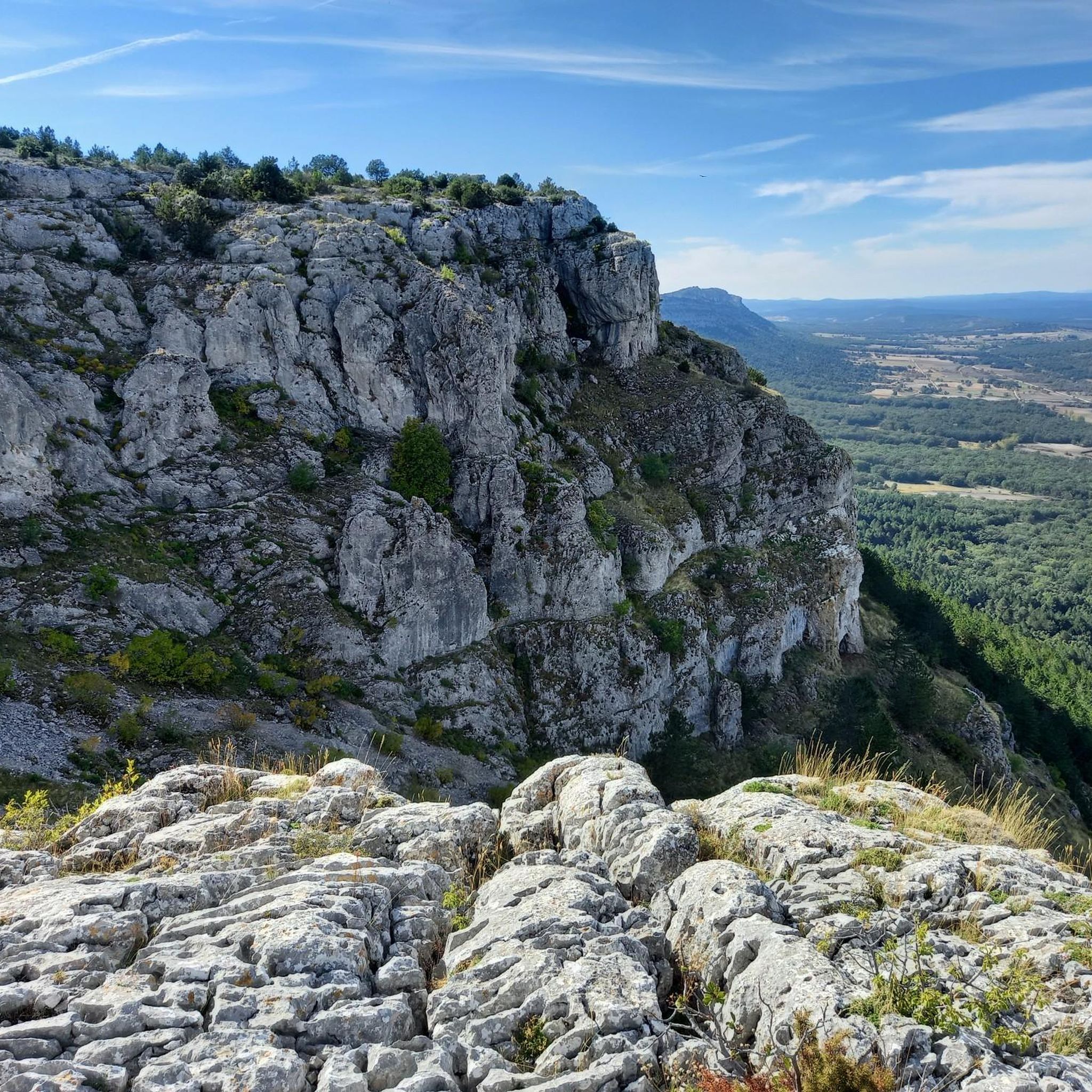
It is accessed by a gravel path that by bike may require some effort
Translated by Google •
Tip by
Alto del Pie Wind Turbines
Highlight • Structure
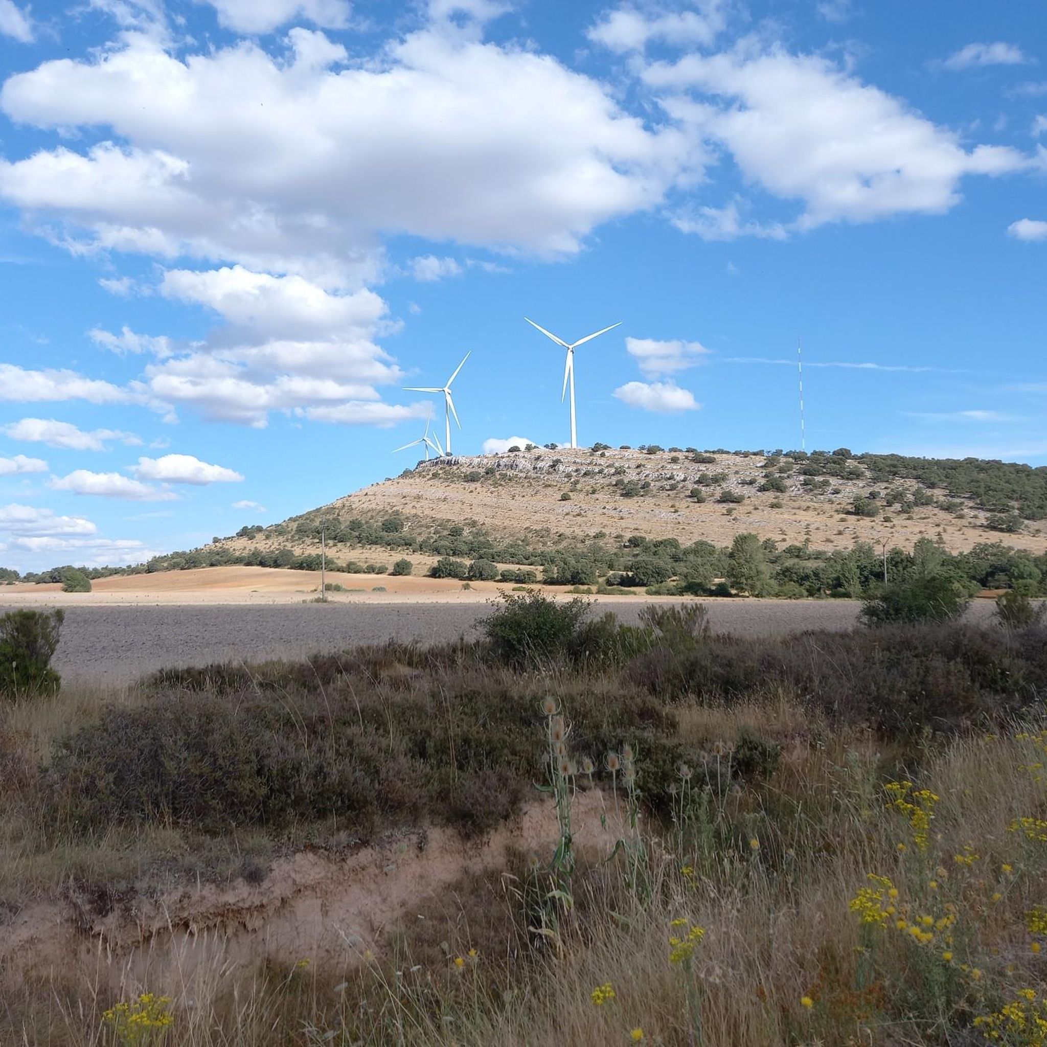
If you are going to climb by bike, …
Translated by Google •
Tip by
View from El Riscal Geodetic Vertex
Highlight • Viewpoint
Starting from the road next to it, there is a path that goes directly to the vertex.
Translated by Google •
Tip by
Start today with a free account
Your next adventure awaits.
Login or Signup

Tips from the Community

A beautiful high altitude route, it requires a certain effort and skill.
1
0

Located in the Sierra Llana and near the town of Fuentetoba, at 1,382 meters above sea level we are in Pico Frentes, with wonderful 360 degree views. We can see the peaks of Urbión, Cebollera, Piqueras, Pinar Grande, Valonsadero, Soria, Golmayo, Camaretas, and further down the Madero, Moncayo, Sierra de Toranzo, Tablado, etc.
2
0

It is the highest point of Mount Valonsadero and from above you can enjoy pleasant views of the surroundings. It is accessed by a gravel path that by bike may require some effort
2
0
It can be reached on foot by bike or even by car (although the grace lies in arriving on its own merit). If you are going to climb by bike, the most complicated part is the last climb up the slope, but it is worth it for the views from above and for the windmills above. The day day I went up to quite windy and it was impressive to see them in movement.
3
0
The Pico Frentes is located at the eastern end of the Sierra de Cabrejas and is well known for its size and shape. The easiest option to go up is following the path that starts from the Fuentetoba urbanization that takes you practically to the geodesic vertex from where you can contemplate an impressive panoramic view of Soria.
7
0
It is a geodesic vertex from which a great panoramic view of Valonsadero and surroundings can be contemplated. Starting from the road next to it, there is a path that goes directly to the vertex.
5
0
It is the highest peak of the Sierra de Cabrejas having 1433 meters. From its summit there is a spectacular view from the Cuerda del Pozo reservoir to Soria to the east. Going up is not very complicated, I went up the Viñuela path to Los Castillejos and from there I went up a narrow pass to the top.
5
0
Frequently Asked Questions
What are the most prominent mountain peaks around Villaciervos?
The most prominent peaks in the Villaciervos area, located within the Soria region of Spain, are Pico Frentes and Alto de la Risca Summit. Pico Frentes, at 1,382 meters, offers impressive 360-degree panoramic views, while Alto de la Risca, the highest peak in the Sierra de Cabrejas at 1,433 meters, provides spectacular vistas stretching from the Cuerda del Pozo reservoir to Soria.
What kind of views can I expect from the mountain peaks in the Villaciervos area?
From peaks like Pico Frentes, you can expect extensive 360-degree panoramic views, including other significant peaks like Urbión, Cebollera, Moncayo, and the city of Soria itself. Alto de la Risca Summit offers a spectacular view from the Cuerda del Pozo reservoir all the way to Soria to the east. Additionally, the View from El Riscal Geodetic Vertex provides a great panoramic view of Valonsadero and its surroundings.
What are the difficulty levels of hiking trails near Villaciervos' peaks?
Many trails around Villaciervos' peaks are considered moderate in difficulty. For example, the "Pico Frentes and La Toba Waterfall Loop Trail" is a moderate 5.9-mile route. While some ascents, like to Alto de la Risca Summit, require a certain effort, they are generally not overly complicated. There are also easy options available, such as the "Pinturas rupestres, Cañada Honda y Mirador La Cabaña – circular por el Monte Valonsadero" route.
Are there family-friendly hiking options among the Villaciervos peaks?
Yes, there are options suitable for families. While some routes are moderate, the "Pinturas rupestres, Cañada Honda y Mirador La Cabaña – circular por el Monte Valonsadero" is an easy hiking route, making it a good choice for families. The "Pico Frentes and La Toba Waterfall Loop Trail" is also suitable for various fitness levels, taking approximately 2 hours and 47 minutes to complete, which might be manageable for active families.
What is the best time of year to hike the mountain peaks near Villaciervos?
The region around Villaciervos offers pleasant hiking conditions during spring and autumn, when temperatures are milder. Summer can also be a good time, especially in the mornings or late afternoons, though it can get warm. Winter hiking is possible, but requires appropriate gear for colder temperatures and potential snow, especially at higher elevations like Alto de la Risca Summit.
Are there other outdoor activities besides hiking near the Villaciervos peaks?
Absolutely! Beyond hiking, the area around Villaciervos offers opportunities for other outdoor activities. You can explore various running trails, including the "Pico Frentes y Cascada La Toba – trail running circular desde Fuentetoba". There are also numerous cycling routes, such as the "Santander-Mediterranean Greenway: Abejar - Hontoria del Pinar Loop" for more challenging rides.
What natural features, beyond the peaks themselves, can I explore in the Villaciervos region?
Beyond the impressive peaks, the region boasts beautiful natural features. The "Pico Frentes and La Toba Waterfall Loop Trail" combines panoramic summits with the beauty of a waterfall. The area is also home to the Sierra de Cabrejas, offering diverse landscapes. You can also find the Cuerda del Pozo reservoir, visible from Alto de la Risca Summit, and the expansive Monte Valonsadero.
Where can I find parking when visiting the mountain peaks around Villaciervos?
For Pico Frentes, a common starting point is the Fuentetoba urbanization, where you can typically find parking to access the path. For other trails, parking is often available at designated trailheads or nearby villages. It's advisable to check specific route descriptions for detailed parking information.
Are there any amenities like cafes or restaurants near the trailheads?
The Fuentetoba urbanization, which serves as a starting point for hikes to Pico Frentes, is a developed area where you can expect to find some amenities. For other trailheads, it's best to check the nearest villages or towns for cafes, pubs, or restaurants to refuel before or after your hike.
How long do hikes to the main peaks typically take?
The duration of hikes varies depending on the peak and your chosen route. For instance, the "Pico Frentes and La Toba Waterfall Loop Trail" is a moderate route that typically takes approximately 2 hours and 47 minutes to complete. Ascents to peaks like Alto de la Risca Summit can take longer, depending on your starting point and pace.
What wildlife might I encounter around the Villaciervos mountain peaks?
The natural areas around Villaciervos, including the Sierra de Cabrejas and Monte Valonsadero, are home to diverse wildlife. While specific sightings are never guaranteed, you might encounter various bird species, small mammals, and possibly larger wildlife depending on the season and your location. The region's forests and open landscapes provide habitats for a range of creatures.
Can I bring my dog on trails around Villaciervos' mountain peaks?
Many outdoor trails in Spain are dog-friendly, especially in natural parks and less restricted areas. However, it's always recommended to keep your dog on a leash, especially in areas with wildlife or livestock, and to check for any specific local regulations or signage at trailheads. Always pack out any waste to preserve the natural environment.
Most popular routes around Villaciervos
Most popular attractions around Villaciervos

Get inspired with the komoot mobile app


Explore more
See even more amazing summits around Villaciervos with these guides:
