The best walks and hikes around Palenciana
4.2
(15)
47
hikers
6
hikes
Hiking around Palenciana offers trails through a landscape characterized by the Genil River, extensive cereal fields, and olive groves in the south of Córdoba province. The terrain features riverside ecosystems with poplars and willows, alongside gentle hills like Cerro del Hacho. These natural elements combine to create diverse routes for outdoor exploration.
Best hiking trails around Palenciana
- The most popular hiking route is Route of the Norias of the Genil River, a 5.2 miles (8.3 km) moderate trail that…
Last updated: May 21, 2026
3.7
(3)
6
hikers
7.33km
02:01
120m
120m
Moderate hike. Good fitness required. Easily-accessible paths. Suitable for all skill levels.
4.0
(1)
2
hikers
8.31km
02:21
180m
180m
Moderate hike. Good fitness required. Mostly accessible paths. Sure-footedness required.

Sign up for free
Easy hike. Great for any fitness level. Easily-accessible paths. Suitable for all skill levels.
3.8
(6)
18
hikers
8.95km
02:31
180m
180m
Moderate hike. Good fitness required. Easily-accessible paths. Suitable for all skill levels.
4.7
(3)
12
hikers
9.15km
02:36
190m
190m
Moderate hike. Good fitness required. Easily-accessible paths. Suitable for all skill levels.
Our route recommendations are based on thousands of hikes, rides, and runs completed by other people on komoot.
Start today with a free account
Your next adventure awaits.
Login or Signup
Tips from the Community

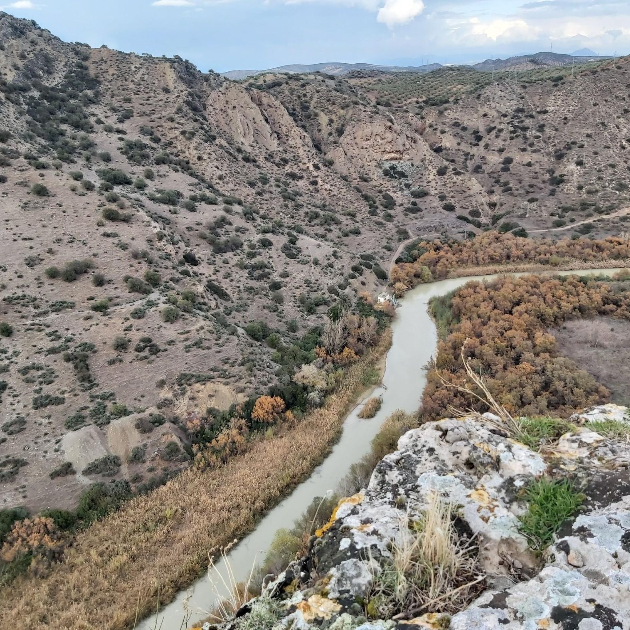
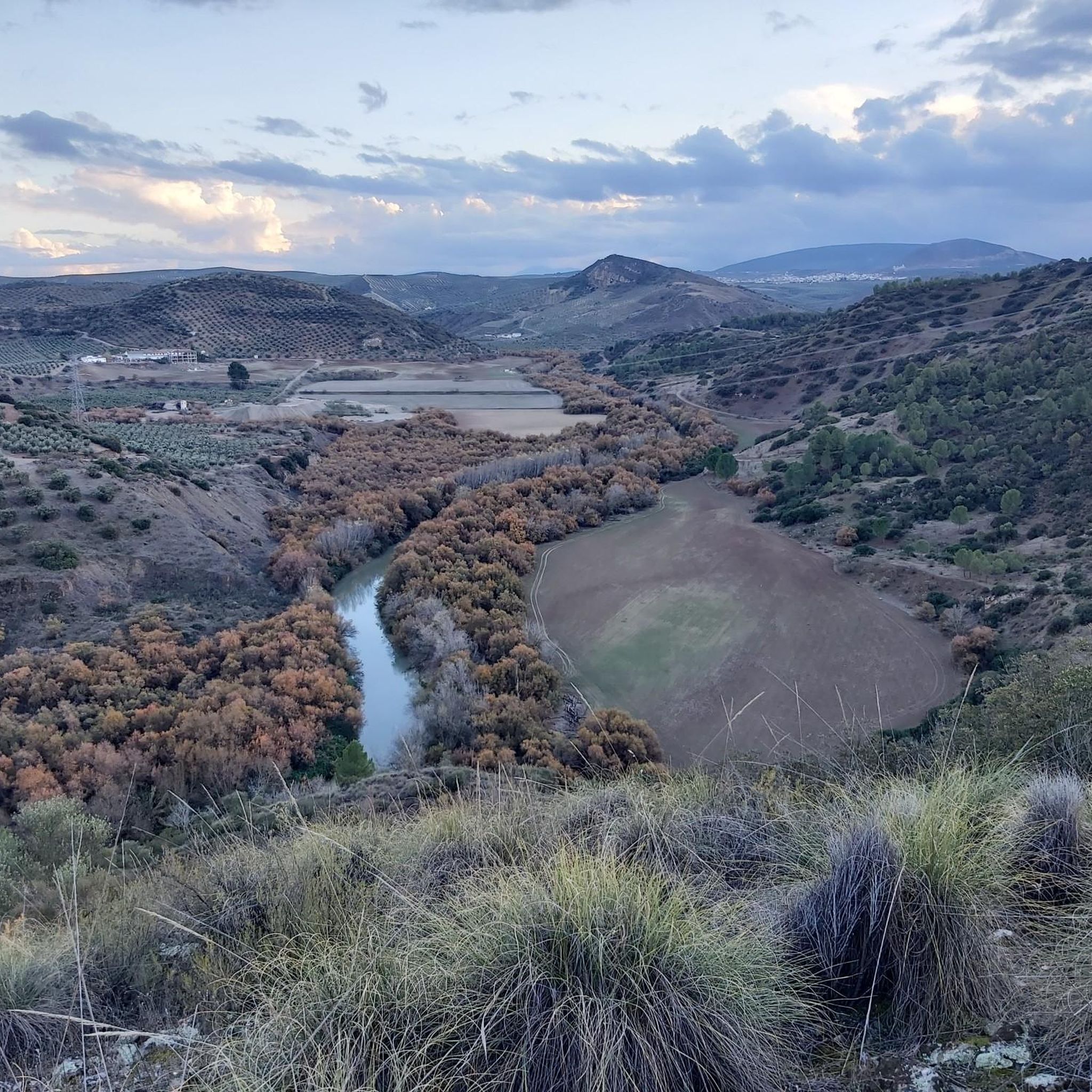
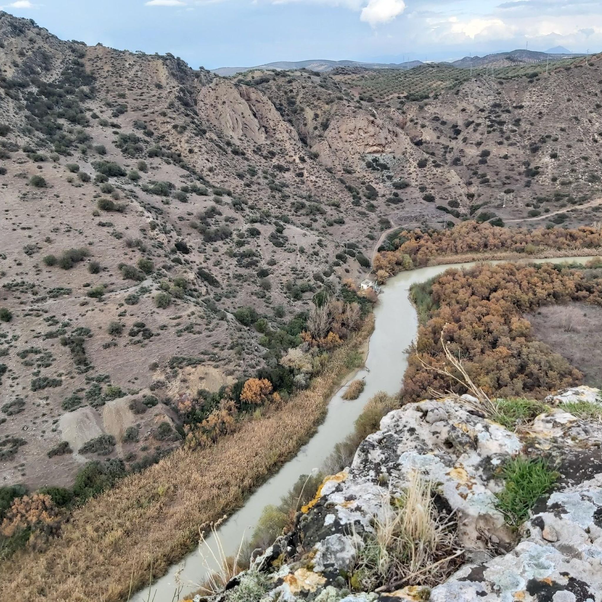
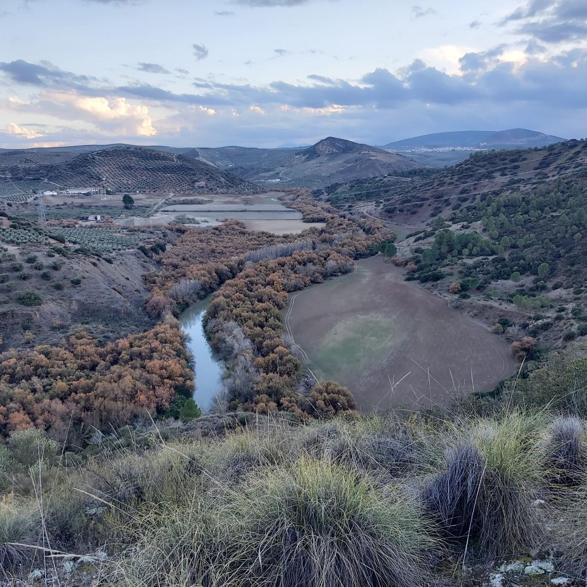
Beautiful valley through which the Río Genil runs and which offers a wide view of this area that is above the arrival of the reservoir.
0
0
Hermitage that still contains the style of a Mozarabic-style cave church in which the amplitude of its façade stands out, making it one of the few monuments of these characteristics in Andalusia.
0
0
Beautiful views of the Malpasillo Reservoir and you can also see the continuity of the Río Genil!
0
0

Outdoor adventure route, passing through the Hermitage of Nuestra Señora de la Fuensanta and the ruins of old mines.
1
0
View of the Malpasillo Dam on the Genil River on the outskirts of the town of Badolatosa. The slowing of the river creates a unique natural landscape and a habitat for wildlife. A great outdoor space for adventure.
1
0

From this point we can see the dam on the Genil river and the town of Badolatosa on our left. Going down the dirt road we will arrive at the famous meander of the Genil river (it is a 15-minute walk).
2
0
It is located on the outskirts of the municipality and was built between 1544 and 1620. It is a Mozarabic-style cave church in which the breadth of its façade stands out, making it one of the few monuments of these characteristics in Andalusia. .
1
0
One of the last meanders of the Genil river before reaching the Malpasillo Reservoir, close to the town of Badolatosa. Space to be there for a while, quietly and enjoying this beautiful landscape!
1
0
Frequently Asked Questions
How many hiking trails are available around Palenciana?
There are over 5 hiking routes documented around Palenciana, offering a variety of experiences through the region's unique landscapes.
What kind of landscapes will I encounter on hikes in Palenciana?
Hiking in Palenciana offers diverse scenery, from extensive cereal fields and olive groves to the rich riverside ecosystems of the Genil River, featuring poplars, willows, and tamarisks. You'll also find trails with views of gentle hills like Cerro del Hacho.
Are there any easy hiking options suitable for beginners or families?
Yes, Palenciana offers easy hiking options. For instance, the Path of the Arroyo de las Cañas - circular from Palenciana (PR-A 8) is an easy 4.3 km circular trail that takes just over an hour to complete, perfect for a relaxed outing through agricultural landscapes.
What historical or natural landmarks can I see along the hiking trails?
Many trails offer glimpses into the region's history and natural beauty. You can see ancient Arab-origin waterwheels along the Genil River, the ruins of the Gómez Arias castle on Cerro del Hacho, and the historic Hernán Ruiz II bridge. The Hermitage of Our Lady of Fuensanta, an old Mozarabic cave church, is also a notable landmark near some routes.
Are there any circular hiking routes in Palenciana?
Yes, Palenciana features several circular routes. The Route of the Norias of the Genil River is a moderate 8.3 km circular trail, and the Path of the Arroyo de las Cañas - circular from Palenciana (PR-A 8) is an easier 4.3 km loop.
What is the best time of year to go hiking in Palenciana?
The best time to hike in Palenciana is typically during the spring (March to May) and autumn (September to November) when temperatures are milder and the landscapes are vibrant. Summers can be very hot, making early mornings or late afternoons preferable if hiking during that season.
Are the hiking trails in Palenciana dog-friendly?
While specific regulations for dogs on trails are not detailed, generally, dogs are welcome on most rural trails in Andalusia, provided they are kept under control, especially near livestock, and owners clean up after them. Always ensure your dog is well-behaved and consider the heat during warmer months.
What do other hikers enjoy most about hiking in Palenciana?
The area is highly rated by the komoot community, with an average score of 4.2 stars. Reviewers often praise the tranquil agricultural settings, the historical and ecological significance of the Genil River, and the opportunities to discover ancient hydraulic structures and historical sites embedded within its natural landscapes.
Are there any specific natural features like waterfalls or unique water sources?
While large waterfalls are not a prominent feature, the Molinillo Path is associated with small waterfalls and pools. Additionally, about 2 km southeast of Palenciana, you can find the Fuente de los Ciélagos, a water source known for its mineral-medicinal, sulphurous waters.
Where can I find parking for the hiking trails in Palenciana?
Specific parking areas for each trail are not detailed, but as Palenciana is a village, you can typically find parking within or on the outskirts of the village, especially near trailheads or local amenities. It's advisable to check local signage upon arrival.
Are there any places to eat or stay in Palenciana after a hike?
Palenciana is a charming village, and while specific establishments are not listed, you can expect to find local cafes, restaurants, and possibly guesthouses or rural accommodations within the village to refresh and relax after your hike.
What is the longest hiking route available in the area?
Among the listed routes, the Genil River Meander – Arroyo del Pontón loop from Corcoya is one of the longer options, covering approximately 9.15 km and typically taking around 2 hours and 35 minutes to complete.
Most popular attractions around Palenciana

Get inspired with the komoot mobile app


Explore more
Browse the best Hikes in other regions.
