The best walks and hikes around Arroyomolinos De La Vera
4.1
(37)
206
hikers
18
hikes
Hiking around Arroyomolinos De La Vera offers trails through varied landscapes, characterized by its natural water features and rolling terrain. The region features a mix of open plains, wooded areas, and paths leading to waterfalls. Elevation changes are present, providing diverse hiking experiences.
Best hiking trails around Arroyomolinos De La Vera
- The most popular hiking route is Cascada del Caozo – circular from Valdastillas (PR-CC 32), a 5.1 miles (8.2 km) trail that takes 2 hours 24 minutes to…
Last updated: June 24, 2026
4.6
(13)
68
hikers
8.19km
02:25
240m
240m
Moderate hike. Good fitness required. Easily-accessible paths. Suitable for all skill levels.
5.0
(1)
11
hikers
14.4km
04:03
300m
300m
Hike the moderate 8.9-mile Mojón Blanco Trail in Valle del Jerte, offering splendid views of the La Vera region and a summit with panoramic

Sign up for free
4
hikers
5.54km
01:48
250m
250m
An easy 3.4-mile hike in Valle del Jerte, leading to the beautiful Calderón Waterfall with 820 feet of elevation gain.
4.0
(2)
6
hikers
13.0km
03:31
180m
180m
Moderate hike. Good fitness required. Easily-accessible paths. Suitable for all skill levels.
2
hikers
21.8km
06:21
570m
570m
Hike the difficult 13.6-mile Los Llanos - Calderón Trail through a volcanic landscape, gaining 1871 feet to panoramic views.
Get access to more routes and recommendations from other explorers.
Sign up for free
Already have an account?
Our route recommendations are based on thousands of hikes, rides, and runs completed by other people on komoot.
Start today with a free account
Your next adventure awaits.
Login or Signup

Tips from the Community

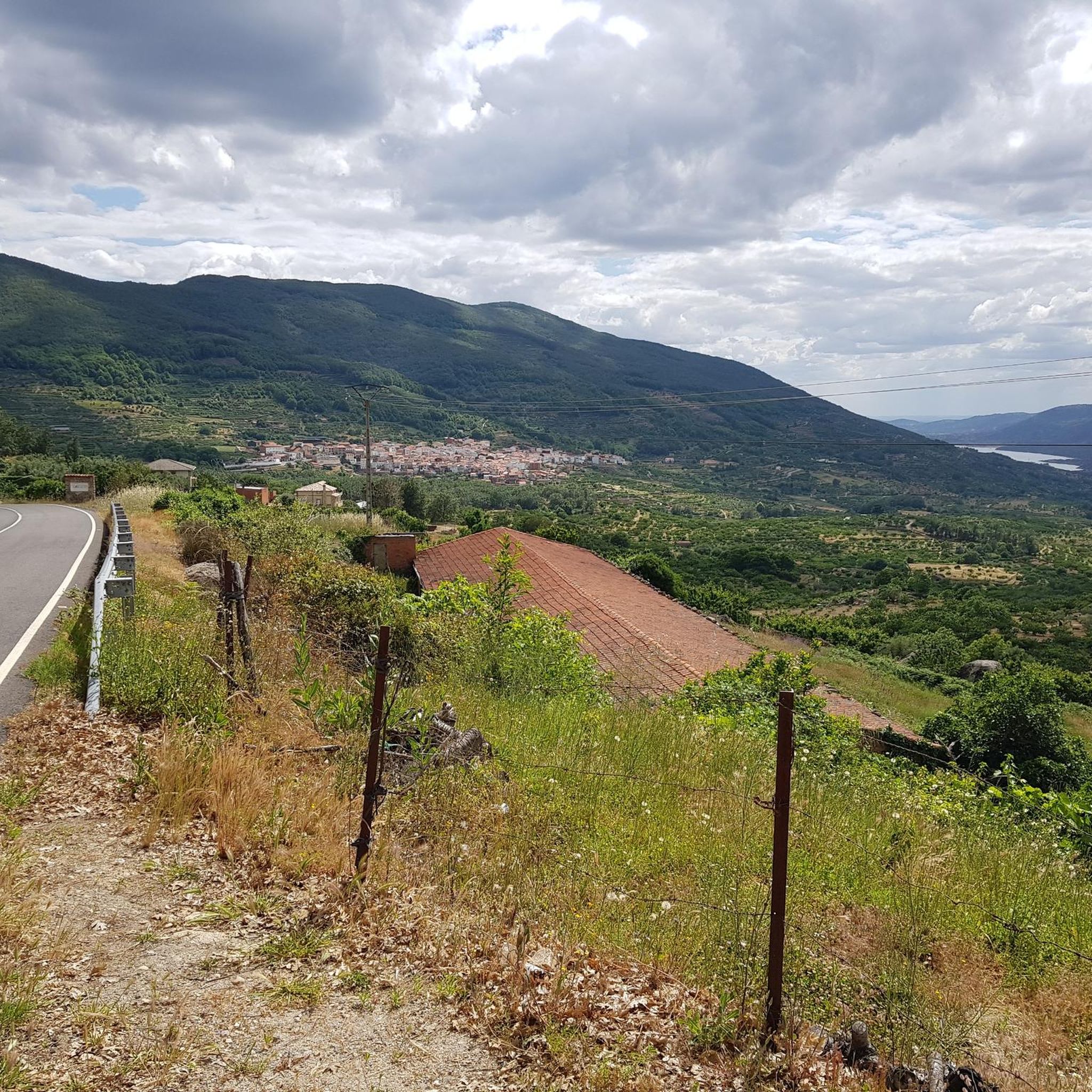
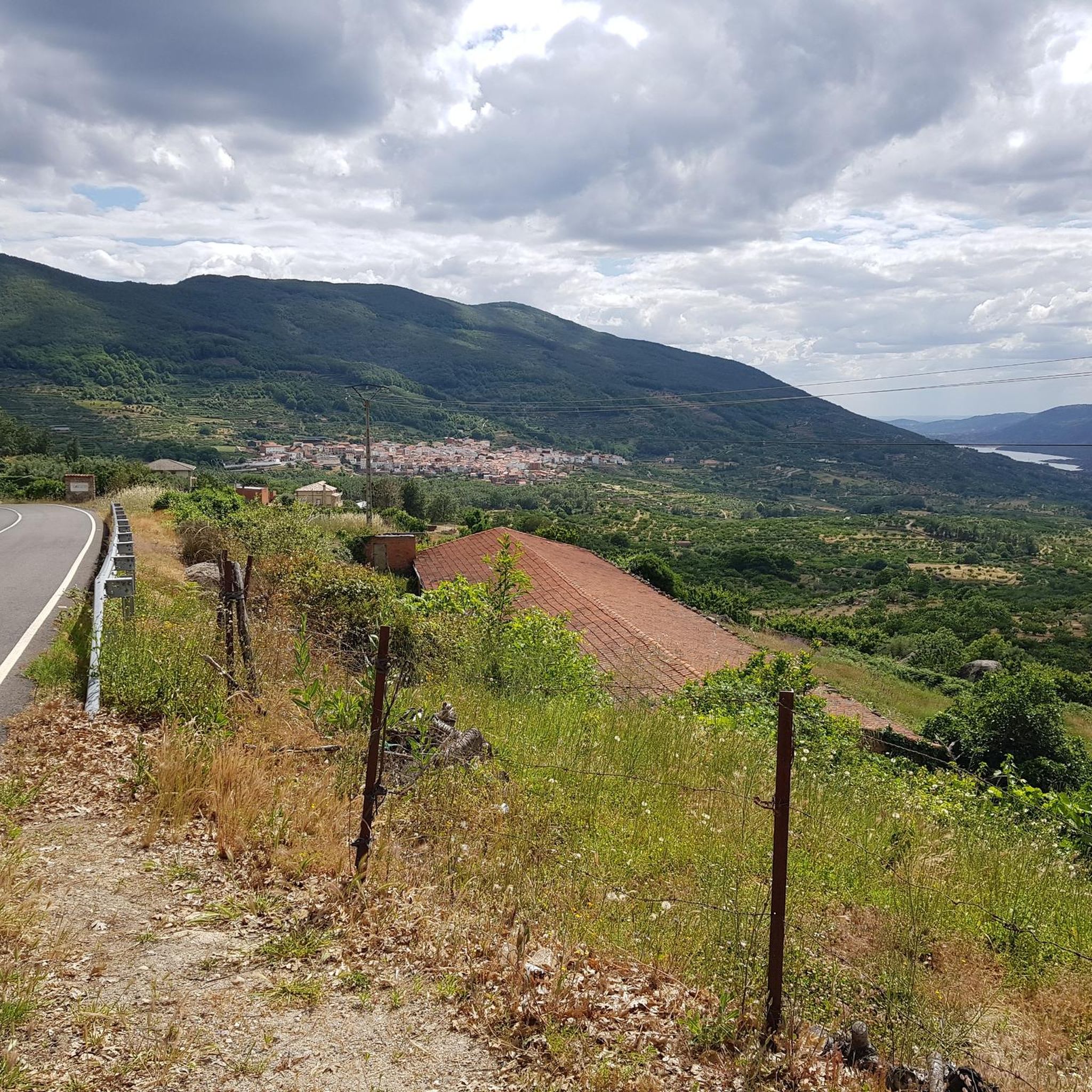
This viewpoint in Los Pueblos offers an incredible panoramic view. From here, you can see the towns of Tejeda de Tiétar, Arroyomolinos de la Vera, and Pasarón de la Vera, nestled in a beautiful meadow dotted with holm oaks and large oak trees. In the background, the incredible Gredos and Tormantos mountain ranges loom.
0
0
Tejeda de Tiétar is a peaceful gateway to the La Vera region, surrounded by holm oaks, oak trees, and olive groves, overlooking the Tiétar River. Its historic center, with its whitewashed houses, holds treasures such as a Renaissance church and ancient Roman remains.
0
0

The path from the Cascada Caozo is a partly very steep mountain path with very few cairns and is densely overgrown. The pool at the Cascada Calderon invites you to swim.
2
0

The picturesque path that leads to this waterfall is worth the trip, but this does not rule out the beauty of the Cascada del Calderón.
1
0
This is one of the most spectacular waterfalls in the area. It's only a short walk from the road, but if you're with a bike, you'll need to leave it on the road or ride up a steep path.
0
0

The Route of the Mojón Blanco offers a very entertaining itinerary and views and highlights the Cuerda de los Cervigueros with wonderful views towards the entire Valley of La Vera.
0
0
The top of the Mojón Blanco at 1400 meters above sea level offers beautiful views of the entire interior of Extremadura and the valley of La Vera. It can be reached by the marked route PR-CC 14 from Piornal.
3
0
The interior of Extremadura is full of waterfalls and beautiful waterfalls. This is one of them and it can be easily reached either from Valdastillas via the Caozo waterfall or from Piornal via a picturesque path without difficulty.
4
0
Frequently Asked Questions
How many hiking trails are available in Arroyomolinos De La Vera?
There are 18 hiking routes around Arroyomolinos De La Vera, offering a variety of experiences for different skill levels. These trails are highly rated by the komoot community, with an average score of 3.8 stars.
Are there easy hiking trails suitable for beginners or families in Arroyomolinos De La Vera?
Yes, Arroyomolinos De La Vera offers 7 easy hiking routes. One excellent option is the Los Llanos - Calderón Trail, which is 3.4 miles (5.5 km) long and leads through plains and natural features, typically completed in under 2 hours. This trail is well-suited for a relaxed outing.
What kind of natural attractions can I see along the hiking trails?
The region is known for its beautiful water features and natural monuments. Hikers can discover the impressive Caozo Waterfall, explore the Natural pools of Valdastillas, or admire the ancient Centuries-old chestnut trees. The Lake Alonso Vega also offers scenic views.
Are there any circular hiking routes in Arroyomolinos De La Vera?
Yes, many trails in the area are circular, allowing you to start and end at the same point. A popular circular route is the Cascada del Caozo – circular from Valdastillas (PR-CC 32), which is 5.1 miles (8.2 km) long and features a notable waterfall.
What is the best time of year to go hiking in Arroyomolinos De La Vera?
The ideal time for hiking in Arroyomolinos De La Vera is typically during spring (April-May) and autumn (September-October). During these seasons, temperatures are milder, and the landscape is vibrant with blooming flora or rich autumn colors. Summers can be very hot, making early morning or late afternoon hikes preferable.
Are there any trails that feature waterfalls?
Absolutely! Arroyomolinos De La Vera is characterized by its stunning waterfalls. The Cascada del Caozo – circular from Valdastillas (PR-CC 32) specifically highlights the beautiful Caozo Waterfall. Other notable waterfalls in the area include El Calderón - Garganta Mayor and Garganta de Marta.
Are the hiking trails in Arroyomolinos De La Vera dog-friendly?
Many trails in the Arroyomolinos De La Vera region are suitable for hiking with dogs, provided they are kept under control, especially near livestock or protected areas. It's always advisable to check local regulations for specific routes and ensure your dog is well-behaved and on a leash when necessary. Remember to bring enough water for both you and your pet.
How long do hikes typically take in this region?
Hike durations vary depending on the trail's length and difficulty. For instance, the Los Llanos - Calderón Trail takes approximately 1 hour 48 minutes, while the longer Mojón Blanco Trail can take around 4 hours. There are options ranging from short walks to longer excursions.
Are there any challenging or difficult hikes in Arroyomolinos De La Vera?
Yes, for experienced hikers seeking a challenge, there is 1 difficult route among the 18 available. An example of a more demanding trail is the longer version of the Los Llanos - Calderón Trail, which spans over 13.5 miles (21.8 km) and involves significant elevation changes, requiring approximately 6 hours to complete.
What do other hikers enjoy most about hiking in Arroyomolinos De La Vera?
The area is highly rated by the komoot community, with an average score of 3.8 stars from over 30 reviews. Hikers often praise the varied terrain, the presence of beautiful waterfalls, and the well-maintained established trails that offer both open views and wooded sections. The natural beauty and diverse options for all skill levels are frequently highlighted.
Are there any trails that offer views of the Mojón Blanco summit?
Yes, the Mojón Blanco Trail is an 8.9-mile (14.4 km) path that traverses varied terrain and offers open views, likely including glimpses of the Mojón Blanco summit itself. This moderate route provides a great opportunity to experience the region's higher points.
Are there any trails that follow the PR-CC official routes?
Yes, the region includes officially designated trails. For example, the PR-CC 79 Ruta de los Pontones is a moderate 8-mile (12.9 km) route that offers a well-marked experience through the local landscape.
Most popular routes around Arroyomolinos De La Vera
Most popular attractions around Arroyomolinos De La Vera

Get inspired with the komoot mobile app


Explore more
Browse the best Hikes in other regions.
