The best walks and hikes around National Park Redes
4.6
(447)
3,882
hikers
43
hikes
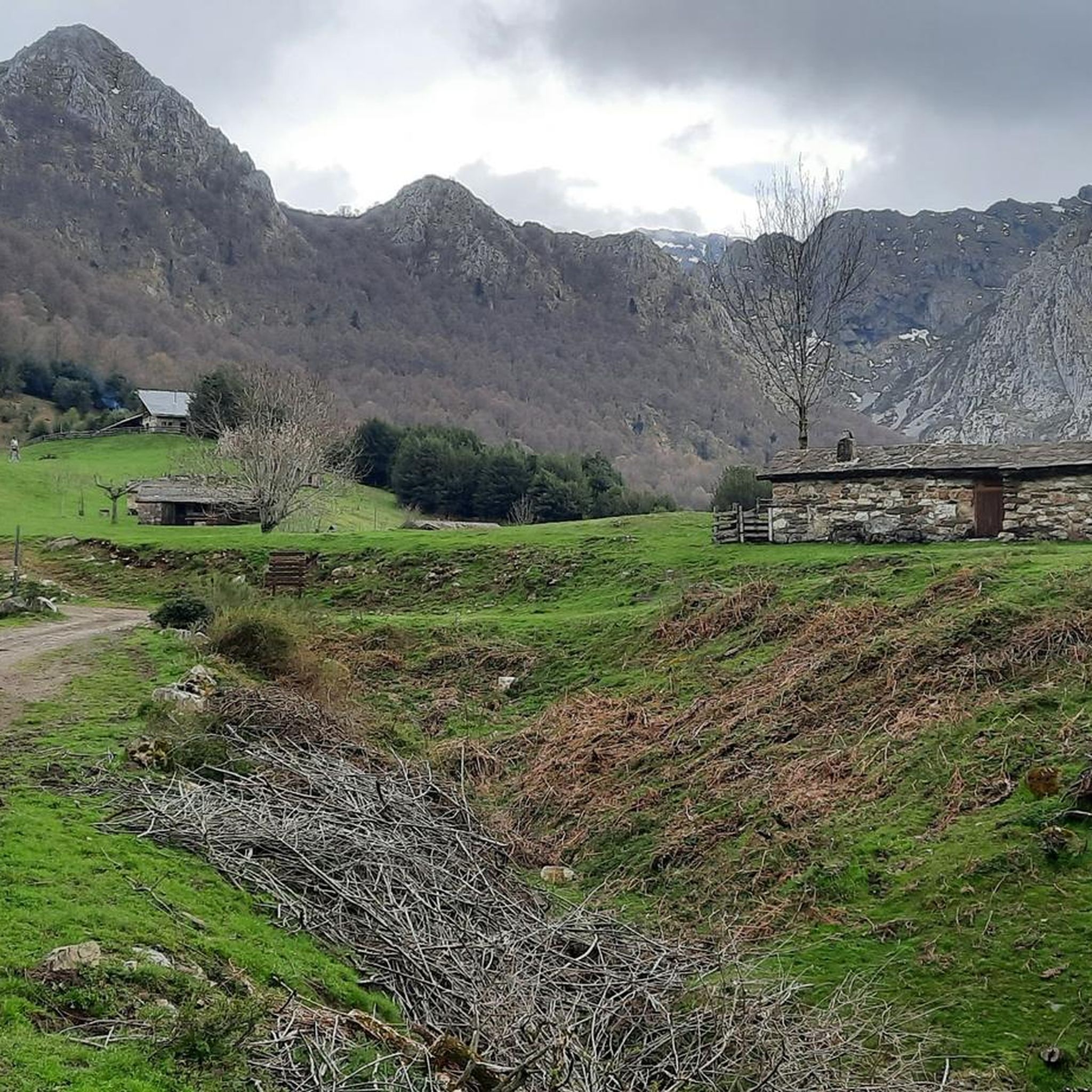
Hiking around National Park Redes offers diverse and striking natural beauty within Asturias, Spain. The park is characterized by glacial valleys, karst caves, jagged peaks, and extensive beech and oak forests. Rivers like the Nalón carve through the landscape, creating picturesque routes, while elevations range significantly, with almost 80% of the surface above 800 meters. This mountainous terrain provides a natural environment largely untouched by human development, ideal for outdoor activities.
Best hiking trails around National Park Redes
- The most popular hiking route is Tabayón de Mongallu Route, a 6.6 miles (10.7 km) trail that takes 3 hours 23 minutes to complete. This route leads through beech forests to a stunning waterfall and offers mountain views.
- Another top favourite among local hikers is Cabeza de Arco Trail, a difficult 8.3 miles (13.4 km) path. This trail features diverse scenery and a natural arch.
- Local hikers also love the Ruta del Cuyargayos — circular desde Soto de Agues, a 9.0 miles (14.5 km) trail leading through varied mountain terrain, often completed in about 5 hours 16 minutes.
- Hiking around National Park Redes is defined by glacial valleys, extensive beech forests, and jagged peaks. The network offers options for easy walks to challenging mountain routes.
- The routes in National Park Redes are highly rated by the komoot community with an average score of 4.6 stars from over 100 reviews. More than 1,000 hikers have used komoot to explore National Park Redes's varied terrain.
Last updated: October 10, 2026
4.6
(13)
124
hikers
10.7km
03:23
440m
440m
Moderate hike. Good fitness required. Easily-accessible paths. Suitable for all skill levels.
4.3
(14)
81
hikers
13.4km
05:21
750m
740m
Hard hike. Very good fitness required. Mostly accessible paths. Sure-footedness required.

3.7
(3)
26
hikers
14.5km
05:16
890m
890m
Hard hike. Very good fitness required. Mostly accessible paths. Sure-footedness required.
4.7
(16)
135
hikers
10.6km
03:25
460m
460m
Moderate hike. Good fitness required. Easily-accessible paths. Suitable for all skill levels.
4.6
(8)
61
hikers
8.76km
02:51
370m
370m
Moderate hike. Good fitness required. Easily-accessible paths. Suitable for all skill levels.
Get access to more routes and recommendations from other explorers.
Already have an account?
Our route recommendations are based on thousands of hikes, rides, and runs completed by other people on komoot.
Start today with a free account
Your next adventure awaits.

Other adventures around National Park Redes

Tips from the Community

The small mountain village of Caleao hangs beautifully on the slope and appears very authentic. Even if the village is suitable as a starting point for various tours, such as the one into the Desfiladero de los Arrudos, it appears at best a little touristy. If you can't find a parking space here, you might find one on the other side of the road leading to the village, near the campsite - the parking spaces opposite the main building seem to be public, not just for visitors to the campsite.
0
0
Coming from Caleao, the cart track ends here at the last house into the Desfiladero de los Arrudos and from here you continue on a largely natural path into the gorge, which digs itself ever deeper and steeper into the mountains. This gorge is truly impressive, the path is worth it.
0
0
There is no way around Soto de Agues if you want to hike the Ruta del Alba in the Redes Natural Park, like I did, as a classic. A beautiful village with many beautiful old houses. Hikers are intercepted with their cars in a large car park just before the village, so they don't park randomly in the village. If you choose the Camín de Socuitu, which runs approximately parallel, for the last approx. 2km of the return journey instead of the Ruta del Alba, you will pass numerous hórreos (Asturian granaries) in the village.
0
0
Coming out of the forest, I saw the waterfall for the first time, the goal of my tour. You could already hear it earlier...
0
0
Along the path from Tarna to Tabayón de Mongallu, you will repeatedly find so-called pollarded beeches - beeches that were previously repeatedly cut back for timber harvesting above the height accessible to cattle, and then formed new shoots there, so that the very old trees now have a thick but low main trunk and above it many comparatively thin younger shoots.
0
0
The Tabayón del Mongallu, with its 60 meters of height, is quite impressive. It doesn't just fall straight down, it looks very beautiful, even if it doesn't carry huge amounts of water. After the last stretch to the waterfall, which is a bit steeper on a scree ground, you can take a slightly longer break here. It's quite cool near the waterfall, which is very good on a hot day.
0
0
From Tarna to the waterfall, two paths lead, relatively direct or a bit longer and flatter along the stream. Together, as PR-AS 060 Ruta del Tabayón de Mongallu, they form a beautiful circular route, where you relatively rarely encounter other hikers - only at the waterfall did I have some company. The loop is good for warming up before hiking longer distances, it certainly has a few strenuous climbs but is quite manageable. The last stretch to the waterfall is quite rocky, you should take your time on the descent here.
0
0

Several routes depart from Soto de Agues, including the typical Ruta del Alba.
0
0
Frequently Asked Questions
How many hiking trails are available in National Park Redes?
National Park Redes offers a vast network of trails, with over 30 official hiking routes. These range from easy walks to challenging mountain expeditions, covering a total distance of 200 km across the park.
Are there easy hiking trails suitable for beginners or families in National Park Redes?
Yes, National Park Redes has several easy trails perfect for beginners or families. While specific easy routes aren't detailed here, the park's diverse network includes options that are less strenuous, allowing everyone to enjoy its natural beauty. Look for trails with lower elevation gain and shorter distances.
Can I find circular hiking routes in National Park Redes?
Yes, circular routes are available. For example, the Ruta del Cuyargayos — circular desde Soto de Agues is a popular 14.5 km trail that offers varied mountain terrain and starts from the village of Soto de Agues.
Are there any trails that feature waterfalls in National Park Redes?
Absolutely! The park is known for its abundant water features. A highlight is the Tabayón de Mongallu Route, which leads through beautiful beech forests to the stunning Tabayón del Mongayu Waterfall. Another option is the Tabayón del Mongallu Waterfall – Tarna loop from Tarna.
What kind of natural landscapes can I expect to see while hiking in National Park Redes?
National Park Redes boasts incredibly diverse landscapes. You'll encounter glacial valleys, dramatic karst caves, jagged peaks, and extensive, ancient beech and oak forests. Rivers like the Nalón carve through the terrain, creating picturesque gorges and providing numerous springs and streams. The park's elevation ranges significantly, offering varied scenery from verdant meadows to high mountain environments.
Are there any interesting villages or cultural sites to visit near the trails?
Yes, the park is dotted with charming traditional villages. Soto de Agues, Caleao, Tarna, and Bezanes are excellent starting points for many routes and offer glimpses into Asturian rural life with their ancient stone cottages. You can explore Soto de Agues Village, for instance, which is a popular trailhead.
What do other hikers say about their experience in National Park Redes?
The hiking routes in National Park Redes are highly rated by the komoot community, with an average score of 4.6 stars from over 100 reviews. Hikers often praise the park's spectacular and varied landscapes, the extensive and well-maintained trails, and the rich biodiversity, including opportunities to spot wildlife.
Is National Park Redes suitable for hiking with dogs?
While the park is a natural environment, specific regulations regarding dogs on trails can vary. It's generally advisable to keep dogs on a leash to protect wildlife and ensure a pleasant experience for all hikers. Always check local signage or park authority guidelines for the most current information on specific trails.
What are some of the more challenging hikes in National Park Redes?
For experienced hikers seeking a challenge, National Park Redes offers several difficult routes. The Cabeza de Arco Trail is an 8.3-mile path featuring diverse scenery and a natural arch. Another demanding option is the Texu la Oración Viewpoint – Crestón Tunnel loop from Bezanes, a 21.5 km route with significant elevation changes.
What is the best time of year to go hiking in National Park Redes?
The best time to hike in National Park Redes largely depends on your preferences. Spring and autumn offer pleasant temperatures and vibrant colors, with autumn being particularly stunning due to the extensive beech forests. Summer is also popular, though some higher routes might be very warm. Winter hiking is possible but requires appropriate gear and experience, especially at higher elevations, due to snow and ice.
Are there any specific trails known for their unique natural features like gorges or forests?
Yes, the park is rich in such features. The Ruta del Alba, a former mining trail, is famous for running along the Alba River through a gorge, featuring pools, waterfalls, and rapids. The Desfiladero de los Arrudos (Arrudos Gorge) also offers a long route between vertical walls. For forests, the Fabucao beech forest is particularly renowned for its scenic routes.
Are there any viewpoints or scenic spots accessible via hiking trails?
Absolutely. Many trails lead to breathtaking viewpoints. The Texu la Oración Viewpoint is a notable scenic spot, often included in longer loops like the Texu la Oración Viewpoint – Crestón Tunnel loop from Bezanes. The park's mountainous terrain ensures expansive views from numerous points along its trails, including from peaks like Picu Torres and Tiatordos Peak.
Most popular routes around National Park Redes
Most popular attractions around National Park Redes

Get inspired with the komoot mobile app


Explore more
Browse the best Hikes in other regions.
