The best walks and hikes around Purujosa
4.7
(125)
1,230
hikers
34
hikes
Hiking around Purujosa offers access to trails within the Moncayo Natural Park, characterized by its mountainous landscape, deep gorges, and diverse forests. The region features a mix of rocky outcrops, river valleys, and elevated viewpoints. The terrain provides varied conditions for hikers, from moderate ascents to more challenging climbs.
Best hiking trails around Purujosa
- The most popular hiking route is Peñas de Herrera - circular from Talamantes, a 9.3 miles (15.0 km) trail that takes 4 hours 50 minutes…
Last updated: July 2, 2026
4.5
(11)
55
hikers
15.0km
04:50
650m
650m
Moderate hike. Good fitness required. Easily-accessible paths. Suitable for all skill levels.
4.7
(3)
10
hikers
15.7km
05:28
890m
890m
Hard hike. Very good fitness required. Easily-accessible paths. Suitable for all skill levels.

Sign up for free
5.0
(2)
4
hikers
7.26km
02:08
210m
210m
Moderate hike. Good fitness required. Easily-accessible paths. Suitable for all skill levels.
5
hikers
Moderate hike. Good fitness required. Easily-accessible paths. Suitable for all skill levels.
3
hikers
Moderate hike. Good fitness required. Easily-accessible paths. Suitable for all skill levels.
Get access to more routes and recommendations from other explorers.
Sign up for free
Already have an account?
Our route recommendations are based on thousands of hikes, rides, and runs completed by other people on komoot.
Start today with a free account
Your next adventure awaits.
Login or Signup

Other adventures around Purujosa

Tips from the Community

The Peñas del Cabo Caves are located on the western cliffs of the Peñas del Cabo, near Calcena, in the province of Zaragoza, Aragon. These caves are known for their impressive geological structure and speleothems, such as stalactites, stalagmites and flowstones. One of the most popular caves is the Cueva Honda, which has been used as a shelter for livestock and has housed archaeological remains from the Neolithic period. In addition, the cave is an important refuge for bat colonies during the summer. The caves offer a unique experience for caving and nature lovers.😊
4
0
The Mirador de la Ermita de San Cristóbal is located in the municipality of Los Fayos, in the province of Zaragoza, Aragon. This viewpoint offers spectacular views of the Queiles River Valley and the surrounding area, including the Val reservoir. The San Cristóbal hermitage, located next to the viewpoint, is a place of great historical and cultural interest. Built in the 17th century, the hermitage is an example of religious architecture in the region. Access to the viewpoint and the hermitage can be made through several hiking routes that run through the area, offering the opportunity to enjoy nature and panoramic views.
4
0

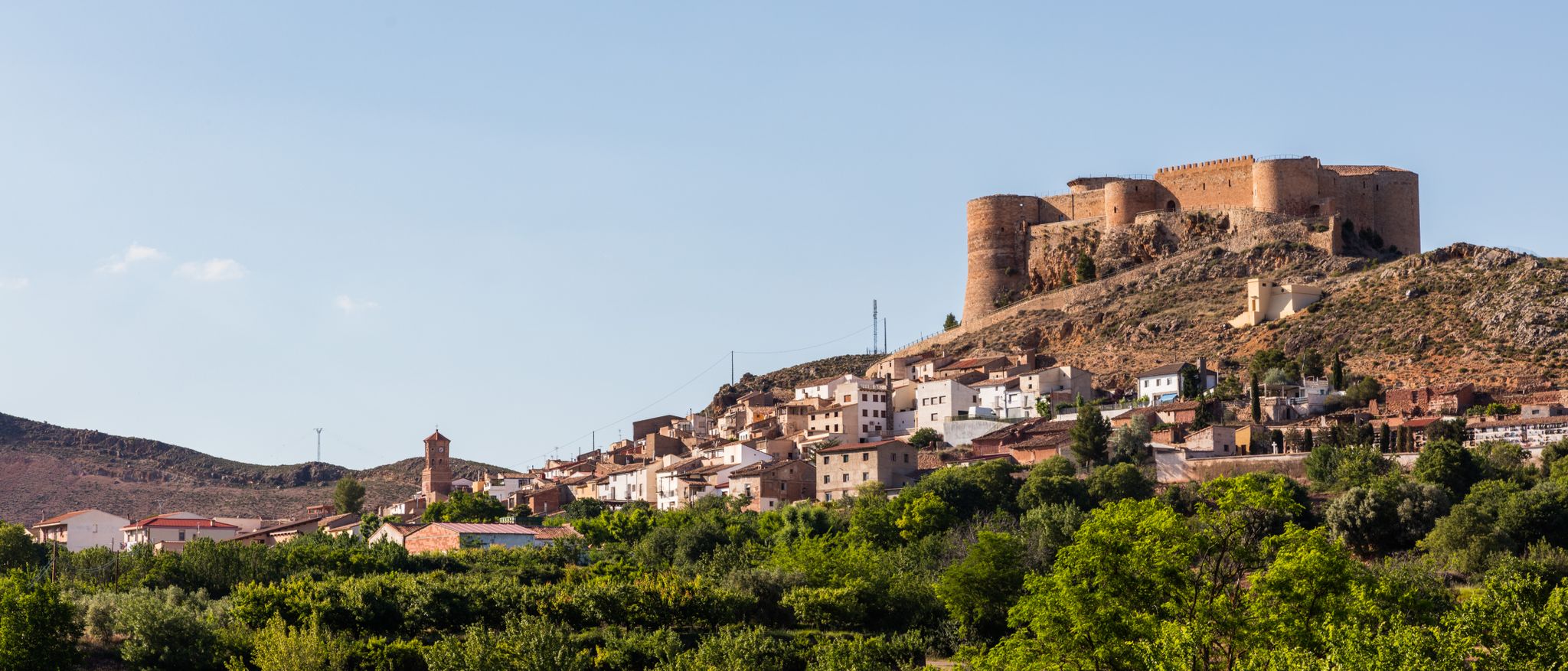
The Talamantes castle was built in the 11th century with the purpose of defending the border crossing between Castile and Aragon in the Valdeherrera and Valdetreviño ravines. Although much of the fortification is in a state of ruin, the north wall and one of its towers are still quite well preserved.
0
0
The Valdeherrera ravine connects the town of Talamantes with the Estacas hill, a point where the GR 90 forks into two variants. The ravine, although it consists of steep slopes, offers fantastic views of the surrounding rocks.
1
0

At the Collado de la Atalaya you have to head northeast along the slope of the mountain range following a level path marked with stone markers. The path crosses the Las Hoyas de los Portillos valley and climbs halfway through the pine forest towards the wall of the Muela del Cerro Morrón. In the pine forest you have to keep climbing towards the east and at the base of the walls connect with the path coming from the north face of the mountain. The landmarks are clear between the pine trees and the mole wall, they jump a couple of small slopes near other cavities and lead to the spectacular Cueva de los Pilares, a fantastic natural rock sanctuary with arches, vaults and giant columns. The climb to the summit of the mole leaves from the cave through the canal located to the west, it is a clear and obvious climb, it has stone markers and although it seems that there is no exit with good visibility, it is a simple section along some aerial ledges without too many complications, unless the rock is wet, it cannot even be classified as a climbing step, rather technical mountain hiking. The milestones enter the large inclined molar plain and take the direction of the summit through the center of the mountain.
0
1
At Cerro Morrón (1,730 m) there is a trig point and good views of the Moncayo massif. The visible summit is Lobera (2,226 m) and behind it the distant San Miguel peak (2,315 m), simply showing the silhouette of the summit. And below the pedestal of the great mountain covered by endless forests of pines, oaks and beech trees. Towards the north the enormous plain of the Ebro valley and around it the rest of the reliefs of the eastern Iberian region.
0
0

The Herrera rocks are formations that break the smooth crest of the mountain and resemble castles. From this point you can see its peaks, to the southeast.
0
0

At this point we will find an informative poster (very worn) facing the beautiful Muela de Beratón.
1
1
Frequently Asked Questions
How many hiking trails are available around Purujosa?
Purujosa offers access to over 30 hiking trails within the Moncayo Natural Park. These routes vary in difficulty, providing options for different experience levels.
Are there easy hiking trails suitable for beginners or families?
Yes, there are a few easy trails around Purujosa, with 2 specifically categorized as easy and 24 as moderate. While specific family-friendly routes aren't detailed, many moderate trails can be suitable for families with some hiking experience. For a moderate option that is popular and offers scenic views, consider the Valcongosto Gorges and Cuartún - circular from Purujosa, which is 4.5 miles (7.3 km) long.
What kind of challenging hikes can I find in the Purujosa area?
For experienced hikers seeking a challenge, Purujosa offers 7 difficult trails. A notable challenging route is the Cueva de los Pilares and Cerro Morrón Loop. This 9.7-mile (15.7 km) path features significant ascents to Cerro Morrón and varied terrain, making it a demanding option.
Are there any circular hiking routes around Purujosa?
Yes, many trails in the region are designed as circular routes, allowing you to start and end at the same point. An example is the Valcongosto Gorges and Cuartún - circular from Purujosa, which takes you through scenic gorges and the Cuartún area.
What are some interesting natural landmarks or attractions to see while hiking?
The region is rich in natural beauty. You can explore highlights such as the Cueva de los Pilares, a fascinating cave formation. For panoramic views, consider trails that lead to viewpoints like Cabezo de la Mata or View of Moncayo.
Are there any specific viewpoints worth seeking out on the trails?
Absolutely. The mountainous terrain around Purujosa offers several stunning viewpoints. The Cabezo de la Mata and the View of Moncayo are popular spots for expansive vistas of the surrounding hills and valleys. Some trails also lead to summits like Cerro Morrón Summit, offering elevated perspectives.
What do other hikers enjoy most about the trails around Purujosa?
The trails around Purujosa are highly rated by the komoot community, with an average score of 4.7 stars from over 100 reviews. Hikers frequently praise the diverse terrain, from deep gorges to forested paths, and the opportunities for both moderate walks and challenging ascents within the Moncayo Natural Park.
Is Purujosa a dog-friendly hiking destination?
While specific regulations for dogs on trails within the Moncayo Natural Park can vary, generally, dogs are welcome on most hiking trails in the Purujosa area, especially if kept on a leash. It's always advisable to check local signage and ensure your dog is well-behaved and doesn't disturb wildlife or other hikers.
What is the best time of year to go hiking in Purujosa?
The best time to hike in Purujosa is typically during the spring (April to June) and autumn (September to October) when the weather is mild and the natural scenery is at its most vibrant. Summers can be hot, especially at lower elevations, while winters may bring snow to higher parts of the Moncayo Natural Park, requiring appropriate gear.
Are there options for parking near the trailheads in Purujosa?
Parking availability can vary depending on the specific trailhead. In Purujosa itself, you can usually find parking within the village. For trails starting outside the village, it's common to find designated parking areas or roadside spots near popular access points. Always check maps or route descriptions for specific parking recommendations for your chosen hike.
What should I pack for a hike in Purujosa?
Given the mountainous and varied terrain, it's recommended to pack sturdy hiking boots, layers of clothing suitable for changing weather conditions, plenty of water, snacks, a map or GPS device (like komoot), sun protection, and a first-aid kit. For longer or more challenging routes, trekking poles can also be beneficial.
Can I reach the hiking trails around Purujosa using public transport?
Public transport options directly to all trailheads around Purujosa may be limited, as it is a more rural area. It's generally easier to access the region by car. However, some local bus services might connect Purujosa to larger towns, from which you could potentially arrange further transport or start a hike if the trailhead is accessible from the village.
Most popular attractions around Purujosa

Get inspired with the komoot mobile app


Explore more
Browse the best Hikes in other regions.
