The best walks and hikes around Quintanilla De Trigueros
4.8
(22)
71
hikers
24
hikes
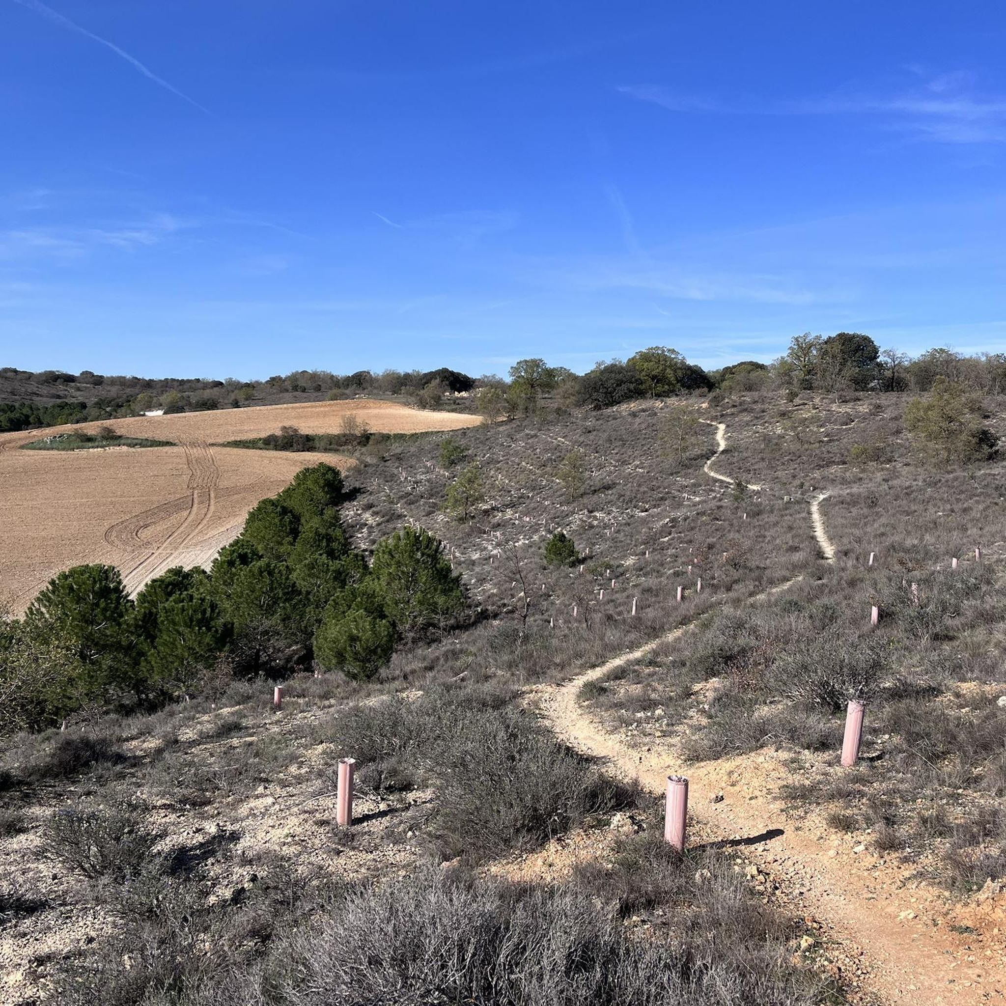
Hiking around Quintanilla De Trigueros offers diverse natural landscapes, characterized by a mix of agricultural fields, pine forests, and varied topography. The region features gentle hills, deep valleys, and rocky outcrops, providing a range of elevations for hikers. Water features like the Arroyo del Pocillo and Fuente del Conde add to the natural environment. Holm oak groves are also present, particularly in valleys and on steeper slopes.
Best hiking trails around Quintanilla De Trigueros
- The most popular hiking route is…
Last updated: June 29, 2026
5.0
(1)
2
hikers
16.6km
04:25
170m
170m
Moderate hike. Good fitness required. Mostly accessible paths. Sure-footedness required.
1
hikers
17.1km
04:30
150m
150m
Moderate hike. Good fitness required. Easily-accessible paths. Suitable for all skill levels.

Sign up for free
12.6km
03:20
110m
110m
Moderate hike. Good fitness required. Easily-accessible paths. Suitable for all skill levels.
7.79km
02:03
70m
70m
Moderate hike. Good fitness required. Easily-accessible paths. Suitable for all skill levels.
4.5
(4)
4
hikers
8.87km
02:15
20m
20m
Moderate hike. Good fitness required. Easily-accessible paths. Suitable for all skill levels.
Get access to more routes and recommendations from other explorers.
Sign up for free
Already have an account?
Our route recommendations are based on thousands of hikes, rides, and runs completed by other people on komoot.
Start today with a free account
Your next adventure awaits.
Login or Signup



Tips from the Community

On clear days the views reach up to the Palencia mountains.
0
0

The castle of Ampudia, the most important and best preserved in Palencia. Built between the 13th and 15th centuries in the Gothic style, it has a trapezoidal plan and three square corner towers. The keep stands out. Its symmetrical façade is decorated with Flemish scaraguaitas and a coat of arms of the Duke of Lerma. In addition, it was the place where the document that changed the capital from Valladolid to Madrid was signed.
1
0
Built in the 15th century, it is a magnificent example of medieval architecture in the province of Valladolid. Its imposing stone walls and its watchtower bear witness to its storied past. The interior has been restored and houses the permanent exhibition El Castillo Encantado with different themed areas with hidden passages, dungeons and much more.
1
0

Defensive building dating from the fifteenth century that houses a permanent exhibition on "The Enchanted Castle", where you can enjoy various works of art such as dragons, unicorns and fantasy animals between hidden passages.
2
0
Spanish medieval castle, now in ruins, located in the small town of the same name. It is located on the top of an isolated hill very close to the town, one of the foothills of the Torozos mountains.
1
0
Catholic temple of worship located in the small Palencia town of Torremormojón. Until the restoration work in 1986, the building was considered a work of the 16th century with Renaissance plasterwork and other masks.
2
1
It is the most important and best preserved fortification in the province of Palencia. It was built between the 13th and 15th centuries, being declared a national monument on July 3, 1931.
2
0
Picnic area and recreational park located on the route of the viewpoints of Monte de la Villa. This trail runs through the páramos of Monte de la Villa in Dueñas.
2
0
Frequently Asked Questions
How many hiking trails are available around Quintanilla De Trigueros?
There are over 20 hiking trails around Quintanilla De Trigueros, offering a variety of experiences from easy strolls to more moderate ascents. The komoot community has rated these routes highly, with an average score of 4.9 stars.
What kind of terrain can I expect on hikes in Quintanilla De Trigueros?
The terrain around Quintanilla De Trigueros is quite varied. You'll find expansive agricultural fields, serene pine forests, and diverse valleys. The landscape includes gentle hills, deep valleys, ravines, and both steep and gradual slopes, providing a range of elevations and scenic backdrops.
Are there any easy hiking trails suitable for beginners in the area?
Yes, Quintanilla De Trigueros offers 9 easy hiking trails, perfect for beginners or those looking for a leisurely walk. These routes often traverse agricultural fields and gentle landscapes, providing a pleasant introduction to the region's natural beauty.
What natural features or landmarks can I see while hiking?
Hikers can discover several natural features and landmarks. The region boasts water elements like the Arroyo del Pocillo and the Fuente del Conde. You'll also encounter rocky outcrops (peñas) and dense holm oak groves. Additionally, nearby attractions include the Casa Grande de Palencia, the View of the Fields of Tierra de Campos, and the Hexagonal Church of Valoria la Buena.
Are there any circular hiking routes around Quintanilla De Trigueros?
Yes, many routes in the area are circular. For example, the Senderos del Clarete: Trigueros del Valle - Quintanilla de Trigueros Loop is a popular 7.8-mile (12.6 km) option. Another great choice is the Senda de los Majuelos — circular desde Trigueros del Valle, which is shorter at 4.8 miles (7.8 km).
What is the best time of year to go hiking in Quintanilla De Trigueros?
The region's landscapes, with their expansive fields of wheat and cereals interspersed with meadows of wildflowers and pine forests, create spectacular and ever-changing seasonal views. Spring and autumn generally offer pleasant temperatures and vibrant scenery, making them ideal for hiking. Even winter can be appealing for those who enjoy crisp air and quieter trails.
Are there family-friendly hiking options in Quintanilla De Trigueros?
Yes, the area offers several routes suitable for families. The diverse terrain includes leisurely strolls through fields and gentle paths, which are perfect for all ages. Look for the 'easy' graded trails on komoot for the most family-friendly options.
Can I bring my dog on the hiking trails?
Many trails in natural areas like Quintanilla De Trigueros are generally dog-friendly, but it's always advisable to keep your dog on a leash, especially when passing through agricultural land or near livestock. Ensure you carry water for your pet and clean up after them.
Is there public transport available to reach the hiking trailheads?
Quintanilla De Trigueros is a small village, and public transport options might be limited. It's recommended to check local bus schedules in advance if you plan to rely on public transport. Many hikers prefer to arrive by car, which offers more flexibility for accessing various trailheads.
Where can I find parking for hiking in Quintanilla De Trigueros?
Parking is typically available within the village of Quintanilla De Trigueros. For specific trailheads outside the village, you may find designated parking areas or roadside parking. It's always a good idea to check the starting point of your chosen route on komoot for detailed parking information.
What do other hikers enjoy most about the trails in Quintanilla De Trigueros?
The trails in Quintanilla De Trigueros are highly rated by the komoot community, with an average score of 4.9 stars from over 10 reviews. Hikers often praise the diverse natural landscapes, including the mix of agricultural fields, pine forests, and varied topography. The authentic rural charm and the opportunity to explore historical elements also receive positive feedback.
Are there any long-distance trails that pass through Quintanilla De Trigueros?
Yes, Quintanilla De Trigueros is part of the Ruta del Vino de Cigales, and the long-distance GR 296 "Senderos del Clarete" (Clarete Trails) passes through the village. This offers an excellent opportunity for hikers to experience the local landscape and nature on a more extended journey.
Most popular attractions around Quintanilla De Trigueros

Get inspired with the komoot mobile app


Explore more
Browse the best Hikes in other regions.
