The best walks and hikes around Piña De Campos
4.4
(14)
58
hikers
5
hikes
Hiking around Piña De Campos offers exploration of the Tierra de Campos region in Palencia, Spain. The landscape is characterized by expansive, generally treeless plains with gentle slopes, occasionally broken by low hills. Key natural features include the Canal de Castilla and the Ucieza River, providing serene waterways for walking. This steppe-like environment offers open-air routes and panoramic views.
Best hiking trails around Piña De Campos
- The most popular hiking route is Boadilla del Camino from Frómista — circular by…
Last updated: June 28, 2026
4.8
(4)
24
hikers
Moderate hike. Good fitness required. Easily-accessible paths. Suitable for all skill levels.
4.0
(1)
3
hikers
Easy hike. Great for any fitness level. Easily-accessible paths. Suitable for all skill levels.

Sign up for free
Easy hike. Great for any fitness level. Easily-accessible paths. Suitable for all skill levels.
5.86km
01:30
20m
20m
Easy hike. Great for any fitness level. Easily-accessible paths. Suitable for all skill levels.
11.3km
02:52
20m
20m
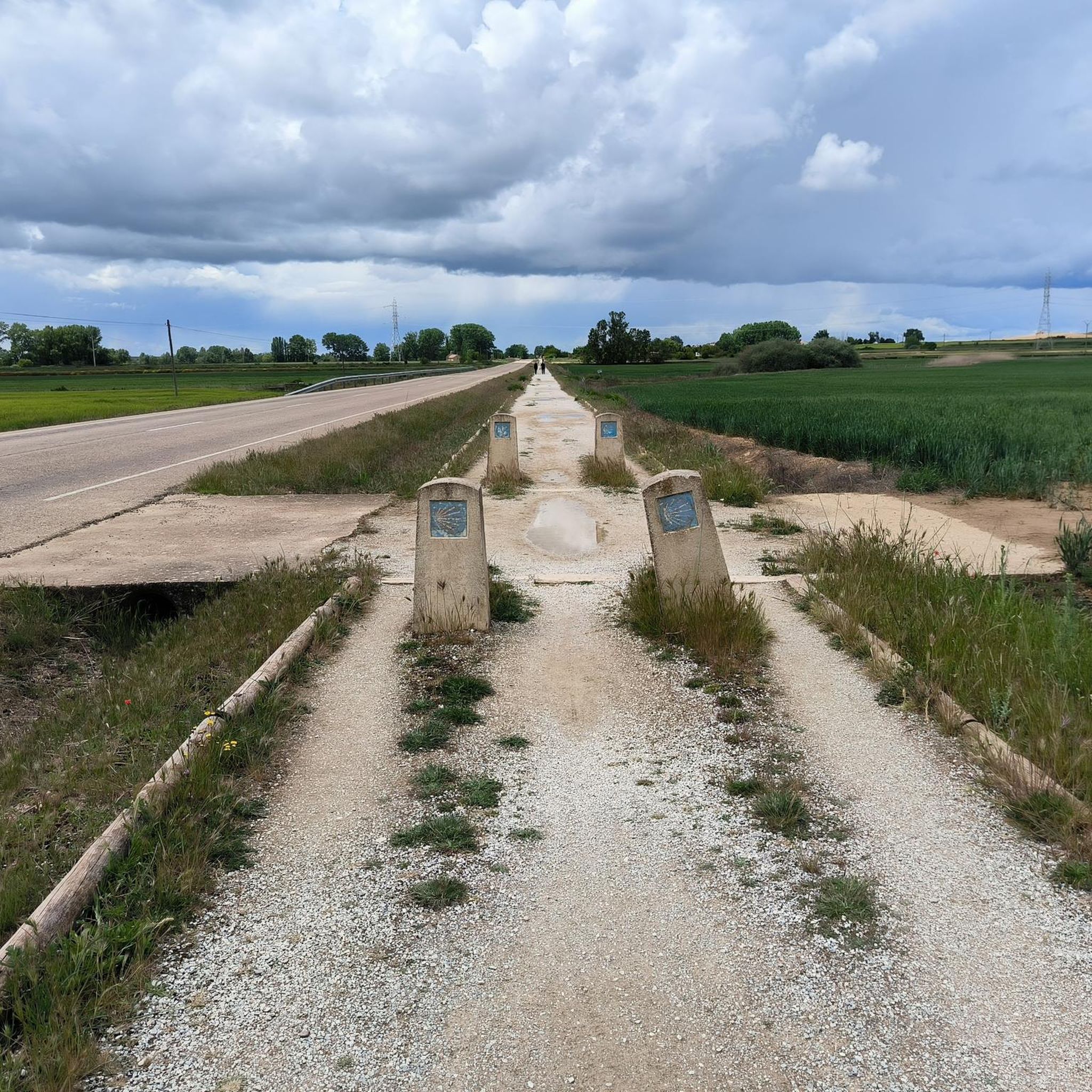
Hike a moderate 7.0-mile (11.3 km) loop along the Ucieza River, exploring Camino de Santiago symbols in Tierra de Campos.
Our route recommendations are based on thousands of hikes, rides, and runs completed by other people on komoot.
Start today with a free account
Your next adventure awaits.
Login or Signup
Popular around Piña De Campos
Tips from the Community

A short, pleasant stretch to walk because the water cools the air a little.
1
1


The Castile Canal, whose construction began in 1753, was intended to connect Castile to the Atlantic Ocean.
7
0

The Statue of the Pilgrim in Revenga de Campos is an iron sculpture created in 2004 by local blacksmith Ángel Abad. This work represents a pilgrim and is located in the town of Revenga de Campos, in the province of Palencia. Revenga de Campos is a stop on the French Way of St. James, and this sculpture pays tribute to the pilgrims who travel this historic route.
5
0

Iron sculpture commemorating the figure of the pilgrim passing the Camino de Santiago.
2
0

A beautifully designed pilgrim figure on the way. These are increasingly seen and come in a variety of designs.
2
0

It is one of the purest Spanish Romanesque buildings. It was built by Doña Mayor, widow of Sancho Mayor, King of Navarre, and served as a spiritual resting place for pilgrims on the way to Santiago.
3
0
Frequently Asked Questions
What kind of terrain can I expect on hiking trails around Piña De Campos?
The hiking trails around Piña De Campos are primarily characterized by the expansive, generally treeless plains of the Tierra de Campos region. You'll find gentle slopes and occasionally low hills, offering a unique steppe-like environment. Many routes follow the tranquil waters of the Canal de Castilla and the Ucieza River, providing easy and accessible terrain.
Are there any easy hiking trails suitable for beginners or casual walkers?
Yes, Piña De Campos offers several easy hiking options. For instance, the Puente del Gallo y esclusas de Calahorra de Ribas — circular por el Canal de Castilla is an easy 6.6 km path exploring the Canal's locks and bridges. Another great choice is Fromista and its locks of the Canal de Castilla, a 5.9 km trail that can be completed in about 1 hour 30 minutes.
What are the best times of year to go hiking in Piña De Campos?
Given the continental climate of the Tierra de Campos region, spring and autumn are generally the most pleasant seasons for hiking. The weather is milder, making it ideal for exploring the open plains and waterways. Summer can be quite hot, while winter might bring colder temperatures, though the generally flat terrain can still be accessible.
Are there any circular hiking routes in the area?
Yes, there are several circular routes available. A popular moderate option is Boadilla del Camino from Frómista — circular by the Canal de Castilla, which is 12.7 km long. For an easier circular walk, consider Boadilla del Camino — circular along the banks of the Canal de Castilla, covering 5.2 km.
What historical or natural landmarks can I see while hiking around Piña De Campos?
The region is rich in both natural and historical landmarks. You can explore sections of the historic Canal de Castilla, including impressive structures like the Quadruple Lock of the Canal de Castilla and the Calahorra de Ribas Locks. The town of Frómista is also a notable point of interest along many routes.
Can I bring my dog on the hiking trails in Piña De Campos?
Many of the trails along the Canal de Castilla and Ucieza River are generally suitable for dogs, especially given the open and accessible nature of the terrain. However, it's always recommended to keep your dog on a leash, respect local regulations, and ensure they are well-behaved around other hikers and wildlife.
Are the hiking trails around Piña De Campos suitable for families with children?
Yes, the area offers several family-friendly options. The generally flat and well-maintained towpaths along the Canal de Castilla are excellent for families. Easy routes like the 5.9 km Fromista and its locks of the Canal de Castilla are particularly suitable for shorter legs and strollers.
What do other hikers enjoy most about hiking in Piña De Campos?
The area is highly rated by the komoot community, with an average score of 4.5 stars from over 10 reviews. Reviewers often praise the tranquility of the Canal de Castilla routes, the expansive views of the Tierra de Campos plains, and the accessibility of the trails for various fitness levels.
Is there public transport available to reach hiking trailheads in Piña De Campos?
While Piña De Campos is a smaller town, local bus services connect it to larger towns in the Palencia province. It's advisable to check specific bus schedules to see if they align with your hiking plans, especially for reaching trailheads outside the immediate village center. Many routes are accessible directly from Piña De Campos or nearby villages.
Are there opportunities to experience the Camino de Santiago while hiking here?
Yes, the French Way of the Camino de Santiago traverses the broader Tierra de Campos region, offering a chance to experience a part of this historic pilgrimage route. The French Way Alternative Route Loop is a moderate 11.3 km hike that allows you to connect with this iconic path.
What is the typical elevation gain on hikes around Piña De Campos?
Hikes around Piña De Campos are generally characterized by minimal elevation changes. The terrain consists of expansive plains and gentle slopes, particularly along the Canal de Castilla and Ucieza River. Most routes feature very modest ascents and descents, making them suitable for those who prefer flatter walks.
Where can I find parking for hiking trails in Piña De Campos?
Parking is typically available in or near the village centers of Piña De Campos and other towns along the Canal de Castilla, such as Frómista or Boadilla del Camino. Many trailheads are easily accessible from these points, offering convenient places to leave your vehicle before starting your hike.
Most popular routes around Piña De Campos
Most popular attractions around Piña De Campos

Get inspired with the komoot mobile app


Explore more
Browse the best Hikes in other regions.
