The best cycling routes around La Pesquera
4.7
(5)
56
riders
10
rides
Touring cycling routes around La Pesquera traverse a landscape characterized by significant elevation changes, including peaks and deep valleys. The region features prominent natural landmarks such as the Cuchillos de Contreras and Moluengo Peak, alongside man-made structures like the Contreras Dam. Cyclists can expect routes that navigate through varied terrain, often offering expansive viewpoints over areas like the Cabriel Valley. The area's geography lends itself to challenging rides with notable climbs.
Best touring cycling routes around La Pesquera
- The most…
Last updated: July 8, 2026
2
riders
33.5km
03:15
760m
760m
Hard bike ride. Very good fitness required. You may need to push your bike for some segments of this route.
50.5km
03:57
850m
850m
Hard bike ride. Very good fitness required. Mostly paved surfaces. Suitable for all skill levels.

Sign up for free
5.0
(3)
14
riders
29.0km
02:03
550m
550m
Hard bike ride. Very good fitness required. Mostly paved surfaces. Suitable for all skill levels.
5.0
(1)
10
riders
Hard bike ride. Very good fitness required. Mostly paved surfaces. Suitable for all skill levels.
8
riders
Hard bike ride. Very good fitness required. Mostly paved surfaces. Suitable for all skill levels.
Get access to more routes and recommendations from other explorers.
Sign up for free
Already have an account?
Our route recommendations are based on thousands of hikes, rides, and runs completed by other people on komoot.
Start today with a free account
Your next adventure awaits.
Login or Signup
Tips from the Community

It is worth it, especially if you love nature, spectacular landscapes and outdoor activities. The best thing about the Contreras Reservoir is: * Impressive landscape: the reservoir is surrounded by the Cabriel river gorges, with rocky walls, pine forests and waters of an intense blue-green color. It is one of the most beautiful corners between the provinces of Valencia and Cuenca. * Hiking: the Ruta de los Cuchillos de Contreras is the best known. It is a relatively simple route with viewpoints and spectacular views of the reservoir.
10
0

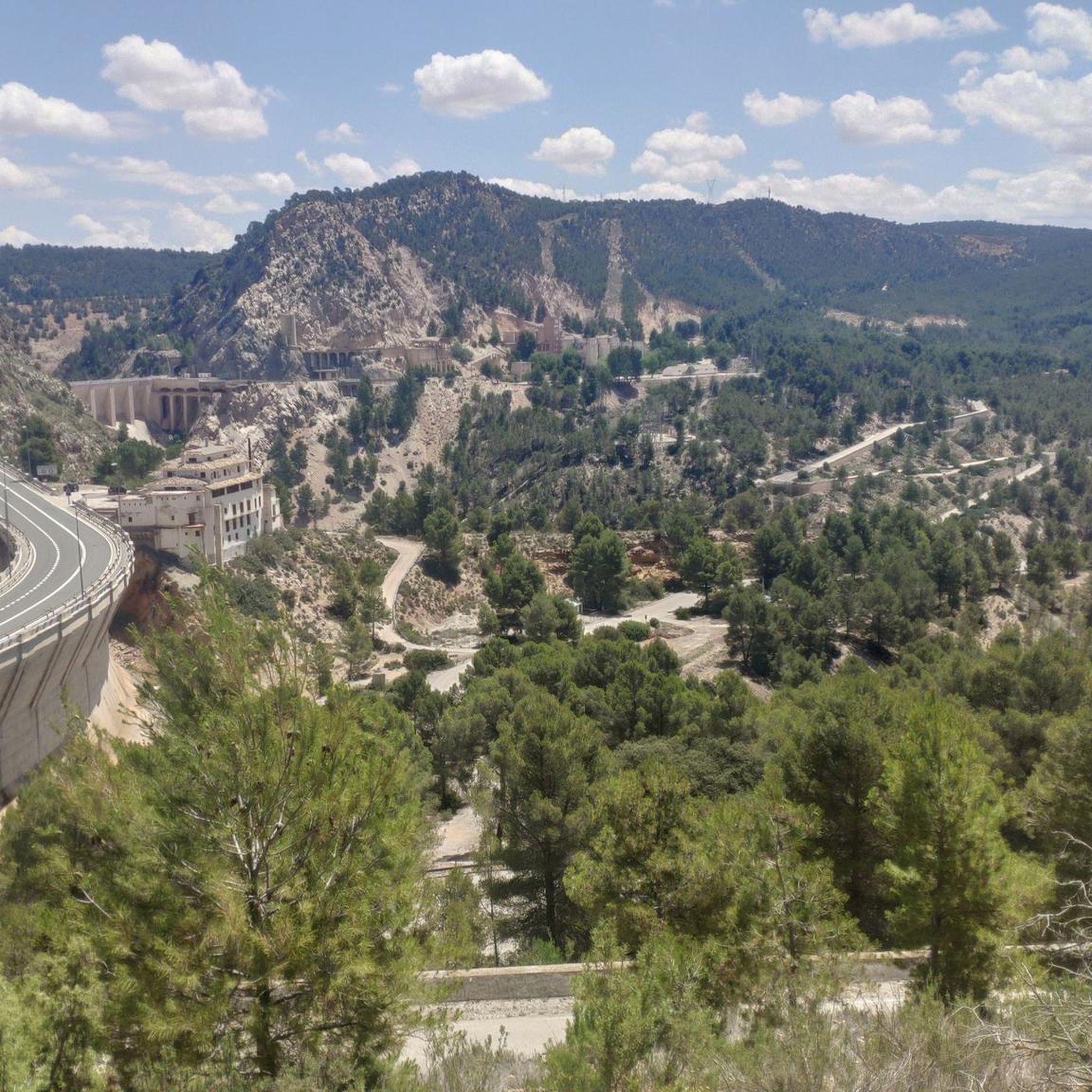
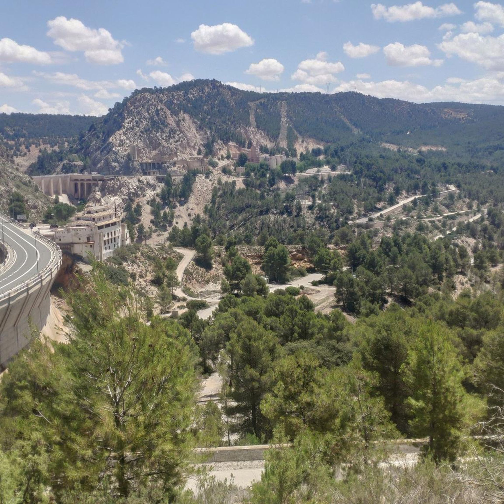
Beautiful viewpoint of the dam, the river and the factory.
11
0
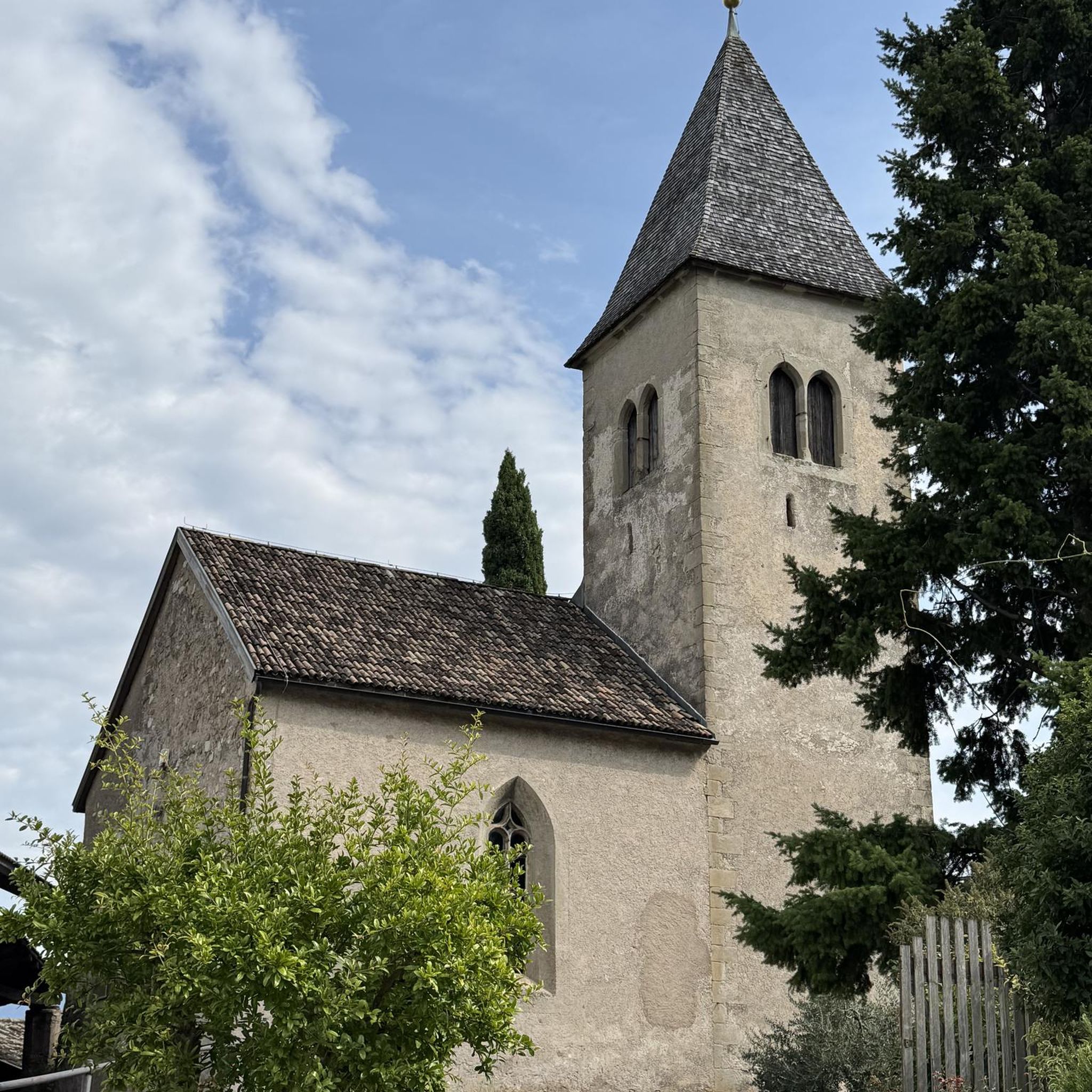
Square remarkable tower.
12
0
The Contreras dam (Embalse de Contreras) is a 129-meter-high arch dam built in 1972. Located on the border of the provinces of Cuenca (Castilla-La Mancha) and Valencia, the dam spans the Cabriel and Guadazaón rivers. The reservoir serves mainly for water supply, flood protection, and irrigation.
11
1
Some houses are still inhabited!!
0
0
Villargordo del Cabriel is a municipality in the Requena-Utiel region, in the province of Valencia. The town is located on the banks of the Cabriel River and is on the border between Castilla-La Mancha and the Valencia region. One of the biggest tourist attractions is the beautiful nature, which is remarkably well preserved.
14
0
Small village in a beautiful setting, with a central square, a small shop and a huge church.
13
0
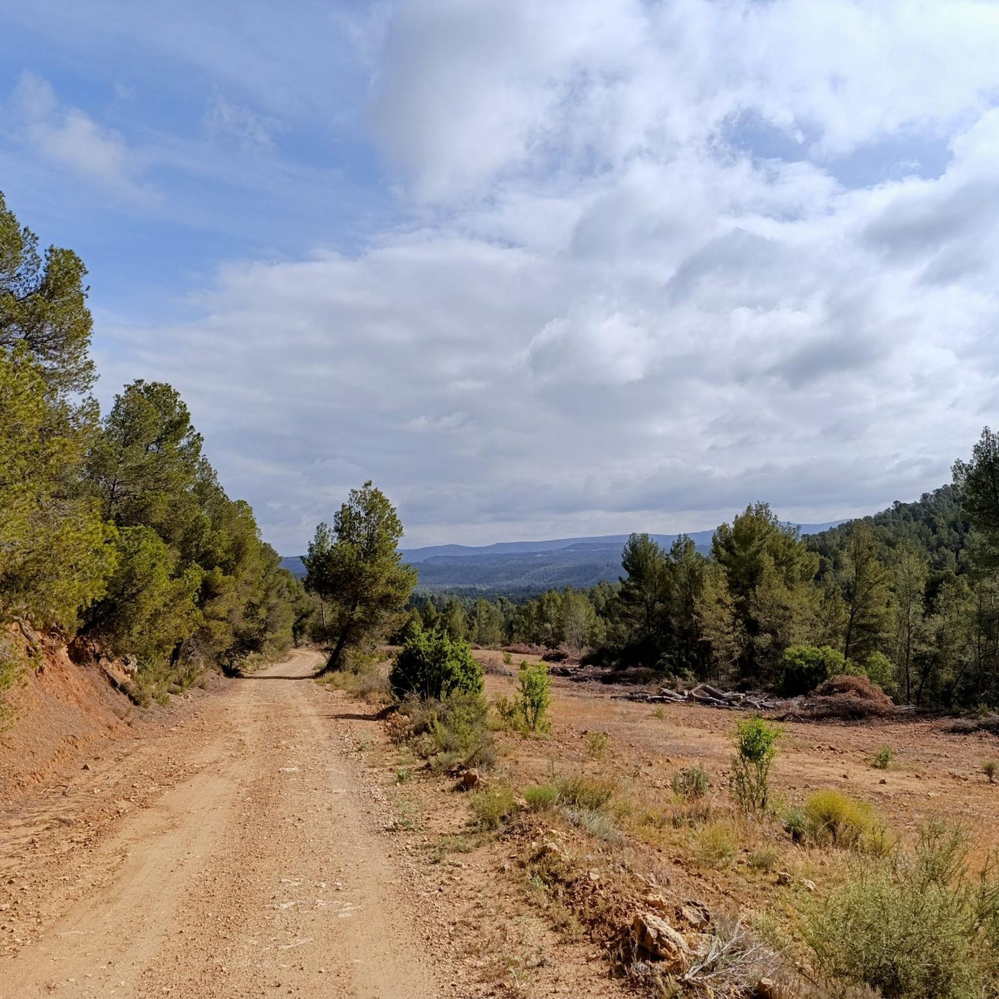
The road between Cardenete and Enguídanos, in the Serranía Baja region of Cuenca, is one of the most beautiful stretches in this area. Although not officially designated as a "scenic road," the route is featured on hiking and cycling itineraries that highlight its stunning landscapes, rivers, gorges, mountains, and natural monuments.
3
0
Frequently Asked Questions
What is the general difficulty level of touring cycling routes around La Pesquera?
Touring cycling routes in La Pesquera are generally considered difficult. The region is characterized by significant elevation changes, including prominent peaks and deep valleys, which means you can expect challenging rides with notable climbs. All 8 available routes are rated as difficult.
Are there any circular touring cycling routes in La Pesquera?
Yes, several routes are circular. For example, the Cardenete from Enguídanos — circular by Víllora is a difficult 50.5 km path connecting several villages. Another option is the Contreras Viewpoint – Contreras Inn loop from Minglanilla, which is a 33.6 km difficult route.
What kind of natural landmarks or viewpoints can I expect to see on a touring bike ride in La Pesquera?
The routes often offer expansive viewpoints over areas like the Cabriel Valley and feature prominent natural landmarks such as the Cuchillos de Contreras and Moluengo Peak. You can find specific viewpoints like Hoz del Rabo de la Sartén Viewpoint, La Fonseca Viewpoint, and Peña Azul Viewpoint along or near the routes.
Are there any waterfalls along the touring cycling routes in La Pesquera?
Yes, the area features natural attractions including waterfalls. You can find Las Chorreras, a notable waterfall, in the gorges around La Pesquera, which might be accessible from some touring routes.
What do other touring cyclists say about the routes in La Pesquera?
The touring cycling routes in La Pesquera are highly rated by the komoot community, with an average score of 4.5 stars from 3 reviews. Over 39 touring cyclists have used komoot to explore the varied and challenging terrain, often praising the panoramic views and significant climbs.
What are some longer touring cycling routes available in the region?
For a longer challenge, consider the Cardenete from Enguídanos — circular by Víllora, which is a difficult 50.5 km route. Another substantial option is the Contreras Dam – Cabriel Valley Viewpoint loop from Aparcamiento de emergencia Vialidad Invernal Minglanilla, covering 44.5 km with significant elevation gain.
Are there any historical sites or unique man-made structures to see while cycling?
Yes, the region features man-made structures like the Contreras Dam. You can also find historical sites such as the Peñas Blancas Path Trench and the Contreras Trench, which offer glimpses into the area's past.
What is the best season for touring bike trails in La Pesquera?
Given the significant elevation changes and potential for challenging conditions, spring and autumn generally offer the most pleasant weather for touring cycling in La Pesquera, with milder temperatures. Summers can be hot, and winters may bring colder temperatures and potentially adverse conditions in higher elevations.
Are there any routes that specifically highlight the Contreras Dam?
Yes, the Contreras Dam – Cabriel Valley Viewpoint loop from Villargordo del Cabriel is a 28.5 km route that provides direct views of the Contreras Dam and the surrounding valley.
What should I wear for cycling in La Pesquera, considering the terrain?
Due to the significant elevation changes and varied terrain, it's advisable to wear layered cycling apparel that can adapt to changing temperatures. Technical fabrics that wick moisture are recommended. Always bring a windbreaker or light jacket for descents and higher altitudes, even on warmer days.
Are there any trails that are part of a larger network or nature trail?
Yes, you can find sections of the Turia-Cabriel Nature Trail in the vicinity of La Pesquera, which might connect to or run alongside some touring cycling routes, offering extended exploration opportunities.
How many touring cycling routes are available in La Pesquera?
There are 8 touring cycling routes available around La Pesquera, all of which are rated as difficult due to the region's mountainous terrain and significant elevation gains.
Most popular attractions around La Pesquera

Get inspired with the komoot mobile app


Explore more
Browse the best Cycling routes in other regions.
