Attractions and Places To See around Mengamuñoz - Top 10
Best attractions and places to see around Mengamuñoz include a blend of historical sites and natural features within the province of Ávila. This municipality is situated between the Sierra de la Paramera and La Serrota, offering mountain landscapes and traditional village life. Mengamuñoz is also known for its connection to ancient Roman roads and the Puerto de Menga mountain pass. The area provides opportunities to explore both cultural landmarks and the natural beauty of the Ávila mountains.
Best attractions and…
Last updated: June 29, 2026
Serrota
Highlight • Summit
Translated by Google •
Tip by

Rollo de Muñotello
Highlight • Monument
Translated by Google •
Tip by

Sign up now to discover places like this
Get recommendations on the best single tracks, peaks, & plenty of other exciting outdoor places.
Sign up for free
Cepeda la Mora
Highlight • Settlement
Translated by Google •
Tip by
Chozo Blanco de la Dehesa de la Serrota
Highlight • Mountain Hut
Translated by Google •
Tip by
Villatoro
Highlight • Settlement
Translated by Google •
Tip by
Sign up for free to discover even more attractions around Mengamuñoz.
Sign up for free
Already have an account?
Start today with a free account
Your next adventure awaits.
Login or Signup


Tips from the Community

Beautiful and at the same time small town that is characterized by the Sierra de la Serrota and to the north, by the "dehesas" that are close to the Río Alberche (Dehesa de San Martín and Dehesa de las Cañadas).
0
0
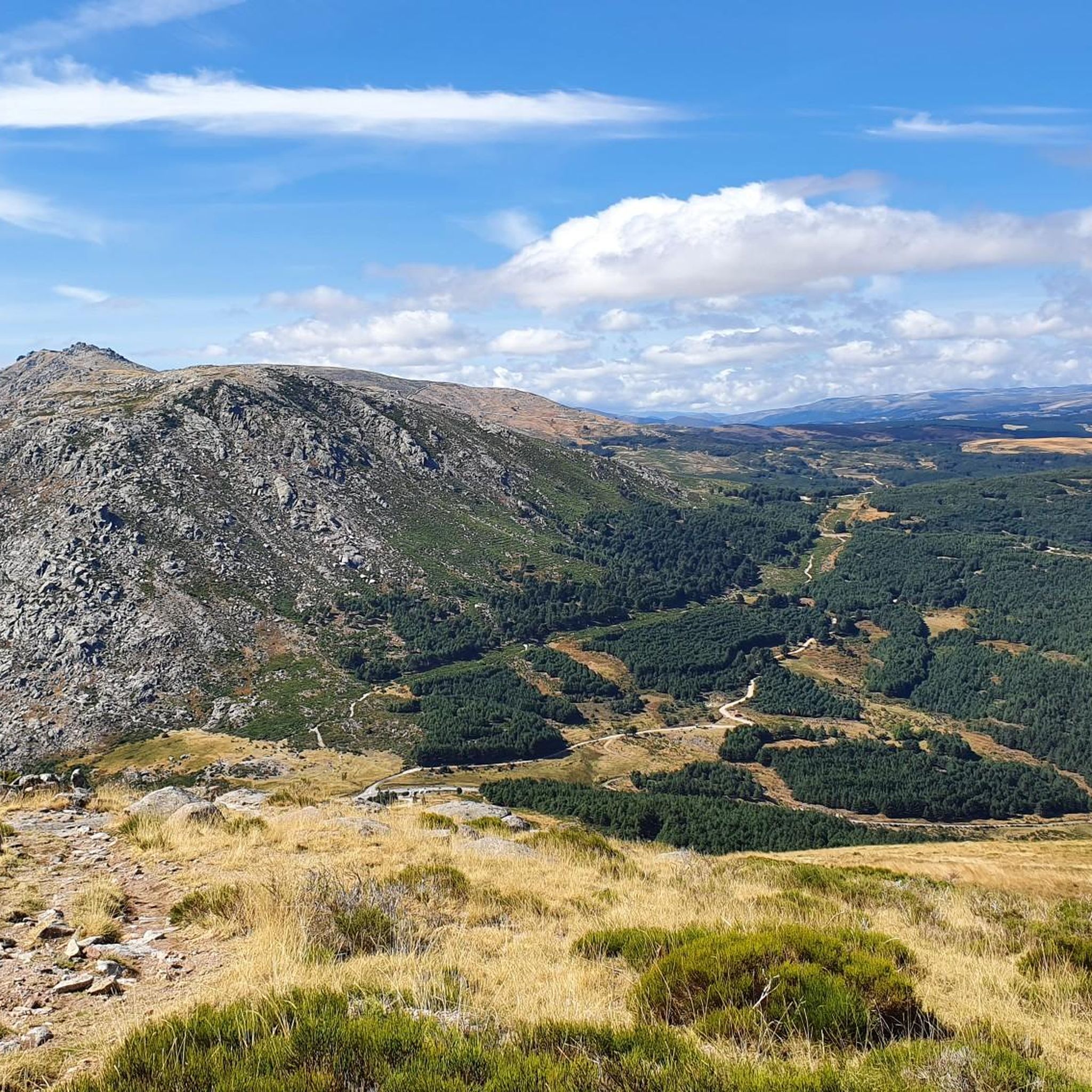
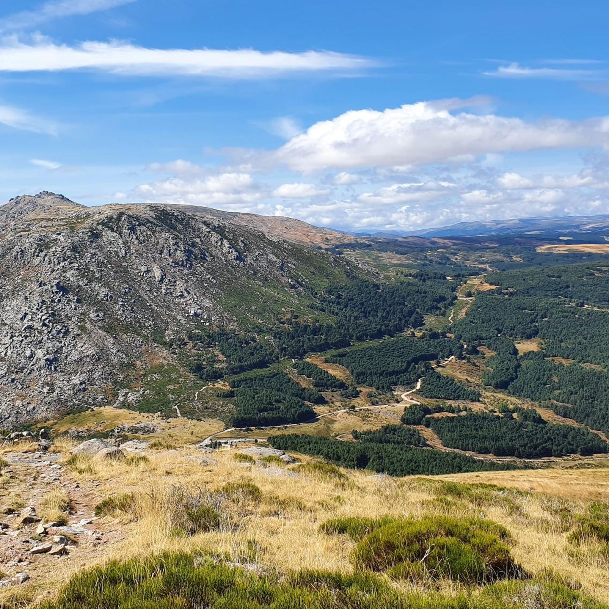
The Serrota is a mountain that reaches 2,292 meters in height, which means that you need to watch the time of its ascent, where the snow covers the area completely with low temperatures.
1
0
The relief of the municipality is formed by two mountainous areas separated by the Amblés valley, through which the Adaja river runs, which is born in the territory. The northern area is called Sierra de Villanueva, a branch of the Sierra de Ávila.
0
0

In the final stretch of the ascent, milestones appear in several places and the best option is to find the optimal path according to the moment, the mountain conditions and personal taste. The geodesic vertex is visible long before you arrive, it is placed on a tower of rocks and the views are extraordinary, practically covering the entire Central System, from the Sierra de Guadarrama to the peaks of Las Batuecas and the distant Sierra de Gata. Below the channels that form the sources of Corneja and Adaja and a little further on is the valley of the highest Alberche, when it is not yet a river in the páramos of San Martín de la Vega del Alberche.
0
0

The Muñotello roll symbolizes the jurisdictional independence obtained by the town with respect to the Villatoro council in 1733, during the reign of Felipe V. The construction is made of carved granite, it is five meters high and represents the sovereignty of the town of Muñotello to administer Justice. The prisoners were tied to the stone pillory during the trial and depending on the sentence they were stoned to death or released.
0
0
The Chozo Blanco de la Dehesa de la Serrota is in the pastoral meadow of the Garganta de las Hoyuelas, on the southern slope of the mountain range, within a cattle farm. The building is a traditional shelter for shepherds with a stone vault in good condition. Inside, the rustic and effective construction style of the dome can be appreciated. Near the hut there is a circular corral to enclose the herds that completes the ethnographic set.
0
0
Frequently Asked Questions
What historical sites can I explore around Mengamuñoz?
Mengamuñoz is rich in history. You can visit the Rollo de Muñotello, a significant man-made monument symbolizing the town's historical jurisdictional independence. Additionally, the area features an ancient Roman road, part of the Cañada Real Leonesa Occidental, highlighting its past importance for transhumance. The village of Cepeda la Mora also offers insights into traditional life and historical settlements.
Are there any notable natural features or viewpoints near Mengamuñoz?
Absolutely. The region is nestled between the Sierra de la Paramera and La Serrota. A prominent natural feature is the Serrota summit, reaching 2,292 meters, which offers extraordinary views across a significant portion of the Central System. Mengamuñoz is also located at the beginning of the Puerto de Menga mountain pass (1564 m), providing scenic vistas. The Risco del Águila, or 'Eagle's Crag,' is another significant natural landmark in the area.
What kind of outdoor activities can I do around Mengamuñoz?
The mountainous landscape around Mengamuñoz is ideal for various outdoor activities. You can find numerous routes for road cycling, mountain biking, and general cycling. For example, there are challenging road cycling loops like the Puerto de Villatoro – Peña Negra Pass loop, and moderate MTB trails such as the Eras de Navalacruz loop. Explore more options on the dedicated guides for Road Cycling, Cycling, and MTB Trails around Mengamuñoz.
Are there family-friendly attractions or activities in the area?
Yes, several attractions are suitable for families. The Rollo de Muñotello is an interesting historical monument that can be visited with children. The settlement of Cepeda la Mora and Villatoro are also considered family-friendly, offering a glimpse into traditional village life and local landscapes. Gentle walks and exploring the natural surroundings can also be enjoyable for families.
What is the best time to visit Mengamuñoz for outdoor activities?
Mengamuñoz offers different experiences depending on the season. For hiking and cycling, spring and autumn generally provide pleasant temperatures and beautiful scenery. Summer can be warm, especially at lower altitudes, but higher elevations like the Serrota summit offer cooler conditions. Winter brings snow to the higher areas, making some routes challenging and requiring appropriate gear, but can be beautiful for those seeking winter activities.
Where can I find accommodation or places to eat in Mengamuñoz?
While Mengamuñoz is a small village, it offers a tranquil setting. For accommodation, you might find rural houses (casas rurales) in and around the municipality. For dining, the Plaza de la Torre and Fuente de Piedra in a nearby settlement features a bar where you can regain strength. Exploring nearby larger towns will likely offer more extensive options for cafes, pubs, and restaurants.
What are the main religious sites in Mengamuñoz?
The municipality has a couple of notable religious sites. The **Church of San Miguel Arcángel** is a significant religious building served by a parish priest. Additionally, the **Ermita de Nuestra Señora de la Paz** (Hermitage of Our Lady of Peace) is another site where public worship is held, supported by the faithful.
How challenging are the hiking trails around Mengamuñoz?
The hiking trails around Mengamuñoz vary in difficulty. While specific hiking trails are not detailed in the provided data, the presence of the Serrota summit (2,292 meters) suggests that challenging ascents are available, especially in winter when snow covers the area. There are also likely easier paths in the valleys and around the villages, suitable for moderate walks. Always check route details for elevation and conditions before heading out.
Is public transport available to reach attractions around Mengamuñoz?
Mengamuñoz is a small, rural municipality. Public transport options might be limited. It is generally recommended to use a personal vehicle to access the various attractions and trailheads in the surrounding areas, especially for reaching more remote natural features or starting points for outdoor activities. Always check local transport schedules if relying on public services.
What is the significance of the 'Rollo de Muñotello'?
The Rollo de Muñotello is a historical monument that symbolizes the jurisdictional independence obtained by the town of Muñotello from the Villatoro council in 1733, during the reign of Felipe V. This five-meter-high carved granite structure represents the town's sovereignty to administer justice. Historically, prisoners were tied to this stone pillory during trials.
What can I expect from the village of Villatoro?
Villatoro is a settlement characterized by its relief, formed by two mountainous areas separated by the Amblés valley, through which the Adaja river runs. It offers views of the Sierra de Villanueva, a branch of the Sierra de Ávila, and provides a glimpse into the local geography and traditional life in the region.
Most popular routes around Mengamuñoz

Get inspired with the komoot mobile app


Explore more
Still not found the Highlight you’re looking for? See guides of the top attractions in other regions:
