The best walks and hikes around Vallejera De Riofrío
4.6
(148)
848
hikers
80
hikes
Hiking around Vallejera De Riofrío offers access to trails characterized by varied elevation and natural landscapes. The region features a mix of forested areas, open viewpoints, and routes near water bodies like the Embalse de Navamuño. These trails provide opportunities to explore the local terrain, which includes both gradual ascents and more challenging climbs.
Best hiking trails around Vallejera De Riofrío
- The most popular hiking route is Béjar - El Castañar Trail, a 2.6 miles (4.2 km) trail that…
Last updated: July 8, 2026
4.21km
01:25
180m
180m
Hard hike. Great for any fitness level. Sure-footedness, sturdy shoes and alpine experience required.
4.6
(5)
34
hikers
10.7km
03:03
250m
250m
Moderate hike. Good fitness required. Easily-accessible paths. Suitable for all skill levels.

Sign up for free
4.2
(6)
31
hikers
19.0km
05:55
710m
710m
Hard hike. Very good fitness required. Mostly accessible paths. Sure-footedness required.
5.0
(9)
39
hikers
Hard hike. Very good fitness required. Easily-accessible paths. Suitable for all skill levels.
4.9
(7)
24
hikers
14.6km
04:23
450m
450m
Moderate hike. Good fitness required. Easily-accessible paths. Suitable for all skill levels.
Get access to more routes and recommendations from other explorers.
Sign up for free
Already have an account?
Our route recommendations are based on thousands of hikes, rides, and runs completed by other people on komoot.
Start today with a free account
Your next adventure awaits.
Login or Signup


Tips from the Community

The Peña de la Cruz shelter has 20 beds and offers traditional cuisine for both guests and passers-by. According to its own promotion, it is an ideal place to go and see the stars with friends.
1
0

The bullring of the city of Béjar, in the province of Salamanca (Spain), better known as La Ancianita, is the oldest bullring preserved in Spain, inaugurated in 1711.2 Located on the Castañar mountain next to the Sanctuary of the Virgen del Castañar, two kilometers from Béjar.3
0
0


This hermitage receives the visitor as soon as they enter the Villa de Candalario and is called the hermitage of Santo Cristo del Refugio, on a large esplanade presided over by the Terminus Cross. Inside rests the Cristo del Refugio, of great devotion by the residents of the town.
2
0
Nice dam on the Cuerpo de hombre river. Perfect for taking a dip on a hot summer day.
2
1

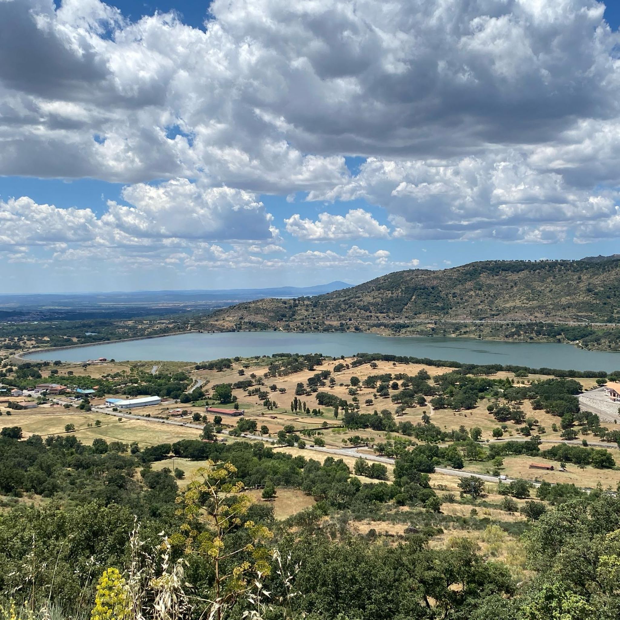
One of the many jewels offered by the Sierra de Candelario, the Navamuño Reservoir combines perfectly with the landscape that surrounds it.
1
0
Located on the outskirts of Béjar in the middle of the Sierra de Candelario forest, this magnificent Sanctuary was built after the apparition of the Virgin in 1496. It is a very picturesque building and it is also worth visiting inside.
1
1
A very popular place in the area and with good reason it is. Next to the cross is the viewpoint that offers beautiful panoramic views of the entire Sierra de Béjar valley and the town below. A few meters away is the refuge and an area with tables to take a break and enjoy this wonderful place.
1
1
Frequently Asked Questions
How many hiking trails are available around Vallejera De Riofrío?
There are over 80 hiking trails in the Vallejera De Riofrío area, offering a diverse range of experiences for different skill levels. You'll find everything from easy strolls to more challenging ascents.
What kind of terrain can I expect on hikes around Vallejera De Riofrío?
Hikes in Vallejera De Riofrío feature varied elevation and natural landscapes. You can expect a mix of forested areas, open viewpoints, and routes that often pass near water bodies like the Embalse de Navamuño. The terrain includes both gradual ascents and more challenging climbs.
Are there easy hiking routes suitable for beginners in Vallejera De Riofrío?
Yes, Vallejera De Riofrío offers a good selection of easy routes. There are 16 designated easy trails, perfect for beginners or those looking for a relaxed walk. These routes typically have less elevation gain and shorter distances.
Are there any circular walks around Vallejera De Riofrío?
Many of the trails around Vallejera De Riofrío are designed as circular routes, allowing you to start and end at the same point. An example is the moderate Fuente de la Hoja – Ermita del Humilladero loop from Béjar, which offers scenic views and historical points.
What are some interesting natural landmarks or attractions I can see while hiking?
The region boasts several notable natural landmarks. You might encounter the unique Peña de la Cruz and Balanced Boulder, or the impressive Cedro de la Francesa. For those seeking panoramic views, the Peña Negra Summit and Calvitero Peak offer rewarding climbs.
Are dogs allowed on the hiking trails in Vallejera De Riofrío?
Generally, dogs are welcome on hiking trails in the Vallejera De Riofrío area. However, it's always recommended to keep them on a leash, especially in areas with livestock or wildlife, and to follow local regulations regarding pet waste. Always check specific trail rules if available.
What do other hikers enjoy most about hiking in Vallejera De Riofrío?
The hiking trails in Vallejera De Riofrío are highly rated by the komoot community, with an average score of 4.6 stars from over 130 reviews. Hikers often praise the varied terrain, the beautiful viewpoints, and the opportunities to explore both forests and areas near reservoirs.
Are there any routes that pass by water features or reservoirs?
Yes, several routes in the area offer views of or pass near water bodies. For instance, the difficult Crossroads and beautiful views – Views on the embalse de Navamuño loop from Béjar provides extensive views of the Embalse de Navamuño.
What is the best time of year to hike in Vallejera De Riofrío?
The spring and autumn months are generally ideal for hiking in Vallejera De Riofrío, offering pleasant temperatures and vibrant natural scenery. Summer can be warm, so early morning or late afternoon hikes are preferable. Winter hiking is possible, but some higher elevation trails may require appropriate gear due to colder conditions.
Are there any challenging hikes for experienced hikers?
Yes, for experienced hikers seeking a challenge, there are 21 difficult routes available. An example is the Béjar - El Castañar Trail, which features notable elevation changes over its 4.2 km distance.
Where can I find parking for hiking trails in Vallejera De Riofrío?
Parking availability varies by trailhead. Many popular starting points, especially near towns like Béjar, will have designated parking areas. For more remote trails, roadside parking might be an option, but it's always advisable to check specific route details or local signage for the best and most appropriate parking spots.
Are there any routes that offer views of mountain passes?
Yes, the region is home to several mountain passes that can be incorporated into or viewed from hikes. Notable passes include Puerto de Vallejera, Puerto del Tremedal, and Travieso Pass, offering scenic vistas and sometimes more challenging terrain.
Most popular routes around Vallejera De Riofrío
Most popular attractions around Vallejera De Riofrío

Get inspired with the komoot mobile app


Explore more
Browse the best Hikes in other regions.
