Attractions and Places To See around Fresnedoso - Top 20
Attractions and places to see around Fresnedoso include a blend of local historical sites and access to significant natural and historical routes. This municipality is nestled in a valley within the Sierra de Béjar in the province of Salamanca, Spain. The area offers scenic valley and mountain views, extending to the Sierra de Francia and other peaks. Its location provides access to ancient routes like the Vía de la Plata, suitable for hiking and cycling.
Best attractions and places to…
Last updated: July 7, 2026
Béjar Station and Vía de la Plata Tunnel
Highlight • Trail
80.1 kilometers. 730 positive meters.
The route leaves the Béjar station through a curved tunnel with automatic artificial lighting that passes under the historic complex, where the …
Translated by Google •
Tip by

Peña de la Cruz and Balanced Boulder
Highlight • Monument
At the end of the path we find …
Translated by Google •
Tip by

Sign up now to discover places like this
Get recommendations on the best single tracks, peaks, & plenty of other exciting outdoor places.
Sign up for free
Vía Verde de la Plata
Highlight (Segment) • Cycleway
Don't …
Translated by Google •
Tip by
Ermita del Humilladero
Highlight • Religious Site
Translated by Google •
Tip by
Peña Negra Summit
Highlight • Summit
Translated by Google •
Tip by
Sign up for free to discover even more attractions around Fresnedoso.
Sign up for free
Already have an account?
Start today with a free account
Your next adventure awaits.
Login or Signup


Tips from the Community


The Silver Route (Vía Verde de la Plata) in the Port of Béjar is part of the old Astorga–Plasencia railway line, now a nature trail for hiking and cycling. Don't miss the Little Station: a bar/restaurant in the old station, with a terrace and railway atmosphere (open during tourist season).
4
0

Stage 2. Béjar/Plasencia 80.1 kilometers. 730 positive meters. The route leaves the Béjar station through a curved tunnel with automatic artificial lighting that passes under the historic complex, where the main monuments and buildings are located around the Plaza Mayor, the Doge's Palace, the churches and the streets with a medieval atmosphere. The route passes through another tunnel that ends in a small gorge, with climbing routes, and leaves the Corpus de Hombre river valley towards the Navalmoral de Béjar pastures, where the conditioning of the natural path ends. The last kilometer to the town still has the rails of the road but it can be easily reached by pedaling to the town. At the entrance you turn towards the town and at the first intersection you have to turn left again to go down towards the Camino de Santiago. Immediately the Béjar road appears, you must continue on the right, pass the Calzada de Béjar detour and 400 meters later the yellow arrows of the Jacobean route appear marking the Vía de la Plata to Astorga. The gravel journey continues in the opposite direction to the indication of the arrows and at many intersections it is difficult to see the signs because they are painted so that they are useful in the opposite direction, towards Santiago de Compostela. The path runs through a stretch of land and reaches the beautiful street on the way to Calzada de Béjar. At the entrance there is a pilgrim fountain and a sealing place, but the pilgrim hostel is at the end of the town. The street has facades typical of the popular architecture of the region, with stone and wood arcades and balconies, adapted to the centuries-old passage of migrating herds and the active commerce generated by the Vía de la Plata. The descent to the valley of the Body of Man River follows the original layout of the medieval road and there is a section with stones but it is easy to navigate slowly. And then the dirt road continues parallel to the Montemayor del Río highway. In this section you could go along the road to the Malena bridge, losing the possibility of seeing the original milestones that are on the Camino de Santiago. The milestones marked the distance of the Roman roads, in this section there are several but they have been moved and do not coincide exactly with the original “miles”. The Sinforiano milestone is first, indicating mile 135, and then the Malena milestone appears, at the entrance to the medieval bridge that spans the Corpus de Hombre river. Mile 134 is about 200 meters after passing the bridge, at another milestone that is part of the wall of a farm. At the Malena bridge the hardest climb of the route begins, the slope is steep and there are sections with loose stones that require patience, grinding technique and good legs. The oak and chestnut forest and the beautiful rural environment help a lot to overcome the slope. The climb ends in Puerto de Béjar but it is not yet time to connect with the Vía de la Plata railway route. The route continues along the Camino de Santiago towards Baños de Montemayor and goes down a modern cobblestone built on the original one of the medieval itinerary. The views of the Ambroz Valley are fantastic. At the entrance to Baños de Montemayor the track leaves the urban complex on the right and continues along the La Garganta road to climb the Natural Path, right where the rest area and the stone fountain are. The bikepacking adventure continues through familiar terrain on the old railroad track. The slope is favorable, the bicycles fly along the side of the mountain, they pass by the Hervás station and one kilometer before the Aldeanueva del Camino station you have to take a detour to the right to enter the urban complex and connect again with the Camino de Santiago.
0
0

This hermitage receives the visitor as soon as they enter the Villa de Candalario and is called the hermitage of Santo Cristo del Refugio, on a large esplanade presided over by the Terminus Cross. Inside rests the Cristo del Refugio, of great devotion by the residents of the town.
2
0

This picturesque section of the Vía de la Plata runs through a beautiful landscape of the Sierra de Béjar and connects the town of Puerto de Béjar with Béjar rolling along a gravel track in perfect condition and without any technical difficulty.
2
1
A very popular place in the area and with good reason it is. Next to the cross is the viewpoint that offers beautiful panoramic views of the entire Sierra de Béjar valley and the town below. A few meters away is the refuge and an area with tables to take a break and enjoy this wonderful place.
1
1
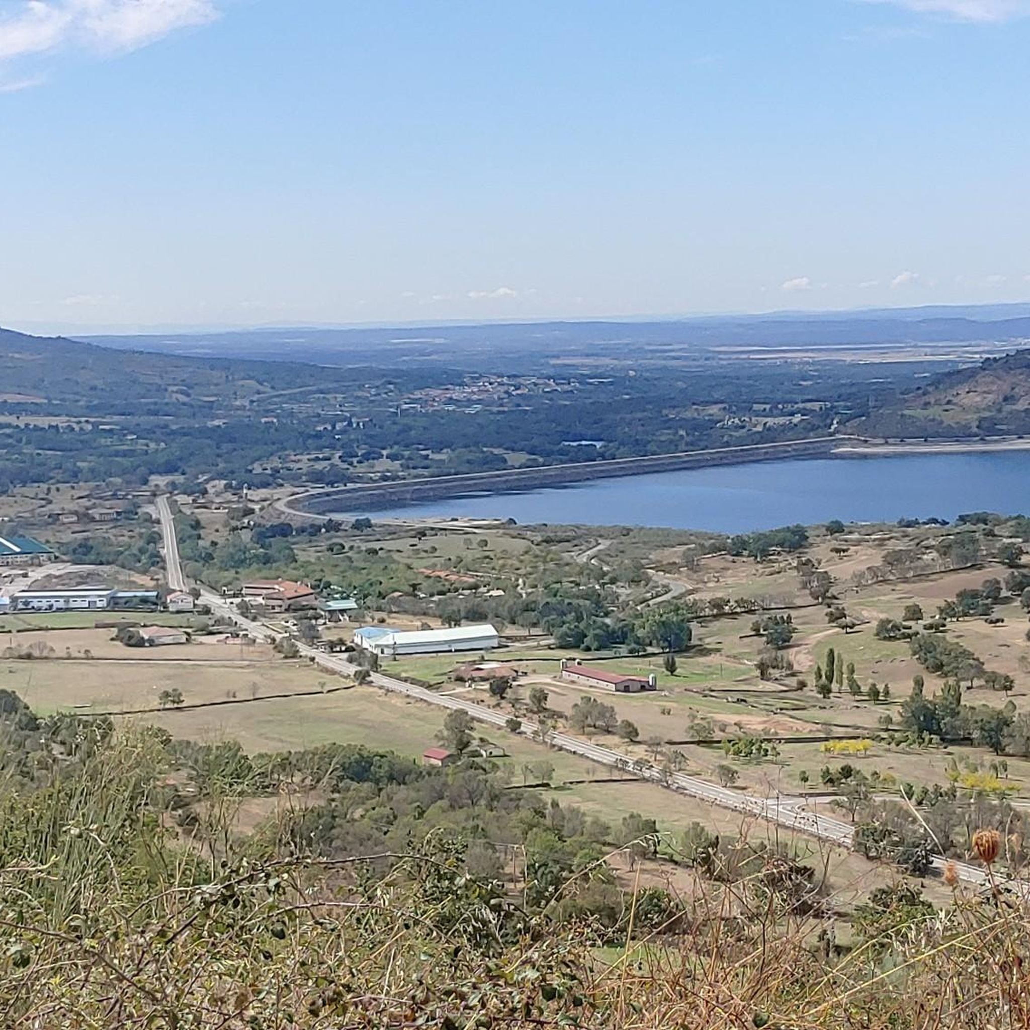
Peña Negra is one of those challenging but highly rewarding peaks. The views from its top at 1634 meters above sea level are truly amazing and you will have 360 degree panoramic views of the entire Sierra de Candelario Natural Area, including the Navamuño Reservoir.
1
1
Hiking route up to the Peña Negra in the Sierra de Béjar.
6
1
Frequently Asked Questions
What natural features and viewpoints can I explore near Fresnedoso?
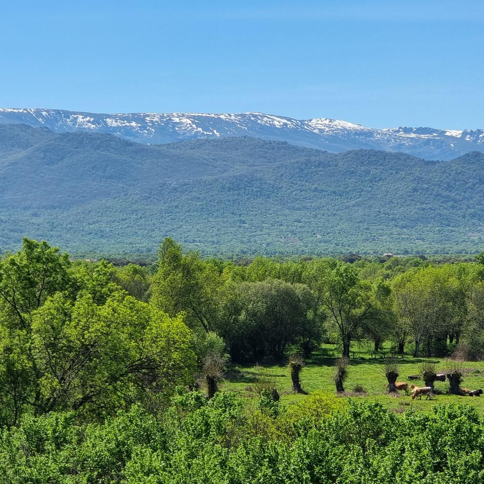
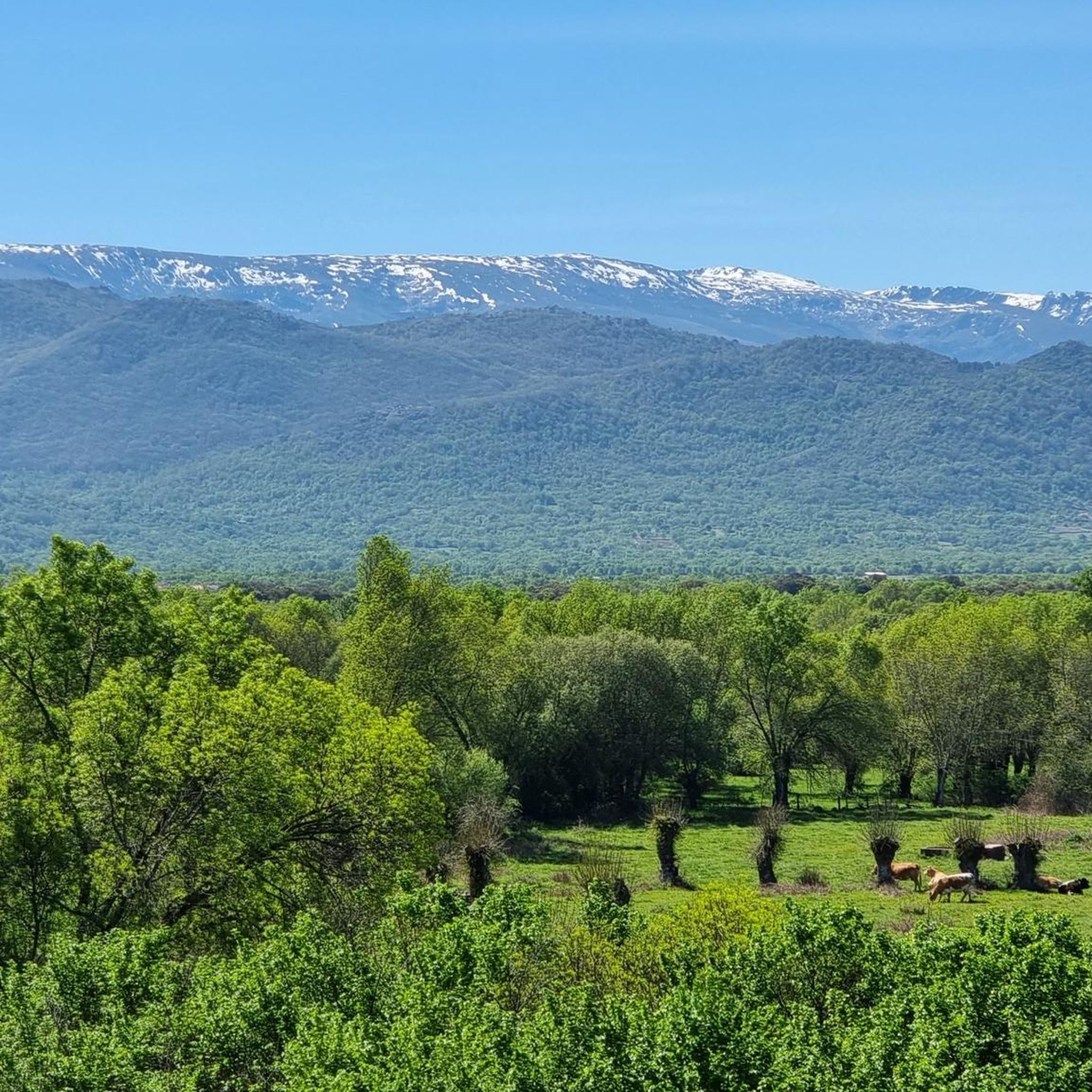
Fresnedoso is nestled in a valley offering beautiful views extending to the Sierra de Francia, the Piquitos de Sanchotello, and the Picos de Valdesangil. For breathtaking panoramic views, consider hiking to Peña Negra Summit, which offers 360-degree vistas of the Sierra de Candelario Natural Area. Another popular spot is Peña de la Cruz and Balanced Boulder, featuring a large granite cross and a viewpoint overlooking the entire Sierra de Béjar valley.
What historical sites are there in and around Fresnedoso?
Within Fresnedoso, you can visit the 15th-century Iglesia Parroquial de San Antonio Abad, notable for its detached bell tower, believed to be an old 13th-century watchtower. The Capilla de María Auxiliadora, near the Plaza Mayor, is another significant local site. Historically, El Ventorro de Fresnedoso served as a postal station along the Vía de la Plata. Nearby, the town of Béjar features a historic complex with monuments around its Plaza Mayor and the Ducal Palace.
Are there good hiking trails near Fresnedoso?
Yes, the region around Fresnedoso is well-suited for hiking. The Vía Verde de la Plata, part of the old Astorga–Plasencia railway line, is a nature trail perfect for hiking. For more challenging routes, consider trails leading to Peña Negra Summit. You can find various running trails, including difficult ones like the 'La Ancianita bullring – Views on the embalse de Navamuño loop from Béjar', by exploring the Running Trails around Fresnedoso guide.
What cycling opportunities are available around Fresnedoso?
The area offers excellent cycling opportunities, particularly along the Vía Verde de la Plata. This picturesque section runs through the beautiful landscape of the Sierra de Béjar, connecting Puerto de Béjar with Béjar on a well-maintained gravel track suitable for all skill levels. For more extensive cycling adventures, including mountain biking, explore the MTB Trails around Fresnedoso and Cycling around Fresnedoso guides, which feature routes like the 'Dehesa de Candelario Trail' and 'Béjar Tunnel – Navamuño Dam loop'.
Are there family-friendly activities or attractions in the Fresnedoso area?
The Vía Verde de la Plata is a great option for families, as it's a flat, well-maintained gravel track with no technical difficulty, ideal for leisurely cycling or walking. The area around Peña de la Cruz and Balanced Boulder also features picnic areas and fountains, making it a pleasant spot for a family outing with scenic views.
When is the best time to visit Fresnedoso for outdoor activities?
The region around Fresnedoso boasts a rich natural landscape, making it ideal for outdoor activities. Spring and autumn generally offer the most pleasant weather for hiking and cycling, with milder temperatures and beautiful scenery. Summer can be warm, but the valley location and mountain proximity can provide some relief, especially in the mornings or evenings. Winter offers a different charm, though some higher trails might be more challenging due to weather conditions.
What is the significance of the Vía de la Plata in this region?
The Vía de la Plata is an ancient route with deep historical ties to Fresnedoso, having once been a Roman road. Today, it's a popular nature trail for hiking and cycling, and also forms part of the Camino de Santiago network. The Vía Verde de la Plata near Béjar is a specific section of this historic route, offering a well-preserved path on the old railway line.
What do visitors particularly enjoy about the attractions near Fresnedoso?
Visitors frequently praise the stunning panoramic views from spots like Peña Negra Summit and Peña de la Cruz and Balanced Boulder. The well-maintained and scenic Vía Verde de la Plata is also highly appreciated for its ease of access and beautiful landscapes, making it a favorite for both hikers and cyclists. The blend of historical sites and natural beauty is a common highlight.
Are there any less-known natural spots or hidden gems to discover around Fresnedoso?
While specific 'hidden gems' are often discovered by exploring, the region's extensive network of paths and trails around Fresnedoso is known for offering many such opportunities. The scenic valley views extending towards the molinos (mills) area of Sorihuela are often overlooked but offer tranquil beauty. Exploring the smaller paths off the main Vía de la Plata can lead to charming, less-traveled natural spots.
What other towns or sites of interest are worth visiting near Fresnedoso?
Just 12 kilometers away, Béjar is a must-visit, featuring a historic complex, the Ducal Palace, and medieval streets. Ascending from Béjar, you can reach El Castañar, an area with picnic spots and a viewpoint. Candelario is home to the Hermitage of Santo Cristo del Refugio, a site of local devotion. Calzada de Béjar, along the Camino de Santiago, showcases traditional architecture with stone and wood arcades.
Are there dog-friendly trails or areas around Fresnedoso?
Many of the natural trails and paths around Fresnedoso, including sections of the Vía Verde de la Plata, are generally dog-friendly. It's always recommended to keep dogs on a leash, especially in areas with wildlife or livestock, and to clean up after them. Specific rules may vary, so always observe local signage.
Where can I find parking for attractions or trails near Fresnedoso?
For attractions within Fresnedoso, parking is typically available in the village center. For trails like the Vía Verde de la Plata, you can often find parking near access points in towns like Béjar or Puerto de Béjar. When planning a hike or cycle, it's advisable to check the starting point of your chosen route for specific parking information.
Most popular routes around Fresnedoso
Most popular attractions around Fresnedoso

Get inspired with the komoot mobile app


Explore more
Still not found the Highlight you’re looking for? See guides of the top attractions in other regions:
