The best road cycling routes around Beamud
4.7
(3)
123
riders
6
rides
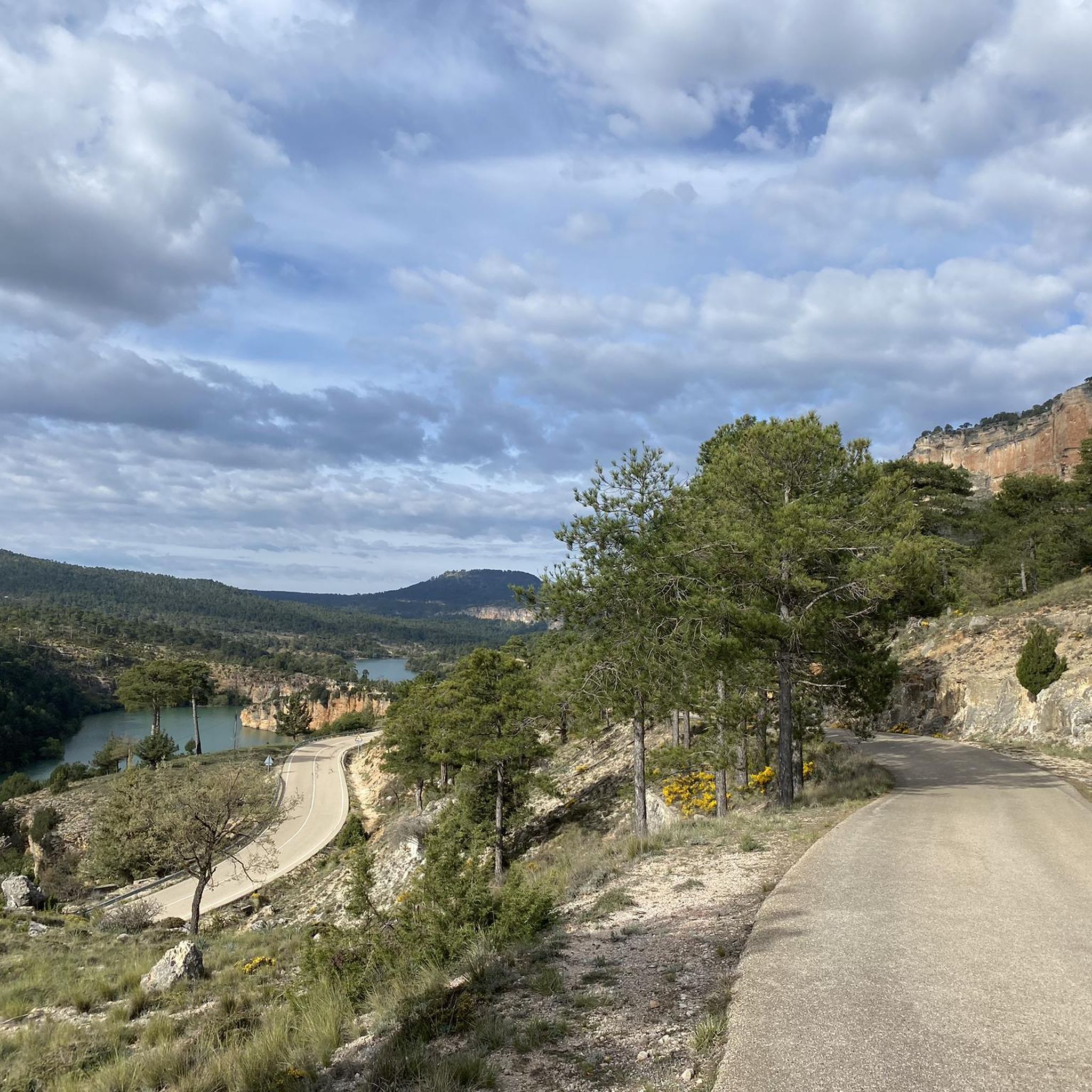
Road cycling routes around Beamud traverse mountainous terrain within the Serranía de Cuenca, characterized by significant elevation changes and winding roads. The region features deep valleys, limestone formations, and dense forests, providing challenging climbs and descents. These routes offer extensive views across the high plateaus and natural landscapes of the area.
Best road cycling routes around Beamud
- The most popular road cycling route is Ventano del Diablo – Júcar Gorge loop from Mariana, a 58.1 miles (93.5 km) trail…
Last updated: August 21, 2026
13
riders
58.4km
03:09
990m
990m
Hard road ride. Very good fitness required. Mostly well-paved surfaces and easy to ride.
5.0
(1)
15
riders
94.6km
05:08
1,420m
1,420m
Hard road ride. Very good fitness required. Some segments of this route may be unpaved and difficult to ride.

Sign up for free
7
riders
102km
05:04
1,590m
1,590m
Hard road ride. Very good fitness required. Mostly well-paved surfaces and easy to ride.
4.0
(1)
10
riders
68.3km
03:22
1,030m
1,030m
Hard road ride. Very good fitness required. Mostly well-paved surfaces and easy to ride.
8
riders
73.7km
03:43
1,050m
1,050m
Hard road ride. Very good fitness required. Some segments of this route may be unpaved and difficult to ride.
Our route recommendations are based on thousands of hikes, rides, and runs completed by other people on komoot.
Start today with a free account
Your next adventure awaits.
Login or Signup
Popular around Beamud


Tips from the Community

The official source of water is located at Fuente de García, in the Montes Universales, within the municipality of Frías de Albarracín (Teruel). It is located at an altitude of approximately 1,590 meters, surrounded by pine forests and high mountain meadows. Access is very easy and well signposted. Take the A-1704 highway, which connects Frías de Albarracín with Huélamo (Cuenca). From the highway, a paved detour of approximately 2 km takes you directly to the recreational area and the monument. There is free parking next to the monument.
10
0
Access is very easy and well signposted. Take the A-1704 highway, which connects Frías de Albarracín with Huélamo (Cuenca). From the highway, a paved detour of approximately 2 km takes you directly to the recreational area and the monument. There is free parking next to the monument.
5
0
The official source is located at Fuente de García, in the Montes Universales, within the municipality of Frías de Albarracín (Teruel). It is located at an altitude of approximately 1,590 meters, surrounded by pine forests and high mountain meadows.
5
0

It is a reference to the place where the longest river in Spain originates, stretching over 1,000 km and flowing into neighboring Portugal. These statues symbolize this point in the Albarracín mountain range.
8
0

Perfectly natural in a beautiful location.
4
0
Puerto del Cubillo is located in the Serranía Alta de Cuenca mountain range, a mountainous region known for its natural beauty and hiking trails. One of the most notable routes is the one that leads to Pico Mogorrita, the highest point in the Serranía de Cuenca mountain range at 1,864 meters. This route begins at Puerto del Cubillo and offers stunning views and the chance to see local wildlife such as deer and roe deer.
29
0

Acceptable cabin with a fireplace and a bedroom. There's a spring next door.
0
0
The Callejones de Las Majadas are a spectacular natural setting located in the municipality of Las Majadas, in the province of Cuenca, within the Serranía de Cuenca Natural Park. It is a karst formation composed of Upper Cretaceous dolomites, where erosion by water, ice, and wind has sculpted the limestone rock, creating a labyrinth of narrow passages, natural arches, monoliths, and stone bridges.
2
0
Frequently Asked Questions
What kind of terrain can I expect on road cycling routes around Beamud?
Road cycling routes around Beamud primarily traverse mountainous terrain within the Serranía de Cuenca. You can expect significant elevation changes, winding roads, deep valleys, limestone formations, and dense forests, offering challenging climbs and descents.
Are there many road cycling routes available in Beamud?
There are several dedicated road cycling routes around Beamud, with komoot featuring 7 distinct tours. These routes are generally designed for experienced cyclists due to their challenging nature.
What is the difficulty level of road cycling routes in Beamud?
All road cycling routes listed for Beamud are classified as difficult. They feature challenging mountain passes and significant elevation gains, making them suitable for experienced cyclists seeking demanding rides.
Are there any circular road cycling routes in Beamud?
Yes, many of the routes around Beamud are circular. For example, you can explore the Ventano del Diablo – Júcar Gorge loop from Mariana or the Cañete – Natural Water Spring loop from Cañete, both offering extensive loops through the region's landscapes.
What are some notable natural features or viewpoints along the road cycling routes?
The routes offer extensive views across the high plateaus and natural landscapes of the Serranía de Cuenca. You can find stunning vistas at highlights such as the Puntal de la Tola Viewpoint and the Viewpoint over the La Toba Reservoir. The Natural Water Spring is also a point of interest.
What do other road cyclists say about the routes in Beamud?
The road cycling routes in Beamud are highly rated by the komoot community, with an average score of 4.0 stars. Cyclists often praise the challenging mountain passes, deep river gorges, and extensive forest roads that define the region's network.
Are there any particularly long or challenging routes for experienced cyclists?
Absolutely. For a significant challenge, consider the El Cubillo Pass – Forest House Refuge loop from Beamud, which covers over 100 km and features nearly 1600 meters of elevation gain. Another demanding option is the Ventano del Diablo – Júcar Gorge loop from Mariana.
What is the best time of year for road cycling in Beamud?
Given the mountainous terrain and potential for varied weather, spring and autumn generally offer the most pleasant conditions for road cycling in the Serranía de Cuenca, with milder temperatures and beautiful scenery. Summers can be hot, and winters may bring colder temperatures and snow at higher elevations.
Are there any natural attractions or caves to explore near the cycling routes?
Yes, beyond the cycling, you can explore natural attractions like the Natural Water Spring and the Boquerón Cave, which are highlights in the vicinity of Beamud.
Can I find routes that pass through specific natural areas like gorges?
Yes, routes like the Ventano del Diablo – Júcar Gorge loop from Mariana specifically take you through impressive natural formations, including the Júcar Gorge, offering spectacular views and a memorable riding experience.
What kind of scenery will I encounter on a road bike in Beamud?
You will encounter diverse and dramatic scenery, including deep river gorges, extensive forest roads, and panoramic views across the high plateaus of the Serranía de Cuenca. The region's limestone formations add to its unique natural beauty.
Most popular routes around Beamud
Most popular attractions around Beamud

Get inspired with the komoot mobile app


Explore more
Browse the best Road cycling routes in other regions.
