The best MTB trails around Vega De Santa María
4.3
(5)
21
riders
22
rides
Mountain bike trails around Vega De Santa María, located in the plains of La Moraña, offer varied terrain for cycling. The region features an undulating landscape with gently rolling lands, providing dynamic routes with varying gradients. Notable hills like Cerro de la Goyá and Alto de San Pedro offer opportunities for climbs and descents. Riverine environments along the Voltoya and Adaja rivers introduce paths through forested sections and near small lagoons, diversifying the riding experience.
Best mountain bike trails around…
Last updated: June 28, 2026
3.0
(1)
7
riders
31.6km
02:44
470m
480m
Moderate mountain bike ride. Good fitness required. Suitable for all skill levels.
4.0
(1)
5
riders
55.4km
04:24
430m
430m
Moderate mountain bike ride. Good fitness required. Advanced riding skills necessary.

Sign up for free
4
riders
25.8km
01:53
310m
310m
Moderate mountain bike ride. Good fitness required. Advanced riding skills necessary.
5.0
(1)
2
riders
31.1km
02:29
320m
320m
Moderate mountain bike ride. Good fitness required. Suitable for all skill levels.
5.0
(2)
3
riders
22.0km
01:51
210m
210m
Easy mountain bike ride. Great for any fitness level. Suitable for all skill levels.
Get access to more routes and recommendations from other explorers.
Sign up for free
Already have an account?
Our route recommendations are based on thousands of hikes, rides, and runs completed by other people on komoot.
Start today with a free account
Your next adventure awaits.
Login or Signup
Popular around Vega De Santa María

Tips from the Community

The Cordel de Granados is part of the old livestock trails (vias pecuarias) that cross the province of Ávila and that are still used today as paths and natural tracks for walking, cycling or connecting different rural towns.
4
0
The Castro de Las Cogotas, located in the municipality of Cardeñosa (Ávila), is one of the most emblematic Iron Age archaeological sites on the Iberian Peninsula, especially linked to the Vetton people. It is situated on a hill next to the Adaja River, surrounded by holm oak groves, pastures, and fertile land. This location offered defensive advantages and abundant natural resources. The fort is open to the public and has an Interpretation Center that explains its history and characteristics. Periodic archaeological conferences are also held on the site.
2
0
The place name Mingorría retains Basque reminiscences, deriving from “mendi gorria,” which means “red mountain” or “red land.” This is observed in other cases in the province of Ávila, such as the town of Mendigorría in Navarra. In historical documents, Mingorría already appears as Ningorría, and it is believed that there was an assimilation due to the change of the liquid initials “M” to “N.” Another legend attributes the name of Mingorría to the notice that José Chinchurreta gave to monarch Felipe II, justifying the delay in the supply of granite during the works of the Monastery of El Escorial.
4
0

Three stone crosses located on a rocky outcrop near the Ermita del Berrocal, on the outskirts of Cardeñosa.
1
0
Along the way you reach the ruins of a medieval settlement, with building stones scattered on the ground of which only the main arch of a church remains standing.
2
0

Cardeñosa is the ideal place to stop along the way and have a drink to continue the route. Here is the Castro Interpretation Center
1
0

Nucleus that has a great history behind it not only because Las Cogotas is located closer to the reservoir but also, for example, the Arco toral of the depopulated Conejeros.
1
0
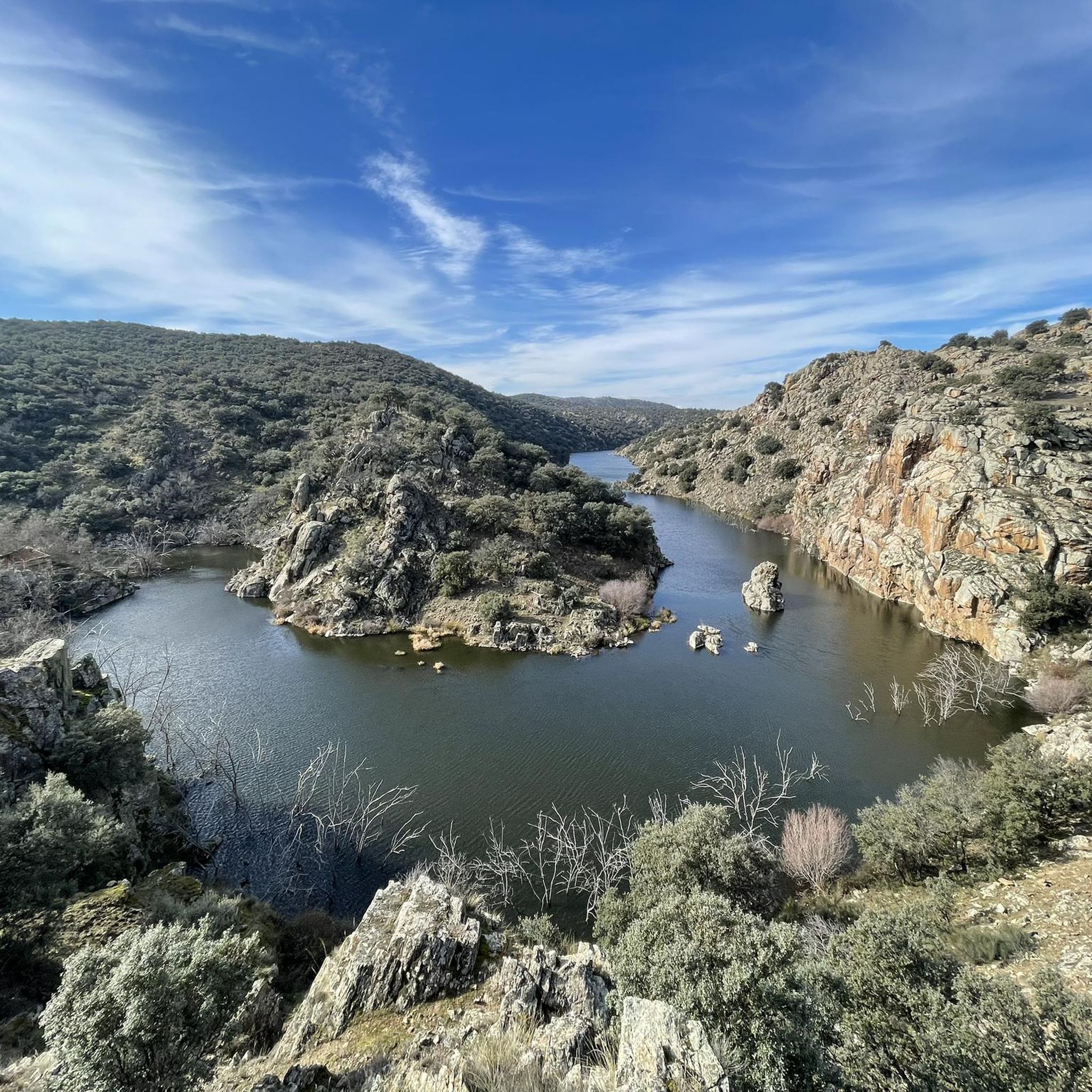
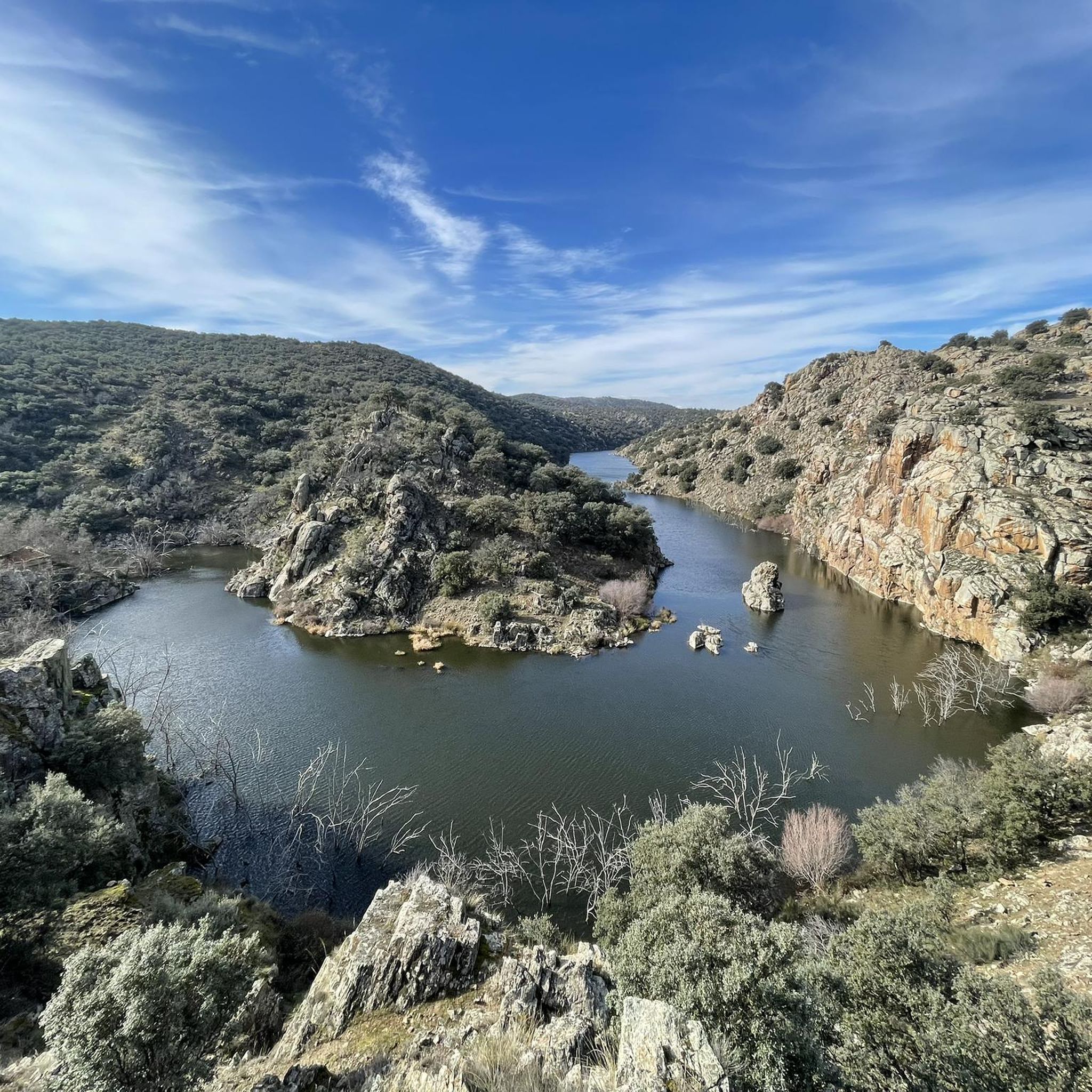
Las Cogotas is an ancient walled enclosure that is currently an important archaeological site located north of the city of Ávila and right next to the Embalse del Castro de Las Cogotas.
0
1
Frequently Asked Questions
How many mountain bike trails are available around Vega de Santa María?
There are 15 mountain bike trails around Vega de Santa María, offering a variety of routes through the undulating plains of La Moraña. These trails cater to different preferences, ranging from moderate to difficult.
What is the general difficulty level of mountain biking in this region?
The mountain bike trails around Vega de Santa María are predominantly moderate, with 14 routes falling into this category. There is also 1 difficult trail for those seeking a greater challenge. Riders should expect varied terrain, including gently rolling lands and some notable hills.
Are there any long-distance mountain bike routes in Vega de Santa María?
Yes, for those looking for longer rides, the Maello – Muñopedro Straights loop from Sanchidrián is a notable option, covering 55.5 km (34.5 miles). This moderate route crosses open plains and varied agricultural landscapes, typically taking around 4 hours and 22 minutes to complete.
What kind of terrain can I expect on the mountain bike trails?
The terrain around Vega de Santa María is characterized by undulating plains, offering natural rises and falls ideal for dynamic mountain biking. You'll encounter both paved and unpaved surfaces, with riverine environments along the Voltoya and Adaja rivers providing paths through forested sections and near small lagoons, contrasting with the more open Castilian plains.
Are there any circular mountain bike routes available?
Yes, many of the routes are designed as loops. For example, the Arco de Consejeros – Castro de Las Cogotas loop from Las Berlanas is a moderate 31.6 km (19.6 miles) trail, and the Charca del Cordel loop from Velayos is a shorter 22.2 km (13.8 miles) option through open countryside.
What do other mountain bikers say about the trails in Vega de Santa María?
The mountain bike trails in Vega de Santa María are highly rated by the komoot community, with an average score of 4.6 stars from over 10 reviews. Riders often praise the varied terrain, from open plains to riverine sections, and the opportunities for scenic rides with moderate challenges.
What are some interesting landmarks or places to see near the mountain bike trails?
While exploring the area, you can visit several interesting spots. Consider stopping by the Church of San Pedro Apóstol and the Verraco Vettón (Stone Bear). The settlements of El Bohodón, Mingorría, and Maello also offer glimpses into the local culture and history.
Are there any routes that pass by historical sites or castles?
Yes, you can explore routes that take you near historical points of interest. The Castle of Narros de Saldueña loop from Las Berlanas is a moderate 32.2 km (20 miles) trail that offers views of the castle, providing a blend of cycling and historical sightseeing.
What are the best times of year for mountain biking in Vega de Santa María?
Given the region's climate, spring and autumn generally offer the most pleasant conditions for mountain biking, with milder temperatures. Summer can be quite warm on the open plains, while winter might bring colder weather, though the undulating landscape remains accessible.
Are there any routes suitable for a moderate ride of around 2-3 hours?
Absolutely. Many routes fit this duration. For instance, the Arco de Consejeros – Castro de Las Cogotas loop from Las Berlanas is a moderate 31.6 km (19.6 miles) trail that typically takes around 2 hours and 44 minutes. Another option is the Sandy Dirt Road loop from Urb. Coto de Puenteviejo, which is 31.0 km (19.3 miles) and takes about 2 hours and 26 minutes.
Can I expect scenic views while mountain biking in this area?
Yes, the region offers contrasting and visually stimulating rides. The notable hills like Cerro de la Goyá and Alto de San Pedro likely provide panoramic views of the surrounding plains. Additionally, the riverine environments along the Adaja and Voltoya rivers, with their small lagoons and forested sections, offer refreshing and picturesque scenery.
Most popular routes around Vega De Santa María
Most popular attractions around Vega De Santa María

Get inspired with the komoot mobile app


Explore more
Browse the best MTB trails in other regions.
