The best walks and hikes around Valtierra
4.4
(191)
1,035
hikers
67
hikes
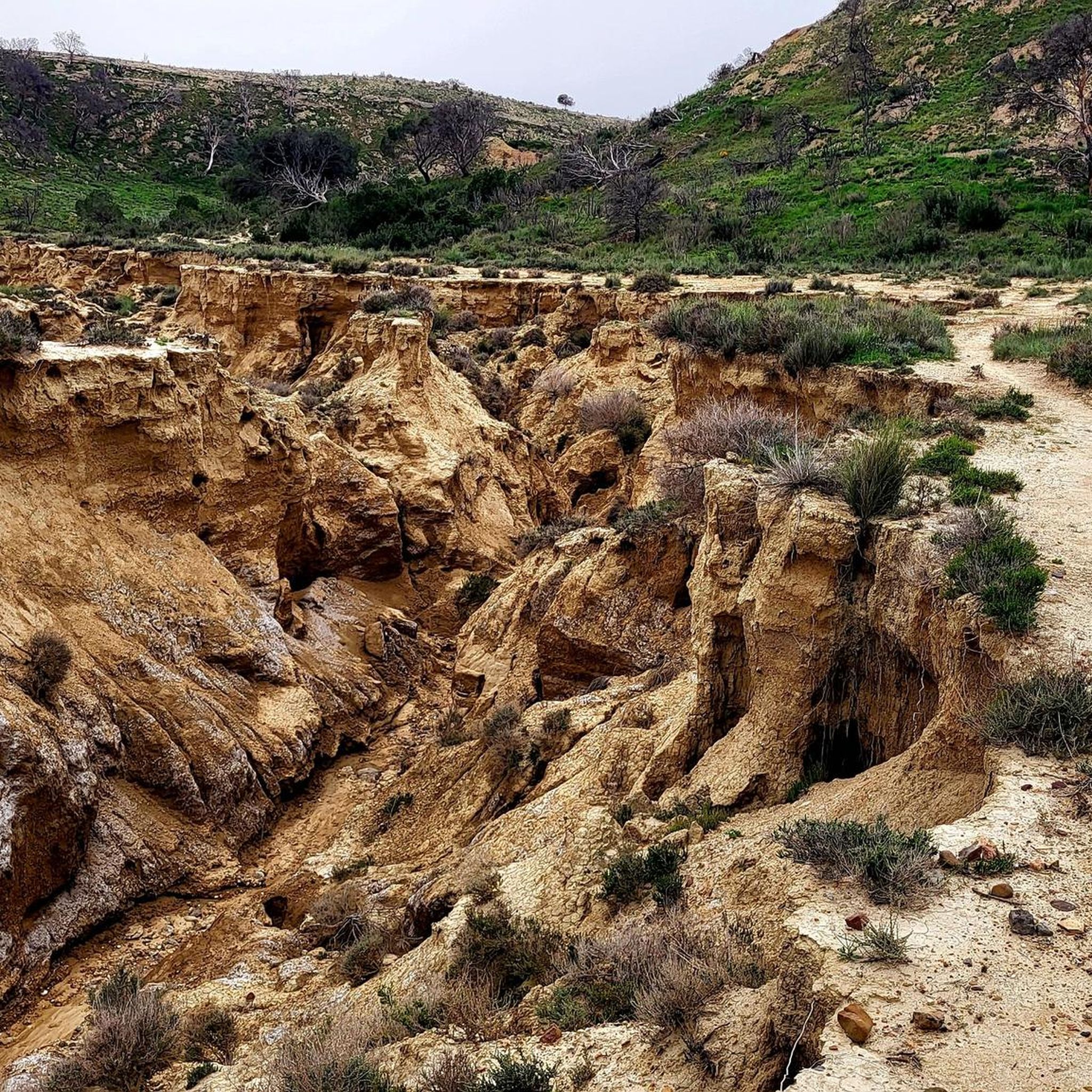
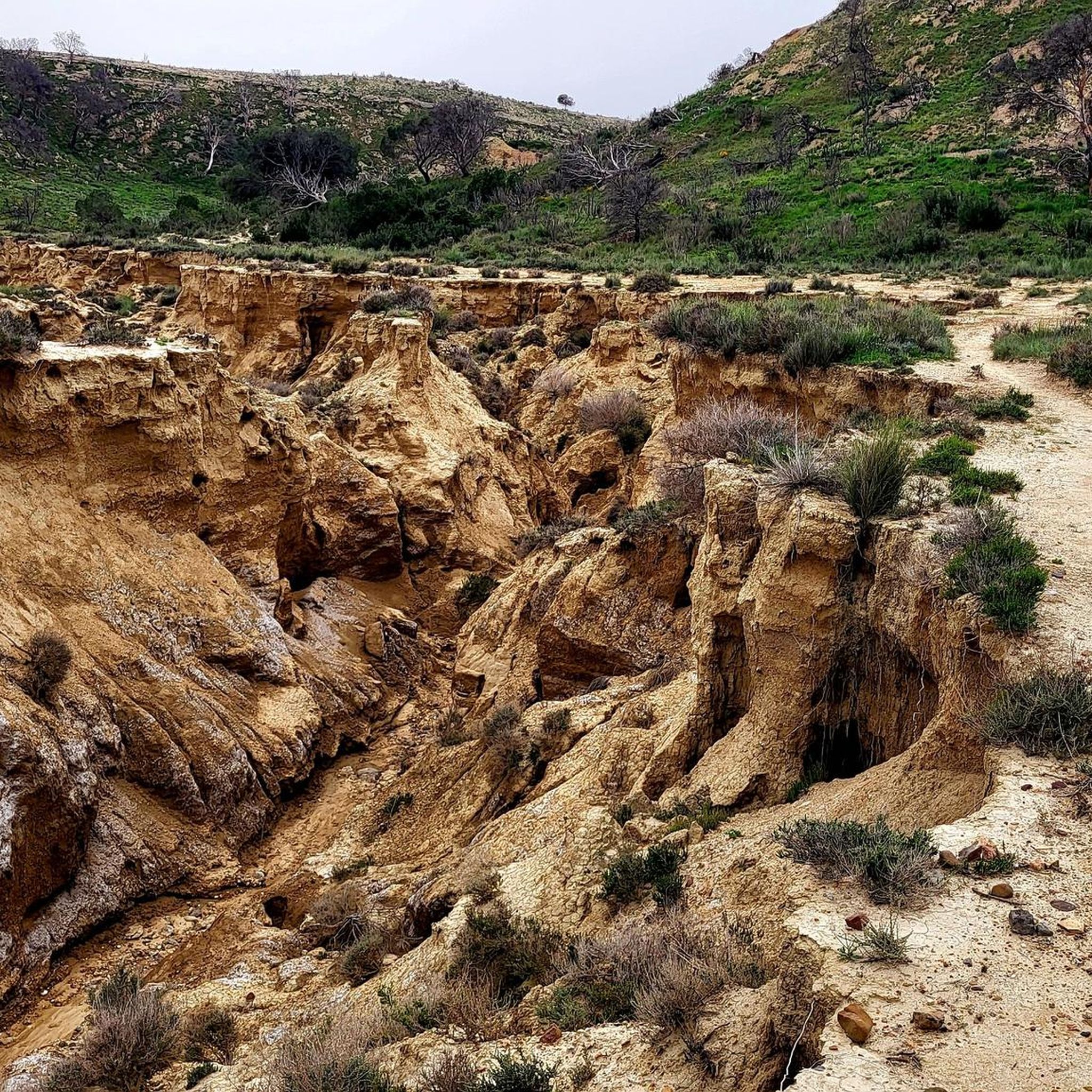
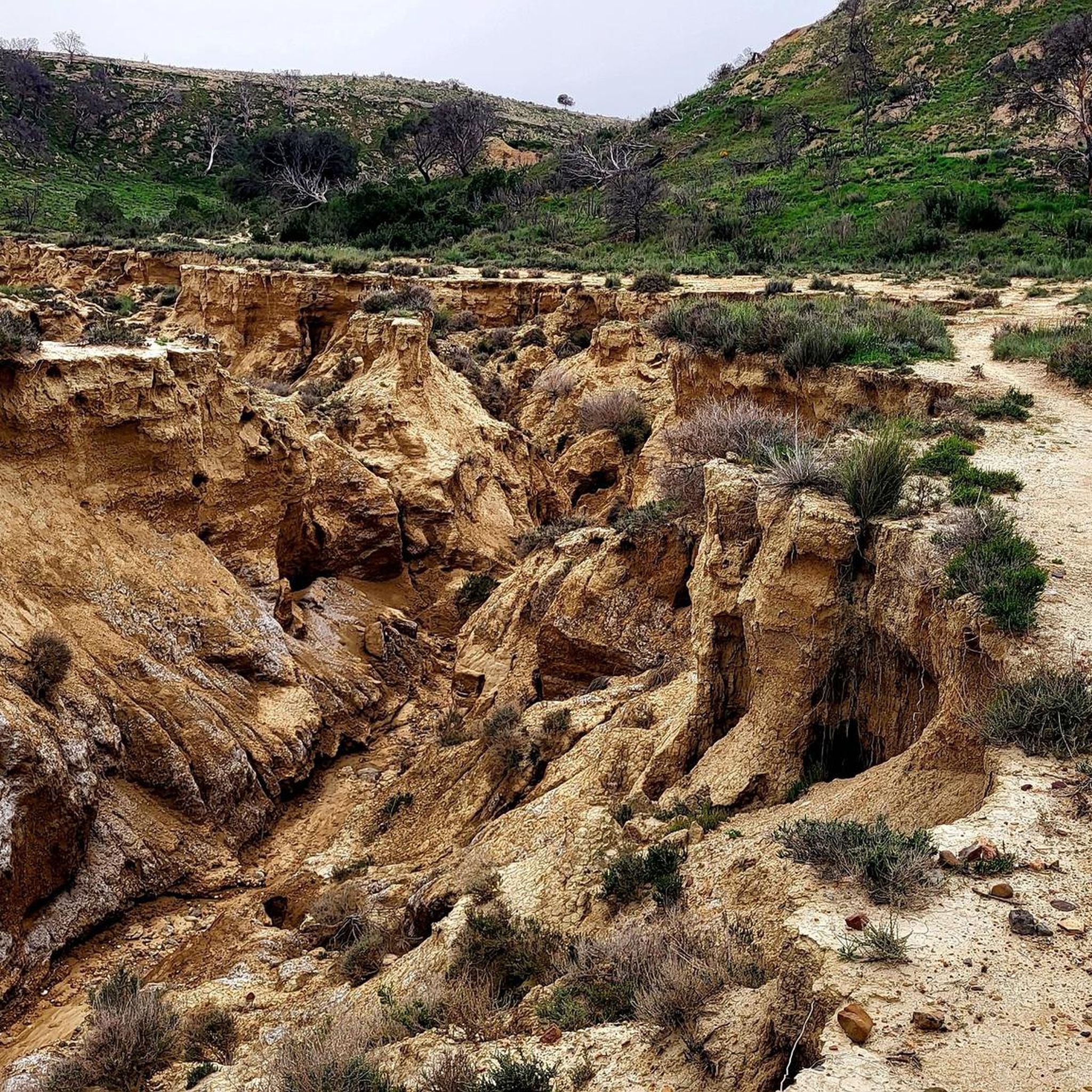
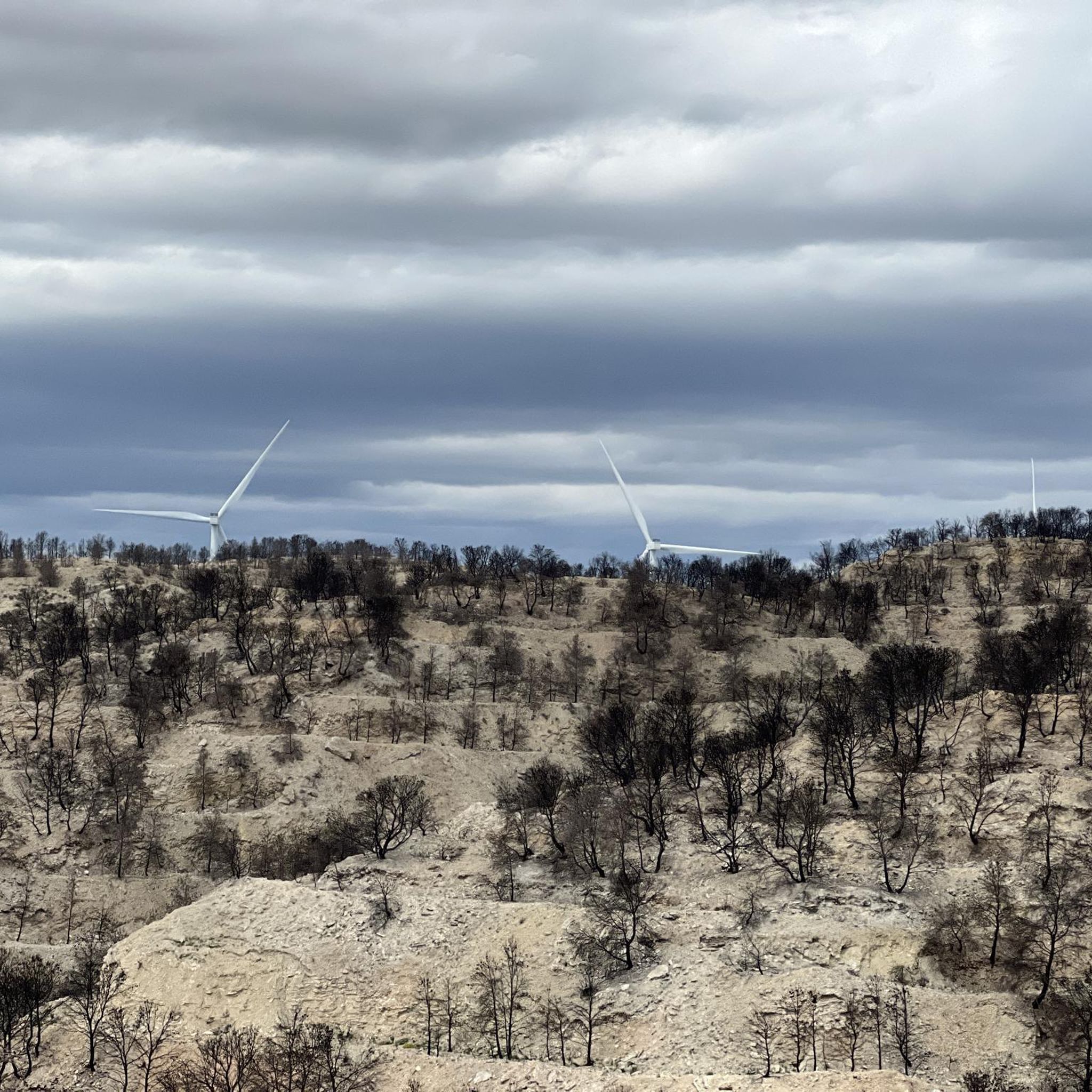
Hiking around Valtierra offers access to the Bardenas Reales Natural Park, a semi-desert region characterized by striking rock formations, deep ravines, and plateaus. This UNESCO Biosphere Reserve features a unique "lunar landscape" with geological wonders sculpted by erosion. The terrain includes pale, gypsum-rich soils and isolated hills known as "cabezos," such as the iconic Castildetierra.
Best hiking trails around Valtierra
- The most popular hiking route is Castildetierra – Cabezo de las Cortinillas loop from Monumento al Segador, a 2.0 miles (3.3 km) trail that takes about 1 hour to complete, exploring iconic "cabezos" in the Bardena Blanca.
- Another top favourite among local hikers is Castildetierra Hill – Castildetierra loop from Monumento al Segador, a moderate 4.9 miles (7.8 km) path offering extended views of the Castildetierra area.
- Local hikers also love the Castillo de Peñaflor – Beautiful Valley loop from Cabaña de Agirre, a 10.4 miles (16.7 km) trail leading through varied terrain including the historic Peñaflor Castle, often completed in about 4 hours 25 minutes.
- Hiking around Valtierra is defined by semi-desert landscapes, striking rock formations, and deep ravines, with routes available for various ability levels.
- The routes in Valtierra are highly rated by the komoot community with an average score of 4.4 stars from over 150 reviews. More than 890 hikers have used komoot to explore Valtierra's varied terrain.
Last updated: July 4, 2026
4.5
(2)
32
hikers
Easy hike. Great for any fitness level. Easily-accessible paths. Suitable for all skill levels.
4.5
(6)
24
hikers
Moderate hike. Good fitness required. Easily-accessible paths. Suitable for all skill levels.

Sign up for free
4.5
(4)
20
hikers
16.7km
04:25
160m
160m
Moderate hike. Good fitness required. Easily-accessible paths. Suitable for all skill levels.
4.8
(9)
49
hikers
4.38km
01:16
110m
110m
Easy hike. Great for any fitness level. Easily-accessible paths. Suitable for all skill levels.
3.6
(10)
25
hikers
12.6km
03:30
240m
240m
Moderate hike. Good fitness required. Easily-accessible paths. Suitable for all skill levels.
Get access to more routes and recommendations from other explorers.
Sign up for free
Already have an account?
Our route recommendations are based on thousands of hikes, rides, and runs completed by other people on komoot.
Start today with a free account
Your next adventure awaits.
Login or Signup

Tips from the Community

So many memories of this first Desertus
0
0
Very pretty little village at the gates of the Bardenas
0
0

short walk through the gorge near cabezo de castildetierra
0
0

One of the most impressive pieces of earth.
10
0
There are many beautiful views here. This mountain is the highlight for many.
17
0

Castildetierra is a natural formation created by water and wind erosion; a stone placed on top protected the ground below, creating a sort of earth pyramid. The soil has different shades, and at sunrise and sunset it takes on extraordinary reddish hues.
2
0

a magical place ... even if it attracts many tourists :)
0
0

The 30 km tour is absolutely worth doing...by car or bicycle...scenery that satisfies the eye and the imagination...and in the sky many griffon vultures
2
0
Frequently Asked Questions
How many hiking trails are available around Valtierra?
Valtierra offers a wide range of hiking opportunities, with over 60 routes available. These include 29 easy trails, 32 moderate paths, and 8 more challenging hikes, catering to various fitness levels and preferences.
What kind of landscape can I expect when hiking near Valtierra?
Hiking near Valtierra primarily takes you into the unique semi-desert landscape of the Bardenas Reales Natural Park. This UNESCO Biosphere Reserve features a dramatic 'lunar landscape' with striking rock formations, deep ravines, and plateaus. You'll encounter pale, gypsum-rich soils and iconic isolated hills known as 'cabezos', such as the famous Castildetierra.
Are there any easy hiking routes suitable for beginners or families?
Yes, there are several easy options perfect for beginners or families. An excellent choice is the Castildetierra – Cabezo de las Cortinillas loop from Monumento al Segador, which is 2.0 miles (3.3 km) and takes about an hour to complete, exploring iconic 'cabezos' in the Bardena Blanca. Another short and easy option is the View of Castildetierra – Castildetierra loop from Monumento al Segador, which is just 1.1 miles (1.8 km).
Can I bring my dog on the hiking trails in Valtierra?
The Bardenas Reales Natural Park, which is the main hiking area near Valtierra, generally allows dogs on trails, but they must be kept on a leash to protect the wildlife and natural environment. Always check local regulations before your visit, as rules can sometimes vary or be updated.
What are some notable natural landmarks or viewpoints to see?
The region is rich in natural landmarks. The most iconic is Castildetierra, a natural monument resembling a castle, which is a highlight for many visitors. You can also find excellent panoramic views from the Bardena Blanca Viewpoint and Cabezo de las Cortinillas. The entire Bardenas Reales Natural Park itself is a significant natural attraction.
Are there any historical sites to explore while hiking?
Yes, the area offers historical points of interest. Within the Bardenas Reales, you can find the ruins of Peñaflor Castle (Castillo de Peñaflor), a 13th-century tower that stands as a symbol of the region. The Castillo de Peñaflor – Beautiful Valley loop from Cabaña de Agirre is a moderate 10.4 miles (16.7 km) trail that leads through this historic site.
Are there circular hiking routes available?
Many of the trails around Valtierra are designed as circular routes, allowing you to start and end at the same point. Examples include the Castildetierra – Cabezo de las Cortinillas loop and the Castillo de Peñaflor – Beautiful Valley loop. These loops offer diverse scenery without retracing your steps.
What is the best time of year to go hiking in Valtierra?
The Bardenas Reales, being a semi-desert region, can experience extreme temperatures. Spring (April-May) and autumn (September-October) are generally considered the best times for hiking, offering milder weather. Summers can be very hot, and winters can be cold, though hiking is possible year-round with appropriate preparation.
Where can I park when visiting the hiking trails near Valtierra?
Many popular trailheads, especially those leading into the Bardenas Reales Natural Park, have designated parking areas. For example, routes like the Castildetierra loops often start from areas with parking facilities, such as near Monumento al Segador. It's advisable to check specific route details for parking information.
What makes the Bardenas Reales Natural Park unique for hiking?
The Bardenas Reales Natural Park is unique due to its striking semi-desert environment, often described as a 'lunar landscape.' Erosion has sculpted the soft soils into dramatic formations, including 'cabezos' (isolated hills) and deep ravines. This geological distinctiveness, combined with its diverse vegetation adapted to the arid climate, offers a hiking experience unlike many other places in Europe.
What do other hikers say about the trails in Valtierra?
The hiking trails around Valtierra are highly rated by the komoot community, with an average score of 4.4 stars from over 150 reviews. Hikers often praise the unique and otherworldly landscapes, the well-marked paths, and the opportunity to explore iconic natural monuments like Castildetierra.
Are there any longer, more challenging hikes for experienced hikers?
Yes, for those seeking a longer challenge, the Castillo de Peñaflor – Beautiful Valley loop from Cabaña de Agirre is a moderate 10.4 miles (16.7 km) trail that takes about 4 hours 25 minutes to complete. Another moderate option is The Little Balcony of the Moors – Bardenas Viewpoint loop from Arguedas, covering 7.8 miles (12.6 km) with more significant elevation changes.
What kind of vegetation can be found in the Bardenas Reales?
Despite its semi-desert classification, the Bardenas Reales hosts a variety of vegetation adapted to the climate. You'll find fields of cereals, especially in the more fertile areas, and patches of evergreen oaks and junipers in parts of the central Ebro Valley. The plant life is resilient and contributes to the unique ecosystem of the park.
Most popular attractions around Valtierra

Get inspired with the komoot mobile app


Explore more
Browse the best Hikes in other regions.
