The best running trails around Berrocal
5.0
(1)
130
runners
8
runs
Jogging routes around Berrocal are characterized by a diverse landscape featuring a mountain atmosphere, shady forests, and extensive holm oak pastures. The region's terrain includes ancient mining areas and the unique Río Tinto, providing varied surfaces for running. These natural attributes make Berrocal an appealing destination for outdoor activities, offering both open spaces and sheltered paths. The area's rich scenic and cultural heritage adds an element of historical exploration to running pursuits.
Best jogging routes around Berrocal
- The most popular…
Last updated: May 10, 2026
2
runners
15.4km
01:52
260m
260m
Hard run. Very good fitness required. Mostly paved surfaces. Suitable for all skill levels.
15.3km
02:00
420m
420m
Jog a difficult 9.5-mile (15.3 km) circular route from Berrocal, exploring the unique red landscapes of the Rio Tinto.

Sign up for free
15.4km
02:02
430m
430m
This difficult 9.5-mile (15.4 km) trail run near Berrocal offers challenging terrain, river views, and panoramic vistas from Río Tinto Viewp
65
runners
33.7km
04:45
1,300m
1,300m
Hard run. Very good fitness required. Mostly paved surfaces. Suitable for all skill levels.
5.0
(1)
48
runners
17.6km
02:31
790m
790m
Hard run. Very good fitness required. Mostly paved surfaces. Suitable for all skill levels.
Get access to more routes and recommendations from other explorers.
Sign up for free
Already have an account?
Our route recommendations are based on thousands of hikes, rides, and runs completed by other people on komoot.
Start today with a free account
Your next adventure awaits.
Login or Signup
Tips from the Community

The Peña del Hierro Viewpoint, located in Nerva (Huelva), is part of the Riotinto Mining Park and offers one of the most impressive views of the source of the Tinto River, as well as the mining crater of the old pyrite mine.
1
0
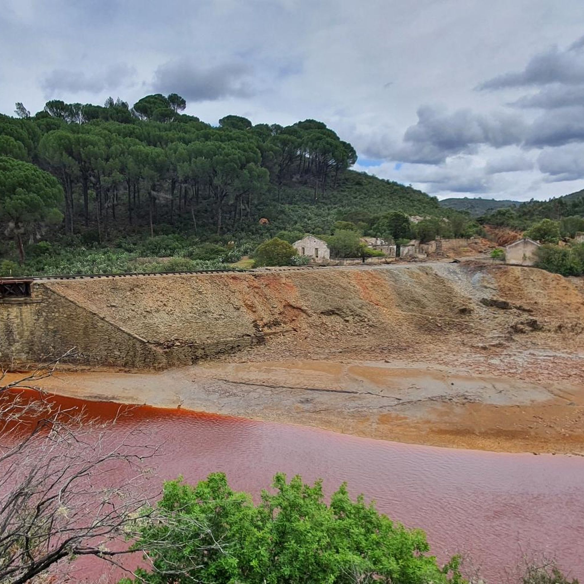
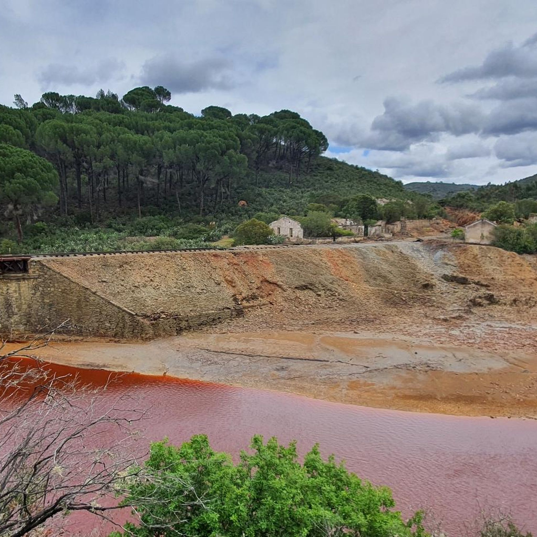
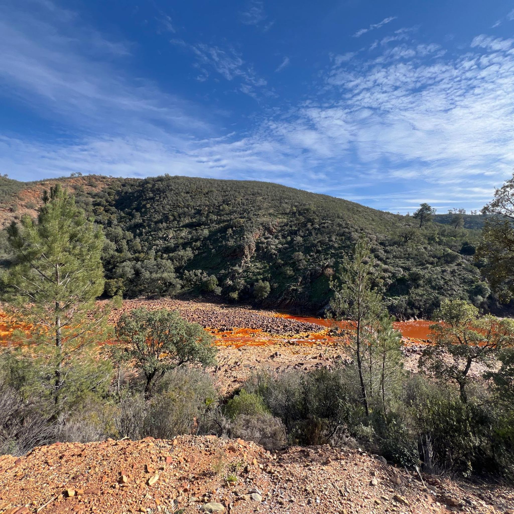
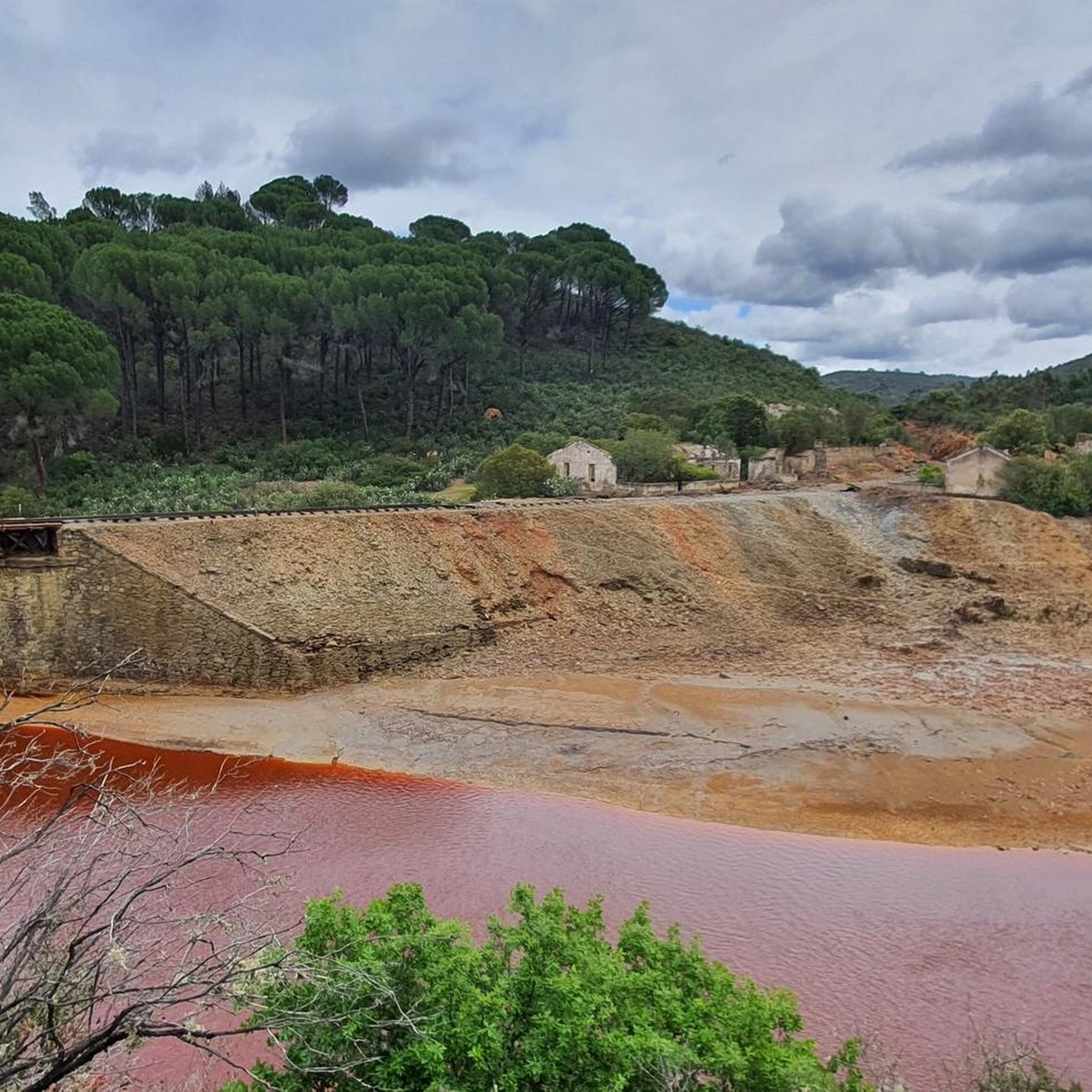
The source of the Tinto River is located in the municipality of Nerva, in the province of Huelva, Andalusia, and is one of the most unique landscapes in Europe due to its reddish color and its scientific and geological value.
1
0

An approximately 3 kilometer long circular route leads around the natural monument Montera de Gossan. Don't miss it because of the beautiful views.
0
0

Also known as the Padre Caro mountain range, it indicates the source of the Río Tinto which runs through the interior of Huelva for about 100 km until it reaches the Odiel River. Its name is due to the reddish color of its waters, caused by the weathering of minerals with a high content of heavy metal sulfides that were found and exploited in various deposits along the riverbed.
0
0

Views of one of the meanders formed by the Rio Tinto as it passes through the municipality of Berrocal.
1
1
Religious sanctuary of the town of Berrocal. Said congregation was divided into two buildings that represented two sides, the one above and the one below. That is why we still find the Hermitage of the Brotherhood of the Santa Cruz de Abajo and the one above.
1
1

Very nice vantage point with picnic area.
1
0

Bridge that crosses the Río Tinto in its red colors and unusual waters with these dyes. The pedestrian-only bridge crosses both sides of the river.
0
1
Frequently Asked Questions
How many running routes are available in the Berrocal area?
There are over 8 dedicated running routes around Berrocal, offering a variety of experiences for runners. These routes are highly rated by the komoot community, with an average score of 5.0 stars.
What kind of terrain can I expect on the running trails in Berrocal?
The running trails in Berrocal feature a diverse landscape, including a mountain atmosphere, shady forests, and extensive holm oak pastures. You'll also encounter unique ancient mining areas and the distinctive Río Tinto, providing varied surfaces from natural paths to more rugged terrain.
Are there any easy running routes for beginners in Berrocal?
While many routes in Berrocal are rated as moderate to difficult, there are options that can be adapted for beginners. The region's varied terrain means you can find flatter sections within the holm oak pastures, though dedicated easy routes are less common. We recommend checking the route details on komoot for elevation profiles before you go.
Are there circular running trails in Berrocal?
Yes, Berrocal offers several excellent circular running trails. A popular choice is Peña del Hierro y nacimiento del Río Tinto - running circular desde Nerva, which is a challenging 9.6-mile loop exploring historic mining landscapes. Another option is the Berrocal - Río Tinto Loop Trail, also a 9.6-mile circular route through the unique Río Tinto area.
What interesting landmarks or sights can I see along the running routes?
Many running routes in Berrocal pass by significant historical and natural landmarks. You can explore the unique landscapes of the Río Tinto, and some trails are near sites like the Corta Atalaya Mine, the Touristic Railway for Rio Tinto Mines, and the Cachán Bridge, offering a blend of natural beauty and industrial heritage.
Can I bring my dog on the running trails in Berrocal?
Generally, the natural areas around Berrocal are welcoming to dogs, especially on trails that pass through forests and open pastures. However, it's always best to check local regulations for specific routes or protected areas, and ensure your dog is on a leash and you clean up after them. The varied terrain and open spaces are often ideal for running with canine companions.
Are there any running routes suitable for families with children?
While many routes are rated difficult, families can find sections of trails through the holm oak pastures or along the less strenuous parts of the Río Tinto area that are suitable for a family run or walk. For a full family outing, consider shorter, flatter segments or look for routes specifically marked as easy on komoot. Always check the distance and elevation before heading out with children.
When is the best time of year to go running in Berrocal?
The presence of shady forests and holm oak pastures makes Berrocal appealing for running during various seasons. Spring and autumn offer pleasant temperatures, while the shady areas provide respite from the sun during warmer months. Winter running is also possible, with the region's mild climate, though checking local weather conditions is always advisable.
What do other runners enjoy most about jogging in Berrocal?
The komoot community highly rates the running experience in Berrocal, with an average score of 5.0 stars. Runners often praise the unique blend of natural beauty, the historical mining landscapes, and the varied terrain that keeps runs interesting. The peaceful escape from more bustling areas and the opportunity to explore a rich cultural heritage are also frequently highlighted.
Are there longer running options for experienced runners?
Absolutely. Experienced runners looking for a challenge will find several longer and more difficult routes. For instance, the Cachán Bridge – Riscos Altos Viewpoint loop from Los Frailes is a demanding 20.9-mile (33.7 km) route with significant elevation gain, offering a substantial workout and expansive views.
What kind of cultural heritage can I explore while running in Berrocal?
Berrocal boasts a rich scenic and cultural heritage. The region is known for its ancient mining areas, particularly around the Río Tinto, which has a history dating back to the Tartessian civilization. Running through these areas allows you to witness traces of this past, including old mining structures and unique landscapes shaped by centuries of human activity, adding a historical dimension to your run.
Is there parking available near the running trailheads?
While specific parking information varies by trailhead, many routes in natural areas like Berrocal typically have designated parking spots or roadside areas where you can leave your vehicle. For detailed parking information for a specific route, it's best to check the route description on komoot, as users often provide tips on access and parking.
Most popular attractions around Berrocal

Get inspired with the komoot mobile app


Explore more
Browse the best Running Trails & Routes in other regions.
