The best running trails around Orejana
5.0
(1)
52
runners
17
runs
Jogging routes around Orejana traverse a distinctive high-desert environment characterized by the prominent Orejana Rim and the deeply carved Orejana Canyon. This geological formation includes five smaller side canyons, offering varied terrain for exploration. The landscape is primarily covered by sagebrush and bunchgrass, creating a rugged and scenic backdrop for running. These features provide an excellent setting for trail running, with expansive routes away from urban development.
Best jogging routes around Orejana
- The most popular jogging route is Views of…
Last updated: June 28, 2026
26
runners
13.1km
01:33
240m
250m
Moderate run. Good fitness required. Mostly paved surfaces. Suitable for all skill levels.
5.0
(1)
6
runners
5.35km
00:36
30m
40m
Moderate run. Good fitness required. Mostly paved surfaces. Suitable for all skill levels.

Sign up for free
4
runners
5.34km
00:35
50m
50m
Moderate run. Good fitness required. Mostly paved surfaces. Suitable for all skill levels.
3
runners
9.85km
01:06
100m
100m
Moderate run. Good fitness required. Mostly paved surfaces. Suitable for all skill levels.
3
runners
6.96km
00:46
50m
50m
Moderate run. Good fitness required. Mostly paved surfaces. Suitable for all skill levels.
Get access to more routes and recommendations from other explorers.
Sign up for free
Already have an account?
Our route recommendations are based on thousands of hikes, rides, and runs completed by other people on komoot.
Start today with a free account
Your next adventure awaits.
Login or Signup
Tips from the Community

Medieval city center of a great region. Very suitable for tourism.
0
0

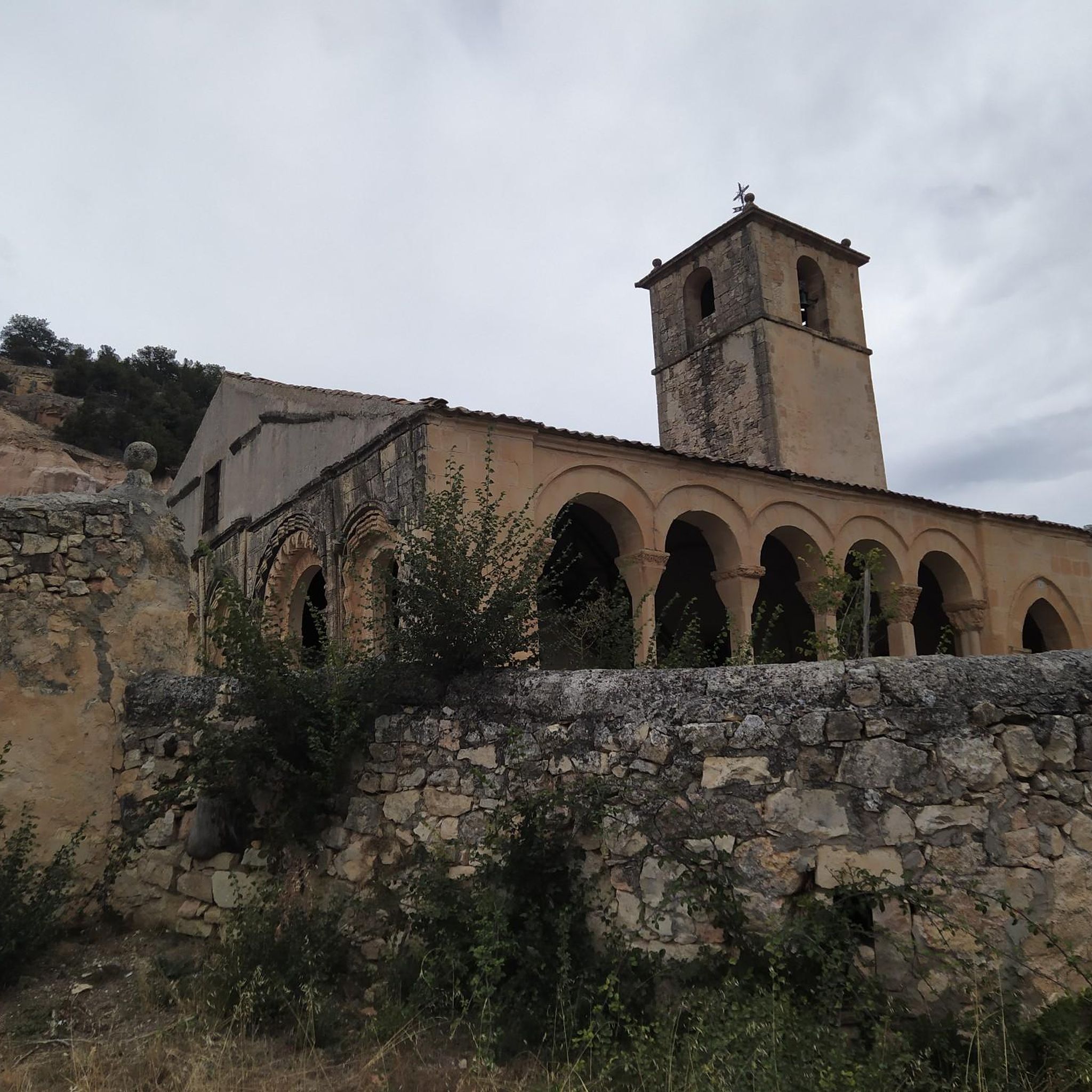
San Pedro de Gaíllos is a town located at the entrance to the great plains in the north of the province of Segovia. The town, with its church as its flag, governs the core.
1
0
Before reaching the town of Pedraza itself, there are beautiful views of the town, located at the top of a hill.
2
0
San Pedro de Gaíllos is a town located at the entrance to the great plains in the north of the province of Segovia. The town, with its church as its flag, governs the core.
0
1
Frequently Asked Questions
How many running routes are available around Orejana?
There are over 15 running routes available around Orejana, offering a variety of options for different skill levels. The komoot community has explored these trails more than 40 times.
What kind of terrain can I expect on the running trails in Orejana?
The running trails in Orejana traverse a distinctive high-desert environment. You can expect varied terrain characterized by the prominent Orejana Rim and the deeply carved Orejana Canyon, including five smaller side canyons. The landscape is primarily covered by sagebrush and bunchgrass, providing a rugged and scenic backdrop ideal for trail running.
Are there any easy or beginner-friendly running routes in Orejana?
While many routes are moderate, there is at least one easy running route available in Orejana. These trails are generally well-suited for off-road adventures, offering a good workout with varied elevation and surfaces.
Can I find circular running routes in the Orejana area?
Yes, several circular running routes are available. For example, the Views of Pedraza loop from Pedraza is a popular option, as is the Running loop from Matabuena, and the Charca del Barrero loop from Arcones.
What is the best time of year for trail running in Orejana?
Given the high-desert environment, spring and autumn generally offer the most pleasant temperatures for trail running in Orejana. Summers can be hot, and winters might bring colder conditions, but the expansive landscape provides opportunities for outdoor activity year-round. Always check local weather conditions before heading out.
What do other runners say about the trails in Orejana?
The running routes in Orejana are highly rated by the komoot community, with an average score of 5.0 stars from reviews. Runners often praise the varied terrain and scenic views offered by the high-desert environment.
What natural features or landmarks can I see while running in Orejana?
While running in Orejana, you'll encounter significant natural features like the Orejana Rim and the deeply carved Orejana Canyon. You might also discover highlights such as the Puerto de Linera mountain pass, the Horizontal Trail, or even a Mill and Waterfall. The historic settlement of Pedraza and the Church of Our Lady of the Vegas are also notable points of interest nearby.
Are the running trails in Orejana suitable for families?
Many of the trails in Orejana offer varied terrain that can be enjoyed by families, especially those looking for an active outdoor experience. Consider routes with moderate difficulty and shorter distances, such as the Running loop from Matabuena, which has gentle elevation changes.
Can I bring my dog on the running trails around Orejana?
Generally, wilderness areas like Orejana Canyon WSA are suitable for dogs, but it's always best to check local regulations for specific trails or protected areas. Ensure your dog is on a leash and practice Leave No Trace principles to preserve the natural environment.
Where can I park when visiting the running routes in Orejana?
Parking availability can vary depending on the specific trailhead. For routes starting from villages like Pedraza, Matabuena, or Arcones, you can typically find parking within or near the village. It's advisable to check specific route details on komoot for parking recommendations.
Is there public transport available to reach the running trails in Orejana?
Public transport options directly to trailheads in the Orejana wilderness area might be limited due to its remote nature. However, some routes may be accessible from nearby villages like Pedraza, Matabuena, or Arcones, which might have limited public transport connections. Planning your journey in advance is recommended.
Are there any permits required for running or hiking in the Orejana area?
The Orejana Canyon Wilderness Study Area (WSA) is managed by the Bureau of Land Management (BLM). Generally, permits are not required for day-use activities like running or hiking in BLM wilderness study areas. However, it's always a good practice to check the official BLM website for any specific regulations or updates regarding the Orejana Canyon WSA before your visit. You can find more information on the BLM website.
Are there any places to stop for refreshments or accommodation near the running routes?
While the Orejana Canyon WSA itself is a remote wilderness, nearby villages such as Pedraza, Matabuena, and Arcones may offer amenities like cafes, pubs, or accommodation. These villages often serve as starting points for many of the running routes, making them convenient for pre- or post-run refreshments.
Most popular attractions around Orejana

Get inspired with the komoot mobile app


Explore more
Browse the best Running Trails & Routes in other regions.
