The best walks and hikes around Sotobañado Y Priorato
4.8
(12)
33
hikers
12
hikes
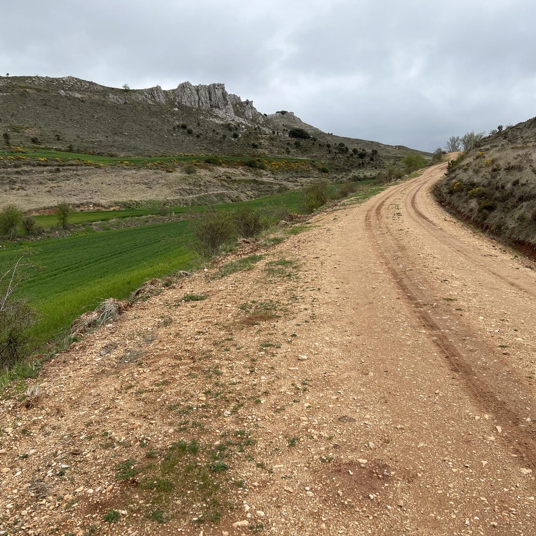
Hiking around Sotobañado Y Priorato offers diverse natural landscapes within the Boedo-Ojeda region of Palencia, Castilla y León. The terrain transitions from vast páramos to lush green lands shaped by the Boedo River, which is lined with abundant poplar groves. The area also features the historic Canal de Castilla, providing flat routes, alongside gentle valleys, rolling hills, and extensive oak and pine forests. These natural features contribute to varied hiking experiences.
Best hiking trails around Sotobañado Y Priorato
- The most…
Last updated: June 28, 2026
4.5
(2)
4
hikers
10.9km
02:59
180m
180m
Moderate hike. Good fitness required. Mostly accessible paths. Sure-footedness required.
5.0
(3)
5
hikers
7.65km
01:57
20m
20m
Easy hike. Great for any fitness level. Easily-accessible paths. Suitable for all skill levels.

Sign up for free
1
hikers
Moderate hike. Great for any fitness level. Mostly accessible paths. Sure-footedness required.
4.0
(1)
2
hikers
13.2km
03:44
280m
270m
Moderate hike. Good fitness required. Easily-accessible paths. Suitable for all skill levels.
Hard hike. Very good fitness required. Easily-accessible paths. Suitable for all skill levels.
Get access to more routes and recommendations from other explorers.
Sign up for free
Already have an account?
Our route recommendations are based on thousands of hikes, rides, and runs completed by other people on komoot.
Start today with a free account
Your next adventure awaits.
Login or Signup
Popular around Sotobañado Y Priorato


Tips from the Community

The San Andrés Lock, located in Herrera de Pisuerga (Palencia), is part of the historic Canal de Castilla, one of the most important hydraulic engineering works in Spain in the 18th and 19th centuries.
1
0

Church from the 14th century, built on top of the remains of a castle.
2
0
It is a limestone rock 120 cm high, which served for centuries to mark the property and jurisdiction limits of the convent of San Andrés de Arroyo. The place has an information panel.
2
0
Fuente de la Gallina recreational area has benches and tables to eat or have a snack. Beautiful place that invites you to observe, rest, and walk along the path that leads the Pisuerga River. A quiet and charming landscape.
2
0
At this place the Canal de Castilla begins its journey - a masterpiece of Spanish hydraulic engineering from the 18th / 19th century. The canal is 207 km long. Here we can see the commemorative monolith for the 200 years of the North Branch of the canal, installed in 1991.
3
0

Built on top of the remains of a castle, the Church of San Juan Bautista dates from the 14th century.
1
0

Cultural point that celebrates the patrimonial past of the Canal de Castilla, the Retention of San Andrés is an incredible natural park. If you are looking for a place to rest it is the perfect place.
1
0
Frequently Asked Questions
How many hiking trails are available around Sotobañado y Priorato?
There are over 10 hiking trails available around Sotobañado y Priorato, offering a variety of experiences for different skill levels. You'll find options ranging from easy strolls to more moderate routes through diverse landscapes.
What kind of terrain can I expect on hikes in Sotobañado y Priorato?
The terrain around Sotobañado y Priorato is quite varied. You can expect to encounter vast páramos (moorlands), lush green areas along the Boedo River with abundant poplar groves, and the flat towpaths of the historic Canal de Castilla. The broader region also features gentle valleys, rolling hills, and extensive oak and pine forests, acting as a transition zone between plains and more rugged mountains.
Are there any easy, flat walks suitable for all abilities?
Yes, the historic Canal de Castilla offers excellent easy and flat routes. Its towpaths are ideal for accessible hikes. For example, the Canal de Castilla Circular from Herrera de Pisuerga is an easy 4.8-mile (7.7 km) path that showcases the canal's impressive hydraulic engineering.
What do other hikers enjoy most about hiking in Sotobañado y Priorato?
The area is highly rated by the komoot community, with an average score of 4.75 stars from over 10 reviews. Hikers often praise the diverse natural landscapes, the peaceful riverine paths along the Boedo, and the historical significance of the Canal de Castilla routes.
Are there any circular hiking routes in the area?
Yes, there are several circular routes available. A popular moderate option is the Fuente la Gallina and Mojón de la Abadesa Loop, which is 6.7 miles (10.9 km) long and explores the area around the source of the Canal de Castilla. Another is the Santibáñez de Ecla y Peña Pico — circular desde Prádanos de Ojeda, an 8.2-mile (13.2 km) trail through varied terrain.
What natural features or landmarks can I see while hiking?
You'll encounter a rich variety of natural and historical features. The Boedo River with its poplar groves is a central element, as is the 18th-century Canal de Castilla. Notable landmarks include the Dock and Locks of the Canal de Castilla in Alar del Rey and the Source of the Canal de Castilla. The region also boasts extensive oak and pine forests.
Are there any family-friendly hiking options?
Absolutely. The flat towpaths of the Canal de Castilla are particularly well-suited for families with children or those looking for an easy, gentle walk. These paths offer a safe and scenic environment to enjoy the outdoors together.
Is Sotobañado y Priorato a good destination for dog-friendly hikes?
Yes, the natural environment around Sotobañado y Priorato, with its open spaces, riverine paths, and forest trails, generally offers good opportunities for hiking with dogs. The Canal de Castilla towpaths are also a great option for walks with your canine companion.
What is the best time of year to go hiking in Sotobañado y Priorato?
The region is generally pleasant for hiking during spring and autumn when temperatures are milder and the landscapes are vibrant. Spring brings lush greenery, while autumn offers beautiful colors in the forests. Summer can be warm, but early mornings or late afternoons are still enjoyable, especially along shaded river paths.
Are there any moderate trails for hikers looking for a bit more challenge?
Yes, there are several moderate trails. Beyond the popular Fuente la Gallina and Mojón de la Abadesa Loop, you might consider the Nogales de Pisuegra by the Parque de la Gallina — circular from Alar del Rey, a 4-mile (6.4 km) route with some elevation gain, or the longer Barrio de San Vicente by the Canal de Castilla from the Centro de Interpretación — round trip, which is 9 miles (14.5 km) and offers a moderate experience.
Is public transport available to reach hiking trailheads?
While specific public transport links directly to every trailhead might be limited, the region of Boedo-Ojeda is accessible. It's advisable to check local bus schedules for connections to towns like Alar del Rey or Herrera de Pisuerga, which serve as starting points for several popular routes, including those along the Canal de Castilla.
Where can I find parking for hiking routes?
Parking is generally available in the towns and villages that serve as starting points for hikes, such as Alar del Rey or Herrera de Pisuerga. For routes along the Canal de Castilla, you can often find parking near access points or visitor centers. It's recommended to check specific route details for designated parking areas.
Most popular routes around Sotobañado Y Priorato
Most popular attractions around Sotobañado Y Priorato

Get inspired with the komoot mobile app


Explore more
Browse the best Hikes in other regions.
