The best walks and hikes around Castrelo De Miño
3.9
(58)
309
hikers
25
hikes
Hiking trails around Castrelo De Miño traverse a landscape characterized by river valleys, extensive vineyards, and lush greenery. The region features the expansive Castrelo de Miño reservoir and the Miño River, with trails often running alongside its banks. Hikers can explore areas dominated by pines and oaks, encountering natural features like the Barbantiño Waterfall. The terrain offers a mix of riverside paths and routes through vineyard-covered hills.
Best hiking trails around Castrelo De Miño
- The most popular hiking route is…
Last updated: October 1, 2026
4.5
(4)
21
hikers
12.1km
03:22
220m
220m
Moderate hike. Good fitness required. Mostly accessible paths. Sure-footedness required.
4.0
(2)
25
hikers
4.11km
01:02
10m
10m
Easy hike. Great for any fitness level. Easily-accessible paths. Suitable for all skill levels.

4.0
(4)
16
hikers
11.0km
03:02
190m
190m
Moderate hike. Good fitness required. Easily-accessible paths. Suitable for all skill levels.
3.7
(3)
17
hikers
8.73km
02:20
100m
100m
Moderate hike. Good fitness required. Easily-accessible paths. Suitable for all skill levels.
4.0
(4)
18
hikers
13.5km
03:40
190m
190m
Moderate hike. Good fitness required. Easily-accessible paths. Suitable for all skill levels.
Get access to more routes and recommendations from other explorers.
Already have an account?
Our route recommendations are based on thousands of hikes, rides, and runs completed by other people on komoot.
Start today with a free account
Your next adventure awaits.

Tips from the Community

It is a beautiful waterfall located on the Barbantiño River, in the province of Ourense, Galicia. With a waterfall of about 20 meters, it is one of the most impressive natural landscapes in the area. Surrounded by a lush and green environment, the waterfall is ideal for those who enjoy hiking and contact with nature.
1
0
The Barbantes Thermal Park, in Cenlle, Ourense, has a thermal water pool that occupies about 200 square meters. The water temperature is constant, around 28-29ºC, ideal for a relaxing bath. Its water is rich in minerals and known for its therapeutic properties. The park has green areas and rest areas, making it a popular place for thermal tourism. It stands out for being on the Ribeiro Wine Route, an area famous for its vineyards and wineries, combining wellness and wine tourism.
1
0

The Fervenza do Barbantiño jump overcomes a difference in height of about 15 meters above the rocky ground and in the rainy season it becomes a true spectacle. However, its course is subject to the rules of a mini hydroelectric plant from the late 1990s that reduces its flow during certain times of the year. To get to this beautiful fervenza, just follow the Barbantiño Natural Trail downstream. From the OU-524 bridge over the river you can take the route, since this is the shortest way to get there, with a distance of only 1.7 km. In any case, it is advisable to start the route from the thermal springs in O Bañiño, in A Forxa, and travel the more than 7 km of beautiful and incomparable path, until you reach the San Fiz bridge.
2
0

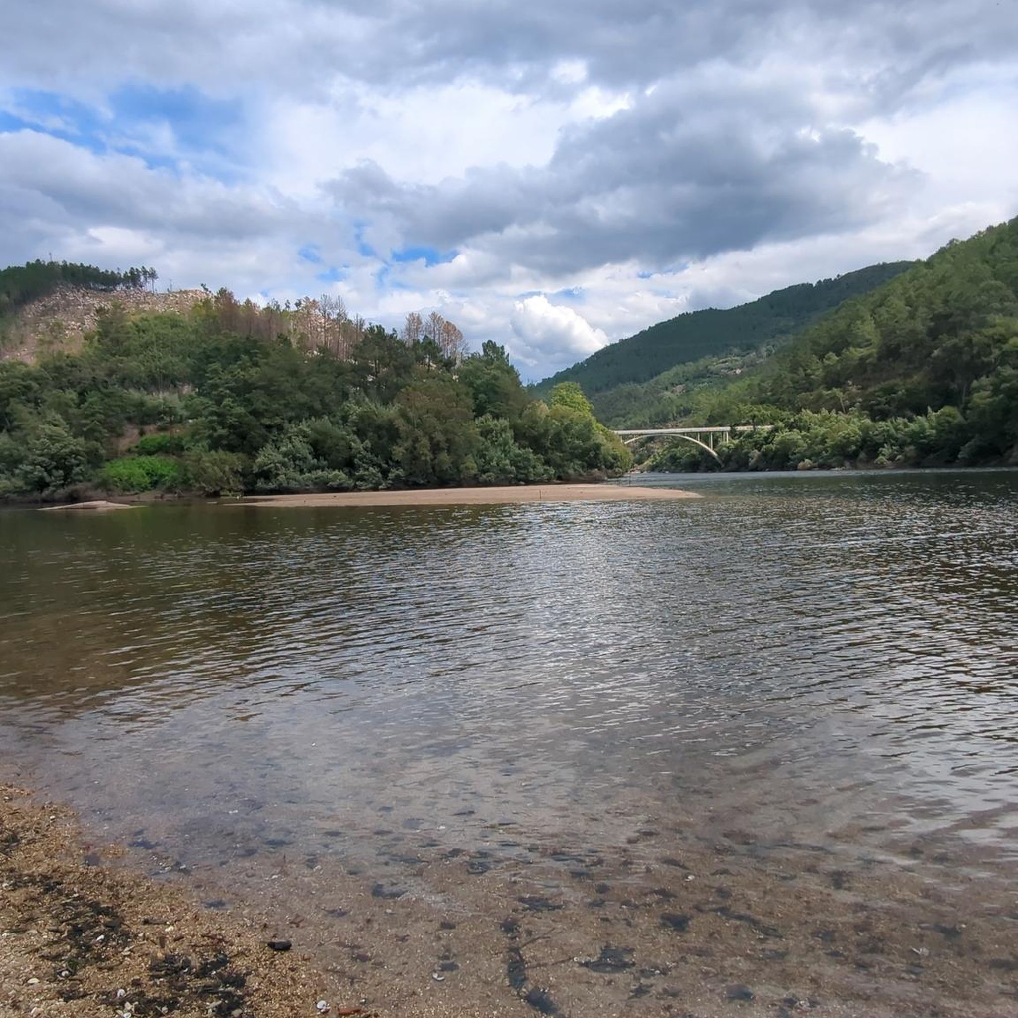
Natural park and path along the river Miño between the town of Laias and the Barbantes hot springs. Cool off by swimming in the cool waters of the river on your adventure. In season, there is a beach bar to buy some food.
1
0
Great gravel track along the river Miño between Barbantes and Laias. The trail is shaded by many native trees. Don't forget your bathing suit to soak in the hot springs and the river
2
0
The path ends along a bridge over the water of the Barbantiño that offers a spectacular view of the waterfall as it falls in four levels, forming pools between the rocks.
2
0

Old mill located in a natural environment of great beauty, next to the Barbantiño river, where there are small bridges and footbridges, as well as other old mills.
2
0
In the Carballiño region, between the municipalities of Amoeiro and Maside, is the Barbantino River waterfall, also known as Fervenza do Cachón. In times of heavy rains, this waterfall, 15 meters high, is a highly recommended visit to enjoy this natural spectacle.
3
0
Frequently Asked Questions
How many hiking trails are available in Castrelo De Miño?
Castrelo De Miño offers a diverse network of over 15 hiking trails, catering to various skill levels. The komoot community has explored more than 19 routes in the area.
What kind of terrain can I expect on the hiking trails in Castrelo De Miño?
The terrain in Castrelo De Miño is characterized by river valleys, extensive vineyards, and lush greenery. Trails often run alongside the Miño River and the Castrelo de Miño reservoir, passing through areas dominated by pines and oaks. You'll find a mix of riverside paths and routes through vineyard-covered hills.
Are there any easy hiking trails suitable for beginners or families?
Yes, Castrelo De Miño has several easy trails. For instance, the Pozas de Melon and Fervenza Touron - circular along the Cerves River is an easy 3.8-mile (6.1 km) route that follows the Cerves River, taking less than two hours to complete.
Can I find any circular hiking routes in the area?
Many trails in Castrelo De Miño are circular, offering convenient starting and ending points. A popular option is the Camino Natural del Río Barbantiño – circular from A Forxa, a moderate 7.5-mile (12.1 km) path with scenic views along the Barbantiño River.
Are there any waterfalls to see along the hiking trails?
Absolutely! The region is home to several beautiful waterfalls. The prominent Barbantiño Waterfall, also known as Fervenza do Cachón, plunges 15 to 20 meters and is a spectacular sight, especially after rainfall. You can access it via routes like the Camino Natural del Río Barbantiño. Other notable waterfalls include Pozas de Melón and A Boutureira Waterfall.
What natural features or landmarks can I expect to see while hiking?
Beyond waterfalls, you'll encounter the expansive Castrelo de Miño reservoir, a habitat for aquatic birds. The Miño River itself offers picturesque trails. The region's unique microclimate supports extensive vineyards, providing stunning views from elevated points like Coto de Novelle. You might also spot the historic 12th-century Iglesia de Santa María de Castrelo along some routes.
Are there any thermal hot springs nearby to relax after a hike?
Yes, the region is known for its thermal springs. The Outariz Hot Springs and Barbantes Thermal Park offer natural hot waters with therapeutic properties, providing an excellent way to unwind after exploring the trails.
What is the best time of year to go hiking in Castrelo De Miño?
Thanks to its unique microclimate, Castrelo De Miño is suitable for hiking much of the year. The 'Mediterranean climate' makes it pleasant, especially during spring and autumn when temperatures are mild and the vineyards are vibrant. Summer can be warm, but riverside and shaded trails offer respite.
What do other hikers enjoy most about the trails in Castrelo De Miño?
The area is highly rated by the komoot community, with an average score of 4.1 stars from over 40 reviews. Hikers often praise the diverse landscapes, the scenic views of the reservoir and vineyards, and the variety of routes available for different fitness levels.
Are there any longer, more challenging routes for experienced hikers?
Yes, for those seeking a greater challenge, there are moderate to difficult routes. The Route of the Fuente de San Benito – circular from Mugares is a 10.4-mile (16.8 km) trail with significant elevation gain, typically taking around 4 hours 51 minutes to complete.
Is Castrelo De Miño a good destination for birdwatching while hiking?
The Castrelo de Miño reservoir is a significant natural feature that has become a habitat for aquatic birds like herons and ducks. Hiking along the reservoir's banks or nearby trails offers excellent opportunities for birdwatching.
Are there any routes that combine hiking with historical sites?
Yes, the Ruta Fluvial Castrelo de Miño, which starts and ends at the Club Náutico de Castrelo de Miño, combines nature with historical heritage. This route offers impressive views of the reservoir and vineyards and passes by the 12th-century Iglesia de Santa María de Castrelo.
Most popular attractions around Castrelo De Miño

Get inspired with the komoot mobile app


Explore more
Browse the best Hikes in other regions.
