The best walks and hikes around Santo Tomé De Zabarcos
2
hikers
4
hikes
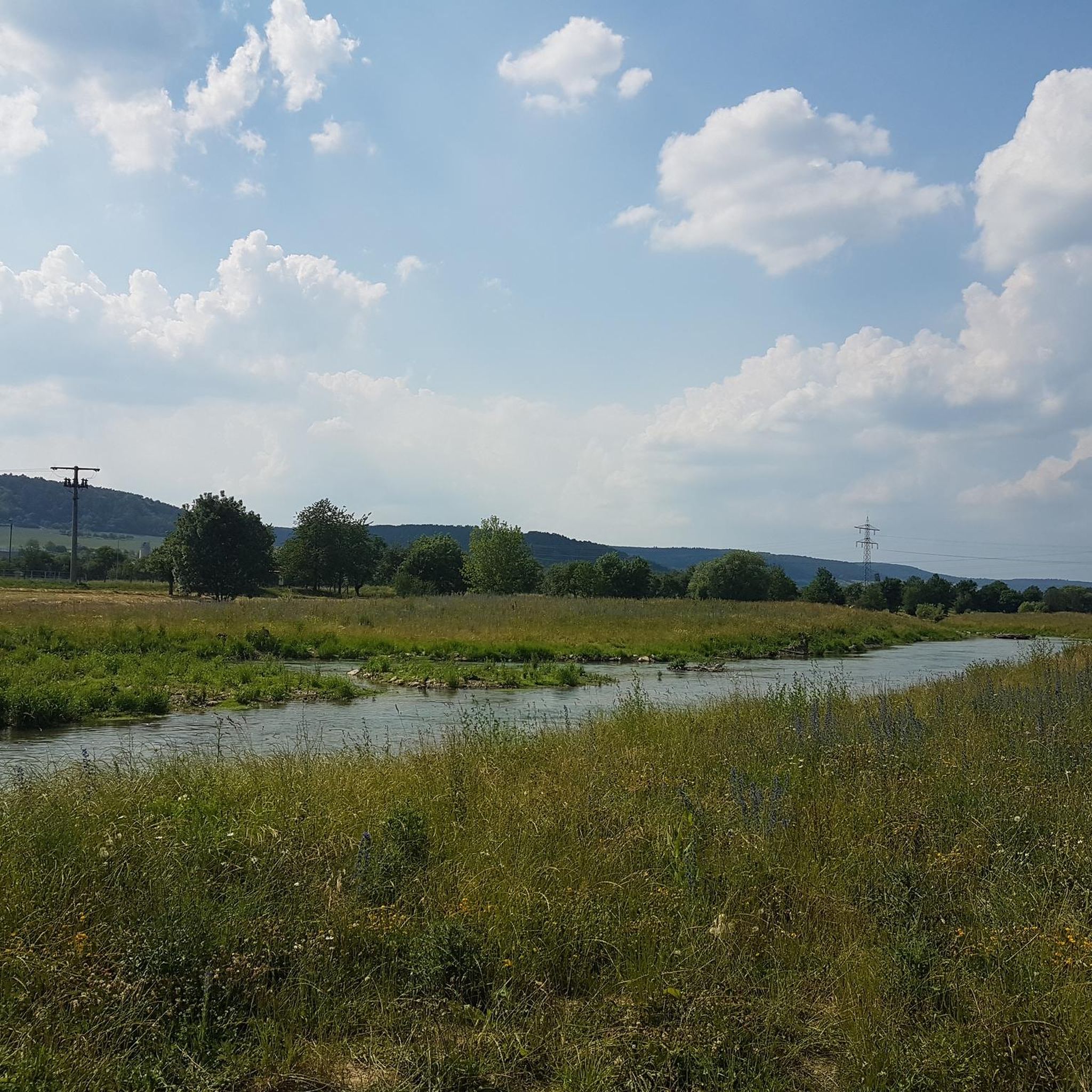
Hiking around Santo Tomé De Zabarcos offers routes through the serene landscapes of La Moraña, a region characterized by open fields primarily used for cereal cultivation. The municipality, situated at an altitude of 959 meters, features varied terrain. The Zapardiel and Arevalillo rivers traverse the area, creating riparian zones with woodlands and meadows along their banks. This rural setting provides a peaceful environment for exploring the less-traveled areas of Ávila province.
Best hiking trails around Santo Tomé De Zabarcos
- The…
Last updated: July 11, 2026
23.4km
06:08
190m
190m
Hike the difficult 14.5-mile La Moraña abulense circular route from Rioacabado, exploring sandy plains, Mudejar architecture, and diverse bi
Moderate hike. Good fitness required. Mostly accessible paths. Sure-footedness required.

Sign up for free
10.4km
02:44
90m
90m
Moderate hike. Good fitness required. Easily-accessible paths. Suitable for all skill levels.
Hike an easy 3.0-mile (4.9 km) circular route from Muñomer del Peco, exploring the historic Castillo del Duque de Montellano.
2
hikers
2.56km
00:39
10m
10m
Easy hike. Great for any fitness level. Easily-accessible paths. Suitable for all skill levels.
Our route recommendations are based on thousands of hikes, rides, and runs completed by other people on komoot.
Start today with a free account
Your next adventure awaits.
Login or Signup
Popular around Santo Tomé De Zabarcos


Tips from the Community

Narros de Saldueña Castle, also known as the Castle of the Duke of Montellano, is one of the best-preserved fortresses in the province of Ávila. It is located in the town of Narros de Saldueña, within the town limits. Construction: Late 15th century, attributed to Rodrigo de Valderrábanos, Lord of the Saldueña Estate. Expansions: It was renovated and enlarged at the beginning of the 16th century by his successors.
4
0
Opened in 2017, the center offers a variety of educational and recreational activities, including guided tours, real-time bird watching via video cameras, and exhibits on local fauna and flora. The center also features dioramas, a screening room, and an observation deck, providing an immersive experience for visitors.
4
0
The museum allows visitors to explore the cultural and natural heritage of El Oso while enjoying a walk in the open air. It is a great way to learn more about the history and traditions of this small municipality in Ávila. 🌄😎🚶♂️
3
0
The Church of San Pedro Apóstol in El Oso, Ávila, is a parish church dating back to the 16th century. It stands out for its stone architecture, with three naves separated by large semicircular arches and a 17th-century Baroque main altarpiece. ⛪😎 In front of the church, there is the Stone Bear, also known as Verraco Vettón. This stone sculpture is part of the town's Open Air Museum and has great historical and cultural importance.🐻
4
0
Half a century ago, the Avila town of Las Berlanas suffered a catastrophe of hitherto unknown proportions. A flood devastated the municipality and one of its main surroundings, El Burgo, in addition to ending the lives of two people. To commemorate this tragic event, a monument has been erected that remembers the victims and the catastrophe, but also the efforts of the people of Berlin to improve themselves.
3
0
Aveinte, a name with historical roots, has a fascinating legend dating back to ancient times. Many centuries ago, at the dawn of the Middle Ages, there was a small town in what we know today as Aveinte. The inhabitants of this place were simple people, dedicated mainly to agriculture and livestock. They lived in harmony with nature and worshiped the gods of the earth and sky. One day, during a time of drought and scarcity, the locals gathered in the town square to pray for rain and good harvests. The wise old man of the place, known as Adventius, led the ceremony. With his wrinkled hands and deep voice, he spoke words of supplication to heaven. Legend has it that, at that crucial moment, a mysterious figure appeared among the clouds. He was a luminous being, dressed in white robes and silver hair. The villagers were amazed and knelt before this heavenly presence. The being addressed Adventius and spoke to him in an ancient language that only he understood. “For your devotion and the faith of your people, I will grant a blessing,” he said. “From now on, every twenty years, the waters of the river that runs through Aveinte will overflow, fertilizing the land and ensuring abundant harvests.” Thus the name Aveinte was born, which means “advent” or “arrival” in honor of the heavenly visit. Since then, every twenty years, the river overflows and renews the earth, fulfilling the promise of the luminous being. The inhabitants of Aveinte keep this tradition alive and celebrate “Aveinte” with joy and gratitude. The legend has been passed down from generation to generation, and the town's name remains a reminder of its connection to the divine and renewed hope. So, when you walk through the cobblestone streets of Aveinte, remember this story and the magic that surrounds its name. 🌟🏡
2
0
The Castle-Palace of Castronuevo, also known as Castle of Rivilla de Barajas, is an impressive fortification located in the municipality of Rivilla de Barajas, in the province of Ávila, within the autonomous community of Castilla y León. Although its current use is null, its history and structure reveal its former greatness. It was erected by Gil de Vivero before 1481, on the site of Castronuevo, and later remodeled by his son before selling it in 1489 to the Duke of Alba. The castle has three circular towers and two rectangular towers. Despite its age and danger of collapse, this castle remains a fascinating testament to medieval history and architecture. 🏰🌟
3
0
The Castle of the Duke of Montellano, also known as Castle of Narros de Saldueña, is located at the end of the town of Narros de Saldueña, in the heart of the La Moraña plain, in the province of Ávila, autonomous community of Castilla y León. This castle, tracing its origins to the 15th century, is a good example of a castle-palace built with brick and mud (mortar), which relates it to Mudejar architecture.
6
0
Frequently Asked Questions
How many hiking trails are available around Santo Tomé de Zabarcos?
There are several hiking routes available around Santo Tomé de Zabarcos, offering a variety of experiences for different skill levels. Our guide features 4 distinct trails.
What kind of landscape can I expect on hikes in Santo Tomé de Zabarcos?
Hikes in Santo Tomé de Zabarcos take you through the tranquil rural landscapes of La Moraña. You'll primarily encounter open fields of cereal cultivation, interspersed with areas of woodlands and meadows along the Zapardiel and Arevalillo rivers. The terrain, situated at an altitude of 959 meters, offers gentle elevation changes, providing a peaceful environment for exploration.
Are there easy hiking options suitable for beginners or casual walkers?
Yes, there are easy hiking options perfect for beginners or those seeking a relaxed stroll. For instance, the Hiking loop from San Pedro del Arroyo is an easy route covering about 2.6 km with minimal elevation gain, making it very accessible.
Are there any longer or more challenging hikes in the area?
For those looking for a more demanding experience, the Gotarrendura and El Oso Loop is classified as difficult. This route spans over 23 km and includes nearly 200 meters of elevation gain, offering a substantial challenge for experienced hikers.
Are there circular hiking routes available?
Yes, many of the trails in the area are circular, allowing you to start and end at the same point. Examples include the Castillo-Palacio de Castronuevo — circular por los Parajes de La Mora, which is a moderate 15 km loop, and the Camino de Villaflor — circular by Aveinte, a 10 km moderate loop.
What are some interesting places to explore near the hiking trails?
While hiking, you can discover several historical and cultural points of interest. Consider visiting the Castle of Narros de Saldueña, or the charming settlement of Aveinte. There are also several religious buildings like the Church of Our Lady of Sorrows and the Hermitage of Our Lady of Rihondo that offer glimpses into the region's heritage.
Is Santo Tomé de Zabarcos suitable for family hikes?
Absolutely. The peaceful rural environment and the presence of easy, relatively flat trails make Santo Tomé de Zabarcos suitable for family outings. Routes like the Castillo del Duque de Montellano — circular desde Muñomer del Peco, which is under 5 km and easy, are great for families with children.
Can I bring my dog on the trails?
Generally, the rural trails around Santo Tomé de Zabarcos are dog-friendly. Given the open fields and natural settings, it's a great place to enjoy a walk with your canine companion. However, always ensure your dog is under control, especially when passing through agricultural areas or near livestock, and respect local regulations regarding leashes.
What is the best time of year to go hiking in Santo Tomé de Zabarcos?
The best time to hike in Santo Tomé de Zabarcos is typically during spring and autumn. These seasons offer pleasant temperatures, making for comfortable walking conditions. While summer can be warm, the riverine areas provide some shade. Winter hiking is possible, but be prepared for cooler temperatures and potentially muddy paths, especially after rain.
What are the typical trail conditions like?
The trails in Santo Tomé de Zabarcos are generally well-defined, often following forest tracks or paths through agricultural land. You can expect mostly unpaved surfaces, which can range from firm and dry to softer or muddy, particularly after rainfall or near riverbanks. The 'Pista forestal de la Calle Alta' mentioned in local descriptions suggests established, maintained paths.
What kind of elevation changes can I expect on the hikes?
While Santo Tomé de Zabarcos is situated at an altitude of 959 meters, the hikes generally feature gentle elevation changes. Most routes involve less than 100 meters of ascent and descent, with the exception of longer trails like the Gotarrendura and El Oso Loop, which has around 190 meters of elevation gain, offering a more undulating experience.
Most popular routes around Santo Tomé De Zabarcos
Most popular attractions around Santo Tomé De Zabarcos

Get inspired with the komoot mobile app


Explore more
Browse the best Hikes in other regions.
