The best walks and hikes around Agüero
4.6
(315)
1,771
hikers
19
hikes
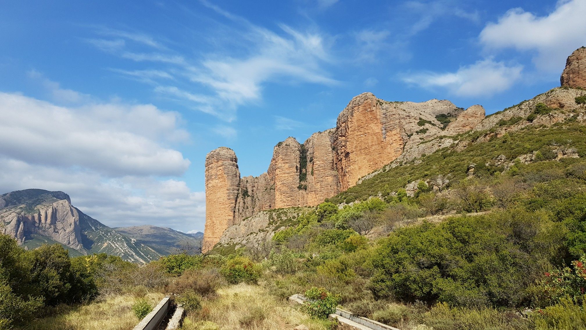
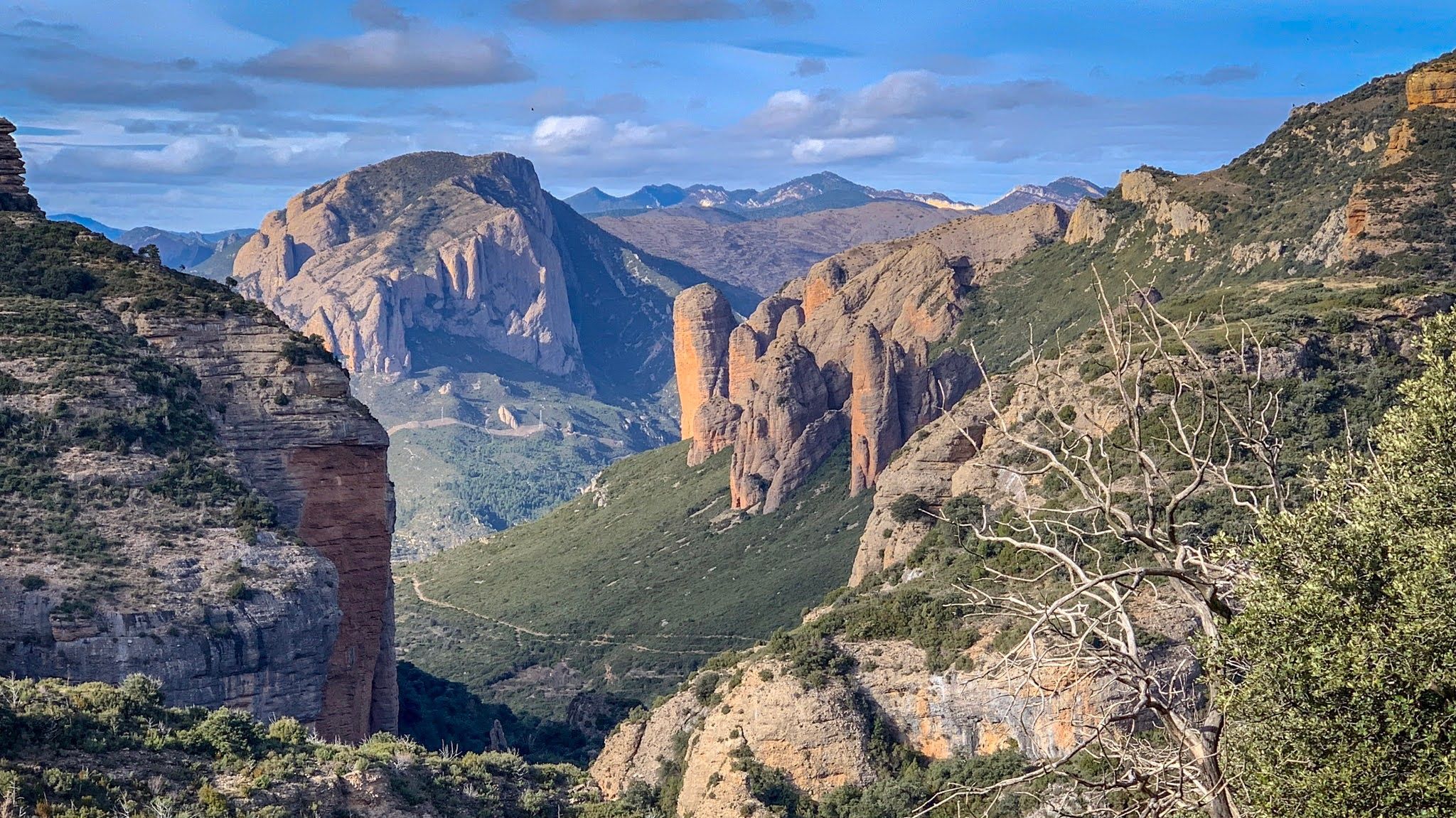
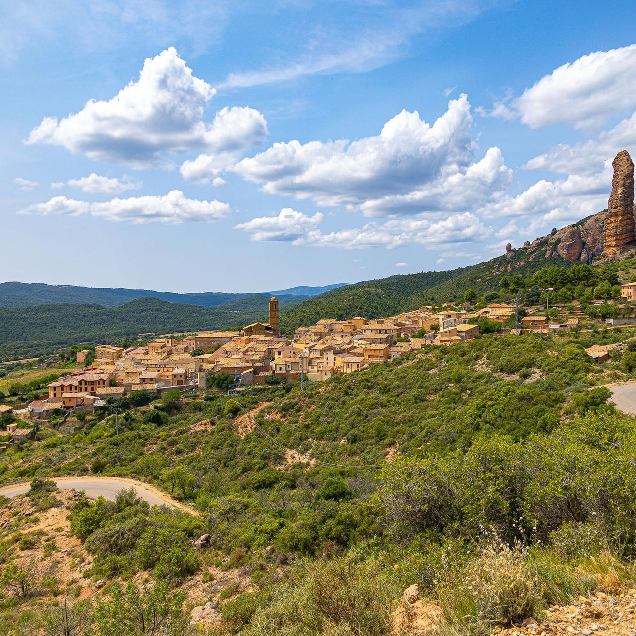
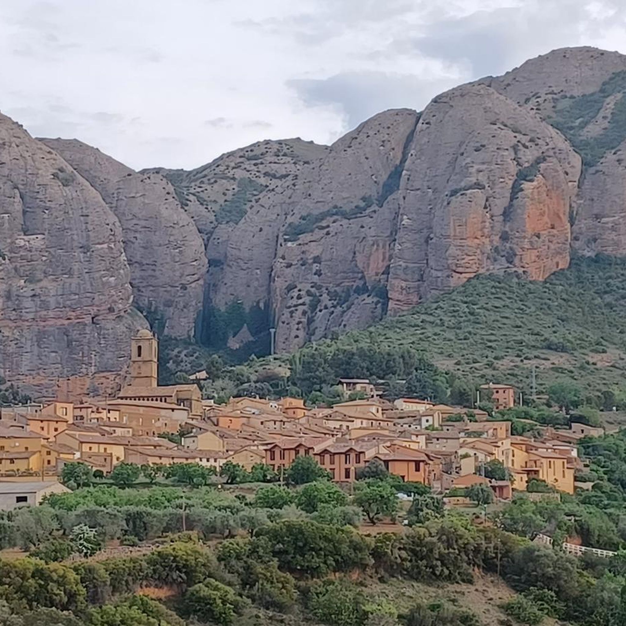
Hiking around Agüero offers access to the dramatic landscapes of the Pre-Pyrenees in Huesca, Spain. The region is defined by the striking Mallos de Agüero, impressive reddish-hued conglomerate rock formations that rise hundreds of meters high. These vertical structures create a rugged backdrop, with trails traversing varied terrain from valleys to elevated viewpoints. The area also features the Sierra de Santo Domingo mountain range and the Hoya de Huesca.
Best hiking trails around Agüero
- The most popular hiking route is Circular Route of the Mallos de Agüero, a 4.5 miles (7.3 km) trail that takes 2 hours 13 minutes to complete. This moderate route explores the base of the iconic rock formations.
- Another top favourite among local hikers is Mallos de Agüero – Mallos de Agüero loop from Agüero, a moderate 5.8 miles (9.3 km) path. This trail offers varied terrain and expansive views of the surrounding landscape.
- Local hikers also love the Refugio La Cochera – Church of Santiago loop from Agüero, a 3.6 miles (5.8 km) trail leading through the landscape to the historic Church of Santiago, often completed in about 1 hour 38 minutes.
- Hiking around Agüero is defined by dramatic rock formations, mountain ranges, and historic landmarks. The network offers options for different ability levels, from easy walks to more challenging ascents.
- The routes in Agüero are highly rated by the komoot community with an average score of 4.6 stars from over 270 reviews. More than 1500 hikers have used komoot to explore Agüero's varied terrain.
Last updated: July 7, 2026
5.0
(3)
8
hikers
7.29km
02:14
240m
240m
Explore the impressive Mallos de Agüero, the historic Church of Santiago, and the accessible Al-Foraz Cave on this moderate 4.5-mile hike.
4.7
(6)
34
hikers
9.34km
03:20
530m
530m
Moderate hike. Good fitness required. Easily-accessible paths. Suitable for all skill levels.

Sign up for free
5.0
(2)
14
hikers
13.5km
04:05
440m
450m
Moderate hike. Good fitness required. Easily-accessible paths. Suitable for all skill levels.
7
hikers
20.6km
06:40
890m
890m
Hard hike. Very good fitness required. Easily-accessible paths. Suitable for all skill levels.
8
hikers
5.84km
01:38
120m
120m
Easy hike. Great for any fitness level. Easily-accessible paths. Suitable for all skill levels.
Get access to more routes and recommendations from other explorers.
Sign up for free
Already have an account?
Our route recommendations are based on thousands of hikes, rides, and runs completed by other people on komoot.
Start today with a free account
Your next adventure awaits.
Login or Signup


Tips from the Community

The onion throw throw throw throw throw throw out c zu iuiki also you chicken how nice I il oh he Kkk I do you the Z the Loo your dds Chris I love Z I you jo gu
0
0

The route in the opposite direction is probably easier because the steep section is equipped with steps!
0
0

San Felices, like most abandoned villages in the Pyrenees, is NOT abandoned. It's being restored. Luckily, it's not fenced off and you can visit it. (If your dog lets you.)
0
0

Spectacular reddish colored rock formations.
2
0

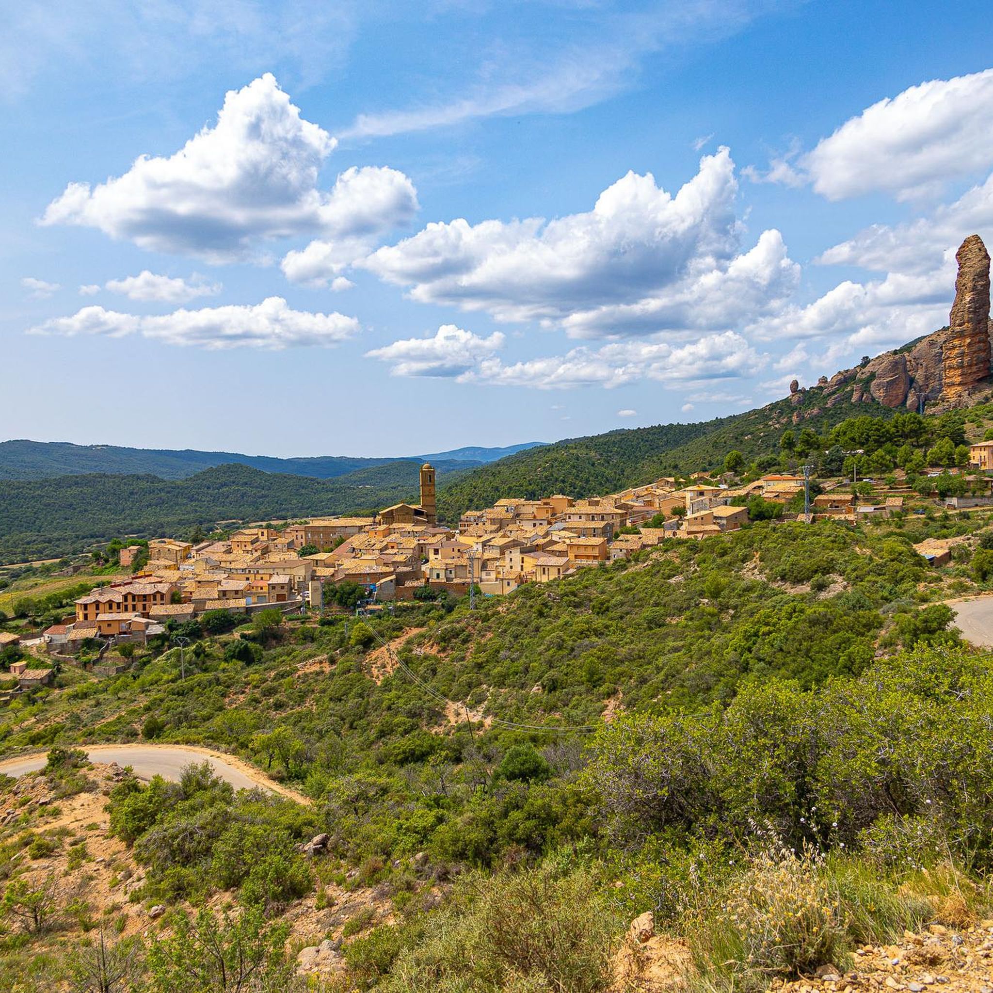
This is a small abandoned hamlet nestled on the Hoya de Huesca nature trail. Among its streets is a Romanesque church that gives an idea of the place's antiquity.
0
0

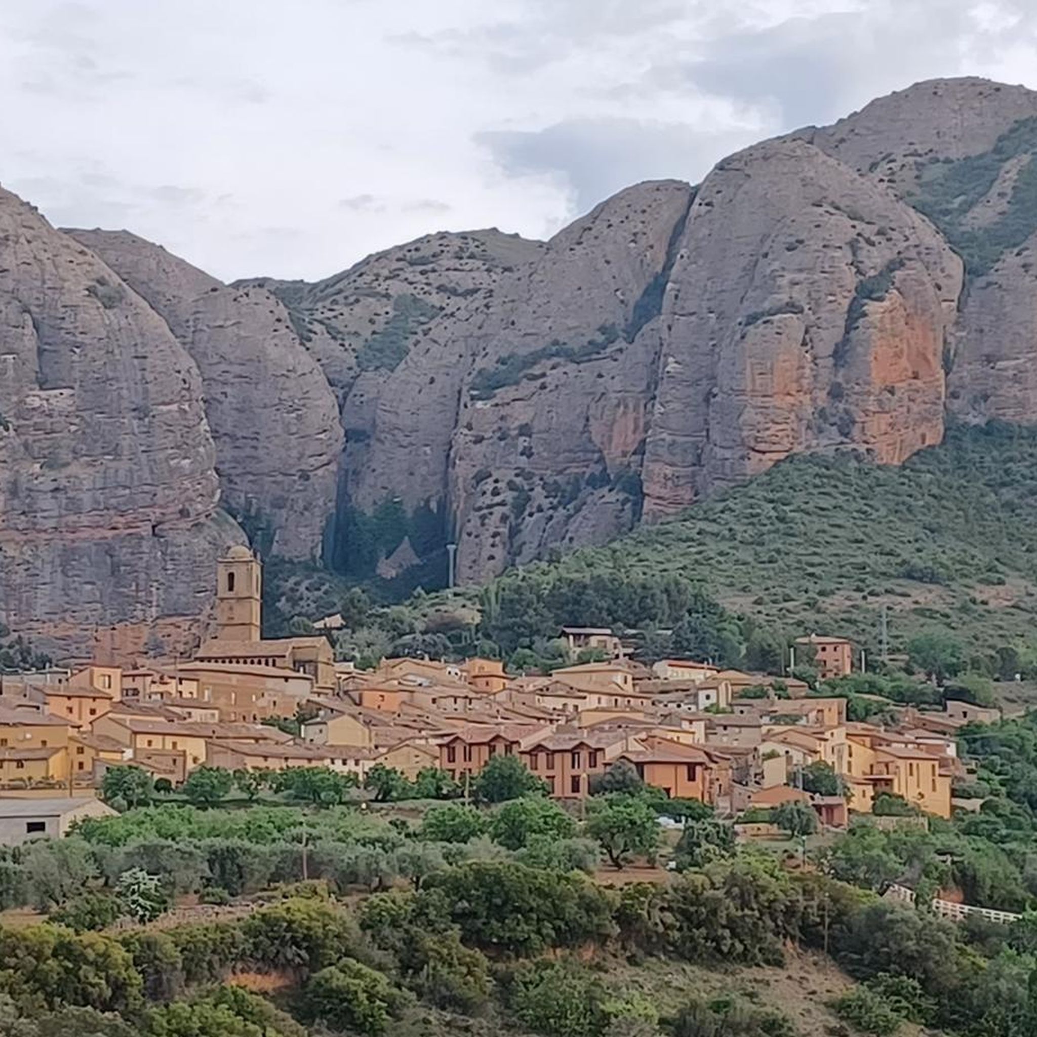
Sweet village in a dreamlike setting!
0
0
Agüero's mallos are a little less tall than those of Riglos, but even so, they are charming whims of erosion. Its contrast with the blue sky on a sunny day is simply spectacular.
1
0

You can get the keys to the church to visit its interior by requesting them at the Agüero senior center.
0
0
Frequently Asked Questions
What types of hiking trails can I find around Agüero?
Agüero offers a diverse range of hiking trails suitable for various fitness levels. You'll find everything from easy walks to more challenging ascents. The komoot community has mapped 19 routes in the area, including 5 easy, 12 moderate, and 2 difficult trails, ensuring there's something for everyone.
Are there any family-friendly hiking options in Agüero?
Yes, Agüero has several easy trails perfect for families. A great option is the Refugio La Cochera – Church of Santiago loop from Agüero, which is 3.6 miles (5.8 km) long and leads to the historic Church of Santiago. This route is generally completed in under 2 hours and offers a pleasant experience for all ages.
What are the most prominent natural features to see while hiking in Agüero?
The most iconic natural features are the spectacular Mallos de Agüero, impressive reddish-hued rock formations that rise hundreds of meters high. Many trails, like the Circular Route of the Mallos de Agüero, explore their base. You can also explore the enormous Al-Foraz Cave, which is embedded within these formations and offers unique views.
Are there any circular hiking routes available in Agüero?
Yes, circular routes are very popular in Agüero. A notable one is the Circular Route of the Mallos de Agüero, a moderate 4.5-mile (7.3 km) trail that takes you around the base of the famous rock formations. Another option is the longer Mallos de Agüero – Al-Foraz Cave loop from Agüero, which is 13.5 km and also circular.
What historical landmarks or attractions can I visit near the hiking trails?
Agüero's trails often lead to or pass by significant landmarks. The 12th-century Romanesque Church of Santiago, a National Monument, is a popular destination, accessible via routes like the Refugio La Cochera – Church of Santiago loop. You can also find Marcuello Castle, which offers spectacular panoramic views over the landscape and is listed as a highlight here.
What do other hikers enjoy most about hiking in Agüero?
The area is highly rated by the komoot community, with an average score of 4.6 stars from over 270 reviews. Hikers often praise the dramatic scenery of the Mallos de Agüero, the varied terrain, and the well-maintained paths that offer expansive views of the Pre-Pyrenees. The blend of natural beauty and historical sites is also frequently highlighted.
Is there parking available for hikers in Agüero?
Agüero is a small village, and parking is generally available within or on the outskirts of the village, serving as a convenient starting point for many of the hiking trails. It's advisable to arrive early during peak seasons to secure a spot, especially for popular trailheads.
What is the best time of year to go hiking in Agüero?
The Pre-Pyrenees region around Agüero is generally pleasant for hiking in spring (April-May) and autumn (September-October) when temperatures are milder. Summer can be hot, especially at midday, but early morning or late afternoon hikes are still enjoyable. Winter offers a different, often quieter experience, though some higher trails might be affected by snow or colder conditions.
Are there any viewpoints offering panoramic vistas of the Mallos de Agüero?
Absolutely. Many trails provide stunning views of the Mallos. For elevated perspectives, consider routes that lead to Punta Común (1,191m), a geodetic vertex that offers comprehensive views of the landscape. Additionally, the Camino del Cielo - Panoramic View is a specific highlight known for its expansive vistas.
Can I access hiking trails in Agüero using public transport?
Public transport options directly to Agüero are limited. While there might be infrequent bus services connecting to larger towns in the Hoya de Huesca region, for maximum flexibility and access to various trailheads, traveling by car is generally recommended. This allows you to reach specific starting points more easily.
What is the typical terrain like on the hiking trails around Agüero?
The terrain around Agüero is varied, reflecting its location in the Pre-Pyrenees. You'll encounter paths ranging from relatively flat sections through valleys to steeper ascents and descents on mountain trails. The ground often consists of rocky paths, dirt tracks, and sometimes gravel, especially around the conglomerate rock formations of the Mallos. Sturdy hiking footwear is recommended.
Most popular attractions around Agüero

Get inspired with the komoot mobile app


Explore more
Browse the best Hikes in other regions.
