The best road cycling routes around Mancera De Abajo
3.0
(1)
67
riders
7
rides
Road cycling routes around Mancera De Abajo benefit from the region's varied landscapes, characterized by flat plains and rolling plateaus. The area offers quiet roads connecting traditional villages, providing scenic rides through the rural Spanish countryside. Cyclists can expect mostly paved surfaces with moderate elevation gains, suitable for various fitness levels. The terrain transitions from open vistas near Mancera de Abajo to more varied landscapes towards the Sierra de Béjar mountains.
Best road cycling routes around Mancera De Abajo
- The…
Last updated: May 16, 2026
8
riders
118km
05:40
1,490m
1,490m
Hard road ride. Very good fitness required. Mostly well-paved surfaces and easy to ride.
3.0
(1)
7
riders
59.6km
02:26
170m
170m
This moderate 37.1-mile (59.6 km) road cycling route from Peñaranda de Bracamonte explores the Azud de Riolobos and Zorita de la Frontera.

Sign up for free
16
riders
43.4km
01:48
280m
280m
Easy road ride. Great for any fitness level. Mostly well-paved surfaces and easy to ride.
13
riders
85.7km
03:53
950m
950m
Hard road ride. Very good fitness required. Mostly well-paved surfaces and easy to ride.
8
riders
103km
04:41
1,170m
1,170m
Hard road ride. Very good fitness required. Mostly well-paved surfaces and easy to ride.
Get access to more routes and recommendations from other explorers.
Sign up for free
Already have an account?
Our route recommendations are based on thousands of hikes, rides, and runs completed by other people on komoot.
Start today with a free account
Your next adventure awaits.
Login or Signup


Tips from the Community

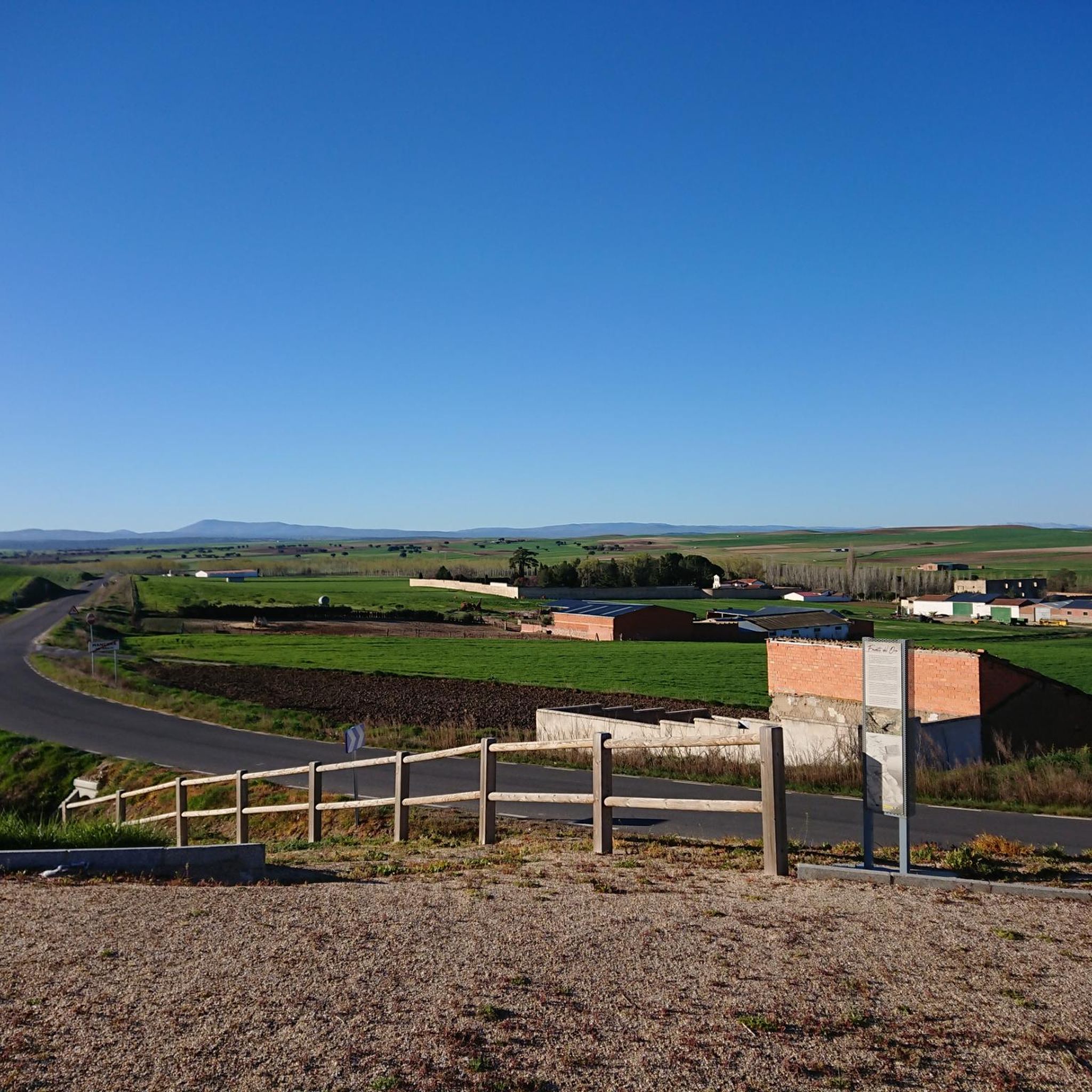
At the Río Lobos Dam, you can take a circular route around it. You can see many birds.
0
0

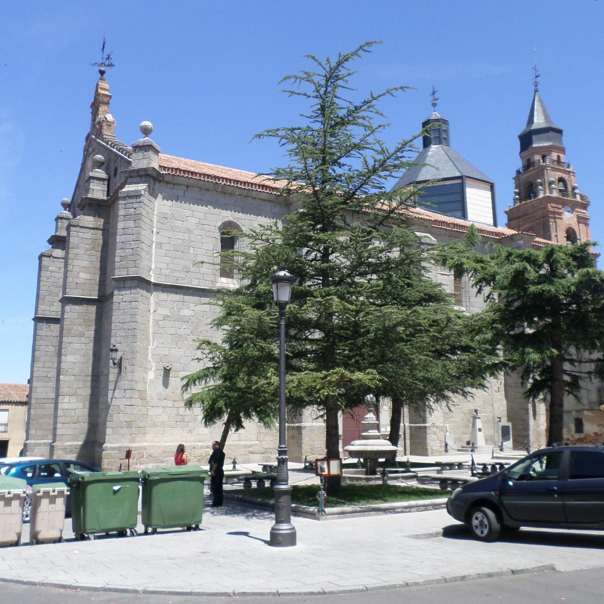
The Church of San Miguel in Peñaranda de Bracamonte is a beautiful classicist-style temple, built in quarry stone. Although its interior was severely damaged in 1971, its imposing exterior façade remains a testament to its history. After the fire of 1971, only the main altar chapel was saved, where the main altarpiece was located, a baroque masterpiece made by Sebastián Ducete and Esteban de Rueda. The chapel of San Antonio is also preserved, and in it you can see the Cristo de la Cama, an object of great local devotion. The stone baptismal font is original and was remodeled under the direction of Fernando Pulín, who received the National Restoration Award for his work. If you ever visit Peñaranda de Bracamonte, be sure to admire this architectural gem. 🌟🏰
2
0

This church was dedicated to the Archangel Michael "San MIGUEL". The name (coming from the Hebrew language) means "Who is like God?". He is often depicted - in paintings or as a statue - with a flaming sword, and occasionally a lance. Michael / Miguel is - along with Raphael, Gabriel and Uriel - one of the four archangels who (according to human understanding) occupy the highest rank in the heavenly hierarchy of angelic beings. Their common feast day in the saints' calendar is September 29th.
1
0

Small town that is located at the foot of the northern side of the Sierra de Ávila and that the center is governed by the parish church of San Juan Bautista. It is worth taking a stroll through its streets.
1
0

The history of this town is linked to the fact that it is the head of a region, Tierra de Peñaranda, also known as Campo de Peñaranda. Its churches and streets are very beautiful!
0
0
Beautiful church located in the town of Mancera de Arriba. This one, made of stone from the area, has flagged the core since a long time ago.
0
0
The relief of the municipality is formed by two mountainous areas separated by the Amblés valley, through which the Adaja river runs, which is born in the territory. The northern area is called Sierra de Villanueva, a branch of the Sierra de Ávila.
0
0
Frequently Asked Questions
What kind of terrain can I expect on road cycling routes around Mancera De Abajo?
The region around Mancera De Abajo offers varied landscapes for road cycling. You'll find mostly flat plains and rolling plateaus, especially in the immediate vicinity, providing comfortable rides. As you venture further towards the Sierra de Béjar mountains, the terrain becomes more varied with potential climbs and steeper pasture lands, offering more challenging sections.
Are there challenging road cycling routes for experienced cyclists?
Yes, for experienced cyclists seeking a challenge, routes with significant elevation gains are available. For instance, the Ascents to the Sierra de Ávila and Villanueva — circular from Peñaranda de Bracamonte is a difficult 73.1-mile (117.6 km) route with substantial climbs, offering expansive views and a demanding ride. Another challenging option is the Fuente del Oro – Las Fuentes Pass loop from Peñaranda de Bracamonte, which covers 85.2 miles (137.1 km) with considerable elevation.
Are there easier road cycling options for beginners?
Yes, the area provides easier road cycling options suitable for beginners or those looking for a more relaxed ride. Routes often feature mostly paved surfaces with moderate elevation gains. An example is the Fuente del Oro loop from Peñaranda de Bracamonte, an easy 27.0-mile (43.4 km) trail leading through wide plateaus.
How long are the road cycling routes near Mancera De Abajo?
The road cycling routes in the Mancera De Abajo area vary significantly in length. You can find shorter loops, such as the Fuente del Oro loop from Peñaranda de Bracamonte at 27.0 miles (43.4 km), to much longer and more challenging rides like the Ascents to the Sierra de Ávila and Villanueva — circular from Peñaranda de Bracamonte, which spans 73.1 miles (117.6 km).
What natural features or landmarks can I see while road cycling in this region?
While road cycling around Mancera De Abajo, you can experience the rural Spanish countryside with its wide plateaus and extensive pastureland. Routes often connect picturesque traditional villages. The Peñaranda Loop: Azud de Riolobos and Zorita de la Frontera, for example, offers views of the Azud de Riolobos wetland, known for birdwatching. The region is also traversed by the River Navazamplón, adding to the natural beauty.
Are there circular road cycling routes available?
Yes, many of the road cycling routes around Mancera De Abajo are designed as circular loops, allowing you to start and end in the same location. Examples include the Ascents to the Sierra de Ávila and Villanueva — circular from Peñaranda de Bracamonte and the Peñaranda Loop: Azud de Riolobos and Zorita de la Frontera.
What are the parking options for road cyclists in Mancera De Abajo?
While specific parking areas for cyclists are not detailed, Mancera De Abajo and nearby towns like Peñaranda de Bracamonte, which serve as common starting points for routes, typically offer public parking facilities within or on the outskirts of the villages. It's advisable to check local signage upon arrival.
What is the best time of year for road cycling in Mancera De Abajo?
The best time for road cycling in Mancera De Abajo is generally during the spring and autumn months. These seasons offer milder temperatures, making for more comfortable rides. Summers can be quite hot, especially during midday, while winters can be chilly. Always check the local weather forecast before heading out.
Are there places to stop for refreshments or food along the road cycling routes?
The road cycling routes in this region often connect to small, traditional villages. These villages typically have local cafes, bars, or small shops where you can stop for refreshments, food, or to refill water bottles. This allows for a pleasant break and an opportunity to experience local culture.
Are the road cycling routes around Mancera De Abajo suitable for families?
For families, the flatter sections and easier loops around Mancera De Abajo can be suitable, especially if children are comfortable with longer distances on paved roads. The quiet rural roads connecting villages offer a safer environment than busier main roads. Always consider the distance and elevation profile of a specific route to match your family's abilities.
How many road cycling routes are available in the Mancera De Abajo area?
There are approximately 8 road cycling routes available in the Mancera De Abajo area, offering a range of difficulties from easy to difficult to suit various skill levels.
What do other road cyclists say about the routes in Mancera De Abajo?
The road cycling routes around Mancera De Abajo are appreciated by the komoot community, holding an average rating of 3.0 stars. Cyclists often highlight the quiet roads, the charm of the rural Spanish countryside, and the varied terrain that offers both gentle plains and more challenging ascents.

Get inspired with the komoot mobile app


Explore more
Browse the best Road cycling routes in other regions.
