The best walks and hikes around Campos Del Río
4.4
(222)
1,013
hikers
59
hikes
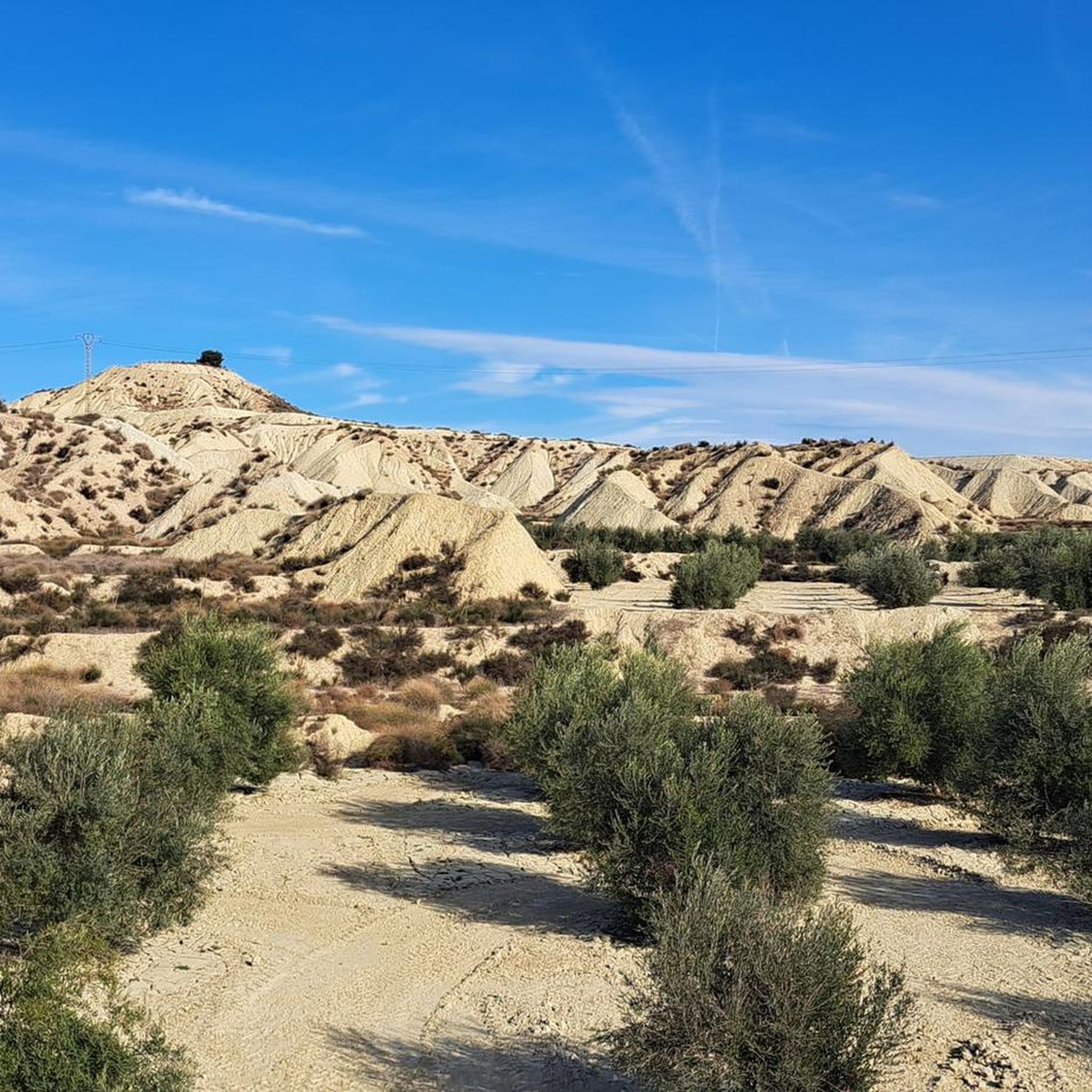
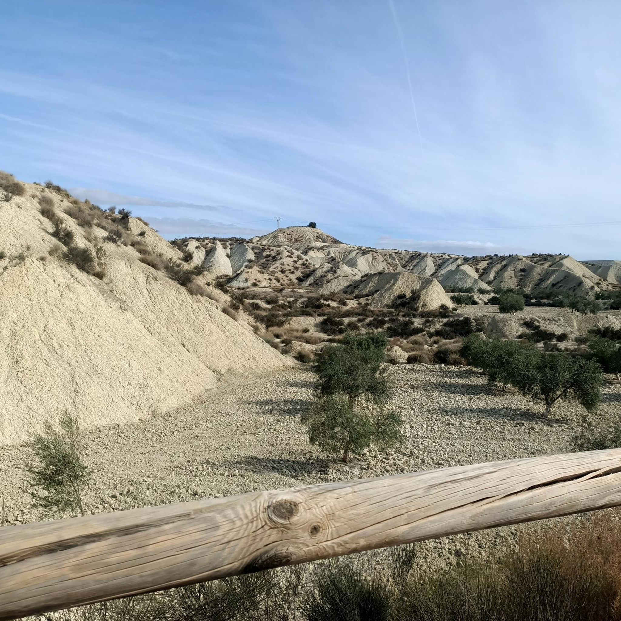
Hiking around Campos Del Río offers diverse natural features, from tranquil river valleys to rugged mountain ranges and unique geological formations. The region is characterized by the picturesque Ricote Valley, traversed by the Segura River, and the challenging Sierra de Ricote. Hikers can also explore extensive badlands, often described as a lunar landscape, showcasing unique erosion patterns and varied ecosystems. These varied landscapes provide a range of experiences for outdoor enthusiasts.
Best hiking trails around Campos Del Río
- The most…
Last updated: May 24, 2026
5.0
(7)
21
hikers
17.4km
05:32
730m
730m
Hard hike. Very good fitness required. Easily-accessible paths. Suitable for all skill levels.
4.5
(2)
16
hikers
Hard hike. Very good fitness required. Mostly accessible paths. Sure-footedness required.

Sign up for free
4.5
(2)
3
hikers
13.4km
03:27
50m
50m
Moderate hike. Good fitness required. Easily-accessible paths. Suitable for all skill levels.
5.0
(3)
17
hikers
9.66km
02:28
30m
30m
Moderate hike. Good fitness required. Easily-accessible paths. Suitable for all skill levels.
5.0
(2)
10
hikers
12.1km
04:26
730m
730m
Moderate hike. Good fitness required. Mostly accessible paths. Sure-footedness required.
Get access to more routes and recommendations from other explorers.
Sign up for free
Already have an account?
Our route recommendations are based on thousands of hikes, rides, and runs completed by other people on komoot.
Start today with a free account
Your next adventure awaits.
Login or Signup

Tips from the Community

Beautiful trail that runs through the interior of the Ricote mountain range
0
0
Pico de los Almeces, at 1,123 meters, is the highest point in the Sierra de Ricote mountain range. Reaching it is a challenge for hiking enthusiasts, but the reward is well worth it: breathtaking panoramic views, unspoiled nature, and a unique sense of accomplishment. The circular route is approximately 17 km long, with an elevation gain of 770 meters. It begins on the outskirts of the town of Ricote and winds through stunning natural landscapes, passing through pine forests, rosemary bushes, and trails that meander through the mountains.
0
0

It is the place to go from one bank to the other to go to the Contraparada.
1
0

Make sure you have enough water and leave the tough climb on time
1
1

Getting to the top of the Almeces peak at 1124 meters above sea level will be demanding but you will have spectacular views when you get there. Despite having many antennas in the surroundings, you can search to get some beautiful panoramic views.
0
0
Nice trail through the Sierra de Ricote and La Navela. By sectors it can be somewhat technical but it can be avoided without problems, you can even take the variants marked as PR-MU-47.1 or Senda Bermeja. Remember to wear suitable footwear and plenty of water, it is an uninhabited area and there will be no fountain.
1
0
It is a beautiful path that runs next to the Segura riverbed. Following the route from Alguazas, you reach the confluence of the Segura and Mula rivers, a beautiful place a few meters from the urban area.
2
1
At an altitude of 1,124 meters above sea level, the views from the top of Almeces are spectacular. Despite having many antennas in the surroundings, you can search to get some beautiful panoramic views.
2
0
Frequently Asked Questions
How many hiking trails are available in Campos Del Río?
Campos Del Río offers a wide variety of hiking opportunities, with a total of 63 routes recorded on komoot. These include 28 easy trails, 31 moderate paths, and 4 more challenging routes, ensuring options for all skill levels.
Are there easy hiking options suitable for beginners or families?
Yes, Campos Del Río has plenty of accessible options. There are 28 easy routes and 31 moderate trails, many of which follow the tranquil river valleys. These paths are generally less demanding and offer a pleasant experience for families or those new to hiking.
Can I find challenging hikes with significant elevation gain in Campos Del Río?
Absolutely. For those seeking a challenge, the region features routes that ascend to mountain peaks. A notable difficult route is The summit of Almeces — Circular via the Pozo ravine (PR-MU 10), which covers 17.4 km with over 700 meters of elevation gain, rewarding hikers with panoramic views from Almeces Peak.
Are there any circular hiking routes in the area?
Yes, several circular routes are available. For instance, The Sierra de Ricote and the Navela — Circular via the Collado de la Madera Trail (PR-MU 47) is a challenging 16.2 km loop. Another option is Confluencia de los Rios Segura y Mula — Circular desde Alguazas, a moderate 13.4 km trail.
What kind of landscapes can I expect to see while hiking around Campos Del Río?
The region boasts diverse landscapes, from the picturesque Ricote Valley with its pine forests and rosemary bushes, traversed by the Segura River, to the rugged Sierra de Ricote and La Navela mountain ranges. A unique feature is the extensive badlands, often described as a 'lunar landscape,' with impressive geological formations shaped by erosion.
Are there any notable natural attractions or landmarks along the trails?
Hikers can discover several interesting points. The Ricote Valley itself is a major natural highlight. You can also reach Almeces Peak for stunning views. The La Contraparada of the Segura River, with its dam and wooden bridge, is a popular starting point for routes and a great spot for a picnic.
What is the best time of year to go hiking in Campos Del Río?
Given its location in Murcia, Spain, the best times for hiking are typically spring (March to May) and autumn (September to November). During these seasons, temperatures are milder and more comfortable for outdoor activities, allowing you to fully enjoy the diverse landscapes without the intense heat of summer.
What do other hikers say about their experience in Campos Del Río?
The hiking routes in Campos Del Río are highly regarded by the komoot community, with an average rating of 4.5 stars from over 200 reviews. Hikers often praise the varied terrain, from serene river paths to challenging mountain ascents, and the unique beauty of the badlands.
Are there any trails that offer panoramic viewpoints?
Yes, many trails provide excellent viewpoints, especially those ascending into the mountain ranges. The summit of Almeces, for example, reached via routes like The summit of Almeces — Circular via the Pozo ravine (PR-MU 10), offers spectacular panoramic vistas of the surrounding region.
Is Campos Del Río a good destination for dog owners who want to hike?
While specific dog-friendly regulations can vary by trail, the natural and open landscapes of Campos Del Río generally welcome dogs. Many of the river valley paths and less crowded mountain trails are suitable for hiking with your canine companion, provided they are kept under control and you follow local guidelines regarding pets.
Are there any long-distance paths that pass through the area?
Yes, the Ricote Valley, a prominent feature of the region, is traversed by the GR127 long-distance path. This offers opportunities for extended exploration and connects hikers to a broader network of trails across the region.
Where can I find parking for hiking trails in Campos Del Río?
While specific parking areas for every trailhead are not detailed, many routes, especially those starting from towns or popular natural attractions like La Contraparada del Río Segura, typically have designated parking nearby. It's advisable to check the starting point of your chosen route on komoot for more precise parking information.
Most popular routes around Campos Del Río
Most popular attractions around Campos Del Río

Get inspired with the komoot mobile app


Explore more
Browse the best Hikes in other regions.
