The best walks and hikes around Brattforshedens naturvårdsområde
4.4
(164)
503
hikers
19
hikes
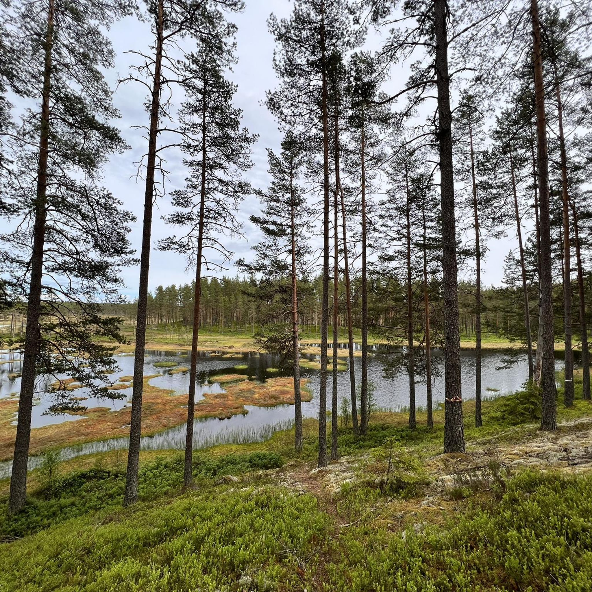
Hiking around Brattforshedens naturvårdsområde offers a diverse landscape shaped by glacial activity, featuring kettle holes, undulating ridges, and deep ravines like Lungälvsravinerna. The region is characterized by extensive sand dunes and heath pine forests, providing unique ecosystems. Meandering streams such as Svartån and Lungälven add to the varied terrain, which includes both open forest environments and wetlands.
Best hiking trails in Brattforshedens naturvårdsområde
- The most popular hiking route is Brattforsleden 10 - Geijersdalsmossens Naturreservat, a 14.6 miles (23.5 km)…
Last updated: August 22, 2026
4.7
(3)
15
hikers
23.5km
06:07
160m
160m
Hard hike. Very good fitness required. Easily-accessible paths. Suitable for all skill levels.
4.6
(9)
35
hikers
5.96km
01:32
30m
30m
Easy hike. Great for any fitness level. Easily-accessible paths. Suitable for all skill levels.

Sign up for free
5.0
(3)
14
hikers
13.7km
03:32
70m
70m
Moderate hike. Good fitness required. Easily-accessible paths. Suitable for all skill levels.
4.4
(7)
13
hikers
Easy hike. Great for any fitness level. Easily-accessible paths. Suitable for all skill levels.
4.6
(9)
16
hikers
Easy hike. Great for any fitness level. Easily-accessible paths. Suitable for all skill levels.
Get access to more routes and recommendations from other explorers.
Sign up for free
Already have an account?
Our route recommendations are based on thousands of hikes, rides, and runs completed by other people on komoot.
Start today with a free account
Your next adventure awaits.
Login or Signup
Popular around Brattforshedens naturvårdsområde
Tips from the Community

Small shelter next to bridge. Ideal for a short break.
0
0

mid september great for looking for blueberries and lingonberries.
0
0
Frequently Asked Questions
What unique natural features can I expect to see while hiking in Brattforshedens naturvårdsområde?
Brattforshedens naturvårdsområde is renowned for its impressive glacial landscape. You can explore unique formations like kettle holes (dödisgropar), including Sundstjärnen with its striking turquoise water, as well as undulating ridges and deep ravines such as Lungälvsravinerna. The area also features one of Sweden's largest dune fields, supporting sparse pine forests, and meandering streams like Svartån and Lungälven.
Are there any historical or cultural sites to explore along the trails?
Yes, the trails in Brattforshedens naturvårdsområde offer glimpses into human history. You can discover remnants such as old cabins, charring sites from charcoal production, and the cultural reserve Military Airfield 16 Brattfors, which played a role during the 1940s war mobilization. These sites add a historical dimension to your hike.
What kind of terrain and difficulty levels can I expect on the hiking trails?
The area boasts a diverse trail network of 75 km, catering to various skill levels. You'll find everything from easy strolls, like the 1 km Dödisgropar loop, to more challenging routes with steep slopes. The terrain varies greatly, encompassing glacial landscapes, extensive sand dunes, heath pine forests, and wetlands.
Are there family-friendly hiking options in Brattforshedens naturvårdsområde?
Absolutely. Brattforshedens naturvårdsområde offers several easy trails suitable for families. Options like the 1 km Dödisgropar loop or the 2.4 km Steglaslingan provide accessible and enjoyable experiences for all ages, allowing you to explore the unique natural features without strenuous effort.
Can I bring my dog on the hiking trails in Brattforshedens naturvårdsområde?
Yes, dogs are generally welcome on the hiking trails in Brattforshedens naturvårdsområde. However, to protect wildlife and ensure a pleasant experience for all visitors, please keep your dog on a leash at all times and remember to clean up after them.
Are there circular hiking routes available?
Many of the trails in Brattforshedens naturvårdsområde are designed as circular routes, offering varied experiences without backtracking. For example, the Lake View – Red Cabin by the Lake loop from Sutterhöjden is an easy 5.4 km circular trail that takes you through forested areas and past a lake.
Where can I park when visiting Brattforshedens naturvårdsområde?
While specific parking locations are not detailed for every trail, Brattforshedens naturvårdsområde is generally well-equipped for visitors. Look for designated parking areas near trailheads, especially at popular starting points like Kittelfältets naturreservat, to ensure convenient access to the hiking network.
What kind of wildlife can I spot while hiking?
Brattforshedens naturvårdsområde is rich in biodiversity. You might encounter various bird species such as black grouse, capercaillie, common crossbill, and nightjar. The unique sandy areas are crucial habitats for rare species like the sand lizard. Keep an eye out for small loons and whooper swans near the mire complexes.
Are there any facilities for hikers, such as shelters or places to stay overnight?
Yes, several shelters are available throughout Brattforshedens naturvårdsområde for hikers to cook food and even spend the night. Firewood is often refilled, but it's always a good idea to bring your own. Remember that open fires are only permitted in designated areas due to dry ground conditions.
What is the best time of year to go hiking in Brattforshedens naturvårdsområde?
The best time to visit Brattforshedens naturvårdsområde for hiking is typically during the spring, summer, and autumn months. These seasons offer pleasant weather conditions for exploring the diverse landscapes. Autumn, in particular, provides beautiful foliage. While winter hiking is possible, be prepared for snow and ice.
What do other hikers enjoy the most about hiking in Brattforshedens naturvårdsområde?
The area is highly rated by the komoot community, with an average score of 4.5 stars from over 80 reviews. Reviewers often praise the diverse and unique natural landscapes, particularly the impressive glacial formations and extensive sand dunes. The well-maintained and varied trail network, offering options for all skill levels, is also frequently highlighted.
Are there any longer, more challenging routes for experienced hikers?
Yes, for experienced hikers seeking a challenge, Brattforshedens naturvårdsområde offers longer and more demanding routes. The Brattforsleden 10 - Geijersdalsmossens Naturreservat is a difficult 23.5 km trail that traverses diverse natural reserves, providing a challenging experience through varied terrain and typically taking over 6 hours to complete.
Can I find trails that pass through the unique sand dune areas?
Yes, Brattforshedens naturvårdsområde is home to one of Sweden's largest dune fields, and many trails allow you to experience this unique landscape. These sandy areas support dry, sparse pine forests, characterized by heather and lichen, offering a distinct hiking environment. The Hiking loop from Kittelfältets naturreservat is a moderate 13.6 km path that leads through areas featuring glacial formations and pine forests, likely including some of these sandy sections.
Most popular routes around Brattforshedens naturvårdsområde

Get inspired with the komoot mobile app


Explore more
Browse the best Hikes in other regions.
