The best road cycling routes around Villar Del Salz
5.0
(1)
68
riders
8
rides
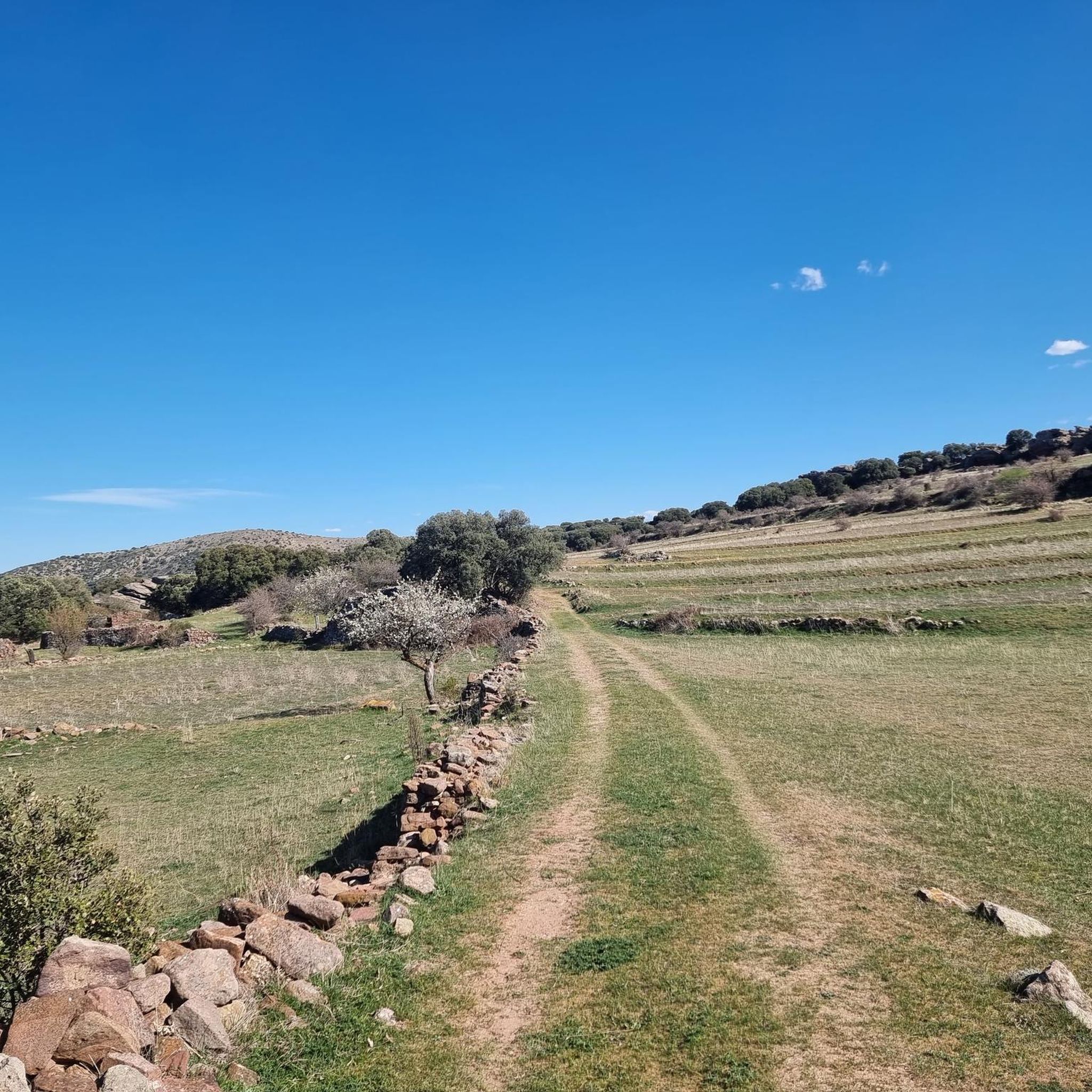
Road cycling routes around Villar Del Salz traverse a diverse landscape situated between the Sierra Menera mountain range and the Jiloca depression. The region features higher elevations dominated by holm oak forests and flatter zones with cultivated fields and moorlands. Notable geological formations include the "Rodeno de Peracense," characterized by reddish sandstone outcrops, and the well-preserved Pyrenean oak forest of "Marojal de Sierra Menera." Pico Atalaya, at 1587 meters, offers significant elevation for challenging climbs.
Best road cycling routes around…
Last updated: July 1, 2026
22
riders
78.7km
03:39
920m
920m
Hard road ride. Very good fitness required. Mostly well-paved surfaces and easy to ride.
5.0
(1)
16
riders
74.2km
03:33
970m
960m
Hard road ride. Very good fitness required. Mostly well-paved surfaces and easy to ride.

Sign up for free
9
riders
153km
07:39
2,400m
2,400m
Hard road ride. Very good fitness required. Some segments of this route may be unpaved and difficult to ride.
6
riders
95.0km
04:30
1,050m
1,050m
Hard road ride. Very good fitness required. Some segments of this route may be unpaved and difficult to ride.
5
riders
44.6km
01:53
370m
370m
Moderate road ride. Good fitness required. Mostly well-paved surfaces and easy to ride.
Get access to more routes and recommendations from other explorers.
Sign up for free
Already have an account?
Our route recommendations are based on thousands of hikes, rides, and runs completed by other people on komoot.
Start today with a free account
Your next adventure awaits.
Login or Signup
Popular around Villar Del Salz


Tips from the Community

Orihuela del Tremedal has its roots in medieval times. It is believed that the town was founded in the 12th century, during the Reconquista, when Christians recovered territories from the Muslims.
13
0
It is known for its characteristic reddish colour, the result of the use of local rodeno stone in its construction. This castle, one of the best preserved in Aragon, is located in a strategic position on a rock formation, which gives it spectacular views of the surroundings, especially the Jiloca valley. Its history dates back to the Bronze Age, although the current structure dates from the 12th to the 14th centuries.
7
0

beautiful we can see it at the last moment
3
0
The Peracense Castle has an exceptional history that spans several eras and societies. This impressive castle, built in the 13th century, took advantage of the natural conditions of the terrain and played a fundamental role in the defense of the kingdom of Aragon during the wars with Castile. A fascinating visit to the past! 🏰 I hope you enjoy your visit to Peracense Castle! 😊🏰
36
0

The Peracense castle is one of the most beautiful and unknown Aragonese castles. Surrounded by a unique natural environment, its builders took advantage of the original topography of the land to build a first-rate defensive enclave. It sits on a strongly steep rocky extension of rodeno, which belongs to the southern end of Sierra Menera, next to the San Ginés hill. Its average elevation is 1,365 meters above sea level. This fortress is made up of three concentric enclosures that sit on outcrops of red sandstone (Buntsandstein micaceous), which were partially pitted and modified to improve the defense. Precisely this sandstone (rodeno), in the form of megaliths, masonry and ashlars laid with lime or gypsum mortars, is the material mainly used in the construction of the walls of this fortress. Wood was used to a lesser extent and always in beams and almojayas. Its character as a privileged watchtower allows optical links in nearby enclaves such as Monreal del Campo, Bueña, Aguatón, Singra and Cerro de San Ginés.
6
0

Charming mountain village in the Tierra de Molina region at the foot of Alto de las Naveras. Great place for your adventures.
1
0
La Yunta is a small and cute town on a plateau, surrounded by cereal fields and agricultural landscapes. Strange for a small town, it has a 14th century watchtower, Hermitage and a church.
1
0

These rock formations are spectacular, the result of erosion around Chequilla, even with some buildings that seem embedded in them.
1
0
Frequently Asked Questions
How many road cycling routes are available around Villar Del Salz?
There are 7 road cycling routes around Villar Del Salz listed on komoot, offering diverse experiences for cyclists. These routes primarily cater to those seeking challenging rides through the region's varied terrain.
What is the general difficulty level of road cycling routes in Villar Del Salz?
Most road cycling routes around Villar Del Salz are considered difficult, with 6 out of 7 routes falling into this category. There is also one moderate route available. The terrain often includes significant elevation changes, particularly in the Sierra Menera mountain range.
Are there any family-friendly or easy road cycling options in the area?
While most listed routes are difficult, the broader region offers the Vía Verde de Ojos Negros-Sagunto. This greenway, a former mining railway, provides a safe and car-free cycling experience, often with a gentle downhill gradient in one direction, making it more accessible for families or those seeking an easier ride. Some sections may be paved, suitable for road bikes with wider tires.
What kind of landscapes can I expect to see while road cycling around Villar Del Salz?
Road cyclists in Villar Del Salz will encounter a diverse landscape. Routes traverse higher elevations dominated by holm oak forests ('carrascales') and flatter zones with cultivated fields and moorlands. Notable natural features include the well-preserved Pyrenean oak forest of 'Marojal de Sierra Menera' and the unique reddish sandstone formations of 'Rodeno de Peracense'.
Are there any circular road cycling routes available?
Yes, several routes are designed as loops. For instance, the difficult route Orihuela del Tremedal – Bronchales Town Center loop from Sierra Menera covers 78.7 km, and the Peracense Castle – Alcoroches loop from Peracense is a challenging 74.2 km ride.
What are some interesting landmarks or attractions to see along the road cycling routes?
Many routes pass by significant landmarks. You can cycle past the historic Peracense Castle, or explore areas near the unique Passage between rocks. The Peracense Castle – Ojos Negros Mill loop from Sierra Menera also takes you past the Ojos Negros Mill.
What do other road cyclists say about the routes in Villar Del Salz?
The road cycling routes in Villar Del Salz are highly rated by the komoot community, with an average score of 5.0 stars. Over 50 road cyclists have used komoot to explore the varied terrain, often praising the challenging rides and scenic beauty of the mountainous Sierra Menera.
Are there any particularly long road cycling routes for endurance riders?
Yes, for endurance riders, the Terzaga – Rock Formations of Chequilla loop from Villafranca del Campo is a substantial 152.9 km trail, typically completed in about 7 hours and 39 minutes, offering extensive riding through varied terrain and notable rock formations.
Can I find routes that offer significant climbs and panoramic views?
Absolutely. The region, particularly around the Sierra Menera mountain range, offers routes with significant elevation gains. Pico Atalaya, at 1587 meters, is the highest point in the municipal area, promising challenging climbs and potential panoramic views for those who venture to its heights.
Is Villar Del Salz a good destination for astrotourism in addition to cycling?
Yes, Villar del Salz holds the distinction of being a 'Paraje Starlight' (Starlight Site) and a 'Parque Estelar Starlight' (Starlight Stellar Park). This means it's an exceptional location for astrotourism due to its clear, unpolluted night skies, making it a great place to combine cycling with stargazing.
What is the best time of year for road cycling in Villar Del Salz?
While specific seasonal advice isn't provided, the diverse landscapes and mountainous terrain suggest that spring and autumn would offer pleasant temperatures for road cycling. Summers can be hot, and winters might bring colder conditions, especially at higher elevations.
Are there any routes that pass through unique geological formations?
Yes, the region is known for its unique geology. Cyclists can explore areas featuring the 'Rodeno de Peracense,' characterized by striking reddish sandstone outcrops from the Lower Triassic period. Erosion has sculpted these sandstones into unique rounded forms, adding to the picturesque scenery.
Most popular routes around Villar Del Salz
Most popular attractions around Villar Del Salz

Get inspired with the komoot mobile app


Explore more
Browse the best Road cycling routes in other regions.
