The best road cycling routes around Gallegos Del Río
110
riders
15
rides
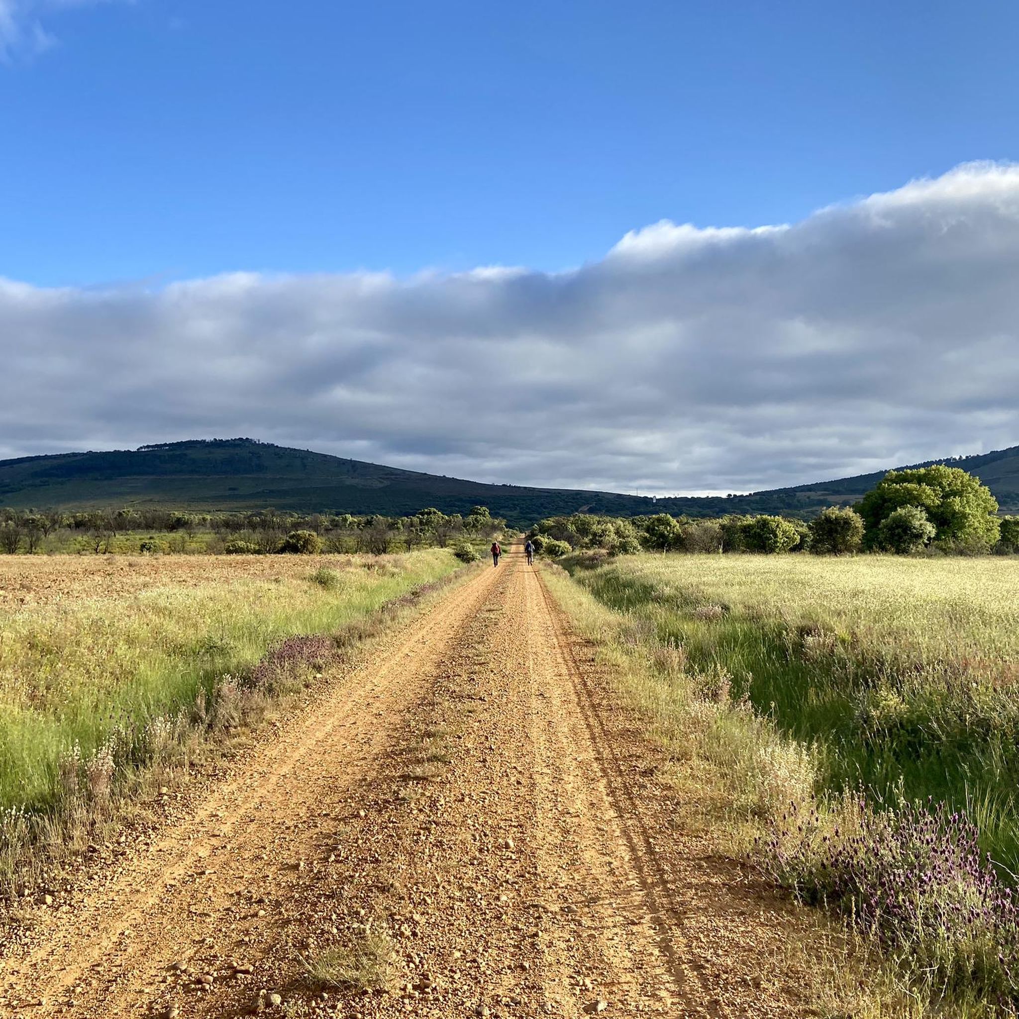
Road cycling routes around Gallegos del Río are situated within the Aliste comarca in Zamora, Spain. The region is characterized by its natural heritage, with landscapes irrigated by the Aliste River. This area offers varied terrain suitable for road cycling, featuring traditional architecture and scenic surroundings. The municipality encompasses several localities that contribute to a diverse environment for outdoor activities.
Best road cycling routes around Gallegos Del Río
- The most popular road cycling route is Valle de la ribera del…
Last updated: July 2, 2026
Moderate road ride. Good fitness required. Mostly well-paved surfaces and easy to ride.
41
riders
93.0km
04:12
920m
920m
Hard road ride. Very good fitness required. Mostly well-paved surfaces and easy to ride.

Sign up for free
14
riders
137km
06:24
1,630m
1,630m
Hard road ride. Very good fitness required. Mostly well-paved surfaces and easy to ride.
9
riders
89.0km
04:21
1,190m
1,190m
Hard road ride. Very good fitness required. Some segments of this route may be unpaved and difficult to ride.
7
riders
92.0km
04:27
1,250m
1,250m
Hard road ride. Very good fitness required. Some segments of this route may be unpaved and difficult to ride.
Get access to more routes and recommendations from other explorers.
Sign up for free
Already have an account?
Our route recommendations are based on thousands of hikes, rides, and runs completed by other people on komoot.
Start today with a free account
Your next adventure awaits.
Login or Signup
Popular around Gallegos Del Río

Tips from the Community

Tábara is a Spanish municipality of about 830-950 inhabitants located in the province of Zamora, within the autonomous community of Castile and León. This small village stands at an altitude of 749 meters and is the capital of the Tierra de Tábara comarca. It represents a center of great historical-cultural importance, as well as being a fundamental stop for pilgrims traveling the Camino Sanabrésl
1
0

Rabanales is known in the Aliste region for preserving a historic center with abundant examples of traditional stone architecture, a hallmark of western Zamora. This architecture is characterized by its robustness, its integration with the landscape, and the use of local materials. The traditional houses and buildings are constructed primarily with local stone, especially granite, which provides solidity and a distinctive rustic aesthetic.
2
0
It spans the Duero River in Zamora (Castilla y León), connecting Avenida de Portugal (Pinilla neighborhood) with Calle de Salamanca in the city. The project began in 1882, with construction starting in 1892, under the direction of engineer Prudencio Guadalajara, to alleviate the overloading of the old Stone Bridge. Inaugurated in 1900, it represented a significant improvement in handling the growing traffic in the city. It was designed in steel, using a metal lattice structure of the St. Andrew's Cross type, typical of the late 19th century.
3
0
Tábara, located in the northwest of the province of Zamora (Castilla y León), is a town with a rich medieval history, a stunning natural setting, and a significant cultural heritage. Origins: These date back to the Bronze Age and Roman period. Middle Ages: It was an important monastic center with the Monastery of San Salvador de Tábara, founded by Saint Froilán in the 9th century at the behest of Alfonso III.
10
0

Rio de Onor is not just a beautiful village; it's a "living museum" of a way of life that has almost disappeared in Europe. It's worth visiting because it is possibly the village with the most fascinating social history in Portugal. Here are the 4 main reasons to go there: 1. It's a Community Village ("Communitarianism") This is Rio de Onor's great trademark. For centuries, the village lived under a system of total sharing among neighbors, something very rare: Sharing of Goods: The bread oven, the watermill, and even the village bull belonged to everyone. The "Rod of Justice": Decisions and fines for infractions in the village were marked on a wooden rod, managed by the "judge" elected by the people. You can see this history explained at the Casa do Touro (House of the Bull), a small, unmissable museum in the village. 2. One Village, Two Countries Rio de Onor is a village bisected by the international border. On this side is Rio de Onor (Portugal); on the other side is Rihonor de Castilla (Spain). For the inhabitants, the border never really existed: they share land, livestock, and even speak their own dialect (Rionorês), an ancient mixture of Portuguese and Castilian. It's very curious to cross from one country to the other on foot in the middle of the main street. 3. The Schist Landscape and Nature Located in the Montesinho Natural Park, the village is visually stunning. The houses are made of dark schist with wooden balconies, typical of Trás-os-Montes, and are very well preserved. The Onor River, which crosses the village, has clear waters and creates a very pleasant natural river beach in the summer, perfect for picnics. 4. The "Roman" Bridge The old stone bridge (which is actually from the 19th century, despite its popular name) is the village's postcard image. The reflection of the arches in the water with the schist houses in the background creates one of the most photogenic landscapes in Northern Portugal. Visiting Rio de Onor is like stepping back in time and understanding how communities survived in isolation in the mountains, supporting each other. It's a lesson in life and history in an incredible natural setting.
2
0

This park is located just outside the city center on the N-128 road toward the Santa Lucía neighborhood. It is a large park, located below the walled area of the Castle, on the banks of the Fresno River. Here, the river is dammed, and there is a bar-café with a very pleasant terrace where you can enjoy a drink, and where you can practice non-motorized water sports, such as canoeing or taking a trip along the river by renting a pedal boat. There is a significant gradient from the road to the riverbank, and numerous paths and pedestrian trails for leisurely strolls.
2
0
This park stretches for about 1.5 kilometres, following the course of the Fresno River. It is a leisure area that offers pedestrian trails along the banks and a pier with support facilities. Along the river, you can see restored mills, fountains and watermills.
2
0

Things to see in Miranda do Douro
0
0
Frequently Asked Questions
What kind of terrain can I expect on road cycling routes around Gallegos del Río?
The region, situated within the Aliste comarca, offers varied terrain. You'll find routes that explore the Aliste River valley, featuring both moderate and challenging sections with significant elevation gains. The landscape is characterized by beautiful natural features and traditional village settings.
Are there any family-friendly road cycling routes in the Gallegos del Río area?
While many routes in the area are rated moderate to difficult, the Valle de la ribera del Río Aliste por Sarracín de Aliste y Gallegos del Río — circular desde Rabanales is a moderate option that explores the scenic Aliste River valley, which might be suitable for families with some cycling experience. It's always best to check the route details for specific elevation and distance to ensure it matches your family's ability.
What are some notable landmarks or attractions I can see while road cycling in Gallegos del Río?
The area is rich in cultural and natural points of interest. You can encounter traditional stone houses in villages, and the wider region features the ruined Alba Castle, offering spectacular views. The Fidionda Spring, known for its sulfur water, is another natural monument. Routes like the Rio de Onor Village – Hermitage of the Incarnation loop from El Enpalme also pass through charming villages and past religious buildings.
Are there any circular road cycling routes available?
Yes, several routes are designed as loops. For instance, the popular Valle de la ribera del Río Aliste por Sarracín de Aliste y Gallegos del Río — circular desde Rabanales is a circular route. Other challenging loops include the Puente de los Poetas – Puente de Hierro de Zamora loop from Fonfría and the Rio de Onor Village – Hermitage of the Incarnation loop from El Enpalme.
What is the best time of year for road cycling in Gallegos del Río?
The region's natural environment, including the Aliste River, makes it appealing for outdoor activities. While specific seasonal recommendations aren't detailed, spring and autumn generally offer pleasant temperatures for cycling in Spain, with autumn also known for an abundance of mushrooms. Summers can be hot, and winters cooler.
How long do road cycling routes typically take to complete in this area?
Route durations vary significantly based on distance and difficulty. For example, a moderate route like the Valle de la ribera del Río Aliste por Sarracín de Aliste y Gallegos del Río — circular desde Rabanales (49.6 km) takes about 2 hours 28 minutes. More difficult and longer routes, such as the Rio de Onor Village – Hermitage of the Incarnation loop from El Enpalme (137.3 km), can take around 6 hours 23 minutes.
Are there options for advanced road cyclists seeking a challenge?
Absolutely. The Gallegos del Río area offers several difficult routes with significant elevation gains. The Puente de los Poetas – Puente de Hierro de Zamora loop from Fonfría, for instance, is a challenging 93.1 km path with over 900 meters of elevation gain. The Castle and Alcazaba ruins – Yellow Rock Viewpoint loop from El Enpalme is another difficult option, covering 89.4 km with nearly 1200 meters of ascent.
What kind of wildlife might I encounter while cycling in the Aliste comarca?
The Aliste comarca is known for its rich natural heritage. The region is home to notable fauna, including the Iberian wolf. While direct encounters are rare, the presence of such wildlife indicates a healthy and diverse ecosystem, adding to the natural beauty of your ride.
Where can I find parking when starting a road cycling route in Gallegos del Río?
While specific parking locations for each route aren't detailed, Gallegos del Río is a municipality with several smaller localities. It's generally advisable to look for parking in the main village centers or near the starting points of routes, especially for circular tours that return to the same location. Many routes start from nearby towns like Rabanales or Fonfría, where parking facilities are typically available.
Are there any cafes or restaurants along the road cycling routes in the Aliste comarca?
The Aliste comarca, including Gallegos del Río and its surrounding villages like Domez de Alba, Flores, Lober, Puercas, Tolilla, and Valer, features traditional architecture and local charm. While specific cafes on routes are not listed, these villages often have local establishments where you can find refreshments and traditional cuisine. Planning your route to pass through these villages can provide opportunities for breaks and meals.
What makes the landscapes around Gallegos del Río unique for road cycling?
The landscapes are particularly beautiful, irrigated by the Aliste River, which creates a vibrant natural environment. Cyclists can enjoy diverse flora, traditional stone architecture, and scenic views, especially along routes that traverse the river valley and connect the charming small towns within the municipality.
How many road cycling routes are available in the Gallegos del Río area on komoot?
There are over 10 road cycling routes available around Gallegos del Río on komoot, offering a range of options from moderate to difficult, catering to various skill levels.
Most popular attractions around Gallegos Del Río

Get inspired with the komoot mobile app


Explore more
Browse the best Road cycling routes in other regions.
