The best road cycling routes around ZPE Évora
4.3
(3)
260
riders
14
rides
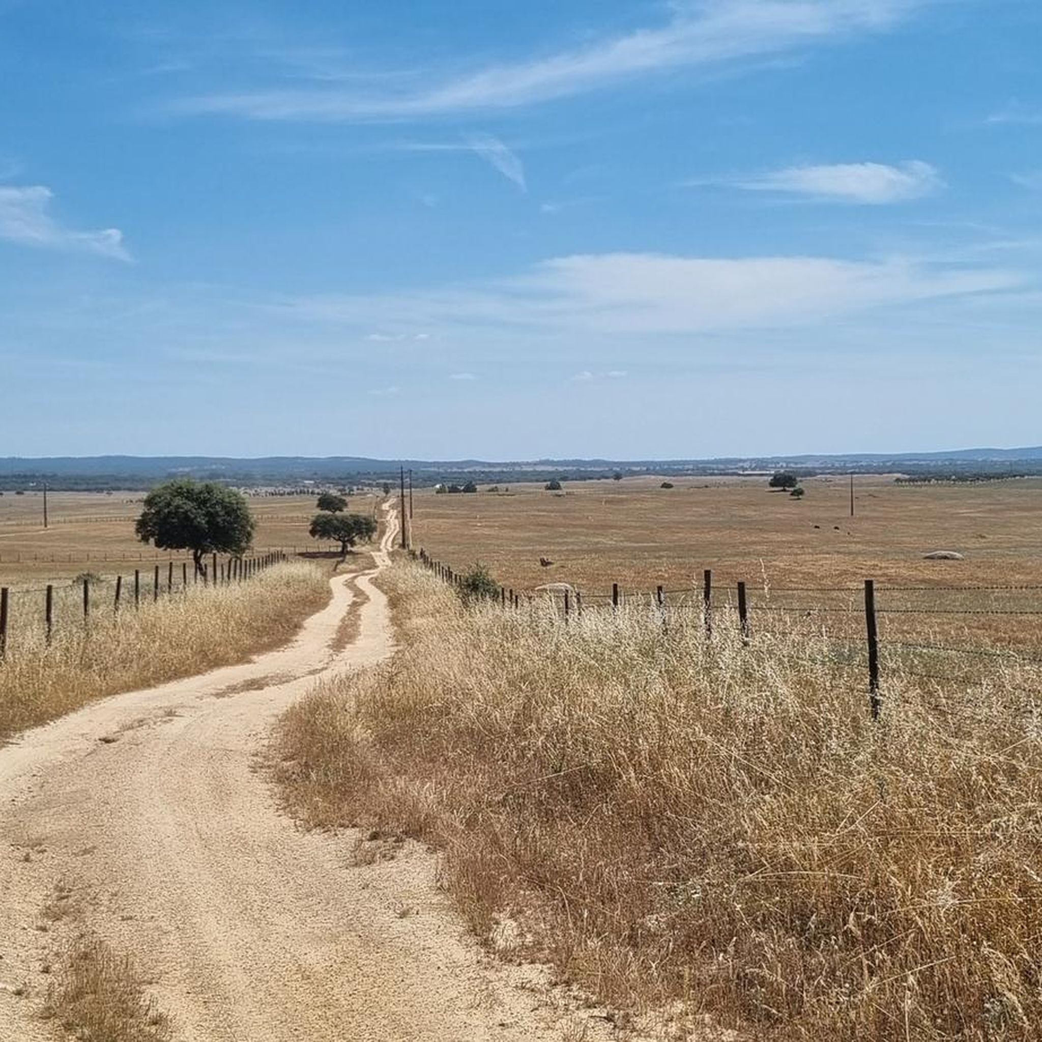
Road cycling routes around ZPE Évora traverse a landscape characterized by expansive, rolling plains and gentle to moderately hilly terrain. The region features the unique Montado landscape, with extensive olive groves and cork oak forests, providing varied scenery for cyclists. Routes often incorporate significant prehistoric sites like megalithic monuments and the impressive 16th-century Água de Prata Aqueduct. This area, part of the Natura 2000 network, offers a blend of natural features and historical attractions.
Best road cycling routes around ZPE…
Last updated: October 27, 2026
4.3
(3)
49
riders
51.1km
02:25
490m
490m
Moderate road ride. Good fitness required. Mostly well-paved surfaces and easy to ride.
40
riders
40.5km
01:59
310m
310m
Moderate road ride. Good fitness required. Some segments of this route may be unpaved and difficult to ride.

17
riders
80.0km
03:53
920m
920m
Hard road ride. Very good fitness required. Mostly well-paved surfaces and easy to ride.
19
riders
88.9km
04:01
670m
670m
Moderate road ride. Good fitness required. Mostly well-paved surfaces and easy to ride.
14
riders
Hard road ride. Very good fitness required. Some segments of this route may be unpaved and difficult to ride.
Get access to more routes and recommendations from other explorers.
Already have an account?
Our route recommendations are based on thousands of hikes, rides, and runs completed by other people on komoot.
Start today with a free account
Your next adventure awaits.



Tips from the Community

The dolmens and megalithic monuments in the Serra de Monfurado (Alentejo region, Portugal) are part of one of the most important prehistoric complexes in Europe. In this hilly area located between Montemor-o-Novo and Évora, the dolmens (locally called antas) bear witness to the intense ritual and funerary activity of Neolithic communities.
1
0
When talking about the "dolmens of Alcanede", one usually refers to the geographical-historical area of the parish of Alcanede (municipality of Santarém, Portugal) and its immediate surroundings in the Serras de Aire e Candeeiros Natural Park. In this area, one of the most fascinating megalithic monuments of the Iberian Peninsula can be found: the Anta-Capela de Alcobertas (also known as the Dolmen of Saint Mary Magdalene).
1
0
The Anta do Monte dos Soldos (also known as Anta do Outeiro de Santa Clara) is a megalithic monument (dolmen) located in Portugal. Main features Structure: It consists of a polygonal burial chamber formed by seven vertical stones (orthostats) and a large cover stone (slab/capstone) that has remained intact. Corridor: It features the remains of an access corridor with two surviving uprights and a side slab. Period: It dates back to the Neolithic-Chalcolithic period. Location: It is located on private land (but accessible via an unlocked gate), near a road, at an altitude of approximately 230 meters.
1
0

A dolmen (anta) with a polygonal chamber, seven pillars and an intact capstone. Its corridor retains two pillars and a side slab. Located on private property, it features a capstone covered with small stones, probably from the neighboring field. What is perhaps most interesting about this anta (or dolmen) is the uncertainty regarding its name. In 1933, Manuel Heleno identified it as Anta do Outeiro de Santa Clara, without specifying its location. Leonor Rocha relocated it in 2002 under the name Anta do Monte dos Soldos, but Manuel Calado mentioned two monuments in 2005: Soldos (nearby) and Santa Clara, about 1.2 km away. A blog post by Rocha (dating from 2011) suggests that this issue should be clarified. The anta is located right on the side of the road. It is on private land, behind a fence. (Source: www.prehistoricportugal.com)
12
0
The Antas de Alcanede (also known as Antas da Herdade de Alcanede) are a group of megalithic monuments (dolmens) located in the parish of Nossa Senhora da Graça do Divor, in the municipality of Évora. Anta de Alcanede 1 (or Anta 1 da Herdade de Alcanede): Structure: It has a polygonal chamber with 6 orthostats (vertical stones) more or less in situ and a height of about 1.6 meters, with the capstone (chapéu) fallen into the interior of the chamber. Corridor: It shows traces of a corridor about 1.5 meters wide, 2 meters long, and 1 meter high. GPS coordinates: 38.682750, -8.051306 [1] Anta de Alcanede 2: Structure: Consists of 6 orthostats and the large capstone (chapéu) kept in situ, slightly inclined, Anta de Alcanede 3: Structure: Very degraded and destroyed monument, where vaguely Anta de Alcanede 4: Structure: They are part of this archaeological site cataloged in the heritage inventory of the municipality of Évora.
10
0
As Antas de Alcanede (também conhecidas como Antas da Herdade de Alcanede) são um conjunto de monumentos megalíticos (dólmenes) situados na freguesia de Nossa Senhora da Graça do Divor, no concelho de Évora. Anta de Alcanede 1 (ou Anta 1 da Herdade de Alcanede): Estrutura: Possui câmara poligonal com 6 esteios (pedras verticais) mais ou menos in situ e uma altura de cerca de 1,6 metros, com a pedra de cobertura (chapéu) caída para o interior da câmara. Corredor: Apresenta vestígios de um corredor com cerca de 1,5 metros de largura, 2 metros de comprimento e 1 metro de altura. Coordenadas GPS: 38.682750, -8.051306 [1] Anta de Alcanede 2: Estrutura: Constituída por 6 esteios e a grande laje de cobertura (chapéu) mantida in situ, ligeiramente inclinada, Anta de Alcanede 3: Estrutura: Monumento muito degradado e destruído, onde são vagamente perceptíveis três a quatro esteios e blocos soltos. Anta de Alcanede 4: Estrutura: Integram este núcleo arqueológico catalogado no inven
11
0
The size and number of megalithic monuments in Évora are associated with the fact that this region is the only place where the river basins of the Tejo, Sado, and Guadiana, the largest rivers in southern Portugal, meet. For this reason, it was an essential crossing point. Megalithic monuments (i.e., made of large stones) therefore appear in the Évora region because the Alentejo plains were perfect for the last hunter-gatherer communities to practice their way of life there. (Source: www.visitevora.net)
12
0
Reference karting track in Portugal, with over thirty years of history.
19
0
Frequently Asked Questions
How many road cycling routes are available in ZPE Évora?
There are over 20 road cycling routes in ZPE Évora, offering a variety of experiences. These include 3 easy routes, 13 moderate routes, and 5 more challenging options, catering to different skill levels.
What kind of landscapes can I expect to see while road cycling in ZPE Évora?
Road cycling in ZPE Évora takes you through diverse landscapes, from expansive, rolling plains and gentle to moderately hilly terrain to the unique Montado landscape, characterized by extensive olive groves and cork oak forests. You'll also encounter historical landmarks and natural features like the 16th-century Água de Prata Aqueduct.
Are there any easy or family-friendly road cycling routes in the region?
Yes, ZPE Évora offers several routes suitable for easier rides, including those that utilize 'ecopistas' – dedicated cycling paths on former railway lines. These provide traffic-free and often downhill experiences, making them accessible for various skill levels, including families. For example, the old Évora-Mora rail track has been converted into an ecotrail.
What historical sites or landmarks can I explore along the road cycling routes?
The region is rich in history. Many routes incorporate significant prehistoric sites like the Almendres Cromlech and Menhir, and the impressive Dolmen of Zambujeiro. You can also cycle past the 16th-century Água de Prata Aqueduct. Within Évora itself, routes often showcase the city's medieval walls and historic center, a UNESCO World Heritage Site. Consider the Valverde – Évora City Walls loop from Évora to experience the city's historic defenses.
Are there any challenging road cycling routes for experienced cyclists?
Yes, for more experienced cyclists seeking a challenge, there are several difficult routes available. One such route is the Checkpoint 3, Évora – View of Alqueva Reservoir loop from Évora, which covers over 120 km and features significant elevation changes, offering a demanding ride with rewarding views.
What are the best routes to see the Água de Prata Aqueduct?
The historic Água de Prata Aqueduct is a prominent feature in the region. A great way to experience this impressive engineering landmark is by taking the Aqueduct Hotel – Checkpoint 3, Évora loop from Évora, which passes directly by it.
What do other road cyclists say about the routes in ZPE Évora?
The road cycling routes in ZPE Évora are highly regarded by the komoot community, with an average rating of 4.4 out of 5 stars. Cyclists often praise the varied terrain, the blend of natural beauty with historical sites, and the well-maintained roads that make for an enjoyable experience.
Can I find routes that offer panoramic views?
Absolutely. The region features several viewpoints that offer expansive vistas. The Alto de São Bento, the highest hill near Évora, provides panoramic views over the city and the surrounding countryside. The hilltop castle of Evoramonte also offers wide visibility across the interior, and some routes, like the Checkpoint 3, Évora – View of Alqueva Reservoir loop from Évora, offer views towards the Alqueva Reservoir.
Are there any circular road cycling routes around ZPE Évora?
Yes, many of the road cycling routes in ZPE Évora are designed as loops, allowing you to start and end in the same location. Examples include the Évora Public Garden – Church of the Holy Spirit loop from Évora, which takes you through rolling landscapes and the Montado.
What is the best time of year for road cycling in ZPE Évora?
While not explicitly stated, the region's description of 'golden wheat fields' and 'extensive olive groves' suggests that spring and early summer offer pleasant temperatures and vibrant scenery. Autumn would also be a good choice, with cooler weather and potentially beautiful foliage, avoiding the peak heat of summer.
Where can I find more information about the natural features of the ZPE Évora region?
ZPE Évora is part of the Natura 2000 network, designated for bird conservation, and is a refuge for over 150 species of birds. The unique Montado landscape with cork oak forests is also a significant natural feature. For more details on the region's nature trails and biodiversity, you can visit the Évora Nature Trails website.
Are there any routes that pass through the historic city of Évora itself?
Yes, several routes incorporate the historic city of Évora. You can enjoy a leisurely ride through its charming streets, showcasing architectural highlights like the Évora Cathedral, Roman Temple, Giraldo Square, and the Chapel of Bones. The Évora City Walls – Valverde loop from Évora is one option that allows you to experience the city's historic surroundings.
Most popular routes around ZPE Évora

Get inspired with the komoot mobile app


Explore more
Browse the best Road cycling routes in other regions.
