The best road cycling routes around O Saviñao
4.6
(19)
797
riders
41
rides
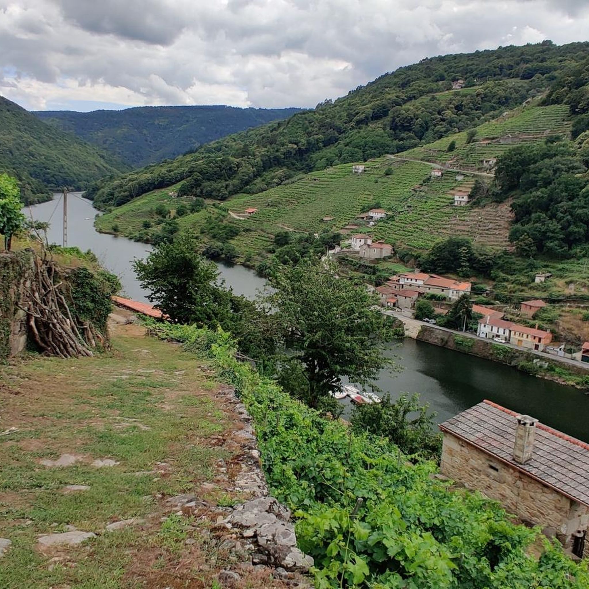
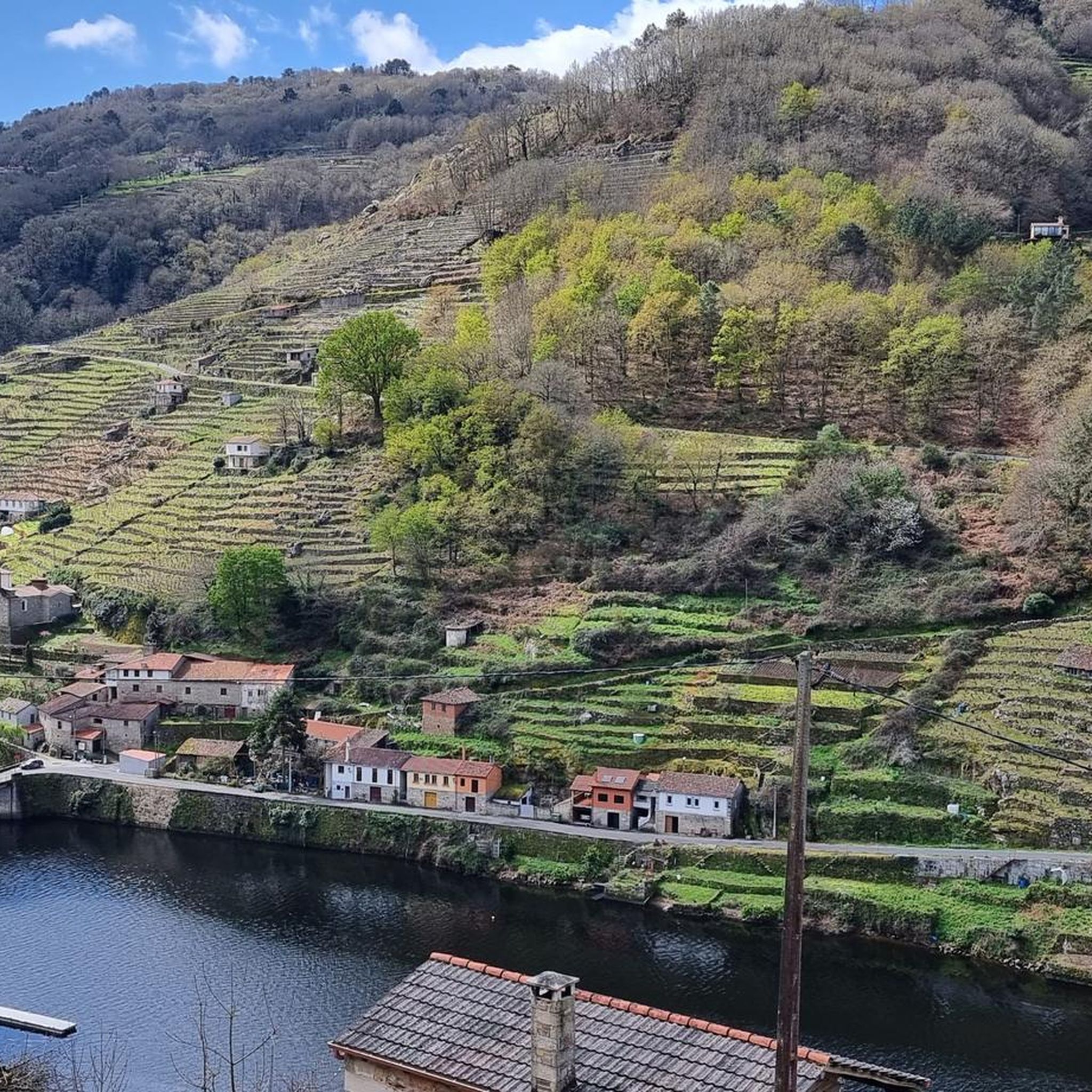
Road cycling around O Saviñao features a landscape characterized by significant elevation changes and river valleys, particularly within the Ribeira Sacra region. The area offers varied terrain, including routes that follow riverside paths and cross numerous bridges over the Miño River and its tributaries. Cyclists can expect a mix of challenging climbs and scenic descents through the Galician countryside, with mountain landscapes, vineyards, and forests of chestnut and oak trees. This diverse topography provides a range of road cycling experiences.
…Last updated: July 7, 2026
9
riders
41.5km
02:18
860m
860m
This moderate 25.8-mile (41.5 km) road cycling route in Ribeira Sacra offers 2814 feet (858 metres) of elevation gain over 2 hours and 18 mi
19
riders
69.5km
03:38
1,200m
1,200m
Hard road ride. Very good fitness required. Mostly well-paved surfaces and easy to ride.

Sign up for free
9
riders
70.3km
03:48
1,320m
1,330m
Hard road ride. Very good fitness required. Some segments of this route may be unpaved and difficult to ride.
7
riders
86.3km
04:30
1,540m
1,540m
Hard road ride. Very good fitness required. Mostly well-paved surfaces and easy to ride.
4
riders
41.3km
02:10
690m
690m
Moderate road ride. Good fitness required. Some segments of this route may be unpaved and difficult to ride.
Get access to more routes and recommendations from other explorers.
Sign up for free
Already have an account?
Our route recommendations are based on thousands of hikes, rides, and runs completed by other people on komoot.
Start today with a free account
Your next adventure awaits.
Login or Signup

Tips from the Community

The access is good and clean, Although I think it's missing a plaque with information about the place.
0
0

Exceptional place for cycling, with good views and little traffic
0
0
Exceptional place for cycling, with good views and little traffic
0
0
Exceptional place for cycling, with good views and little traffic
0
0
Exceptional place for cycling, with good views and little traffic
0
0
Exceptional place for cycling, with good views and little traffic
0
0
Exceptional place for cycling, with good views and little traffic
0
0

The Scallop Fountain in Paradela is an iconic site for pilgrims on the Camino de Santiago. Paradela, located in the province of Lugo, Galicia, is known for its rich history and connection to the Camino Francés. The fountain is a symbol of rest and renewal for pilgrims, and its design includes the famous scallop, the symbol of the Camino de Santiago. In addition to the fountain, Paradela offers other points of interest such as the Church of Santa María de Ferreiros and the Mirador de Santa Marta.
5
0
Frequently Asked Questions
How many road cycling routes are available in O Saviñao?
O Saviñao offers a diverse selection of over 40 road cycling routes, catering to various skill levels. The region is known for its significant elevation changes and scenic river valleys, providing a rewarding experience for cyclists.
What kind of terrain can I expect on road cycling routes in O Saviñao?
Road cycling in O Saviñao features a landscape characterized by significant elevation changes and river valleys. You'll encounter a mix of challenging climbs and scenic descents, often following riverside paths and crossing numerous bridges through the Galician countryside.
Are there challenging road cycling routes in O Saviñao?
Yes, O Saviñao is well-suited for cyclists seeking a challenge. Nearly half of the routes, 21 out of 44, are classified as difficult. For instance, the A Cova Riverside Beach – Plaza de Galicia, Chantada loop from Chantada is a difficult 43.2-mile (69.5 km) path navigating hilly terrain and riverside areas.
Are there any moderate road cycling routes suitable for intermediate riders?
Absolutely. O Saviñao offers 23 moderate road cycling routes. A popular choice is the Chantada - A Cova Loop, a 25.8-mile (41.5 km) trail with substantial elevation gain, typically completed in about 2 hours 18 minutes.
What are some scenic viewpoints or natural attractions along the road cycling routes?
Many routes offer stunning views of the region's natural beauty. You might encounter highlights such as the Augacaída Waterfall, the expansive Ribeira Sacra River Valley, or the tranquil Miño River. These natural monuments provide excellent spots for a break or photo opportunity.
Are there any historical landmarks or points of interest to explore near the cycling paths?
Yes, the area around O Saviñao is rich in history and culture. Cyclists can discover landmarks like the Portomarín Bridge, the historic Church of St John of Portomarín, or traditional structures like an Hórreo. These attractions offer a glimpse into the region's heritage.
Are there circular road cycling routes in O Saviñao?
Many of the road cycling routes in O Saviñao are designed as loops, allowing you to start and finish in the same location. Examples include the Plaza de Galicia, Chantada – Chantada Town Center loop from Chantada, a 44.9-mile (72.3 km) trail, or the Puente de Mourulle – San Fiz Bridge loop from Chantada.
What do other road cyclists enjoy most about cycling in O Saviñao?
The komoot community highly rates road cycling in O Saviñao, with an average score of 4.7 stars from over 10 reviews. Cyclists often praise the varied terrain, challenging climbs, and the scenic beauty of the river valleys and bridge crossings.
What is the best time of year for road cycling in O Saviñao?
While specific seasonal data isn't provided, the region's climate generally makes spring and autumn ideal for road cycling. Temperatures are milder, and the natural scenery is particularly vibrant, offering comfortable conditions for tackling the varied terrain.
Are there any less crowded or 'hidden gem' routes for road cycling in O Saviñao?
While popular routes like the Chantada loops are well-trafficked, exploring some of the longer, more challenging options can lead to quieter experiences. The Santiago Way Marker – Alto do Hospital loop from O Lugar do Vimieiro, for example, offers a substantial 53.6-mile (86.3 km) journey with significant elevation, potentially providing a more secluded ride through the landscape.
Most popular attractions around O Saviñao

Get inspired with the komoot mobile app


Explore more
Browse the best Road cycling routes in other regions.
