Top 9 Hikes and Walks around Campillos-Sierra
3.0
(1)
9
hikers
7
hikes
Hiking trails around Campillos-Sierra traverse a landscape characterized by varied terrain, including river valleys, forested areas, and moderate ascents to local hills. The region features natural watercourses, woodlands, and open spaces, providing diverse environments for outdoor activity. This area offers a range of paths suitable for exploring its natural composition.
Best hiking trails around Campillos-Sierra
- The most popular hiking route is Rio Zafrilla and Cuerno de la Cumbre via the Fuente del Tejo trail (PR-CU 16), an 8.1 miles…
Last updated: May 11, 2026
Moderate hike. Good fitness required. Easily-accessible paths. Suitable for all skill levels.
1
hikers
21.0km
06:41
600m
600m
This difficult 13.0-mile hiking trail in Serranía de Cuenca offers dramatic limestone formations, dense forests, and rich mycological intere

Sign up for free
12.3km
03:41
390m
390m
Hike the moderate 7.7-mile Sendero de las Almas from Salinas del Manzano, featuring riverbanks, forests, and a vulture feeding ground.
4
hikers
6.98km
02:10
190m
190m
Moderate hike. Good fitness required. Mostly accessible paths. Sure-footedness required.
1
hikers
3.97km
01:07
80m
80m
Easy hike. Great for any fitness level. Easily-accessible paths. Suitable for all skill levels.
Get access to more routes and recommendations from other explorers.
Sign up for free
Already have an account?
Our route recommendations are based on thousands of hikes, rides, and runs completed by other people on komoot.
Start today with a free account
Your next adventure awaits.
Login or Signup


Tips from the Community

Former public washhouse in Huerta del Marquesado. Everything about our drinking water, especially access to clean drinking water, is explained in great detail.
0
0

Path to the north of the Huerta del Marquesado where, in season, you can find various mushrooms. Very pleasant to visit in autumn.
0
0

Located on the banks of the Mayor del Molinillo river, the town of Salinas del Manzano is a beautiful and quiet place with various services and paths to explore the beautiful landscape that surrounds it. Among the most outstanding routes is the Las Almas trail that reaches the town of Salvacañete, crossing the Alto de Las Almas and a beautiful forest that make it the ideal plan for the summer months.
2
0
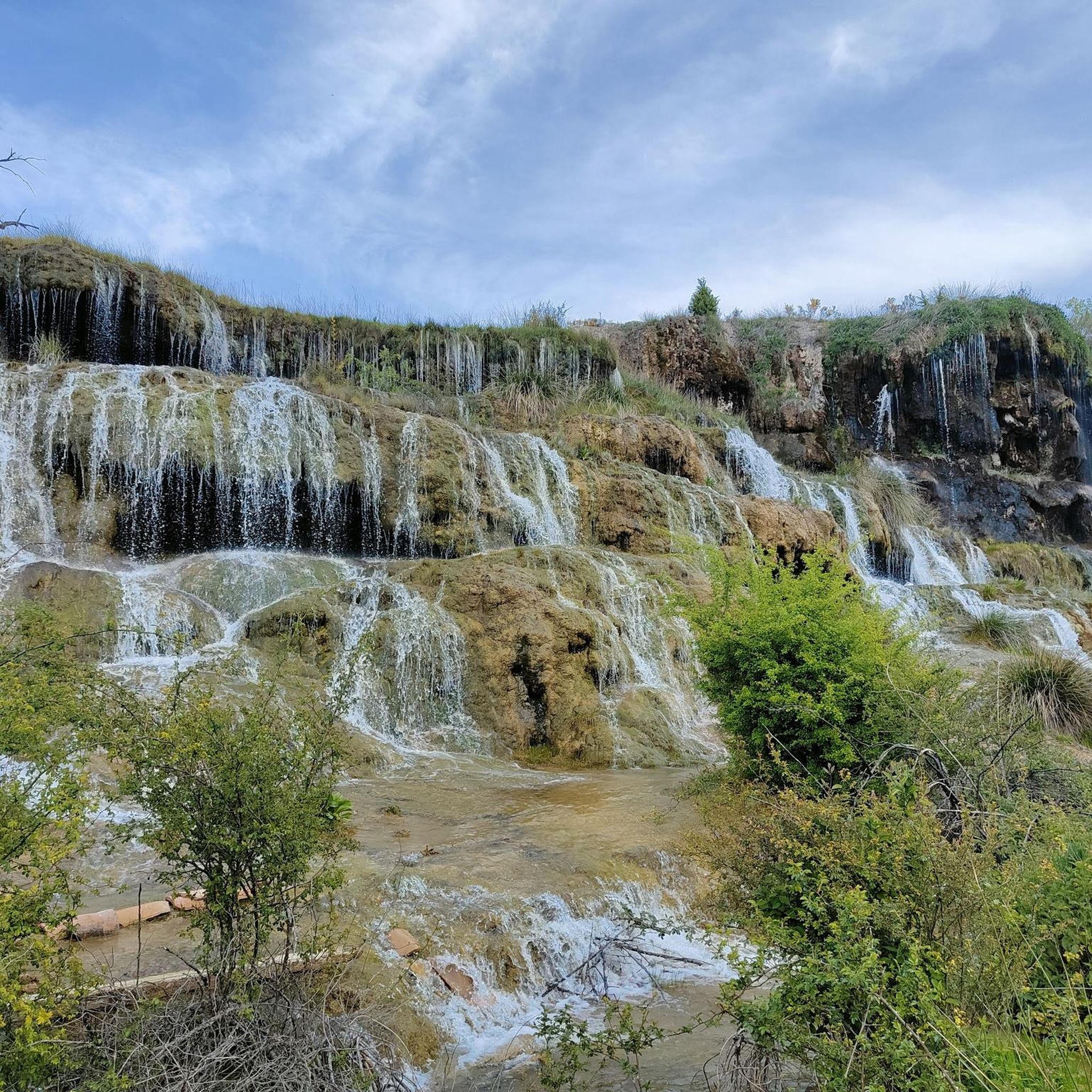
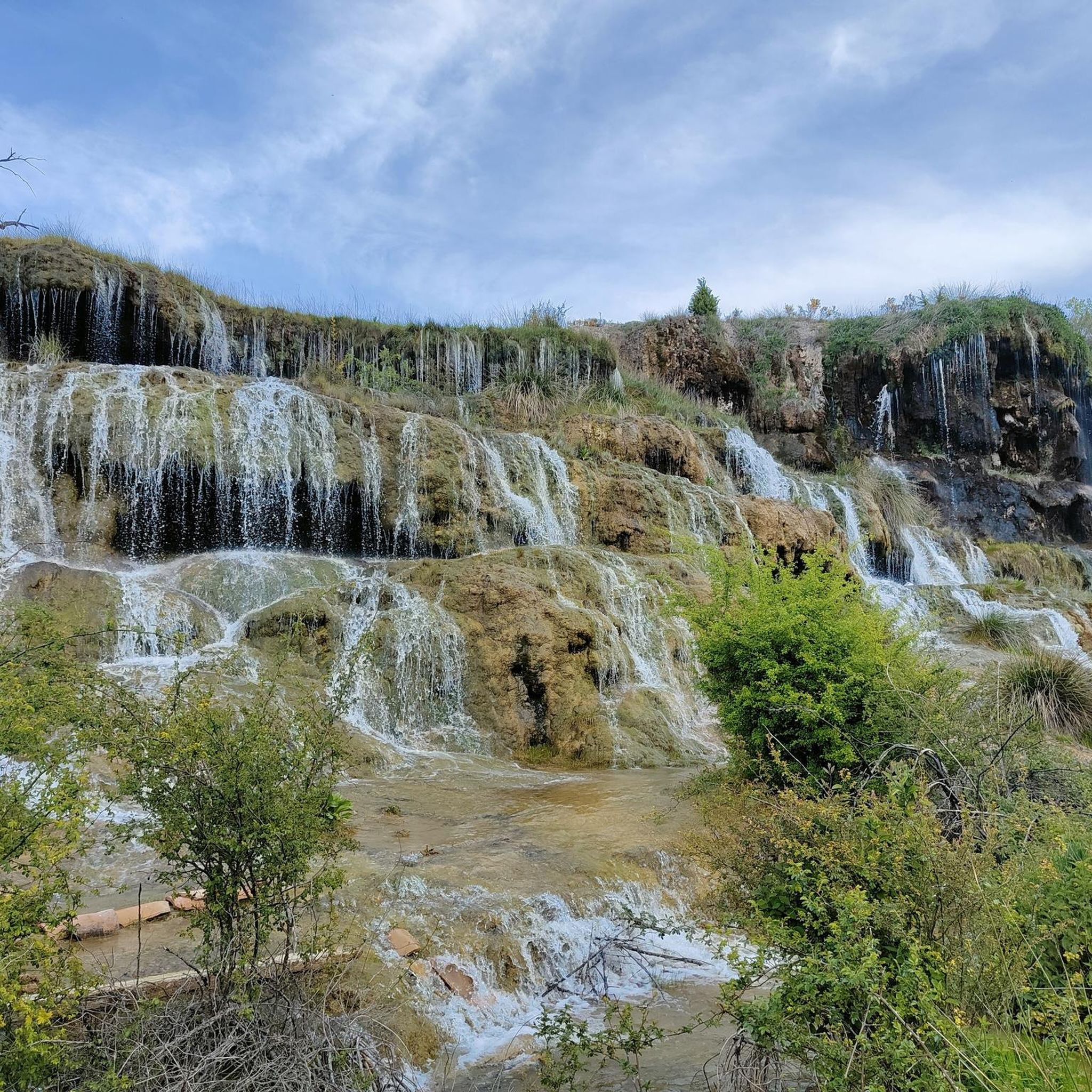
It is worth visiting this remote site where tranquility reigns. A beautiful and picturesque landscape that is covered following a gravel road without difficulty that allows us to appreciate the gorges of the Zafrilla river.
2
0

small welcoming cafe before the lagoon
0
0
Frequently Asked Questions
How many hiking trails are available around Campillos-Sierra?
There are 7 hiking trails around Campillos-Sierra, offering a range of options from easy to difficult. The region features diverse terrain including river valleys, forests, and moderate ascents.
Are there any easy hiking routes suitable for beginners in Campillos-Sierra?
Yes, Campillos-Sierra offers one easy hiking route. While most trails are moderate, beginners can find suitable paths to explore the area's natural beauty. For a gentle introduction, consider routes with minimal elevation changes.
What kind of landscapes can I expect to see on hikes in Campillos-Sierra?
Hiking around Campillos-Sierra will take you through varied landscapes, including natural watercourses, dense woodlands, and open spaces. Many routes feature river sections and ascents to local elevations, providing diverse environments to explore.
What do other hikers say about the trails in Campillos-Sierra?
The trails in Campillos-Sierra are highly rated by the komoot community, with an average score of 4.0 stars. Hikers often praise the varied terrain, which includes rivers, forests, and diverse elevation, offering options for different ability levels.
Are there any circular walks available in Campillos-Sierra?
Yes, there are several circular walks in the area. For example, the Trail of the Souls Loop is a 7.6-mile (12.3 km) circular route through varied landscapes. Another option is the Streams and Mushroom Trail Loop, a more challenging 13.0-mile (21.0 km) path.
What are some interesting places to explore or landmarks to see along the hiking trails?
Along the hiking trails, you can discover several points of interest. Highlights include the Zafrilla River Trail, the prominent Cuerno de la Cumbre, and the serene Laguna del Marquesado Nature Reserve. You might also encounter the Monument to the 1959 Plane Crash Victims.
Are there any trails that feature rivers or watercourses?
Many trails in Campillos-Sierra incorporate natural watercourses. The Rio Zafrilla and Cuerno de la Cumbre via the Fuente del Tejo trail (PR-CU 16), for instance, features significant river sections. The region's landscape is characterized by these natural elements.
What is the longest hiking trail in Campillos-Sierra?
The longest hiking trail in Campillos-Sierra is the Streams and Mushroom Trail Loop, which spans 13.0 miles (21.0 km). This difficult route winds through dense woodlands with significant elevation changes.
Are there any moderate difficulty hikes suitable for a good day out?
Yes, the majority of trails in Campillos-Sierra are of moderate difficulty, perfect for a rewarding day out. The Rio Zafrilla and Cuerno de la Cumbre via the Fuente del Tejo trail (PR-CU 16) is a popular moderate option, taking about 3 hours 43 minutes to complete.
What is the shortest hiking route available?
The shortest hiking route listed is the Traditional Washhouse loop from Huerta del Marquesado, which is 4.2 miles (6.7 km) long and typically takes around 2 hours 6 minutes to complete.
Are there any trails that start near Huerta del Marquesado?
Yes, there are a couple of trails that start from Huerta del Marquesado. These include the Hiking loop from Huerta del Marquesado and the Traditional Washhouse loop from Huerta del Marquesado, offering convenient starting points from this location.
Most popular routes around Campillos-Sierra
Most popular attractions around Campillos-Sierra

Get inspired with the komoot mobile app


Explore more
Browse the best Hikes in other regions.
