The best cycling routes around Cerezo De Abajo
5.0
(4)
155
riders
17
rides
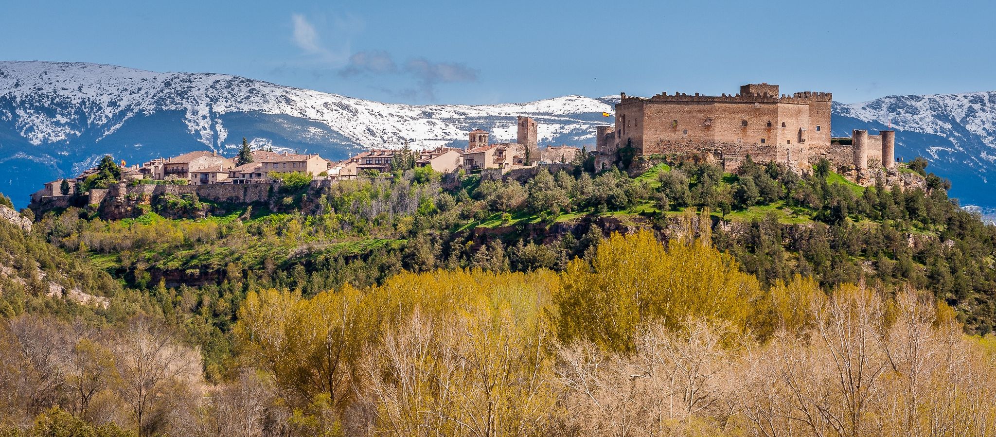
Touring cycling around Cerezo De Abajo offers diverse landscapes at the foot of the Somosierra mountain pass, with proximity to the Sierra de Guadarrama National Park. The region features mountainous terrain, providing varied routes from moderate to challenging ascents. Cyclists can explore ancient oak groves, riverside forests, and unique birch forests, alongside the Cerezuelo River and its streams. This area provides a mix of natural features suitable for touring cyclists seeking varied elevation and natural surroundings.
Best touring cycling routes…
Last updated: June 28, 2026
22
riders
49.5km
03:36
1,050m
1,050m
Hard bike ride. Very good fitness required. Mostly paved surfaces. Suitable for all skill levels.
5.0
(1)
24
riders
26.5km
01:55
570m
570m
Hard bike ride. Very good fitness required. Mostly paved surfaces. Suitable for all skill levels.

Sign up for free
8
riders
44.4km
04:01
420m
420m
Hard bike ride. Good fitness required. You may need to push your bike for some segments of this route.
7
riders
20.2km
01:58
390m
390m
Moderate bike ride. Good fitness required. Mostly paved surfaces. Suitable for all skill levels.
7
riders
37.1km
02:54
280m
270m
Moderate bike ride. Good fitness required. Mostly paved surfaces. Suitable for all skill levels.
Get access to more routes and recommendations from other explorers.
Sign up for free
Already have an account?
Our route recommendations are based on thousands of hikes, rides, and runs completed by other people on komoot.
Start today with a free account
Your next adventure awaits.
Login or Signup

Other adventures around Cerezo De Abajo

Tips from the Community

Very close to Riaza is this pleasant stretch of the western Cañada Real Soriana, which runs between holm oaks and shrubs with privileged views of the Sierra de Ayllón.
0
0
Between San Esteban de Gormáz and Riaza, the western Royal Cattle Trail of Soria runs through a beautiful landscape of moorland, low trees, and reddish earth.
0
0

A lovely place to spend a good rest
0
2
A beautiful and pleasant Castilian-style square.
0
2
Place between Segovia and Guadalajara that is the starting point for many routes.
0
0
The dam's spillway has a system that allows trout to ascend through the water to the reservoir.
0
0

Beautiful city with a historic, spectacular main square, the Plaza Mayor, with arcades; Church and mansions.
0
2
Typical Castilian square with arcades from the late 19th century. In the middle there is a sand square that looks like a bullring. In the center is the town hall in front of the church Nuestra Señora del Manto. It is the center of the beautiful town and has many restaurants and bars with terraces.
1
1
Frequently Asked Questions
How many touring cycling routes are available in Cerezo De Abajo?
There are over 15 touring cycling routes around Cerezo De Abajo, offering a variety of experiences for cyclists. These routes are highly rated by the komoot community, with an average score of 5.0 stars.
What kind of terrain can I expect on touring cycling routes around Cerezo De Abajo?
The region is characterized by its mountainous landscape, providing routes with varied elevation from moderate to challenging ascents. You'll cycle through diverse environments including ancient oak groves, riverside forests along the Cerezuelo River, and unique birch forests.
Are there any easy touring cycling routes suitable for beginners in Cerezo De Abajo?
Yes, while many routes feature significant elevation, there is at least one easy touring cycling route available. The overall network offers options for different ability levels, so you can find a path that suits your experience.
What are some notable natural features or landmarks I might see along the cycling routes?
As you cycle, you can encounter breathtaking views of the Sierra de Cebollera and other surrounding mountain ranges. The area is rich in diverse forests, including ancient oak and holm oak groves, and the unique Somosierra birch forest. You might also pass by the Cerezuelo River and its streams. For specific natural attractions, consider visiting the Chorrera de los Litueros Waterfall or exploring the Birch Forest of Somosierra.
Are there any circular touring cycling routes in the area?
Yes, many routes around Cerezo De Abajo are designed as loops. For example, the difficult route Plaza Mayor de Riaza – Riofrío Reservoir loop from Cerezo de Arriba is a popular option, covering nearly 50 km with significant elevation gain. Another challenging loop is Riofrío Reservoir – Plaza Mayor de Riaza loop from Riaza, offering views of the reservoir.
What is the best time of year for touring cycling in Cerezo De Abajo?
The region's diverse landscapes are enjoyable throughout much of the year. However, for the most comfortable cycling experience, spring and autumn generally offer pleasant temperatures and vibrant scenery. Summer can be warm, but the natural pools in areas like La Dehesa provide a refreshing stop.
Are there any family-friendly cycling options in Cerezo De Abajo?
While many routes involve mountainous terrain, the La Dehesa recreational area offers a more relaxed setting with natural pools, picnic spots, and playgrounds, which could be a good base for families. For specific family-friendly cycling routes, it's best to look for paths with minimal elevation gain and shorter distances.
Can I find cafes or places to eat along the cycling routes?
Cerezo de Abajo and nearby towns like Riaza offer amenities including cafes and pubs where you can refuel. While specific cafes directly on every trail might be limited, planning your route through or near these settlements will provide opportunities for refreshments.
What are the options for parking when accessing touring cycling routes?
Parking is generally available in Cerezo de Abajo and surrounding villages, providing access points to the various cycling routes. It's advisable to check specific starting points for designated parking areas, especially for popular routes.
Are there any long-distance touring cycling routes in the area?
Yes, the region offers longer routes for those seeking a more extensive touring experience. For instance, the Plaza Mayor de Riaza – Hontanares Hermitage loop from Santo Tomé del Puerto is a substantial 77.8 km trail that takes about 6 hours to complete, leading through mountainous terrain and towards the Hontanares Hermitage.
What kind of wildlife might I encounter while cycling?
The local ecosystems support a rich array of wildlife. You might spot mammals like deer, wild boars, rabbits, hares, and foxes in the forests and along riverbanks. Birdwatchers can look out for raptors such as milanos, buzzards, and griffon vultures, alongside a variety of smaller bird species.
Is public transport an option for reaching the cycling routes in Cerezo De Abajo?
Cerezo de Abajo is accessible by public transport, which can be an option for reaching the starting points of various routes. It's recommended to check local bus schedules and routes to plan your journey effectively, especially if you're bringing a bicycle.
Most popular routes around Cerezo De Abajo
Most popular attractions around Cerezo De Abajo

Get inspired with the komoot mobile app


Explore more
Browse the best Cycling routes in other regions.
