The best walks and hikes around Santa Coloma
4.5
(128)
961
hikers
66
hikes
Hiking around Santa Coloma offers a diverse landscape characterized by rolling hills and mountainous terrain, with significant elevation changes on many routes. The region features a mix of forested areas and open spaces, providing varied scenery for outdoor enthusiasts. Trails often lead through historical areas and offer views of the surrounding natural environment. The varied topography supports a range of hiking experiences, from gentle walks to more challenging ascents.
Best hiking trails around Santa Coloma
- The most popular hiking route…
Last updated: July 7, 2026
27.3km
08:21
930m
930m
Hard hike. Very good fitness required. Mostly accessible paths. Sure-footedness required.
5.0
(4)
14
hikers
16.4km
05:02
570m
570m
Hard hike. Very good fitness required. Easily-accessible paths. Suitable for all skill levels.

Sign up for free
5.0
(1)
9
hikers
13.5km
04:08
460m
460m
Moderate hike. Good fitness required. Easily-accessible paths. Suitable for all skill levels.
5.0
(1)
6
hikers
5.88km
01:46
200m
200m
Easy hike. Great for any fitness level. Easily-accessible paths. Suitable for all skill levels.
6
hikers
10.3km
03:26
490m
500m
Moderate hike. Good fitness required. Easily-accessible paths. Suitable for all skill levels.
Get access to more routes and recommendations from other explorers.
Sign up for free
Already have an account?
Our route recommendations are based on thousands of hikes, rides, and runs completed by other people on komoot.
Start today with a free account
Your next adventure awaits.
Login or Signup

Tips from the Community

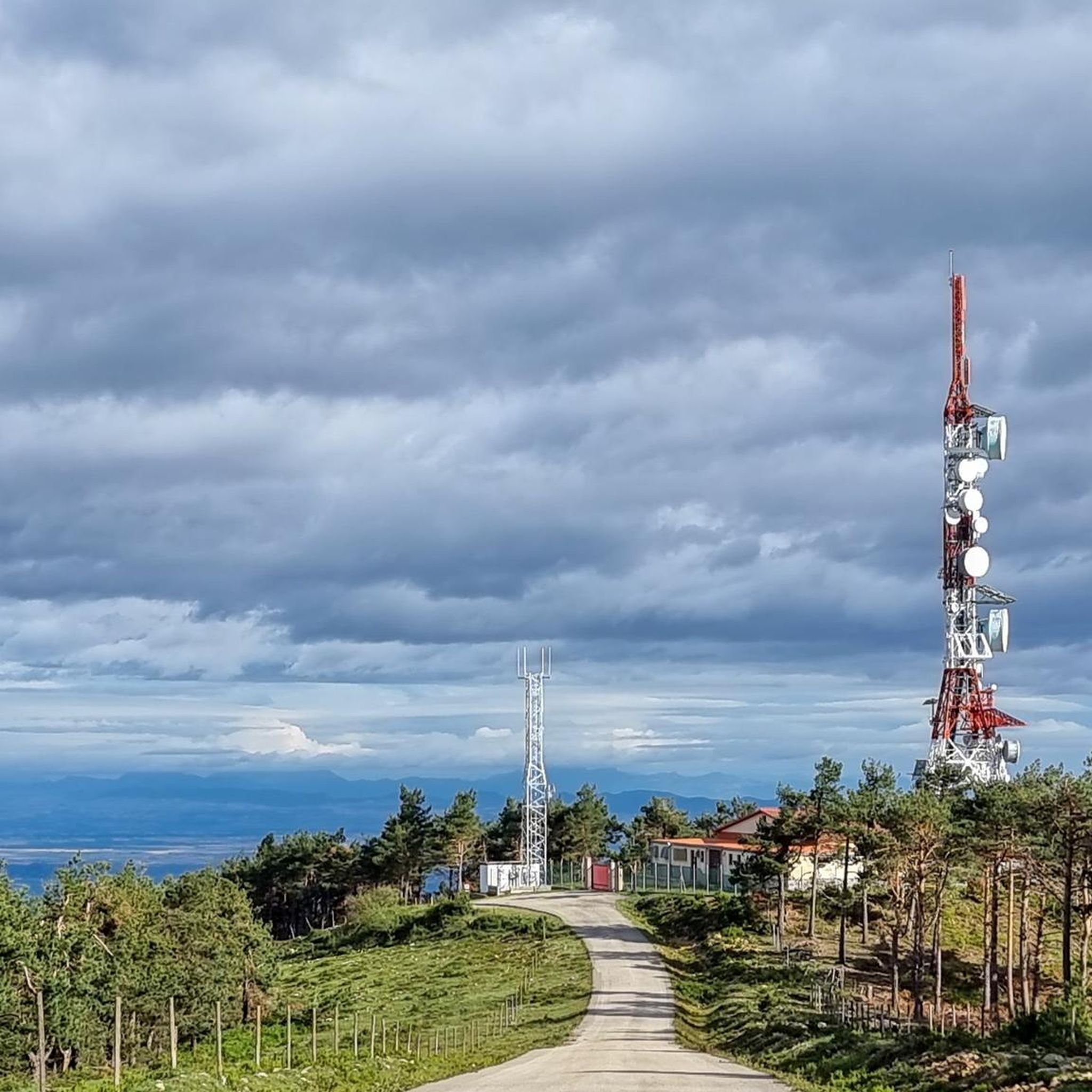
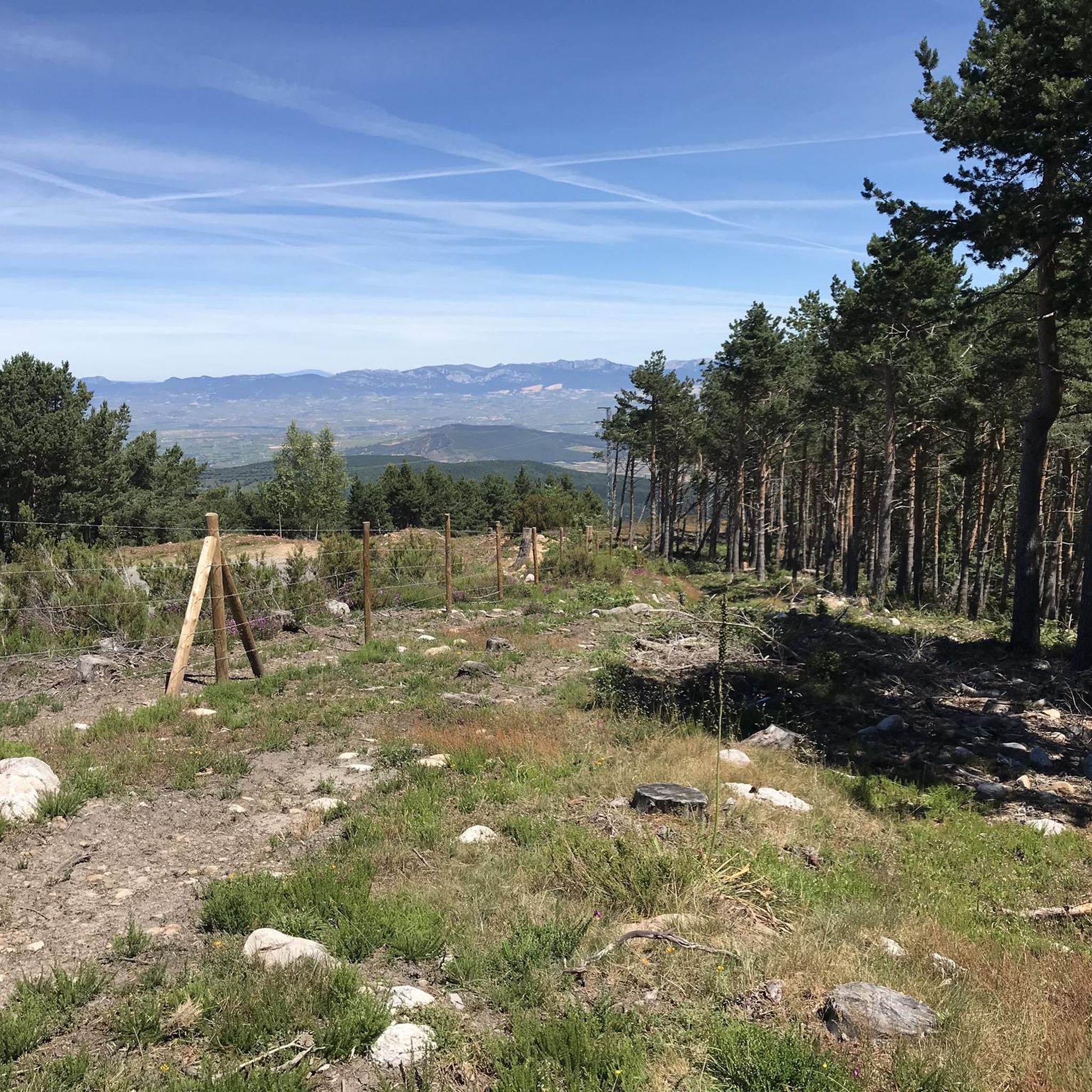
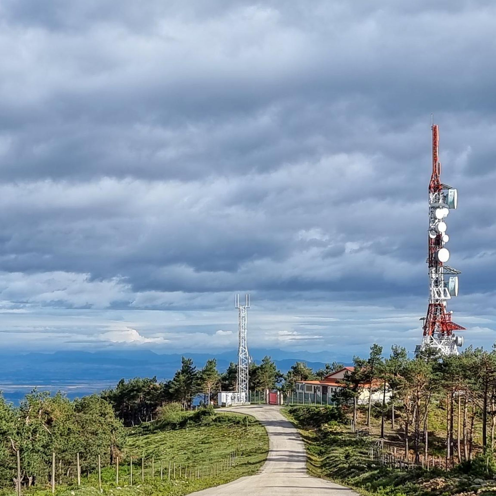
The Alto de Moncalvillo is located on the Las Neveras trail, where the old snow wells were. It is also the entry point to the ridge of the surrounding mountains and a privileged viewpoint.
0
0

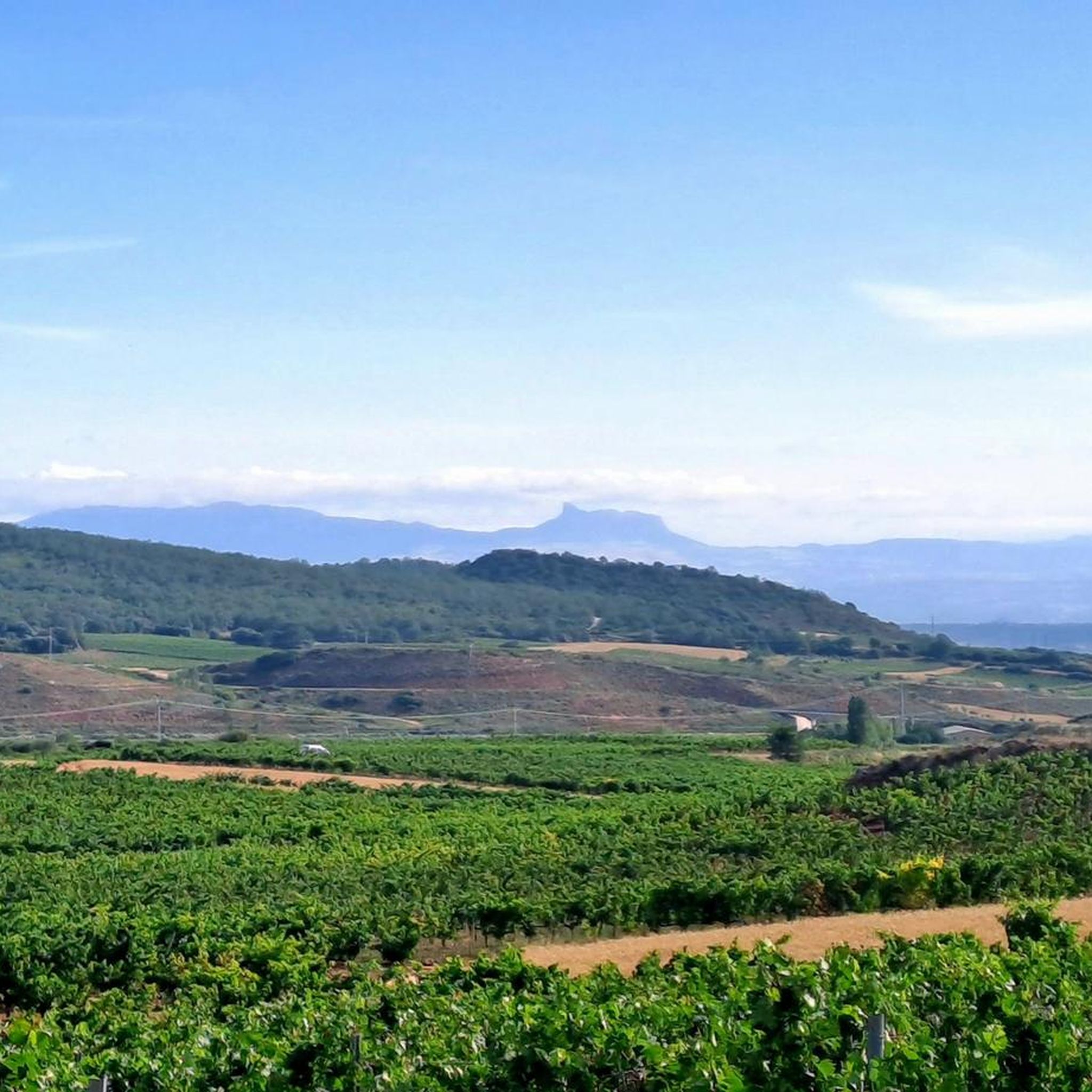
A beautiful village in the Sierra Riojana mountains. From here, you can take many hikes through the surrounding forests.
0
0

On the Komoot map it is also called Cerro de las 3 Villas.
3
0
First of the mountain signs. The other is just over 100 meters away.
3
0
The highest peak in the surrounding area. It's worth the climb.
3
0

Small and quiet town located in the valley of the Yalde river, in the Rioja Alta, with a beautiful wooded environment that surrounds the entire population. The town is located at an altitude of 967 meters, near the Yalde reservoir. It is believed that Castroviejo played an important role as a supplier of fuel from firewood, as well as supplying clay and water.
3
0

Daroca Castle is a modest peak in the Moncalvillo area separated and isolated from the mountain range where the main peaks are found. The route is an easy and short walk.
1
0
Located in the center of the urban area, this beautiful church is from the 16th century. The buttresses prop up the church and give the pointed tower a strange feeling of slenderness in keeping with the landscape.
1
0
Frequently Asked Questions
How many hiking trails are available around Santa Coloma?
There are over 60 hiking routes available around Santa Coloma, offering a wide range of experiences. These include 28 easy trails, 29 moderate routes, and 10 more challenging options, ensuring something for every skill level.
What kind of terrain can I expect on hikes in Santa Coloma?
Hiking around Santa Coloma is characterized by its diverse landscape, featuring rolling hills and mountainous terrain. You'll encounter significant elevation changes on many routes, with a mix of forested areas and open spaces. The region's topography supports everything from gentle strolls to more demanding mountain hikes.
Are there any easy hikes suitable for beginners or families in Santa Coloma?
Yes, Santa Coloma offers several easy hikes perfect for beginners or families. One notable option is the Las Neveras Ice Pits – LasNeveras loop from Serradero, which is just over 6 km long and features an elevation gain of under 200 meters, making it a pleasant and accessible walk.
What do other hikers enjoy most about the trails in Santa Coloma?
The trails in Santa Coloma are highly rated by the komoot community, with an average score of 4.5 stars from over 100 reviews. Hikers often praise the varied terrain, the challenging ascents, and the expansive views of the surrounding area, particularly on routes like the Castroviejo – PiedraHincada(II) loop from Castroviejo.
Are there any circular hiking routes in Santa Coloma?
Yes, many of the trails around Santa Coloma are circular, allowing you to start and end at the same point. A popular example is the Moncalvillo and Las Neveras Loop, a challenging 27.3 km route that takes you through varied terrain with substantial elevation gain.
What are some challenging hikes for experienced hikers in Santa Coloma?
For experienced hikers seeking a challenge, the Moncalvillo and Las Neveras Loop is a difficult 27.3 km trail with significant elevation gain. Another demanding option is the Castroviejo – PiedraHincada(II) loop from Castroviejo, a 16.4 km path known for its substantial climbs and rewarding views.
Are there any natural attractions or viewpoints to discover along the trails?
Yes, the region around Santa Coloma offers several natural attractions and viewpoints. You can explore natural monuments like the Red Rocks of Nájera or the unique Los Peñuejos Rock Formations. For panoramic views, consider routes that lead to summits such as Alto de Moncalvillo or Serradero.
What is the best time of year to go hiking in Santa Coloma?
The varied terrain of Santa Coloma makes it suitable for hiking across different seasons. While specific recommendations depend on the trail's elevation and exposure, spring and autumn generally offer pleasant temperatures and beautiful scenery. Some higher elevation routes might be more challenging in winter due to snow, while lower trails remain accessible.
Are there any moderate hikes in Santa Coloma?
Absolutely. Santa Coloma has 29 moderate routes. A good example is the PiedraHincada(I) – PiedraHincada(II) loop from Castroviejo, an 13.5 km trail that takes about 4 hours 8 minutes to complete, leading through hilly landscapes. Another moderate option is the Castroviejo – CocoteDeLaRisca loop from Castroviejo, covering 10.3 km.
What kind of historical points of interest can be found on hikes in Santa Coloma?
Many routes in Santa Coloma lead through areas with historical significance. While specific historical sites vary by trail, the region's hiking experience is often defined by its connection to local history, offering glimpses into past landscapes and traditional uses of the land. The presence of 'Las Neveras' (ice pits) in some route names, like the Moncalvillo and Las Neveras Loop, suggests historical elements related to ice harvesting.
What should I bring for hiking in Santa Coloma?
Given the diverse terrain and potential for significant elevation changes, it's advisable to bring appropriate hiking footwear, sufficient water, and layers of clothing to adapt to changing weather conditions. For longer or more challenging routes, consider bringing snacks, a map or GPS device, and sun protection. Always check the specific trail conditions before you go.
Most popular routes around Santa Coloma
Most popular attractions around Santa Coloma

Get inspired with the komoot mobile app


Explore more
Browse the best Hikes in other regions.
