The best walks and hikes around Allepuz
4.5
(10)
79
hikers
16
hikes
Hiking around Allepuz offers exploration of a mountainous region situated at an altitude of 1474 meters in the Maestrazgo area of Teruel, Spain. The landscape features dramatic topography with "cinglos" (cliffs) to the east and prominent peaks such as Morrón (1889m), Zaragozana (1911m), and Nave (1975m). The Sollavientos river carves a significant valley, contributing to the area's rugged beauty, and the region is part of the Maestrazgo Geopark, known for its unique geological formations, deeply embedded ravines, and sharp ridges.
…Last updated: June 28, 2026
4.62km
01:41
300m
300m
Easy hike. Great for any fitness level. Easily-accessible paths. Suitable for all skill levels.
24
hikers
6.44km
01:51
160m
160m
Easy hike. Great for any fitness level. Easily-accessible paths. Suitable for all skill levels.

Sign up for free
4.6
(5)
13
hikers
Moderate hike. Good fitness required. Easily-accessible paths. Suitable for all skill levels.
9
hikers
Hard hike. Very good fitness required. Easily-accessible paths. Suitable for all skill levels.
7
hikers
14.3km
04:26
560m
560m
Moderate hike. Good fitness required. Easily-accessible paths. Suitable for all skill levels.
Get access to more routes and recommendations from other explorers.
Sign up for free
Already have an account?
Our route recommendations are based on thousands of hikes, rides, and runs completed by other people on komoot.
Start today with a free account
Your next adventure awaits.
Login or Signup

Tips from the Community

Viewpoint at the geodetic point. Stone turret with iron ladder that allows you to climb over the tree line to enjoy the views.
0
0

The Mirador de Peñarroya is a panoramic viewpoint located in the Matarraña region, in the province of Teruel. The trail is part of the PR-TE 157 circular route, suitable for families. If you are in the area, you can also explore other viewpoints such as El Peñón, which offers impressive panoramic views of Peñarroya and the Alto Valle del Guadiato. Happy hiking! 🚶♀️🌄🌞
8
0
It is located southwest of Collado de la Gitana, accessible via a dirt track and surrounded by forests. If you are interested in exploring the area, you can consider the LA CHAPARRILLA REFUGIO – FUEN ROYA – LAS LAVADERAS WATERFALL Route. This hiking route will take you through impressive landscapes in the Hoya del Colmillo region, Aragon. Enjoy nature and tranquility in this beautiful corner of Spain! 🏞️
8
0

Located in the Sierra de Gúdar and very close to the Valdelinares ski resort, we find this mountain refuge at an altitude of more than 1800 meters next to the path (GR 8) and the passing area of the popular bikepacking route Montañas Vacías . We will find a fireplace for the colder winter months.
2
0
We are at the top of Peñarroya, so we can say that we have reached the highest altitude in the province of Teruel located at 2023 meters above sea level, which is located a few kilometers from the Valdelinares ski resort. From here we will have very nice views of the entire valley and the interior of Teruel. We will find a tower that will allow us to climb above 2028 meters and be able to have 360 degree panoramic views without obstacles ahead.
1
0

In the Sierra de Gúdar and very close to the Valdelinares ski station is this mountain refuge at more than 1800 meters above sea level. Located next to the GR 8 long-distance trail and the Montañas Vacías bikepacking route, its location is very strategic and it has a fireplace for the cold months and is in acceptable condition.
4
1
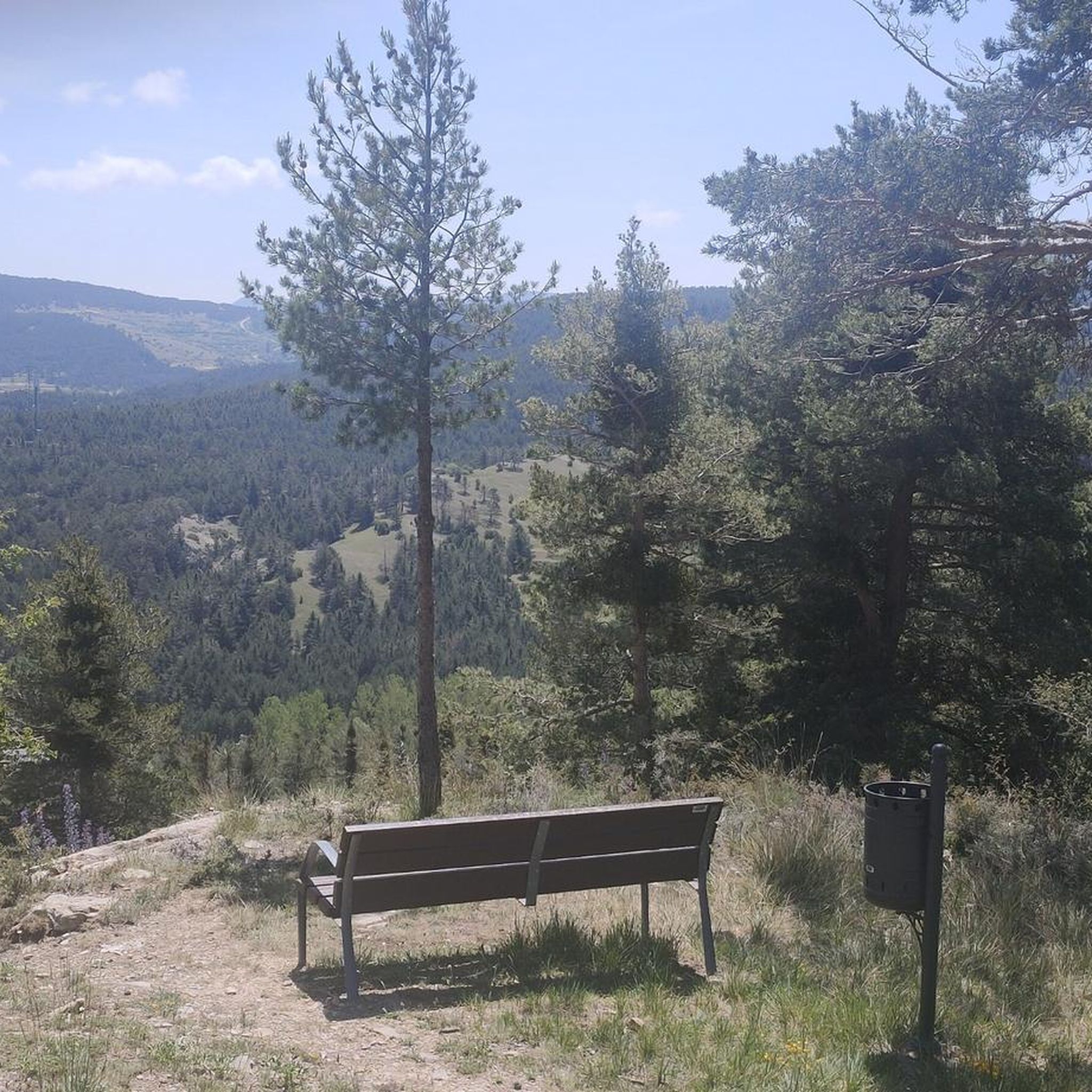
A few kilometers from the Valdelinares ski resort is this panoramic point with very beautiful views of the entire valley and the interior of Teruel. The built turret allows you to climb above 2028 meters above sea level from the top and be able to have 360-degree panoramic views without obstacles ahead.
4
1

Easy and accessible to get to. Go up to the vertex not suitable for people with vertigo.
2
1
Frequently Asked Questions
What kind of terrain can I expect when hiking around Allepuz?
Allepuz is situated in a mountainous region at 1474 meters altitude, characterized by dramatic topography. You'll encounter 'cinglos' (cliffs) to the east, prominent peaks like Morrón (1889m) and Zaragozana (1911m), and the Sollavientos river carving significant valleys. The area is part of the Maestrazgo Geopark, featuring unique geological formations, deeply embedded ravines, sharp ridges, and vertical escarpments. Some areas have scarce tree vegetation, which can be challenging in certain weather conditions, while others offer pleasant picnic spots and hazelnut tree-covered hillsides.
Are there any easy hiking trails suitable for beginners in Allepuz?
Yes, Allepuz offers several easy hiking options. For instance, the Pico Peñarroya via Maestrazgo Trail (GR 8) is an easy 4.6 km route that takes about 1 hour 41 minutes to complete. Another accessible option is the Peñarroya Summit Viewpoint loop from Alto de la Gitana, an easy 6.4 km path offering great views.
What are some notable natural landmarks or viewpoints to see on a hike?
The region is rich in natural wonders. You can explore fascinating geological formations like the Cueva de la Buina and the Chimeneas de hadas (fairy chimneys). The Peñarroya Summit and Observation Tower offers panoramic views. The Sollavientos river valley itself is very scenic, and you can find picnic areas near the Molino del Tormagal. The 'cinglos' (cliffs) to the east and the peaks of Zaragozana and Hornillo also provide impressive vistas.
Are there any circular hiking routes available around Allepuz?
Yes, there are several circular routes. A popular choice is the Peñarroya Summit Viewpoint loop from Alto de la Gitana, an easy 6.4 km path. For a slightly longer option, consider the La Chaparrilla Refuge – Peñarroya Summit Viewpoint loop from estación esquí Valdelinares, which is 9.5 km and takes about 2 hours 55 minutes.
What historical or cultural sites can I visit while hiking in Allepuz?
Allepuz and its surroundings offer several points of cultural interest. The La Chaparrilla Refuge is a notable spot. You can also hike the Camino de los Pilones, a path declared of Cultural Interest that connects Allepuz with Villarroya de los Pinares. Along the trails, you might encounter the remote medieval hermitage of Santa Isabel de Sollavientos. The town itself features historic mansions from the 17th and 18th centuries, and the Church of the Purification (1771).
Can I find trails suitable for families with children?
While specific 'family-friendly' designations are not detailed, the easier routes around Allepuz, such as the Pico Peñarroya via Maestrazgo Trail (GR 8) (4.6 km, easy) or the Peñarroya Summit Viewpoint loop from Alto de la Gitana (6.4 km, easy), could be suitable for families looking for less strenuous walks. The unique geological formations and potential for spotting dinosaur footprints nearby could also add an exciting element for children.
What do other hikers say about the trails in Allepuz?
The hiking routes in Allepuz are highly rated by the komoot community, with an average score of 4.4 stars from more than 5 reviews. Hikers often praise the varied terrain, from easy paths to more challenging ascents, and the stunning natural landscapes within the Maestrazgo Geopark.
Are there any long-distance hiking options or multi-day treks in the area?
Allepuz is part of the Maestrazgo region, which boasts about 400 kilometers of marked trails, including sections of the long-distance Maestrazgo Trail (GR 8). While specific multi-day treks starting directly from Allepuz are not detailed, the extensive network of trails provides ample opportunity for longer excursions by connecting various routes.
What is the best season for hiking in Allepuz?
Given its altitude of 1474 meters and mountainous terrain, spring and autumn generally offer the most pleasant hiking conditions with milder temperatures. Summer can be warm, especially in areas with scarce tree cover, while winter hiking is possible but may require appropriate gear due to potential snow and colder temperatures, particularly on higher peaks like Zaragozana and Hornillo.
Are there any places to eat or stay in Allepuz after a hike?
Allepuz offers some amenities for visitors. The town has historic mansions, including the Casa Grande which now functions as a guesthouse. You can also find 'merenderos' (picnic areas) along the Sollavientos river, perfect for a packed lunch. For more specific dining options, it's advisable to check local listings in Allepuz itself.
What are the options for parking when accessing hiking trails in Allepuz?
While specific parking locations for each trail are not detailed, many routes, especially those starting from Allepuz town or nearby points like Alto de la Gitana or estación esquí Valdelinares, typically have designated or informal parking areas. It's generally recommended to check the starting point of your chosen route for the most convenient parking.
Most popular attractions around Allepuz

Get inspired with the komoot mobile app


Explore more
Browse the best Hikes in other regions.
