The best MTB trails around Lliçà De Vall
4.3
(1901)
14,816
riders
324
rides
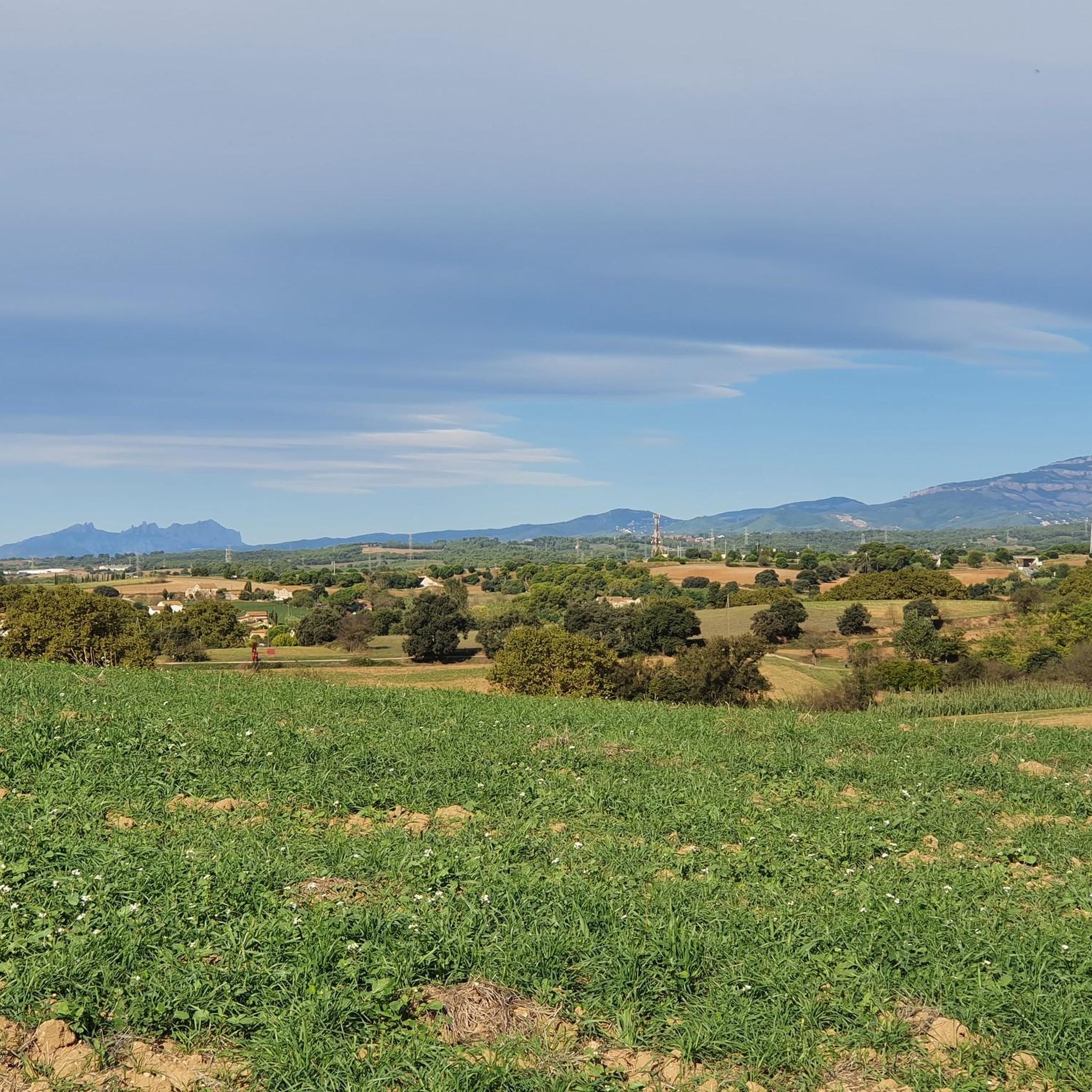
Mountain biking around Lliçà De Vall offers diverse natural landscapes, accessible terrain, and a network of routes suitable for various skill levels. The region is characterized by a blend of agricultural fields, pine, oak, and cork oak forests, alongside gentle elevations and numerous waterways. These features create an environment for mountain bike trails that are either flat or slightly undulating, making them accessible for different fitness levels.
Best mountain bike trails around Lliçà De Vall
- The most popular mountain bike…
Last updated: August 25, 2026
4.6
(93)
213
riders
Moderate mountain bike ride. Good fitness required. Suitable for all skill levels.
4.0
(27)
170
riders
41.2km
03:15
670m
670m
Moderate mountain bike ride. Good fitness required. Suitable for all skill levels.

Sign up for free
4.1
(23)
143
riders
35.2km
02:39
530m
530m
Moderate mountain bike ride. Good fitness required. Suitable for all skill levels.
4.2
(11)
126
riders
Hard mountain bike ride. Good fitness required. Advanced riding skills necessary. Some portions of the route may require you to push your bike.
4.5
(15)
104
riders
67.0km
05:37
1,100m
1,100m
Hard mountain bike ride. Very good fitness required. Suitable for all skill levels.
Get access to more routes and recommendations from other explorers.
Sign up for free
Already have an account?
Our route recommendations are based on thousands of hikes, rides, and runs completed by other people on komoot.
Start today with a free account
Your next adventure awaits.
Login or Signup
Tips from the Community

Pont de la R3 de rodalies sobre el riu Congost i l'antiga carretera de Vic fins al Figaró.
0
0
Camí i corriol paral·lel al riu Congost que permet anar des de la Garriga fins al Figaró sense tocar l'autovia, amb gravel o btt. Atenció als guals, amb pluja és difícil passar-hi.
0
0
Camí paral·lel al riu Congost que permet anar des de La Garriga fins al Tagamanent sense haver de passar per l'autovia, nomes gravel o btt.
0
0

Good place for lunch and breakfast.
0
0

The large Cànoves reservoir, built in the 1980s on the former agricultural valley that was submerged. In addition to its function as a water reserve, there is a little-discussed detail: under its waters still lie the remains of terraces, old paths and some dry stone walls that can only be glimpsed in periods of extreme drought. During construction, springs and water mines were diverted that still drain the area. Access is easy, the perimeter path is gentle and the closed valley creates a characteristic silence that accompanies the entire tour. A perfect point to understand how this corner of Montseny went from an inhabited valley to a peaceful lake.
0
0
Located at a strategic point between La Garriga and Figaró. In addition to the legend of Louis the Pious, what stands out is its practical use: for centuries it was a stop for the porters who came down from Montseny loaded with coal and firewood. There they would dismount their horses, have a drink and leave small offerings to Saint Christopher, patron saint of travelers. Until the 1940s it was common to find horseshoes hanging there as protection. The esplanade still maintains the atmosphere of a place of passage and a place to rest before continuing on their journey.
1
0
Beyond the green and open route that everyone knows, this space occupies old areas of cultivation and wet meadows that, until the 1970s, served as pasture for the livestock of several farmhouses in the area. Even today, under some unevenness in the terrain, you can sense the old layout of the fields and dry stone banks. During its construction, some traditional water channels were respected, which continue to drain part of the subsoil. Access is easy and the environment maintains that combination of plain and forest typical of the foot of Montseny. A place where the agricultural past still rears its head if you pay a little attention.
0
0
This holm oak tree served for decades as a reference tree to mark the boundary between various properties in the area, a common custom before there were clear plans. Some elderly residents remember that, in the mid-20th century, the first meetings were held there to organize the cleaning of the roads before the rainy season. The point continues to be the natural beginning of the route towards the old road from Granollers to Cardedeu, with a flat and obvious access. A tree that, more than a century old, is a living memory of the territory.
0
0
Frequently Asked Questions
How many mountain bike trails are available in Lliçà De Vall?
Lliçà De Vall offers a wide selection of mountain bike trails, with over 320 routes available. These range from easy paths suitable for beginners to more challenging routes for experienced riders.
What are the difficulty levels of mountain bike trails in Lliçà De Vall?
The trails in Lliçà De Vall cater to all skill levels. You'll find approximately 66 easy routes, 141 moderate routes, and 120 difficult routes, ensuring there's something for everyone from casual riders to advanced mountain bikers.
Are there any family-friendly mountain bike trails in Lliçà De Vall?
Yes, Lliçà De Vall is known for its accessible terrain, with many routes that are flat or slightly undulating. The presence of agricultural fields and gentle elevations makes it suitable for families looking for an enjoyable ride. Look for the 'easy' rated trails for the most family-friendly options.
What kind of terrain can I expect on mountain bike trails around Lliçà De Vall?
You can expect diverse terrain, including agricultural fields, pine, oak, and cork oak forests, and gentle elevations. The area is also enriched by numerous streams and torrents, contributing to a varied and scenic riding experience.
What are some notable natural features or landmarks I can see while mountain biking in Lliçà De Vall?
While riding, you can explore areas with pine, oak, and cork oak forests, and enjoy the picturesque streams and torrents. For a cultural touch, consider visiting the well-preserved Dolmen of the Roca d'en Toni. You might also pass by the Parpers Pass, known for its scenic pine and holm oak forests.
Are there any viewpoints along the mountain bike routes in Lliçà De Vall?
Yes, some routes offer excellent panoramic views. For instance, the path leading from Can Farell to Can Buixó hill provides scenic wooded areas and natural viewpoints. Additionally, the nearby La Coscollada Observation Tower offers breathtaking views extending to the Pyrenees, Montseny, and the Mediterranean Sea.
What do other mountain bikers enjoy most about Lliçà De Vall?
The area is highly rated by the komoot community, with an average score of 4.4 stars from over 1,500 reviews. Riders often praise the diverse natural landscapes, the blend of forests and open fields, and the accessibility of routes for various skill levels.
Are there any long-distance mountain bike routes for advanced riders?
Yes, for advanced riders seeking a longer challenge, the Vallforners Reservoir – Vallforners Reservoir loop from Parets del Vallès is a difficult route spanning approximately 67.6 km with over 1100 meters of elevation gain, typically taking around 5 hours and 39 minutes to complete.
Can I find mountain bike routes that follow rivers or waterways?
Absolutely. Lliçà De Vall is nestled within the Tenes River valley, and several routes incorporate waterways. For example, the Alzina de Can Valls – Congost River loop from Granollers - Canovelles follows the Congost River, offering scenic views along its banks.
What is the best time of year for mountain biking in Lliçà De Vall?
The region's pleasant environment, characterized by forests and waterways, makes it suitable for outdoor pursuits throughout the year. However, spring and autumn generally offer the most comfortable temperatures for mountain biking, avoiding the peak heat of summer or potential chill of winter.
Are there any circular mountain bike routes available?
Yes, many of the mountain bike trails in Lliçà De Vall are designed as loops, allowing you to start and finish in the same location. Examples include the Vallforners Reservoir – Vallforners Reservoir loop from Granollers - Canovelles and the Mirador del Puig del Castell – Riu Congost Greenway loop from Granollers - Canovelles.
Are there any routes that pass by historical sites?
Yes, you can combine your ride with a visit to historical sites. The Dolmen of the Roca d'en Toni is a well-preserved megalithic monument that can be incorporated into your mountain biking adventure, offering a blend of nature and history.
Most popular routes around Lliçà De Vall
Most popular attractions around Lliçà De Vall

Get inspired with the komoot mobile app


Explore more
Browse the best MTB trails in other regions.
