The best road cycling routes around Peralveche
66
riders
8
rides
Road cycling around Peralveche, situated in the Alcarria region of Guadalajara, Spain, offers routes through diverse landscapes. The area features extensive pine forests, picturesque valleys, and distinctive limestone formations such as the Tetas de Viana and Peña del Arco. Situated at an altitude of 1111 meters (3645 feet), the region provides routes with significant elevation changes, appealing to cyclists seeking challenging ascents and descents. Proximity to the Alto Tajo Natural Park further enhances the natural beauty and varied terrain available for road cycling.
Best road cycling routes around Peralveche
- The most popular road cycling route is From the Lands of Alcarreria to, a 41.4 miles (66.6 km) trail that takes about 3 hours 8 minutes to complete. This moderate route traverses the scenic Alcarria region, offering views of the characteristic landscape.
- Another top favourite among local road cyclists is Cifuentes – Entrepeñas Viaduct loop from Mantiel, a difficult 75.7 miles (121.8 km) path. This challenging route includes substantial elevation gain, passing through varied terrain and offering distant views of the Entrepeñas Viaduct.
- Local road cyclists also love the Salmerón loop from Castilforte, a 47.1 miles (75.9 km) trail leading through valleys and forests, often completed in about 3 hours 27 minutes.
- Road cycling around Peralveche is defined by pine forests, valleys, and limestone formations, with routes offering considerable elevation changes. The network includes options for both moderate and difficult ability levels.
- The guide includes highly-rated routes that showcase the best of the region's landscape. More than 60 road cyclists have used komoot to explore Peralveche's varied terrain.
Last updated: May 10, 2026
5
riders
66.6km
03:08
840m
840m
This moderate 41.4-mile mountain biking route from Peralveche explores the Tierras de Alcarreria and Serrania de Cuenca, featuring challengi
16
riders
121km
05:47
1,660m
1,660m
Hard road ride. Very good fitness required. Mostly well-paved surfaces and easy to ride.

Sign up for free
6
riders
75.9km
03:28
840m
840m
Moderate road ride. Good fitness required. Some segments of this route may be unpaved and difficult to ride.
5
riders
37.5km
01:47
440m
440m
Moderate road ride. Good fitness required. Mostly well-paved surfaces and easy to ride.
Get access to more routes and recommendations from other explorers.
Sign up for free
Already have an account?
Our route recommendations are based on thousands of hikes, rides, and runs completed by other people on komoot.
Start today with a free account
Your next adventure awaits.
Login or Signup
Popular around Peralveche

Tips from the Community

First checkpoint on the route from Madrid to Barcelona. In the main square we find places to get supplies and rest.
0
0

Beautiful town in Alto Tajo with exceptional landscapes.
0
0
Muslim castle built on a firm rock. Impregnable. for the defense of the Tagus River.
0
0

The parish church of Nuestra Señora de la Asunción is the main monument in Valdeolivas, declared a Bien de Interés Cultural in 1982. It is a Romanesque temple of the XII-XIII siglos with a beautiful tower.
1
0

The parish church of Nuestra Señora de la Asunción is the main monument of Valdeolivas. It is a Romanesque temple from the 12th-13th centuries that has a beautiful tower.
1
0

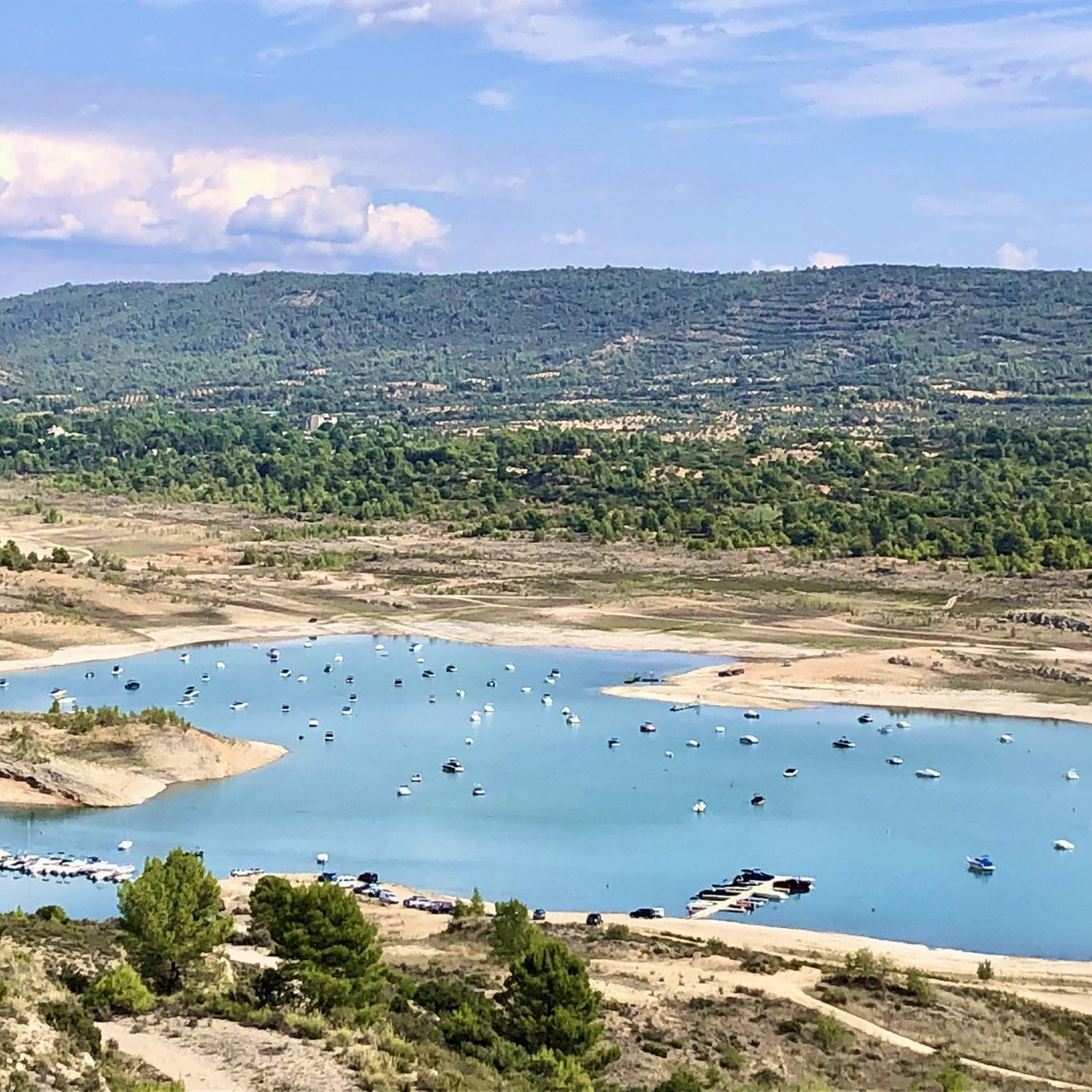
The Entrepeñas viaduct is an impressive construction that allows you to cross this reservoir located in the bed of the Tagus River.
1
0
The Valtablado del Río bridge crosses the waters of the Tagus in an area full of poplars. The great width and shallowness of the river, added to the shade provided by the trees, creates a privileged bathing area on hot days.
2
0

Magnificent arched viaduct built over the Tagus River and the Entrepeñas Reservoir.
1
0
Frequently Asked Questions
How many road cycling routes are available around Peralveche?
There are 8 road cycling routes around Peralveche listed on komoot. These routes offer diverse experiences through the region's landscapes, from moderate to difficult.
What kind of terrain can I expect on road cycling routes near Peralveche?
Road cycling around Peralveche features significant elevation changes, with routes traversing extensive pine forests, picturesque valleys, and distinctive limestone formations. You'll encounter both challenging ascents and exhilarating descents, making it suitable for cyclists seeking varied terrain.
Are there any challenging road cycling routes for experienced riders?
Yes, Peralveche offers routes with substantial elevation gain for experienced riders. For example, the Cifuentes – Entrepeñas Viaduct loop from Mantiel is a difficult 121.8 km path with over 1600 meters of elevation gain, offering a demanding ride through varied terrain.
Can I find moderate road cycling routes around Peralveche?
Absolutely. Several moderate routes are available, perfect for those looking for a balanced challenge. The From the Lands of Alcarreria to route is a popular moderate option, covering 66.6 km and traversing the scenic Alcarria region.
What natural landmarks can I see while road cycling near Peralveche?
The region is rich in natural beauty. You can expect to see prominent landmarks like the distinctive twin limestone mountains of Tetas de Viana (1,145 m), offering panoramic views. The unique natural rock arch of Peña del Arco is another geological highlight. Some routes also offer distant views of the Entrepeñas Reservoir.
Are there any circular road cycling routes starting near Peralveche?
Yes, there are several circular routes. The Salmerón loop from Castilforte is a 75.9 km circular trail that leads through valleys and forests. Another option is the Alcantud – El Recuenco Start loop from Peralveche, a moderate 37.5 km loop.
What is the best time of year for road cycling in Peralveche?
The Alcarria region, where Peralveche is located, generally offers pleasant conditions for cycling during spring and autumn. These seasons typically provide milder temperatures, making long rides through the forests and valleys more comfortable. Summer can be hot, while winter may bring colder temperatures and occasional precipitation.
What do other road cyclists appreciate about the routes in Peralveche?
Road cyclists using komoot often praise the varied terrain, the tranquility of the pine forests, and the scenic views of the Alcarria landscape. The routes are appreciated for their mix of challenging climbs and rewarding descents, providing a stimulating experience for over 60 komoot users who have explored the area.
Are there any viewpoints along the road cycling routes?
Many routes offer scenic viewpoints due to the region's elevated terrain. The area around the Tetas de Viana provides breathtaking panoramic views of the Alcarria Alta, Serranía de Guadalajara, and even the distant Sierra de Guadarrama. The View of Mantiel and the Entrepeñas Reservoir is another notable viewpoint.
What is the average distance and elevation gain for road cycling routes in this area?
The road cycling routes around Peralveche vary significantly. Distances range from approximately 37 km to over 120 km. Elevation gains can be substantial, with moderate routes typically featuring around 800-1000 meters of ascent, while difficult routes can exceed 1600 meters of elevation gain.
Is Peralveche a good starting point for exploring the Alto Tajo Natural Park by road bike?
Peralveche serves as a gateway to the Alto Tajo Natural Park. While specific road cycling routes directly into the park's deepest interior may be limited, the surrounding roads offer challenging rides through similar dramatic landscapes of canyons, gorges, and vast pine forests, characteristic of the broader Alto Tajo region.
Are there any routes that pass by lakes or reservoirs?
Yes, some routes offer views of the region's water bodies. The Cifuentes – Entrepeñas Viaduct loop from Mantiel provides distant views of the Entrepeñas Reservoir. This reservoir is a significant feature in the landscape and can be a scenic point along your ride.
Most popular routes around Peralveche
Most popular attractions around Peralveche

Get inspired with the komoot mobile app


Explore more
Browse the best Road cycling routes in other regions.
