The best MTB trails around Olmillos De Castro
5.0
(4)
130
riders
11
rides
Mountain bike trails around Olmillos De Castro are found within the province of Zamora, offering access to the Sierra de la Culebra. This region features a landscape of soft, rounded relief with undulating mountains reaching around 1,000 meters. Cyclists can traverse diverse ecosystems, including extensive pine, oak, and chestnut forests, alongside valleys and streams formed by rivers like the Aliste. The terrain provides a mix of challenging climbs and enjoyable descents.
Best mountain bike trails around Olmillos De Castro
- The…
Last updated: August 22, 2026
Moderate mountain bike ride. Good fitness required. Advanced riding skills necessary.
5.0
(2)
45
riders
63.5km
05:44
930m
930m
Hard mountain bike ride. Very good fitness required. Suitable for all skill levels.

Sign up for free
10
riders
31.4km
02:46
410m
410m
Moderate mountain bike ride. Good fitness required. Suitable for all skill levels.
8
riders
29.8km
02:35
320m
320m
Moderate mountain bike ride. Good fitness required. Suitable for all skill levels.
5
riders
32.9km
02:59
480m
480m
Moderate mountain bike ride. Good fitness required. Suitable for all skill levels.
Get access to more routes and recommendations from other explorers.
Sign up for free
Already have an account?
Our route recommendations are based on thousands of hikes, rides, and runs completed by other people on komoot.
Start today with a free account
Your next adventure awaits.
Login or Signup
Popular around Olmillos De Castro

Tips from the Community

The Aliste River is a watercourse that originates in the Sierra de la Culebra, in the district of San Pedro de las Herrerías, in the province of Zamora, Spain. Along its route, it passes through the towns that make up the valley of the region that bears its name. Some of these towns include Mahíde, Las Torres de Aliste, Pobladura de Aliste, Palazuelo de las Cuevas, San Vicente de la Cabeza, Bercianos de Aliste, Flores de Aliste, Gallegos del Río, Domez, Vegalatrave, Vide de Alba, El Castillo de Alba, and finally reaches Carbajales de Alba.
1
0

From the top of this small town located at the top of one of the terraces that the Río Aliste has created, we can see perfectly this river crossing and the same bridge that helps to cross on foot to the other side of the stream.
0
0
To the north of the Sierra de Cantadores we find this mountain range that is located along the banks of the Ricobayo Reservoir. Beautiful area of crowded areas.
0
0

A narrow bridge used by the locals to cross the ravine. The water level fluctuates drastically during the dry and wet seasons.
1
0
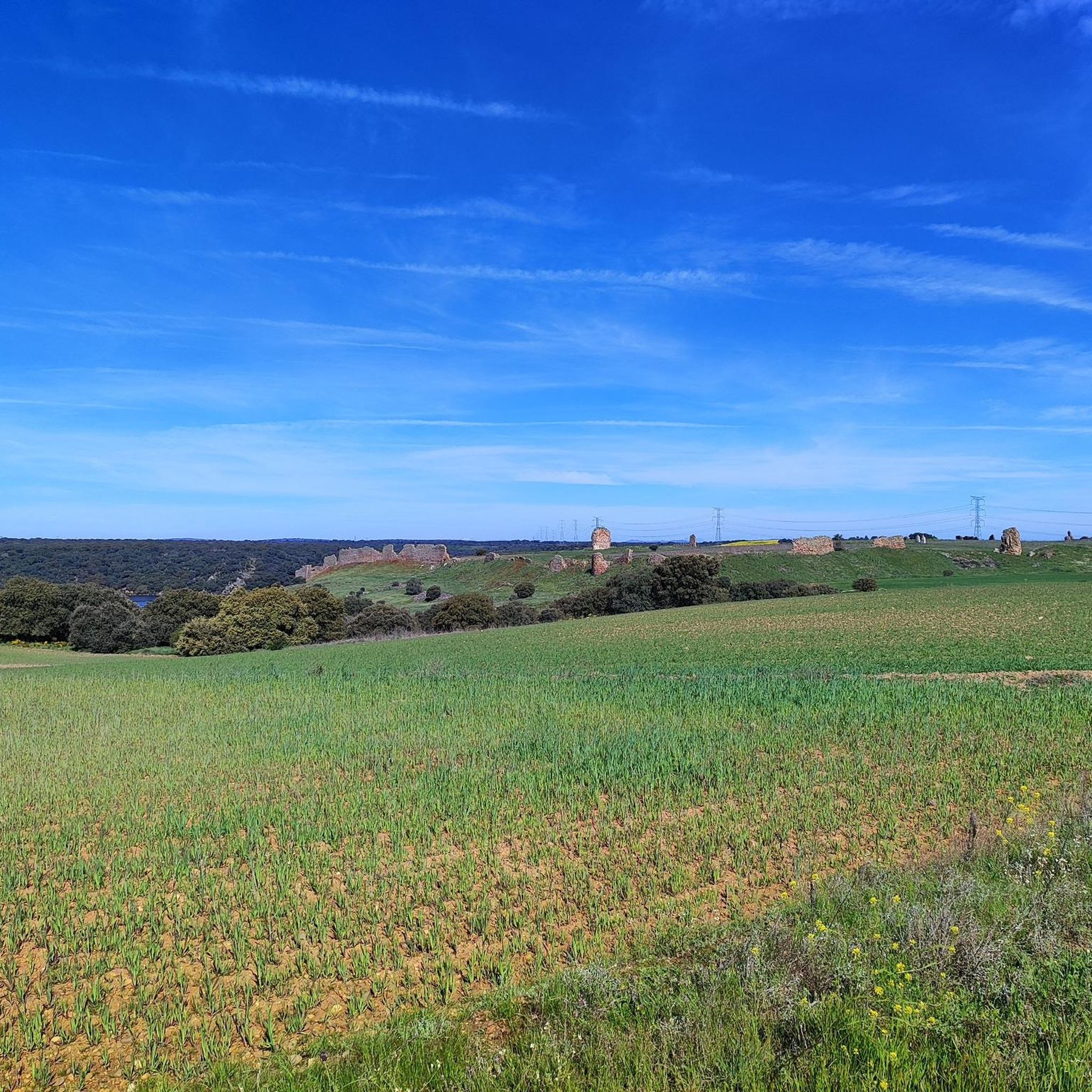
Fortress on a defensive hill that dominates the Aliste river. The ruined castle offers spectacular views of the river canyon.
1
0
The landscape can be completely different depending on the time of year you travel through this region. The Aliste river changes with the rainy season and could completely dry up around Vegalatrave.
2
0
The Valdoradas Bridge crosses the Esla River Reservoir on the ZA-911 road. During dry seasons, this section of the reservoir can dry up.
1
0

We will find beautiful panoramic views walking along the road near the Valdoradas bridge, surely on our route to the La Palia waterfall.
1
0
Frequently Asked Questions
How many mountain bike trails are available around Olmillos De Castro?
The area offers a good selection of mountain bike trails, with 9 routes currently listed on komoot. These routes cater to various skill levels, from moderate to difficult, allowing riders to explore the diverse landscapes of the Sierra de la Culebra.
What kind of terrain and difficulty can I expect on mountain bike trails near Olmillos De Castro?
The terrain around Olmillos De Castro, particularly in the Sierra de la Culebra, features a soft and rounded relief with undulating mountains reaching around 1,000 meters. You'll encounter a mix of challenging climbs and enjoyable descents through extensive pine, oak, and chestnut forests, as well as river valleys. Trails range from moderate, like the Riverbank of the Aliste River from Losacino, to difficult, such as the Perilla de Castro – Losacino Bridge loop.
Are there any family-friendly mountain bike trails near Olmillos De Castro?
While many trails in the region offer a good challenge, there is one easy mountain bike route available. For families looking for a more relaxed ride, consider exploring local tracks and less technical paths, keeping in mind the undulating nature of the Sierra de la Culebra.
What are some notable landmarks or natural features I can see while mountain biking in the area?
The trails often lead through picturesque natural settings, including extensive pine, oak, and chestnut forests, and along rivers like the Aliste. You can also encounter historical landmarks such as the Alba Castle and the Valdoradas Bridge. The region is also known for its abundant wildlife, including the Iberian wolf, deer, and wild boar.
Are there any circular mountain bike routes available around Olmillos De Castro?
Yes, many of the mountain bike routes in the area are circular, offering convenient starting and ending points. Examples include the moderate Riverbank of the Aliste River from Losacino — circular route via the Castle of Alba and the more challenging Valdoradas Bridge – Alba Castle loop from Carbajales de Alba.
What is the best time of year for mountain biking near Olmillos De Castro?
The Sierra de la Culebra region offers enjoyable mountain biking conditions for much of the year. Spring and autumn are generally ideal, with pleasant temperatures and vibrant natural scenery. The deer rutting season between mid-September and early October can also provide a remarkable natural spectacle for those riding during that time.
How long are the mountain bike trails around Olmillos De Castro?
Trail lengths vary significantly to suit different preferences and fitness levels. You can find routes ranging from shorter, moderate rides like the Losacino – Losacino Bridge loop from Carbajales de Alba, which is about 29.5 km, to longer, more challenging expeditions such as the Perilla de Castro – Losacino Bridge loop from Carbajales de Alba, spanning over 63.5 km.
Are there options for beginner mountain bikers in the Olmillos De Castro area?
While many routes feature moderate to difficult sections, there is one easy trail available, making it suitable for beginners or those looking for a less strenuous ride. It's advisable for beginners to choose shorter, less technical paths to get accustomed to the region's undulating terrain.
What should I bring for a mountain biking trip in Olmillos De Castro?
Given the varied terrain and potential for extensive rides through natural spaces, it's recommended to bring plenty of water, snacks, a repair kit, and appropriate safety gear. A GPS device or a pre-loaded komoot route on your phone is also highly advisable for navigation, especially in areas with wide natural spaces without human presence.
Can I find mountain bike rentals or support services in the wider Zamora province?
Yes, facilities like the Zamora Natural activity center in La Casa del Pueblo offer mountain bike rentals and GPS devices pre-loaded with local routes. This suggests a supportive infrastructure for outdoor enthusiasts visiting the wider Zamora province, including areas accessible from Olmillos de Castro.
Are there any particularly scenic mountain bike trails with good viewpoints?
The entire Sierra de la Culebra is known for its natural beauty, offering picturesque scenery through forests and river valleys. The undulating mountains provide various elevated points that can offer expansive views of the diverse ecosystems. Trails following riverbanks, such as those along the Aliste River, are particularly scenic.
What is the typical elevation gain on mountain bike trails around Olmillos De Castro?
The elevation gain varies significantly depending on the route's length and difficulty. For instance, a moderate route like the Riverbank of the Aliste River from Losacino involves around 609 meters of ascent, while more difficult trails, such as the Perilla de Castro – Losacino Bridge loop, can feature over 900 meters of climbing.
Most popular routes around Olmillos De Castro
Most popular attractions around Olmillos De Castro

Get inspired with the komoot mobile app


Explore more
Browse the best MTB trails in other regions.
