The best road cycling routes around Nogales
344
riders
33
rides
Road cycling around Nogales offers diverse terrain within its unique "sky island" geography, where mountain ranges rise from the desert floor. The region features rolling roadways and high rolling grasslands, providing varied ecosystems for cyclists. The landscape includes wooded hills and grasslands, contrasting with typical desert scenery. The Sonoran Desert environment also presents mixed-surface routes for road cyclists.
Best road cycling routes around Nogales
- The most popular road cycling route is View of Feria Castle – Dehesa Extremeña loop from…
Last updated: June 26, 2026
25
riders
60.2km
03:09
960m
960m
Hard road ride. Very good fitness required. Some segments of this route may be unpaved and difficult to ride.
22
riders
92.6km
04:43
1,590m
1,590m
Hard road ride. Very good fitness required. Mostly well-paved surfaces and easy to ride.

Sign up for free
19
riders
68.7km
03:18
930m
930m
Hard road ride. Very good fitness required. Mostly well-paved surfaces and easy to ride.
15
riders
112km
05:41
1,880m
1,880m
Hard road ride. Very good fitness required. Mostly well-paved surfaces and easy to ride.
14
riders
42.9km
02:15
760m
760m
Moderate road ride. Good fitness required. Mostly well-paved surfaces and easy to ride.
Get access to more routes and recommendations from other explorers.
Sign up for free
Already have an account?
Our route recommendations are based on thousands of hikes, rides, and runs completed by other people on komoot.
Start today with a free account
Your next adventure awaits.
Login or Signup
Tips from the Community

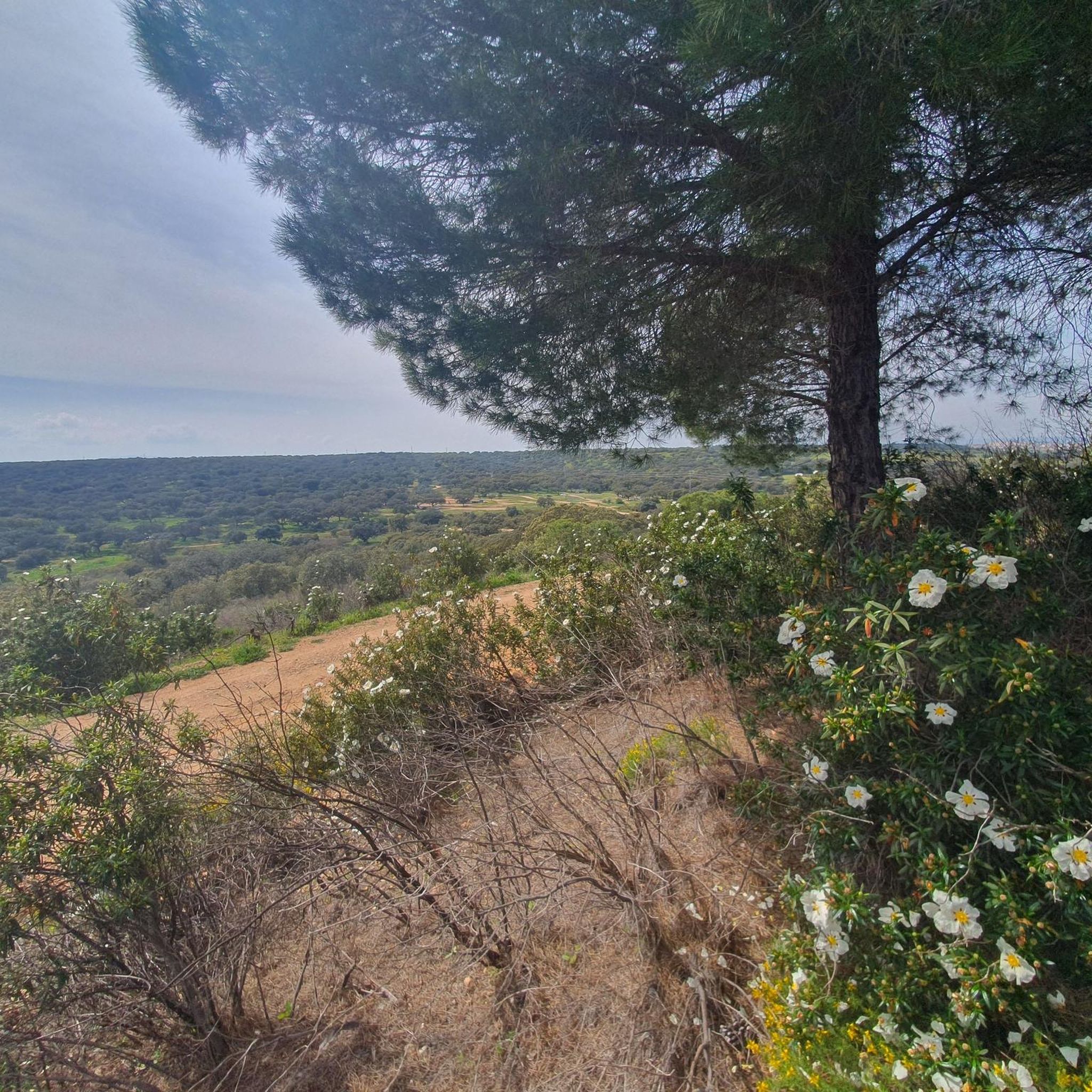
There are two theories about its origin: One links it to a hermitage dedicated to Saint Anne, which gave rise to the settlement. The other places it in the 17th and 18th centuries as a refuge for families from Jerez fleeing an epidemic, under the name of Valle del Pino (Pine Valley).
5
0
Valle de Santa Ana is a picturesque municipality in the province of Badajoz, in the autonomous community of Extremadura, located in the Sierra Suroeste region, very close to Valle de Matamoros and Jerez de los Caballeros.
5
0

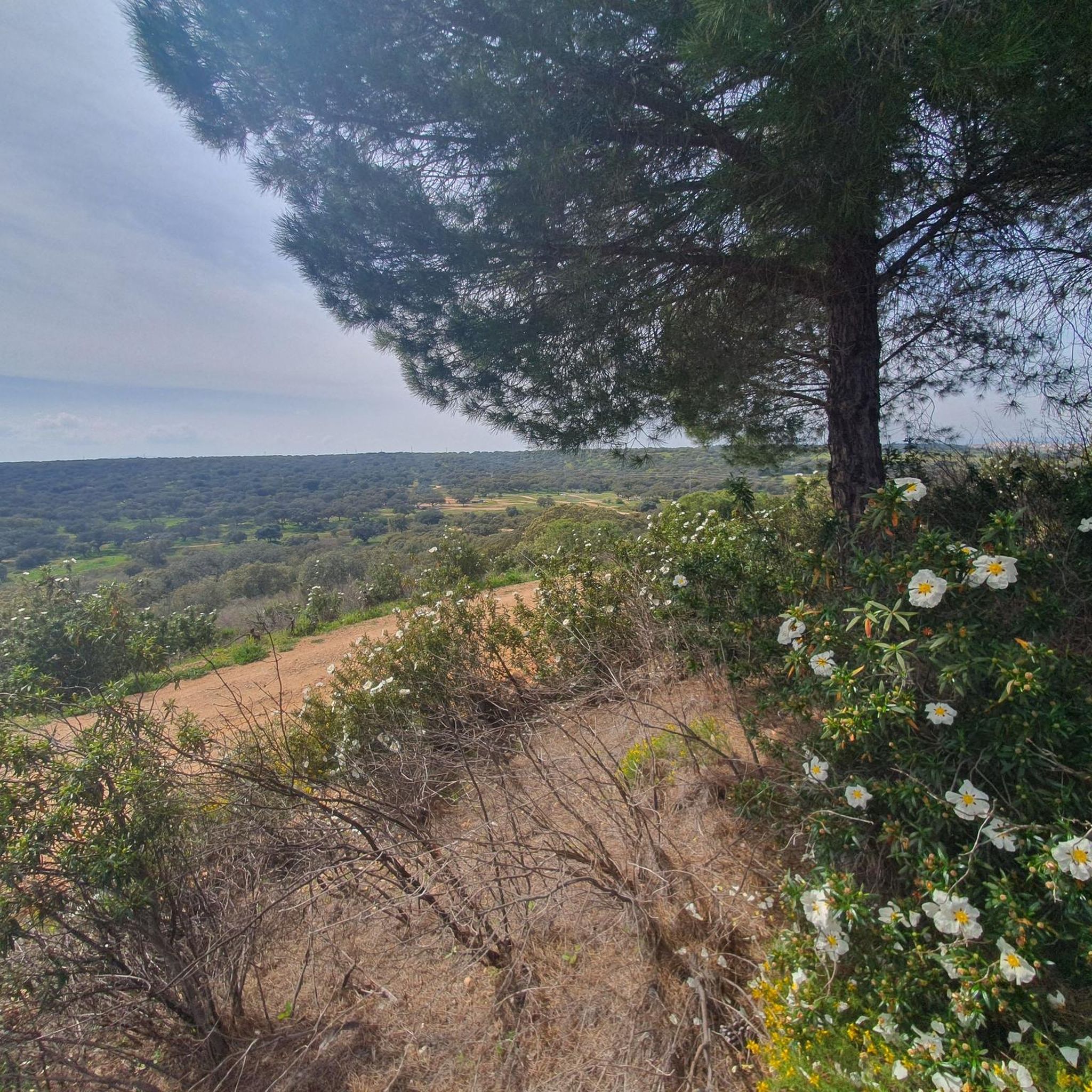
beautiful views. difficult climb
0
0
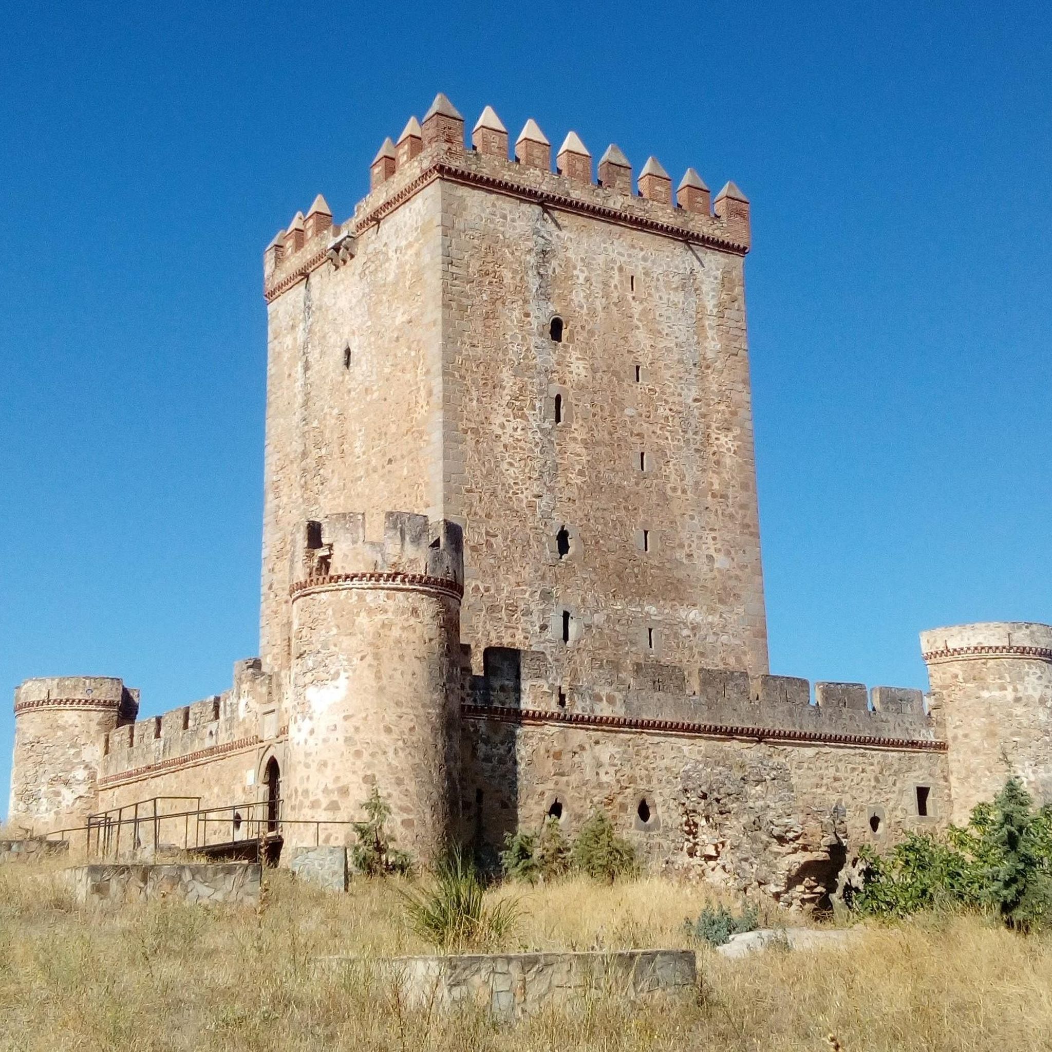
The fortress has a 35-metre-high keep and a perimeter wall with cylindrical towers at the corners. Originally, the castle had a drawbridge that allowed access through a moat, although this no longer exists. The castle was restored by the Junta de Extremadura at the end of the 20th century, preserving its structure and historical elements.
7
0


Perched on top of a hill overlooking the city, Feria's medieval castle is famous for its massive keep. A defensive castle dominates the landscape below.
1
0
Located in the Badajoz town of Nogales, this medieval fortress built in the 15th century sits on a small hill and its character is purely defensive. For this reason, its most outstanding element is the keep surrounded by a wall, since it was of great importance during the clashes with the French and the Portuguese.
9
0

Some connect the origin of the nucleus with the settlement of some inhabitants around an old hermitage dedicated to Santa Ana, existing in that place since remote times, from which the place name of the population that was consolidated under its protection would derive.
0
1
Frequently Asked Questions
What types of road cycling routes can I find around Nogales?
Nogales offers a diverse range of road cycling routes, characterized by its unique 'sky island' geography. You'll find rolling roadways, high rolling grasslands, and routes that traverse wooded hills and desert landscapes. The area provides options for both moderate and difficult ability levels, with some routes featuring significant elevation gains.
How many road cycling routes are available in the Nogales area?
There are over 30 road cycling routes available around Nogales on komoot. These routes cater to various skill levels, with 13 routes rated as moderate and 18 as difficult, ensuring a challenge for experienced cyclists.
Are there any challenging road cycling routes with significant climbs near Nogales?
Yes, Nogales is known for its challenging routes with substantial elevation gains. For instance, the View of Salvaleón – Dehesa Extremeña loop from Torre de Miguel Sesmero is a difficult 57.5-mile (92.6 km) path featuring over 1,500 meters of climbing. Another demanding option is the View of Feria Castle – Dehesa Extremeña loop from Nogales, which covers 37.4 miles (60.2 km) with nearly 1,000 meters of ascent.
What are some scenic viewpoints or landmarks along the road cycling routes?
The region's 'sky island' geography means many routes offer stunning views of mountains rising from the desert floor. You might encounter views of prominent peaks like Mount Wrightson. For specific landmarks, consider routes that pass near historical sites such as the Nogales Castle or natural monuments like the Ancient Olive Tree of La Tapada. The Sonoita area, with its high rolling grasslands, also provides beautiful scenery.
Are there any loop routes for road cycling in Nogales?
Many of the road cycling routes around Nogales are designed as loops, offering a convenient way to start and end your ride in the same location. Examples include the Roadbike loop from Nogales, a moderate 33.8-mile (54.3 km) ride, and the more challenging View of Salvaleón – Dehesas of the Olivenza River loop from Salvaleón.
What is the best time of year for road cycling in Nogales, Arizona?
The Nogales region, being part of the Sonoran Desert, generally offers favorable cycling conditions outside of the peak summer heat. Spring and fall are often ideal, providing pleasant temperatures for exploring the rolling roadways and varied terrain. Winter can also be a good option, especially for those looking to escape colder climates.
Are there any family-friendly road cycling options in the Nogales area?
While many routes around Nogales are rated moderate to difficult due to elevation changes and distances, some of the shorter, less hilly sections or paved paths within nearby parks like Patagonia Lake State Park might offer more suitable options for families. Always check the route details for distance and elevation to ensure it matches your family's ability.
Where can I find parking for road cycling routes in Nogales?
Parking availability can vary depending on the specific starting point of your chosen route. Many routes begin from towns or villages like Nogales itself, Salvaleón, or Torre de Miguel Sesmero, where public parking may be available. It's advisable to check the route details on komoot for specific parking recommendations or access points near the start of your desired ride.
What kind of natural features can I expect to see while cycling around Nogales?
The Nogales area is rich in natural beauty. You'll cycle through unique 'sky island' landscapes with mountains rising from the desert, high rolling grasslands, and wooded hills. The region is part of the Sonoran Desert, offering distinct desert flora and fauna. Nearby attractions like Patagonia Lake State Park and Sonoita Creek State Natural Area also highlight the diverse ecosystems, from tranquil lakes to areas supporting rich birdlife.
Are there any cafes or rest stops along the road cycling routes?
Many road cycling routes in the Nogales area pass through or near small towns and villages. These settlements often provide opportunities for rest stops, cafes, or places to refuel. For example, routes starting from or passing through Nogales, Salvaleón, or Torre de Miguel Sesmero would likely offer amenities. It's always a good idea to plan your route and check for potential stops beforehand, especially on longer rides through more remote sections.
What is the difficulty level of road cycling in Nogales?
Road cycling in Nogales is generally considered moderate to difficult. The terrain features rolling roadways and significant elevation changes due to the 'sky island' geography. Out of over 30 routes, 13 are rated moderate and 18 are difficult, meaning cyclists should be prepared for climbs and varied conditions. There are no easy routes listed in the guide.
Can I combine road cycling with other outdoor activities in the Nogales region?
Absolutely! The Nogales region is a hub for outdoor recreation. Beyond road cycling, you can explore extensive hiking trails in areas like Coronado National Forest or Madera Canyon. Patagonia Lake State Park and Pena Blanca Lake offer opportunities for fishing and boating. The Sonoita Creek State Natural Area is excellent for birdwatching, and the area's minimal light pollution makes for great stargazing.
Most popular attractions around Nogales

Get inspired with the komoot mobile app


Explore more
Browse the best Road cycling routes in other regions.
