The best road cycling routes around Berrocal De Huebra
5.0
(1)
65
riders
8
rides
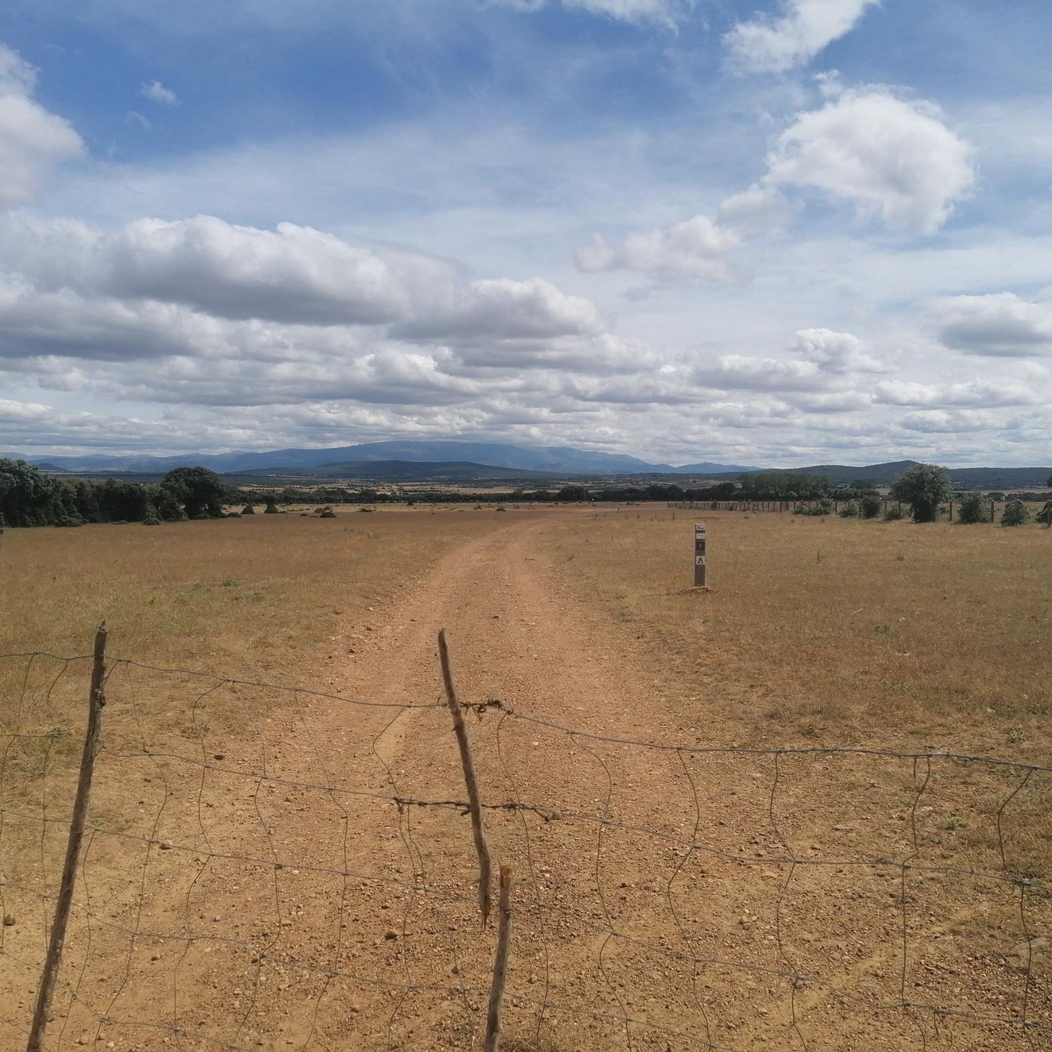
Road cycling routes around Berrocal de Huebra traverse the Campo Charro region, characterized by rolling plains, pastures, and scattered holm oak trees. This landscape offers generally gentle terrain suitable for road cycling. The area also provides access to more varied natural features, including riparian landscapes along the Huebra River and the more rugged, mountainous terrain of the Las Batuecas-Sierra de Francia Natural Park, located approximately 30 km away.
Best road cycling routes around Berrocal de Huebra
- The most popular road…
Last updated: July 2, 2026
71.2km
03:02
610m
610m
Cycle a moderate 44.2-mile (71.2 km) route around Tamames and Río Huebra, exploring rural villages and historic sites in Campo Charro.
31
riders
88.8km
04:32
1,310m
1,310m
Hard road ride. Very good fitness required. Some segments of this route may be unpaved and difficult to ride.

Sign up for free
23
riders
115km
05:45
1,820m
1,820m
Hard road ride. Very good fitness required. Mostly well-paved surfaces and easy to ride.
4
riders
37.6km
01:49
550m
550m
Moderate road ride. Good fitness required. Some segments of this route may be unpaved and difficult to ride.
5.0
(1)
7
riders
61.6km
02:59
900m
900m
Hard road ride. Very good fitness required. Mostly well-paved surfaces and easy to ride.
Get access to more routes and recommendations from other explorers.
Sign up for free
Already have an account?
Our route recommendations are based on thousands of hikes, rides, and runs completed by other people on komoot.
Start today with a free account
Your next adventure awaits.
Login or Signup
Popular around Berrocal De Huebra
Tips from the Community

Beautiful view here, now the last stretch to the top with 200 altitude meters to go.
0
0

On the SA-205 highway, just outside San Esteban de la Sierra heading towards Santibáñez de la Sierra, you'll find the entrance to the Sierra Viewpoints Route, which includes several spectacular panoramic viewpoints. Views: The Alagón River Valley and its meanders. The Sierra de Francia mountain range with the Peña de Francia peak in the background. The Sierra de Béjar mountain range and the Las Quilamas Natural Area. This viewpoint is a magnificent natural balcony, perfect for photography and birdwatching (vultures, eagles, black storks).
2
0
What to see in Miranda del Castañar Medieval Walls: Over 600 meters remain intact, with four gates facing the cardinal directions: San Ginés, Nuestra Señora, La Villa, and El Postigo. Zúñiga Castle: A 15th-century fortress, symbol of the former County of Miranda. Although the interior is not open to the public, its exterior and keep are impressive. Square Bullring: Considered one of the oldest in Spain, built in the 16th century on the site of the former parade ground. Church of Santiago and San Ginés: Gothic in style (13th-16th centuries), with a detached 17th-century bell tower. Houses with Coats of Arms: More than 80 noble coats of arms adorn the facades, reflecting the town's aristocratic past.
8
0
Miranda del Castañar, one of the most beautiful villages in Spain, is located in the Sierra de Francia (Salamanca): Founded in 1213 by Alfonso IX of León as a town and council, it was the administrative capital of the Sierra de Francia. In the 15th century, the County of Miranda was created under the control of the Zúñiga family, consolidating its strategic importance.
9
0

This is the Wolves Pass, the end of the climb to Peña de Francia (Granite Throne) ;)
0
0


Great viewpoint of the Agadon Valley, a mandatory stop on the way up to Peña de Francia or the descent, to take more photos and read interesting facts on the information panel.
2
0

The climb up this narrow valley is a delight, especially on days when there is not much traffic. The views, the sounds of nature, the vegetation, the aromas of rockroses and other wild flowers allow us to almost forget that we are going uphill for a good part of the journey :-D
0
0
Frequently Asked Questions
What kind of terrain can I expect for road cycling around Berrocal de Huebra?
The primary landscape is the Campo Charro, characterized by rolling plains, pastures, and scattered holm oak trees, offering generally gentle terrain. You'll find scenic routes with manageable inclines. For more rugged and mountainous terrain, the Las Batuecas-Sierra de Francia Natural Park is approximately 30 km away, providing varied cycling experiences.
Are there road cycling routes suitable for different skill levels?
Yes, the area offers routes for various skill levels. You can find easy rides like the Berrocal de Huebra loop from Narros de Matalayegua, which is 19.9 miles (32.0 km) long. There are also moderate options and challenging routes with significant elevation gains for experienced cyclists.
Are there any challenging road cycling routes with significant climbs?
Absolutely. For experienced cyclists seeking a challenge, the Ascent to Puerto de Valero – San Miguel de Valero loop from La Sierpe is a difficult 55.1-mile (88.8 km) route featuring over 4,200 feet (1,300 meters) of elevation gain through mountainous terrain. Another demanding option is the Miranda de Castañar – Ascent to Puerto de Valero loop from Vecinos, which covers 115.3 km with over 1,800 meters of ascent.
What historical or natural landmarks can I see while cycling in the region?
While cycling, you can explore several points of interest. The town of La Sagrada is nearby, and you can visit the Old public washhouses of Tamames or the Tamames Tower. The region also features the Church of Santo Tomás Apóstol in Berrocal de Huebra itself, and a small lagoon in Navarredonda de la Rinconada.
Are there any circular road cycling routes available?
Yes, many routes are designed as loops. For example, the popular Campo Charro Loop from Tamames is a moderate 44.2-mile (71.2 km) ride. Another option is the Cilleros de la Bastida – Tamames Tower loop from Tamames, a shorter 37.6 km route.
When is the best time of year for road cycling in Berrocal de Huebra?
The region is generally pleasant for outdoor activities. Spring and autumn typically offer the most comfortable temperatures for road cycling, avoiding the intense heat of summer and the cooler, potentially wetter conditions of winter. These seasons also showcase the natural beauty of the Campo Charro landscape.
Are there family-friendly road cycling routes in the area?
For families looking for easier rides, the gentle terrain of the Campo Charro offers suitable options. Routes like the Berrocal de Huebra loop from Narros de Matalayegua are classified as easy and provide a good introduction to the region's landscapes without significant climbs.
How many road cycling routes are available around Berrocal de Huebra?
There are 7 road cycling routes available around Berrocal de Huebra, ranging from easy to difficult, allowing cyclists to choose based on their preference and fitness level.
What makes road cycling in Berrocal de Huebra unique?
Road cycling in Berrocal de Huebra offers a unique blend of experiences. You'll traverse the distinctive Campo Charro landscape with its rolling plains and scattered holm oak trees, providing a serene backdrop. The area also serves as a gateway to more mountainous terrain, allowing for a diverse range of routes from gentle rural rides to challenging climbs.
Is parking available for cyclists near the routes?
While specific parking areas for cyclists aren't detailed, as Berrocal de Huebra and nearby towns like Tamames and La Sagrada are small municipalities, you can generally find parking in or near these villages, which often serve as starting points for routes.
Can I access cycling routes using public transport?
Accessing rural cycling routes via public transport can be challenging in this region. Public transport options are typically limited in smaller Spanish municipalities. It's advisable to check local bus schedules for connections to towns like Tamames or La Sagrada, but bringing bicycles on board might require specific arrangements or be restricted.
Are there places to eat or stay near the cycling routes?
Berrocal de Huebra and the surrounding small towns like Tamames and La Sagrada offer local amenities. You can find traditional Spanish eateries and some accommodation options in these villages, providing convenient stops for refreshments or overnight stays during your cycling trips.
Most popular routes around Berrocal De Huebra
Most popular attractions around Berrocal De Huebra

Get inspired with the komoot mobile app


Explore more
Browse the best Road cycling routes in other regions.
