The best road cycling routes around Montillana
5.0
(1)
160
riders
13
rides
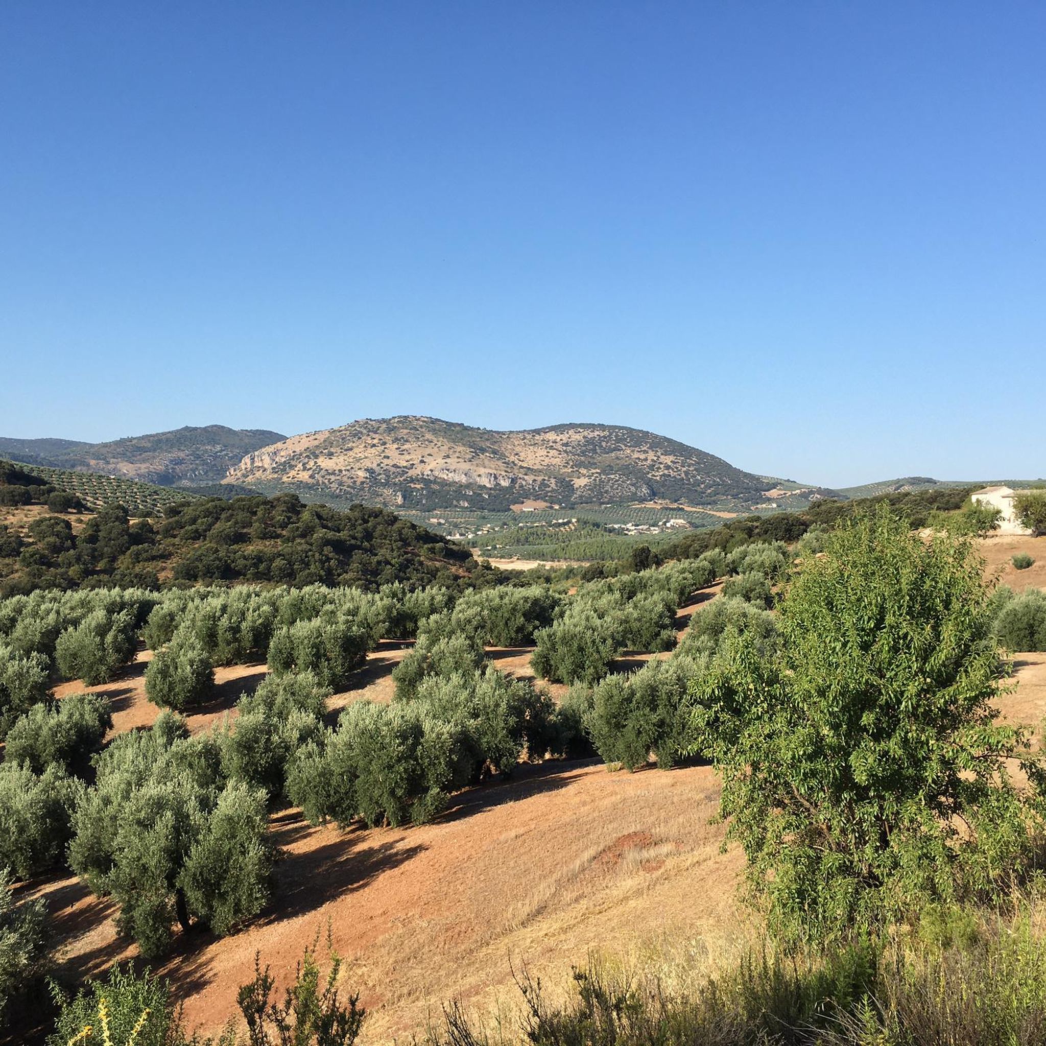
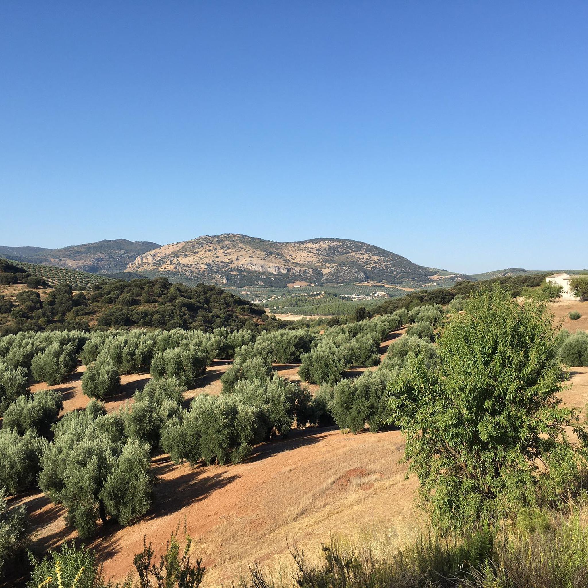
Road cycling around Montillana offers routes through a diverse and challenging natural landscape, situated at 1022 meters above sea level. The region is characterized by its surrounding mountains, including the Sierra de Alta Coloma and the Sierras de los Andanillos, del Trigo y de Montillana. These ranges provide varied topography, from olive groves at lower elevations to more rugged, forested terrain, ideal for challenging road cycling. Cyclists can expect significant elevation gains and rewarding descents across well-paved rural roads.
Best road cycling routes around Montillana
- The most popular road cycling route is Colomera and Iznalloz — circular Sierra del Pozuelo, a 39.7 miles (63.8 km) trail that takes 2 hours 58 minutes to complete. This moderate route offers panoramic views of the surrounding Sierras.
- Another top favourite among local road cyclists is Cascante Tower loop from Tózar, a difficult 51.3 miles (82.6 km) path. This route features substantial climbs and descents through mountainous terrain, providing a demanding ride.
- Local road cyclists also love the Castle of Íllora – Fuente Vieja (Old Fountain) loop from Tózar, a 32.7 miles (52.6 km) trail leading through varied landscapes with significant elevation, often completed in about 2 hours 57 minutes.
- Road cycling around Montillana is defined by challenging climbs, diverse mountainous terrain, and scenic olive groves. The network offers options for easy, moderate, and difficult routes, catering to various ability levels.
- The routes in Montillana are highly rated by the komoot community with an average score of 5.0 stars from 1 review. More than 160 road cyclists have used komoot to explore Montillana's varied terrain.
Last updated: May 20, 2026
5.0
(1)
83
riders
63.8km
02:58
830m
830m
Moderate road ride. Good fitness required. Mostly well-paved surfaces and easy to ride.
11
riders
82.6km
04:11
1,380m
1,380m
Hard road ride. Very good fitness required. Mostly well-paved surfaces and easy to ride.

Sign up for free
8
riders
52.6km
02:57
1,150m
1,150m
Hard road ride. Very good fitness required. Mostly well-paved surfaces and easy to ride.
4
riders
78.9km
04:15
1,330m
1,330m
Hard road ride. Very good fitness required. Some segments of this route may be unpaved and difficult to ride.
7
riders
42.7km
01:58
430m
430m
Moderate road ride. Good fitness required. Mostly well-paved surfaces and easy to ride.
Get access to more routes and recommendations from other explorers.
Sign up for free
Already have an account?
Our route recommendations are based on thousands of hikes, rides, and runs completed by other people on komoot.
Start today with a free account
Your next adventure awaits.
Login or Signup
Popular around Montillana
Tips from the Community


This watchtower houses the castle and wall dating from the Caliphate period between the 9th and 10th centuries. In addition to the castle, there are also watchtowers or watchtowers associated with it, among which the Torre de Brácana stands out.
15
0
This historic fountain, which has been restored and still contains remains of an old wash house, is almost completely empty. There is a sign indicating that the water is not potable, although it is likely marked with a high concentration of other minerals that may be harmful to health.
16
0

Easy route highly recommended
0
0
Cambil is a town that preserves many remains of Arab origin, among which is its castle. Located in a small valley, it is a cold place in winter but cool in summer.
11
0
It is a roundabout as a welcome to the town of Cambil
10
0
It is a basin to supply water whose tube flows from the bottom to the top, not very common in this type of pools.
7
0
Frequently Asked Questions
How many road cycling routes are available around Montillana?
There are 14 road cycling routes around Montillana, offering a variety of experiences. These include 2 easy routes, 6 moderate routes, and 6 difficult routes, catering to different skill levels.
What kind of terrain can I expect when road cycling near Montillana?
Road cycling around Montillana features a diverse and challenging natural landscape. You'll encounter significant elevation changes as the region is situated at 1022 meters above sea level and surrounded by mountains like the Sierra de Alta Coloma. Expect a mix of olive groves at lower elevations and more rugged, forested terrain as you ascend, providing both scenic beauty and demanding climbs.
Are there routes suitable for beginners or less experienced road cyclists?
Yes, Montillana offers 2 easy road cycling routes. These are ideal for those looking for a less strenuous ride while still enjoying the region's beautiful scenery. For example, the route 'Cascante Tower – View of Alcalá la Real Castle loop from Fuente del Rey' is a moderate option that provides a good balance of challenge and accessibility.
What are some of the most challenging road cycling routes in the Montillana area?
For experienced cyclists seeking a challenge, Montillana offers 6 difficult routes with substantial climbs. Notable challenging routes include Cascante Tower loop from Tózar, which features significant elevation gains over 82.6 km, and Castle of Íllora – Fuente Vieja (Old Fountain) loop from Tózar, a 52.6 km trail with varied landscapes and considerable ascents.
What natural features or landmarks can I see along the road cycling routes?
As you cycle, you'll pass through varied landscapes, from extensive olive groves to rugged, forested mountain terrain. While specific natural features directly on the routes are not detailed, the region's mountainous character means stunning panoramic views are common. The nearby Corcuela Spring Labyrinth is a unique natural monument worth exploring.
Are there any historical sites or points of interest near the cycling routes?
Yes, the area around Montillana is rich in history. Cyclists can explore sites such as Moclín Castle, a historic fortress offering commanding views, or the Hermitage of Saint Anthony. The Viewpoint of Moclín also provides a historical perspective alongside scenic vistas.
What do other road cyclists enjoy most about road cycling in Montillana?
The komoot community highly rates road cycling in Montillana, with an average score of 5.0 stars. Cyclists often praise the challenging climbs, the diverse mountainous terrain, and the scenic beauty of the olive groves. The quiet rural roads also contribute to a peaceful and immersive cycling experience.
Are there any circular road cycling routes available?
Yes, many of the routes around Montillana are circular, allowing you to start and end at the same point. A popular example is Colomera and Iznalloz — circular Sierra del Pozuelo, a moderate 63.8 km route offering panoramic views of the surrounding Sierras.
What is the best time of year for road cycling around Montillana?
Given Montillana's mountainous location and the general climate of Granada province, spring (April-May) and autumn (September-October) are typically ideal. During these seasons, temperatures are milder, making the challenging climbs more enjoyable and the diverse scenery, from olive groves to rugged mountains, particularly vibrant.
Are there any routes that offer particularly good viewpoints?
The mountainous terrain surrounding Montillana naturally provides numerous opportunities for scenic viewpoints. Routes traversing the Sierra de Alta Coloma and the Sierras de los Andanillos, del Trigo y de Montillana will offer rewarding panoramic views of the Andalusian landscape. The Viewpoint of Moclín is a specific highlight known for its vistas.
Can I find cafes or places to rest along the road cycling routes?
While specific cafes directly on the routes are not detailed, the routes often connect towns and villages in the region. These villages are likely to offer local establishments where cyclists can stop for refreshments and rest. Planning your route to pass through these settlements will ensure opportunities for breaks.
Most popular routes around Montillana
Most popular attractions around Montillana

Get inspired with the komoot mobile app


Explore more
Browse the best Road cycling routes in other regions.
