The best road cycling routes around Peramola
4.8
(10)
912
riders
35
rides
Road cycling routes around Peramola are situated in the Alt Urgell region of the Catalan Pre-Pyrenees, characterized by a blend of agricultural plains and rugged mountainous terrain. The area features prominent ranges like Serra de Sant Honorat and Serra d'Aubenç, with winding roads and low traffic. The landscape includes the Segre valley and the Oliana reservoir, offering varied cycling experiences. This region provides challenging climbs and scenic routes through its distinct geological formations.
Best road cycling routes around Peramola
- The…
Last updated: October 1, 2026
32
riders
48.7km
02:49
820m
820m
This moderate 30.3-mile (48.7 km) road cycling route from Oliana offers fantastic views of the Embalse de Rialb and significant climbs.
54
riders
104km
05:51
2,340m
2,340m
Hard road ride. Very good fitness required. Mostly well-paved surfaces and easy to ride.

29
riders
76.4km
04:07
1,400m
1,400m
Hard road ride. Very good fitness required. Some segments of this route may be unpaved and difficult to ride.
30
riders
41.1km
02:06
660m
670m
Moderate road ride. Good fitness required. Mostly well-paved surfaces and easy to ride.
11
riders
44.1km
02:36
890m
890m
Moderate road ride. Good fitness required. Some segments of this route may be unpaved and difficult to ride.
Get access to more routes and recommendations from other explorers.
Already have an account?
Our route recommendations are based on thousands of hikes, rides, and runs completed by other people on komoot.
Start today with a free account
Your next adventure awaits.
Tips from the Community

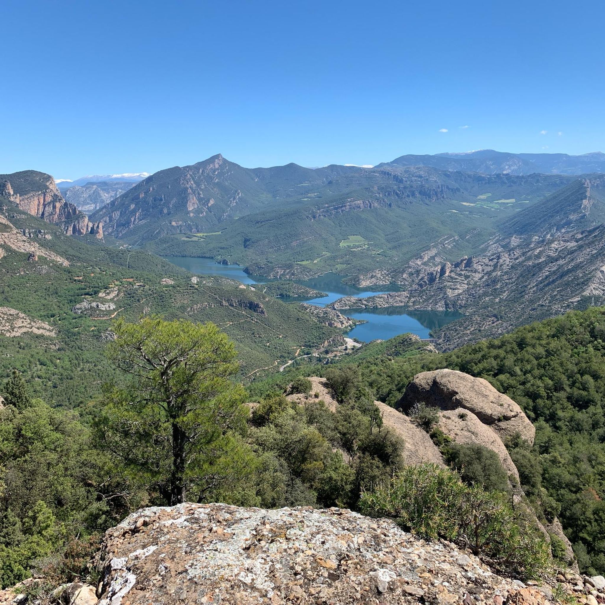
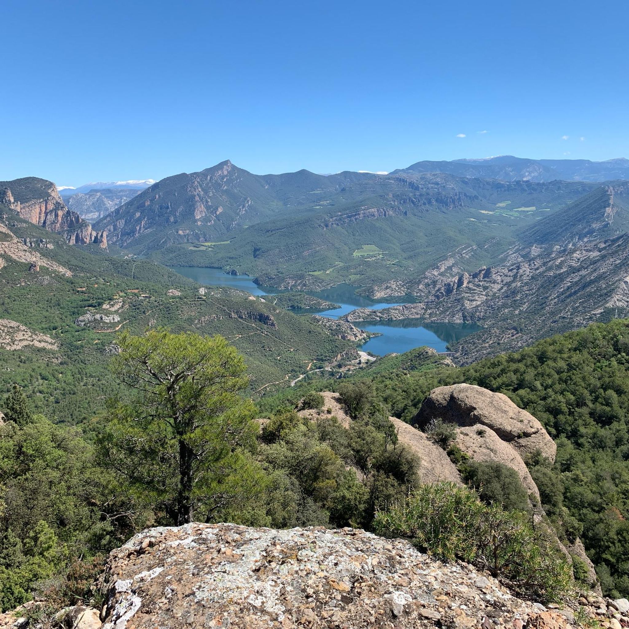
On the border between Alt Urgell and Solsonès, the Serra-seca viewpoint is located near kilometer 25 of the road between Hostal de Cirera and Cambrils. Access is via a signposted track and a small path that leads to a high point from which you can enjoy spectacular views of the Ribera Salada, the Oliana reservoir and a good part of the central Pre-Pyrenees. It is an ideal stop to breathe and enjoy the landscape in silence. The approach terrain can have irregular sections, with loose stones and slopes, so you need to be careful if you go by bike. The environment is exposed and windy on changeable days, so it is advisable to wear suitable clothing and check the bike before continuing.
0
0

Next to the Coll d'Ares, it is the most iconic port in the Montsec mountain range and the Lleida Pre-Pyrenees. The views from above, either towards the Pyrenees and the Isona and Tremp valley, as well as the Plana de Lleida, are magnificent. It is a port with 4 aspects, each one different: - The southern slope, which begins in Artesa de Segre, is almost 24 km long and runs along a road with a lot of traffic, very wide and with long straights. After passing the town of Folquer, you face the hardest section of the climb, now with continuous curves and horseshoes, although with a road that is still very wide. The best are the views of the Lleida plain. It is not a side that I like since it is very stinky. - The southeast slope, the one that begins in Pons, is longer than the previous one, with 29 km. It has 2 rest sections, with some descent, and the road is narrow and twisty. There are good views along the climb. This slope joins the southern slope that comes from Artesa de Segre at the height of Folquer, where the hardest 7 km remain until reaching the top of the pass. - The main northern slope begins in Tremp and is 28.2 km. It is similar to the Artesa de Segre slope, with a similar gradient and a wide, busy road with a progressive slope, although it is true that there are no kilometers that reach 7%. I don't like. - The northwest slope, which also begins in Tremp, takes the old road that goes up through the town of Sant Salvador de Toló. It is a climb without traffic, on an irregular asphalt road, one of the old ones, which is grippy and difficult to roll, but in good condition. If you plan to go up to Comiols on the northern slope, you have to do it here and forget about the slope that runs along the main road.
0
0


Spectacular views from above and a port that leaves you marked.
0
0

Small town located below the Coll de Comiols and at the foot of the Roc de Benavent, a stone structure that can be reached on foot from the town itself.
0
0

Serra-Seca, a Solsonès classic. You can go up from Valldan or Montpol, Solsona, in this case it is advisable to continue to Cambrils, Odèn, Canalda and go down again to Solsona via Lladurs.
0
0

The Coll de Comiols is a hill located at 1101 meters high. It acts as the border of several municipalities in the Pallars Jussà region. It offers magnificent views of the surrounding mountains and the Cuenca de Tremp.
0
0
Frequently Asked Questions
How many road cycling routes are available around Peramola?
There are over 30 road cycling routes around Peramola, offering a diverse range of experiences. These routes cater to various skill levels, with 13 moderate and 17 difficult options available.
What is the typical terrain like for road cycling in Peramola?
The terrain around Peramola is characterized by the dramatic landscapes of the Catalan Pre-Pyrenees. Cyclists can expect winding roads with low traffic, significant elevation changes, and a mix of agricultural plains and rugged mountainous areas. Notable features include the Serra de Sant Honorat and Serra d'Aubenç, as well as the scenic Segre valley and Oliana reservoir.
What do other cyclists say about road cycling in Peramola?
The road cycling routes in Peramola are highly rated by the komoot community, with an average score of 4.7 stars from 8 reviews. Over 700 road cyclists have used komoot to explore the varied terrain, often praising the stunning views, challenging climbs, and quiet roads.
When is the best time of year to go road cycling in Peramola?
The hills and valleys of the Catalan Pre-Pyrenees offer a pleasant climate suitable for road cycling training year-round. However, spring and autumn generally provide the most comfortable temperatures for longer rides and exploring the region's natural beauty.
Are there road cycling routes suitable for beginners or those looking for an easier ride?
Yes, while Peramola is known for its challenging terrain, there are moderate routes available. For example, the Rialb Reservoir Loop from Oliana is a moderate 30.3-mile (48.7 km) route that offers beautiful views without extreme difficulty. Another moderate option is the Madrona loop from Oliana, covering 57.1 km with a manageable ascent.
What are some challenging road cycling routes for experienced cyclists in Peramola?
Experienced cyclists seeking a challenge will find plenty of options. The Peramola – La Clua loop from Oliana is a difficult 47.3-mile (76.2 km) path featuring significant elevation gain through the Pre-Pyrenean landscape. The broader Alt Urgell region, accessible from Peramola, also includes iconic mountain passes like Coll de Bóixols and Coll de Comiols, known for their demanding climbs and incredible views.
What natural features and viewpoints can I expect to see while road cycling around Peramola?
Road cycling around Peramola offers breathtaking natural features and viewpoints. You can encounter the dramatic conglomerate rock formations of the Serra de Sant Honorat, including the impressive Aguja del Corb. Other notable sights include the View of Rocas de Sant Honorat and the Top of the Coscollet viewpoint, offering panoramic vistas of the South Pyrenees. The routes also often pass by the tranquil Oliana Reservoir and through the scenic Segre valley.
Are there any waterfalls along the road cycling routes in Peramola?
While not directly on every road cycling route, the region around Peramola is home to natural attractions like the Waterfalls of Organyà, which can be explored as a side trip or incorporated into a longer ride. These waterfalls are a beautiful natural monument in the area.
Are there any historical or cultural landmarks to see while cycling in Peramola?
Yes, the area boasts a rich Romanesque heritage. You might encounter remnants of the ancient castle of Peramola, the church of Sant Miquel, or the chapel of Sant Joan. The Aguja del Corb also features the ruins of Ermita de Sant Salvador. Additionally, the Dolmen of Pomañons and Hermitage of Santa Eulalia de Pomañons offer a glimpse into the region's ancient history.
Are there any loop routes for road cycling in Peramola?
Yes, many of the road cycling routes around Peramola are designed as loops, allowing you to start and end in the same location. Examples include the Rialb Reservoir Loop from Oliana, the Peramola – Start of the Spring Trail loop from Oliana, and the La Clua loop from Oliana. These circular routes make planning your ride convenient.
Is Peramola suitable for family-friendly road cycling?
While many routes in Peramola involve significant elevation, there are options that might be suitable for families depending on their experience level. The region offers diverse routes, and some of the moderate loops, particularly those in flatter areas along the Segre valley, could be considered. It's always recommended to check the specific route's elevation and distance to ensure it matches your family's capabilities.
Are there cafes or places to stop for refreshments along the road cycling routes?
Peramola and the surrounding villages offer local establishments where cyclists can stop for refreshments. While specific cafes are not listed for every route, the region is known for its local gastronomy, including artisan cheeses. Planning your route to pass through villages will increase your chances of finding places to refuel.
Most popular attractions around Peramola

Get inspired with the komoot mobile app


Explore more
Browse the best Road cycling routes in other regions.
