The best walks and hikes around Casasola
4.4
(62)
762
hikers
44
hikes
Hiking around Casasola features routes that explore river valleys and historical sites. The landscape is characterized by gentle hills and open countryside, with paths often following waterways like the Adaja and Chico rivers. Hikers can expect trails that pass by ancient city walls and offer views of the surrounding plains. The area provides a mix of easy and moderate paths suitable for various fitness levels.
Best hiking trails around Casasola
- The most popular hiking route is Southeastern Way of St.…
Last updated: July 1, 2026
4.0
(5)
26
hikers
7.20km
01:55
70m
70m
This easy 4.5-mile (7.2 km) hiking route from Ávila takes you past the Convento de la Encarnación and the Fuentes Claras Dam.
3.5
(2)
7
hikers
9.35km
02:29
90m
90m
Hike the Cuatro Postes from Ávila circular route, a moderate 5.8-mile trail offering stunning views of the Muralla de Ávila.

Sign up for free
17
hikers
16.9km
04:23
110m
110m
Moderate hike. Good fitness required. Easily-accessible paths. Suitable for all skill levels.
4.0
(2)
6
hikers
3.57km
01:01
80m
80m
Easy hike. Great for any fitness level. Easily-accessible paths. Suitable for all skill levels.
1
hikers
Moderate hike. Good fitness required. Easily-accessible paths. Suitable for all skill levels.
Get access to more routes and recommendations from other explorers.
Sign up for free
Already have an account?
Our route recommendations are based on thousands of hikes, rides, and runs completed by other people on komoot.
Start today with a free account
Your next adventure awaits.
Login or Signup


Tips from the Community

The visit to the medieval city wall from the 11th-14th century is highly recommended with its 88 towers and 9 city gates - the entrance fee is justified, a large part of the city wall is accessible. Unfortunately, there were too few audio guides - we didn't have any. You have grandiose views of the Congress Hall, the Carmelite Convent of San José (place of activity of St. Teresa in the 16th century), the Cathedral, the Romanesque Church of San Vicente and into the nearby mountains.
0
0

The Sancti Spiritus Bridge in Ávila is a historic structure that crosses the Chico River, very close to the Chico River Park. It is a medieval-style stone bridge, probably linked to the ancient Monastery of Sancti Spiritus, founded in the 13th century.
1
0
The park extends between the bridge over the Chico River, the extension of Nuestra Señora de Sonsoles Street, and the Burgohondo road bridge, bordering Juan Pablo II Avenue. One of the most popular routes is the circular route from the Roman Bridge over the Adaja River, ideal for easy walks and enjoying the park's natural surroundings.
1
0
The Basilica of San Vicente in Ávila is one of the finest examples of Romanesque architecture in Spain. Built between the 12th and 14th centuries, this basilica is dedicated to the martyrs Vicente, Sabina, and Cristeta. According to tradition, these brothers were martyred in 306 during the Diocletian persecution. The basilica is also known for its cenotaph, a funerary monument depicting the legend of the martyrs and the repentance of the Jew responsible for their deaths.
15
0
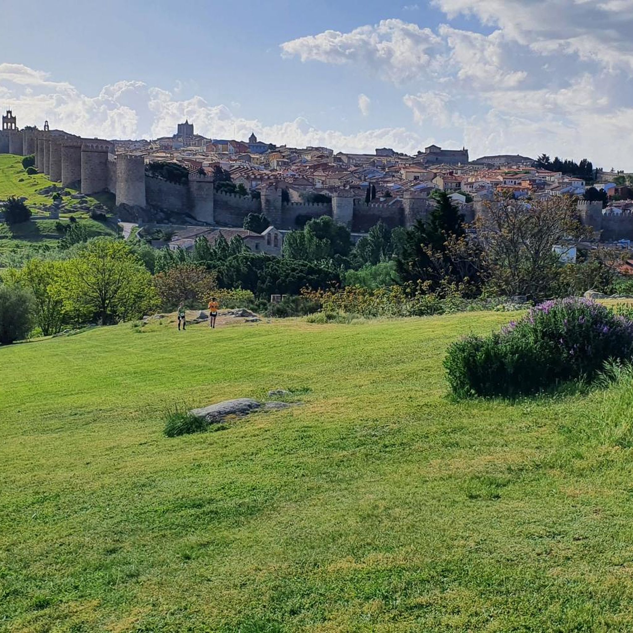
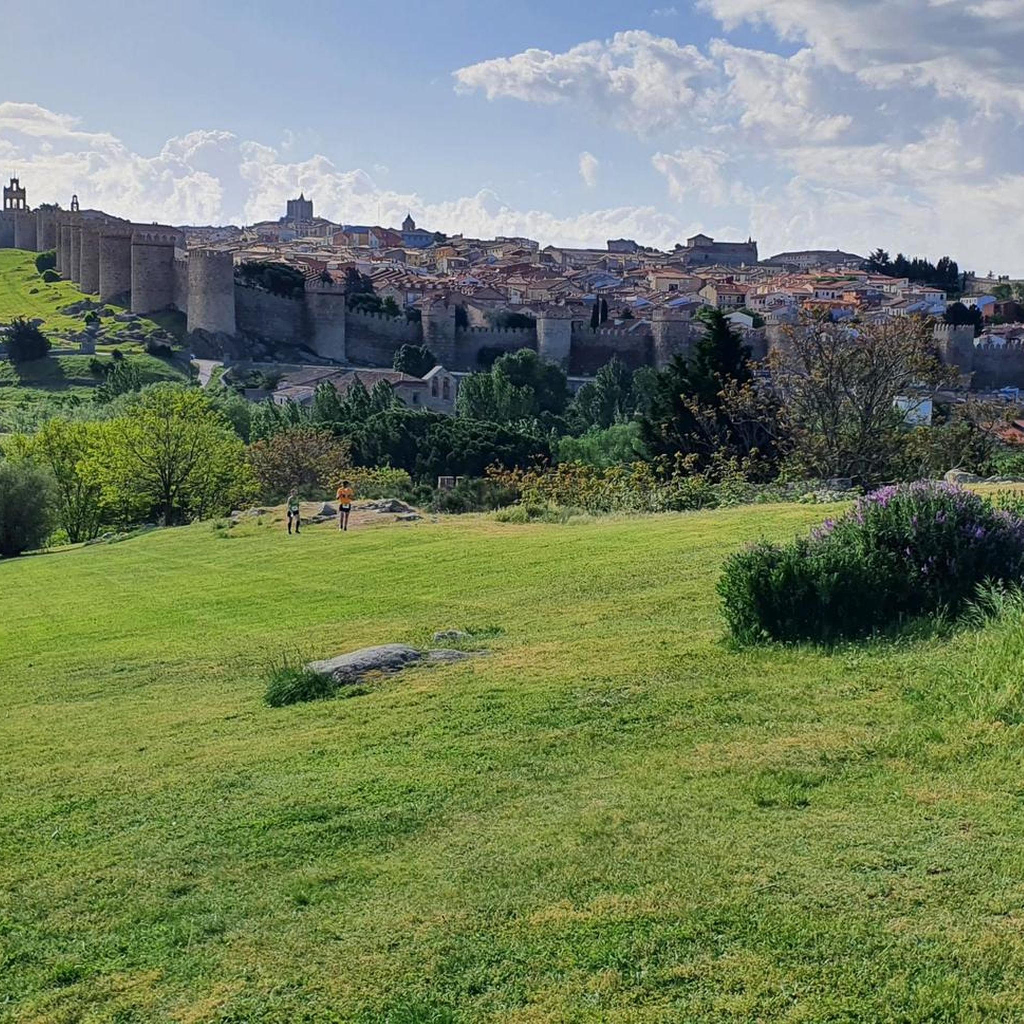
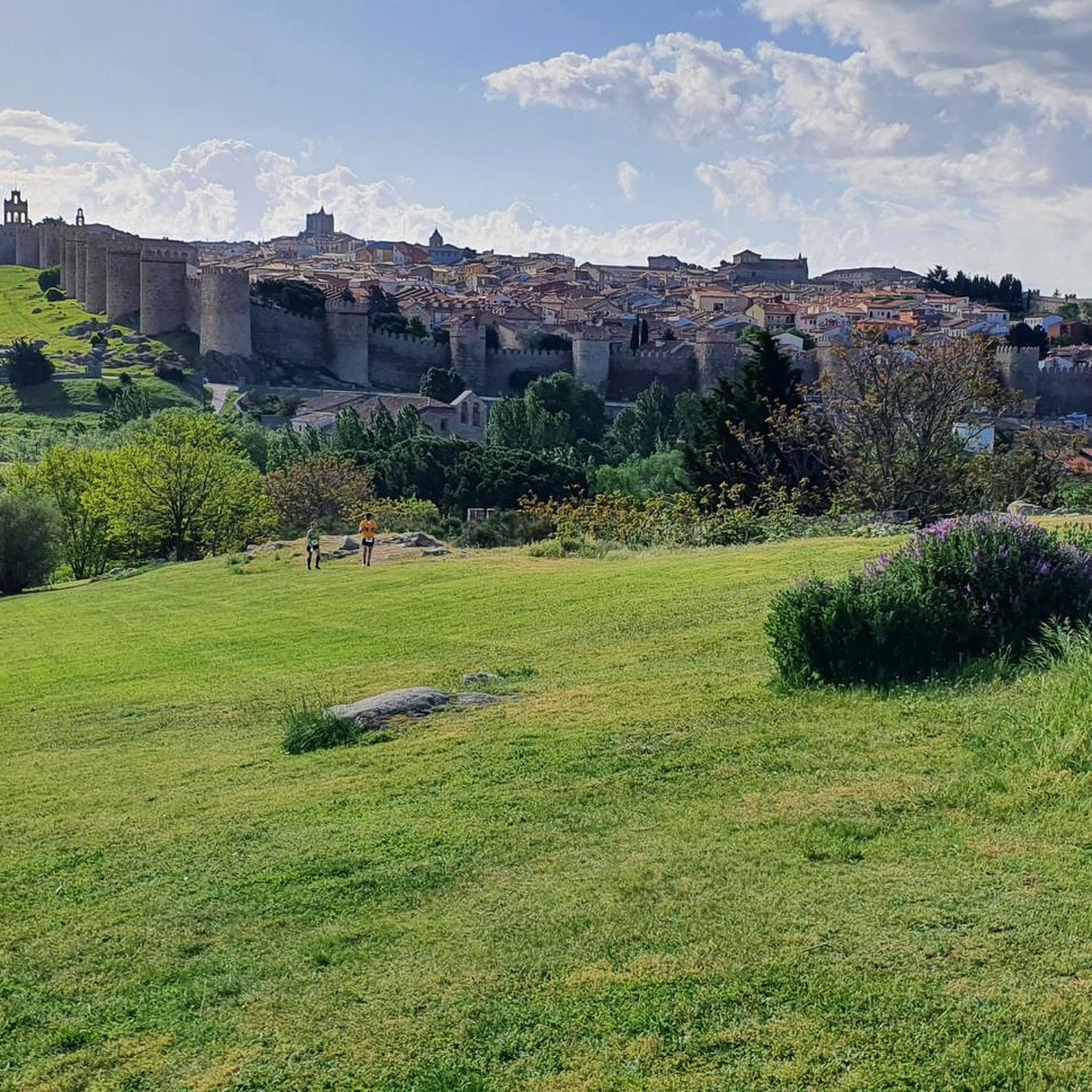
The Walls of Ávila are one of the city's most emblematic monuments and a prominent example of medieval military architecture. Built between the 11th and 14th centuries, this impressive fortification surrounds Ávila's old town and stretches for 2,515 meters. The wall has 87 towers and 9 gates, the Puerta del Alcázar and Puerta de San Vicente being the most famous.
1
0
The bridge over the Fuentes Claras Reservoir is part of the landscape and offers spectacular views of the natural surroundings.
11
0
The Walls of Ávila are an impressive medieval fortification that surrounds the old town of Ávila, in Castile and León. These walls, built in the 11th century, are one of the best-preserved walled enclosures in Spain and were declared a UNESCO World Heritage Site in 1985.
11
0
This bridge was built to facilitate crossing the Adaja River and connect the Roman city of Ávila with the opposite bank. Although only the hidden abutments on the edges of the original Roman bridge remain, the bridge visible today dates back to the 12th century.
13
0
Frequently Asked Questions
How many hiking trails are available around Casasola?
There are around 50 hiking routes in the Casasola area. These trails explore river valleys, historical sites, and open countryside, offering a mix of easy and moderate paths suitable for various fitness levels.
What kind of landscapes can I expect to see while hiking near Casasola?
Hiking around Casasola features routes that explore river valleys and historical sites. The landscape is characterized by gentle hills and open countryside, with paths often following waterways like the Adaja and Chico rivers. You can expect trails that pass by ancient city walls and offer views of the surrounding plains, particularly near Ávila.
Are there any easy hiking trails suitable for beginners or families in Casasola?
Yes, Casasola offers many easy hiking options. Over 30 of the routes are classified as easy. For a pleasant walk through the local countryside, consider the Southeastern Way of St. James and Teresian Route Loop, which is 4.5 miles (7.2 km) long.
What are some notable historical sites or landmarks I can see on a hike?
Many trails in the Casasola area offer views of significant historical landmarks. You can explore routes that pass by the impressive Ávila City Walls, a UNESCO World Heritage site. Another route, the Walls of Ávila and Cuatro Postes Loop, provides scenic views of these historic walls and the iconic Cuatro Postes monument.
Are there any circular hiking routes in the Casasola region?
Yes, there are several circular routes available. A popular choice is the El Fresno from Ávila — circular by the río Adaja, a 10.5-mile (16.8 km) trail that leads through river valleys and open fields. Another option is the Ermita de Sonsoles desde Ávila — Sendero circular de los ríos Chico y Adaja.
What do other hikers say about the trails around Casasola?
The routes in Casasola are highly rated by the komoot community, with an average score of 4.4 stars from over 50 reviews. Hikers often praise the well-maintained paths, the historical scenery, and the peaceful atmosphere along the river valleys.
Is public transport available to access hiking trails near Casasola?
While specific public transport links directly to trailheads from Casasola are not detailed, the region is close to Ávila, which is well-connected by bus and train. From Ávila, local transport or a short taxi ride might be necessary to reach some starting points. We recommend checking local transport schedules for the most up-to-date information.
Are the hiking trails around Casasola suitable for dogs?
Many trails in natural areas are generally dog-friendly, especially those through open countryside and along river paths. However, it's always advisable to keep dogs on a leash, especially near livestock or in protected areas, and to check local regulations for specific routes or historical sites like the Ávila City Walls.
What is the best time of year to go hiking in Casasola?
The region's climate suggests that spring and autumn are ideal for hiking, offering pleasant temperatures and vibrant landscapes. Summer can be warm, especially in open areas, so early morning or late afternoon hikes are recommended. Winter hiking is possible, but some paths might be muddy or require appropriate gear.
Are there any challenging hikes in the Casasola area?
While there are no routes classified as 'difficult' in our guide data for Casasola, there are 17 moderate trails that offer longer distances and some elevation changes. For example, the El Fresno from Ávila — circular by the río Adaja is a moderate 10.5-mile route that provides a good workout.
Where can I find parking near the hiking trails in Casasola?
Specific parking information for individual trailheads is not always available in general guides. However, if starting from larger towns like Ávila, there are usually public parking facilities. For routes beginning in smaller villages or rural areas, roadside parking might be available. We recommend checking komoot tour details for specific parking suggestions or using navigation apps to find nearby parking options.
Most popular attractions around Casasola

Get inspired with the komoot mobile app


Explore more
Browse the best Hikes in other regions.
