The best walks and hikes around La Llosa De Ranes
4.6
(438)
2,283
hikers
112
hikes
Hiking around La Llosa De Ranes offers diverse terrain, moving between mountainous landscapes and the alluvial plain of the Cànyoles river. The municipal area features steep, elevated sections, including the Santa Anna Mountain, which provides strategic viewpoints. Surrounding areas are characterized by orange groves and natural water sources from the Mota river and Xàrcol water. This combination creates varied scenery for exploration on foot.
Best hiking trails around La Llosa De Ranes
- The most popular hiking route is Landscapes of…
Last updated: June 24, 2026
4.7
(23)
86
hikers
16.9km
04:49
340m
340m
Hike the moderate 10.5-mile Cova Negra Circular from Xàtiva, exploring riverside forests, historical aqueducts, and diverse wildlife.
4.4
(9)
26
hikers
4.40km
01:21
150m
150m
Easy hike. Great for any fitness level. Easily-accessible paths. Suitable for all skill levels.

Sign up for free
4.8
(23)
227
hikers
4.78km
01:25
140m
140m
Easy hike. Great for any fitness level. Easily-accessible paths. Suitable for all skill levels.
4.8
(10)
89
hikers
3.43km
01:06
140m
140m
Easy hike. Great for any fitness level. Easily-accessible paths. Suitable for all skill levels.
4.6
(14)
41
hikers
16.0km
04:20
190m
190m
Moderate hike. Good fitness required. Mostly accessible paths. Sure-footedness required.
Get access to more routes and recommendations from other explorers.
Sign up for free
Already have an account?
Our route recommendations are based on thousands of hikes, rides, and runs completed by other people on komoot.
Start today with a free account
Your next adventure awaits.
Login or Signup

Tips from the Community

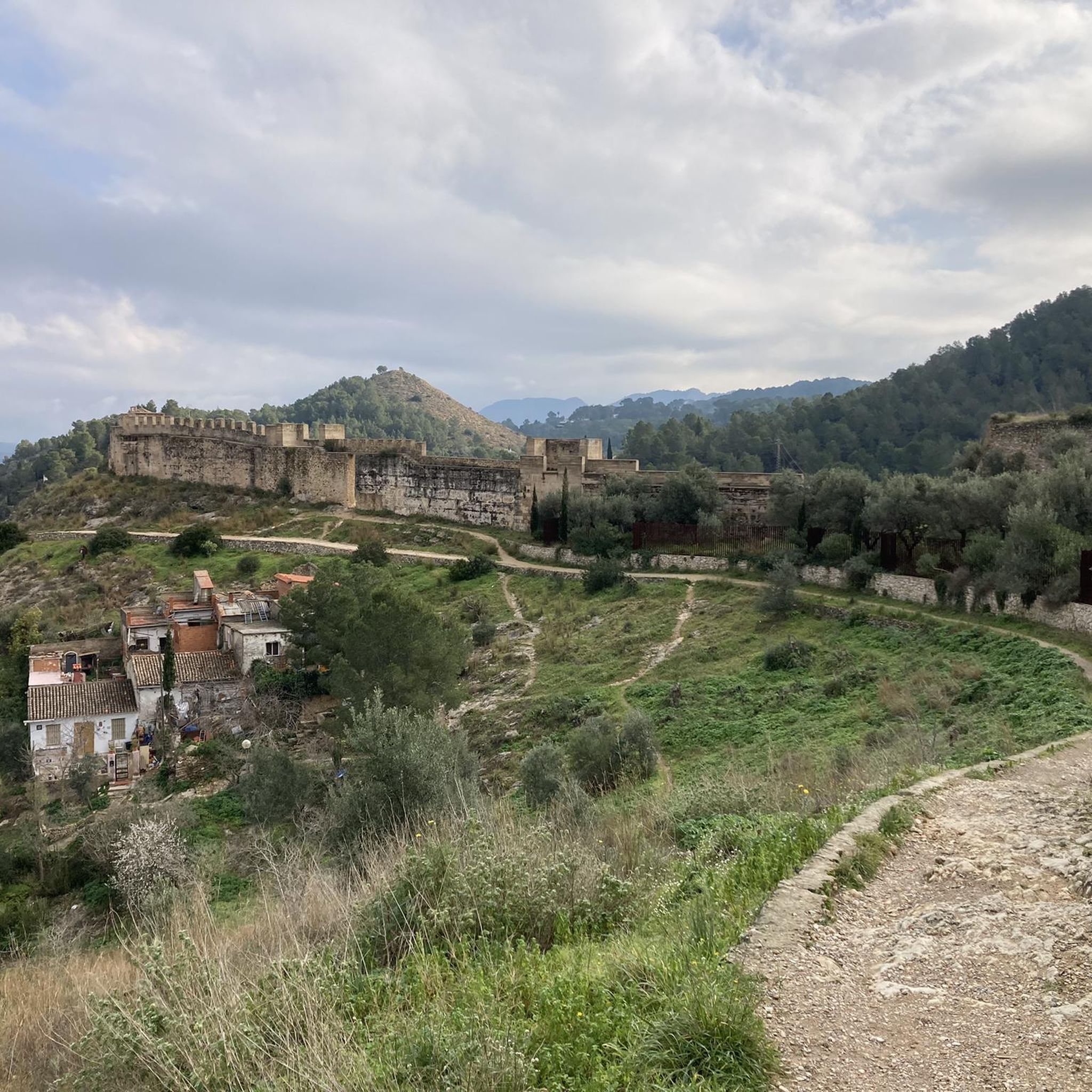
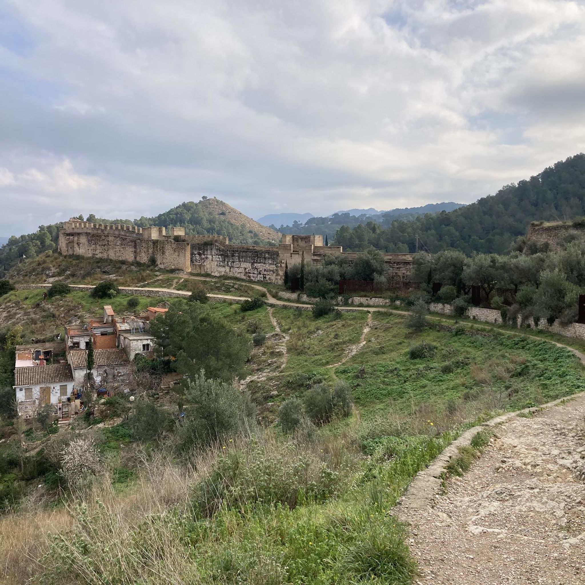
The La Cova Negra municipal natural area is located in the municipality of Játiva, province of Valencia. In the Cova Negra is the Middle Paleolithic site in which remains of Homo Neanderthal have appeared. This natural area is located in the narrow valley formed by the Albaida River, as it crosses the reliefs of the Sierra Grossa, at the exit of the so-called Estret de les Aigües. In the widest meander formed by the Albaida River, at the height of Pico del Paller, you can see the Cova Negra, named for the blackish appearance of its walls.
2
1


Completely surprising to me, a large, cool church with a very large altar. Be sure to go in.
1
0

nice town
1
0

Impressive facility and fantastic views
1
0

One of the ways to cross the river itself. I tried several others in the vicinity which were not suitable as the river flow to high
1
0

La Cova Negra is a cavity that is located in a gorge called the Strait of Waters. Its black color is mainly due to the smoke from the bonfires made by its former inhabitants, the Neanderthals who occupied it for a few months of the year. An important amount of flint tools and other archaeological remains have been found here.
3
0
Frequently Asked Questions
How many hiking trails are available in La Llosa de Ranes?
There are over 110 hiking trails around La Llosa de Ranes, offering a wide variety of options for different preferences and skill levels. You'll find everything from easy strolls to more challenging routes.
What kind of terrain can I expect on hikes around La Llosa de Ranes?
The terrain in La Llosa de Ranes is quite varied. You can expect to hike through steep, mountainous areas, especially around the Santa Anna Mountain, which offers incredible views. Other routes traverse the alluvial plain of the Cànyoles river, passing through irrigated crops and picturesque orange groves. This mix provides diverse scenery, from elevated trails to fertile lowlands.
Are there easy hiking options suitable for beginners in La Llosa de Ranes?
Yes, La Llosa de Ranes offers numerous easy hiking options. There are nearly 40 easy routes available, perfect for beginners or those looking for a relaxed walk. An example is the Xativa — Historic and Cultural Tour, which is an easy 4.4 km path guiding you through historic sites.
What do other hikers say about the trails in La Llosa de Ranes?
The hiking routes in La Llosa de Ranes are highly regarded by the komoot community, with an average rating of 4.6 stars from over 380 reviews. Hikers often praise the varied terrain, the scenic views from elevated points like Santa Anna Mountain, and the blend of natural beauty with historic sites.
Are there any challenging hikes for experienced trekkers in La Llosa de Ranes?
While many routes are moderate or easy, there are a few more challenging options for experienced trekkers. The region features 7 difficult trails that will test your endurance and offer rewarding experiences, often with significant elevation changes in the mountainous areas.
What natural features or viewpoints can I discover on the trails?
Hikers can discover a range of natural features and viewpoints. The Santa Anna Mountain area is known for its 'incredible views,' with the highest point, Greu de la Saliva, offering panoramic vistas. You'll also encounter numerous fountains fed by the Mota river and Xàrcol water, such as the Church fountain and Racó fountain, which are interesting points of interest along routes.
Are there any historical landmarks or attractions along the hiking routes?
Absolutely. The area is rich in historical landmarks. You can hike to the Castell de Xàtiva, a prominent castle, or visit the 15th-century Ermita de Santa Anna, which is a key hiking destination with extensive views. The 18th-century Ermita del Crist del Miracle is also nestled 'in the middle of nature,' suggesting it can be reached via pleasant walks.
Are there any circular hiking routes in La Llosa de Ranes?
Yes, there are several circular hiking routes available. For example, the Sun Tower of Xàtiva – Xàtiva Castle loop from Xàtiva is a popular 4.4 km circular trail that takes you through historic areas and up to the Xàtiva Castle.
Can I find family-friendly hiking trails in La Llosa de Ranes?
Yes, La Llosa de Ranes offers several family-friendly hiking trails. Many of the easy routes are suitable for families with children, providing accessible paths through varied landscapes. These trails often feature points of interest like fountains or recreational areas, making them enjoyable for all ages.
What is the best time of year to go hiking in La Llosa de Ranes?
The best time to go hiking in La Llosa de Ranes is generally during the spring and autumn months. These seasons offer pleasant temperatures, making for comfortable hiking conditions. Summers can be quite warm, so early mornings or late afternoons are preferable if hiking during that time. Winters are typically mild, but it's always wise to check local weather forecasts.
Are there any caves to explore near the hiking trails?
Yes, the region around La Llosa de Ranes features interesting caves. The Cova Negra is a notable cave in the area, and you can find routes like the Arcadetes d’Alboi Aqueduct – Cova Negra loop from Xàtiva that incorporate such natural wonders.
Is there public transport available to reach the trailheads?
While specific public transport details for every trailhead are not provided, La Llosa de Ranes is part of a wider regional network. For routes starting in nearby towns like Xàtiva, public transport options may be available. It's recommended to check local bus or train schedules for connections to the starting points of your chosen hikes.
Most popular routes around La Llosa De Ranes
Most popular attractions around La Llosa De Ranes

Get inspired with the komoot mobile app


Explore more
Browse the best Hikes in other regions.
