The best walks and hikes around Zestoa
4.5
(2126)
15,156
hikers
285
hikes
Hiking around Zestoa, located in the Basque Country, offers diverse terrain for outdoor activities. The region is characterized by the Izarraitz massif, providing a mountainous backdrop with green landscapes and undulating hills. The Urola River meanders through the area, contributing to picturesque riverside scenery. Nearby, the famous Zumaia Flysch Cliffs showcase impressive geological formations along the coast.
Best hiking trails around Zestoa
- The most popular hiking route is Algorri Flysch – Portutxiki Viewpoint loop from Zumaia, a 15.5 miles (25.0 km) trail that takes 7 hours 53 minutes to complete. This difficult route explores the dramatic coastal Flysch formations.
- Another top favourite among local hikers is San Telmo Hermitage – Algorri Flysch loop from Zumaia, an easy 2.9 miles (4.7 km) path. This trail offers views of the Flysch cliffs and coastal geology.
- Local hikers also love the Pagoeta Cross (676 m) – Murugil Summit (717 m) loop from Urdaneta, a 9.0 miles (14.6 km) trail leading through mountainous terrain, often completed in about 5 hours 0 minutes.
- Hiking around Zestoa is defined by the Izarraitz hills, the Urola River valley, and the nearby Flysch geological formations. The network offers options for easy, moderate, and difficult routes, catering to different ability levels.
- The routes in Zestoa are highly rated by the komoot community with an average score of 4.5 stars from over 1,900 reviews. More than 14,000 hikers have used komoot to explore Zestoa's varied terrain.
Last updated: July 3, 2026
4.7
(273)
1,583
hikers
24.1km
07:33
820m
820m
Hard hike. Very good fitness required. Mostly accessible paths. Sure-footedness required.
4.6
(32)
260
hikers
5.00km
01:19
50m
50m
Easy hike. Great for any fitness level. Easily-accessible paths. Suitable for all skill levels.

Sign up for free
4.3
(9)
112
hikers
2.97km
00:48
40m
40m
Easy hike. Great for any fitness level. Easily-accessible paths. Suitable for all skill levels.
4.4
(5)
19
hikers
Moderate hike. Good fitness required. Mostly accessible paths. Sure-footedness required.
5.0
(1)
25
hikers
Moderate hike. Good fitness required. Mostly accessible paths. Sure-footedness required.
Get access to more routes and recommendations from other explorers.
Sign up for free
Already have an account?
Our route recommendations are based on thousands of hikes, rides, and runs completed by other people on komoot.
Start today with a free account
Your next adventure awaits.
Login or Signup

Tips from the Community

A peak very close to Hernio. It's highly recommended to visit it after reaching the summit of Hernio, as the descent from this point to the Iturrihotz hamlet is much more manageable.
0
0

Absolutely breathtaking!
0
0

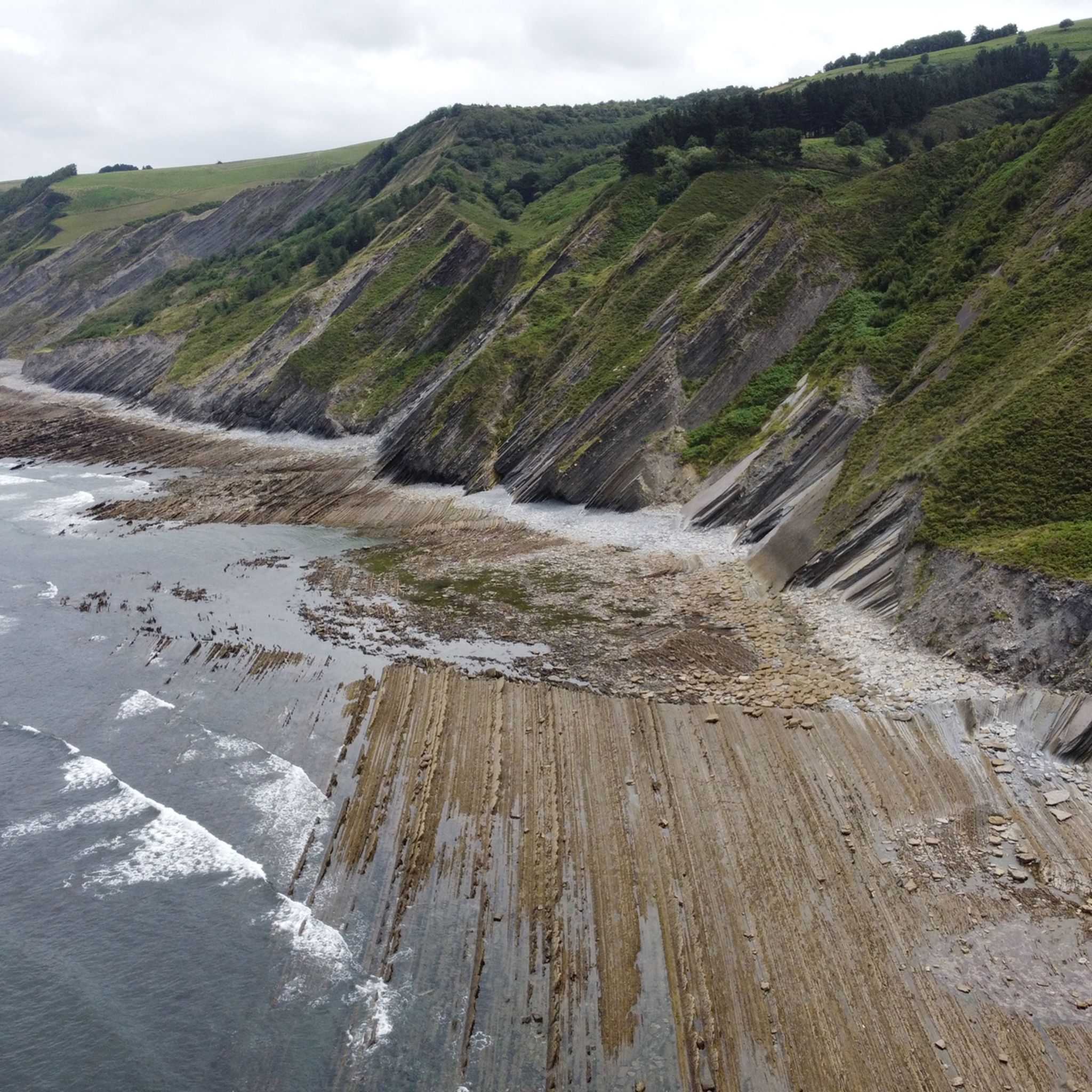
Super beautiful cliffs! Unfortunately, it was still high tide where we were, so the flysch cliffs were only visible at low tide. Check the tides at tideschart.com.
0
0

The first (or last section if reversing the route) section is absolutely NOT accessible. Possibly only at extreme low tide. We were there an hour before extreme low tide, and it was completely impossible. I would choose to simply follow the route at a higher elevation and skip the "beach" section. Especially since the beach is made up of large stones and rocks, difficult to walk on because you always have to watch your step due to loose stones.
1
0

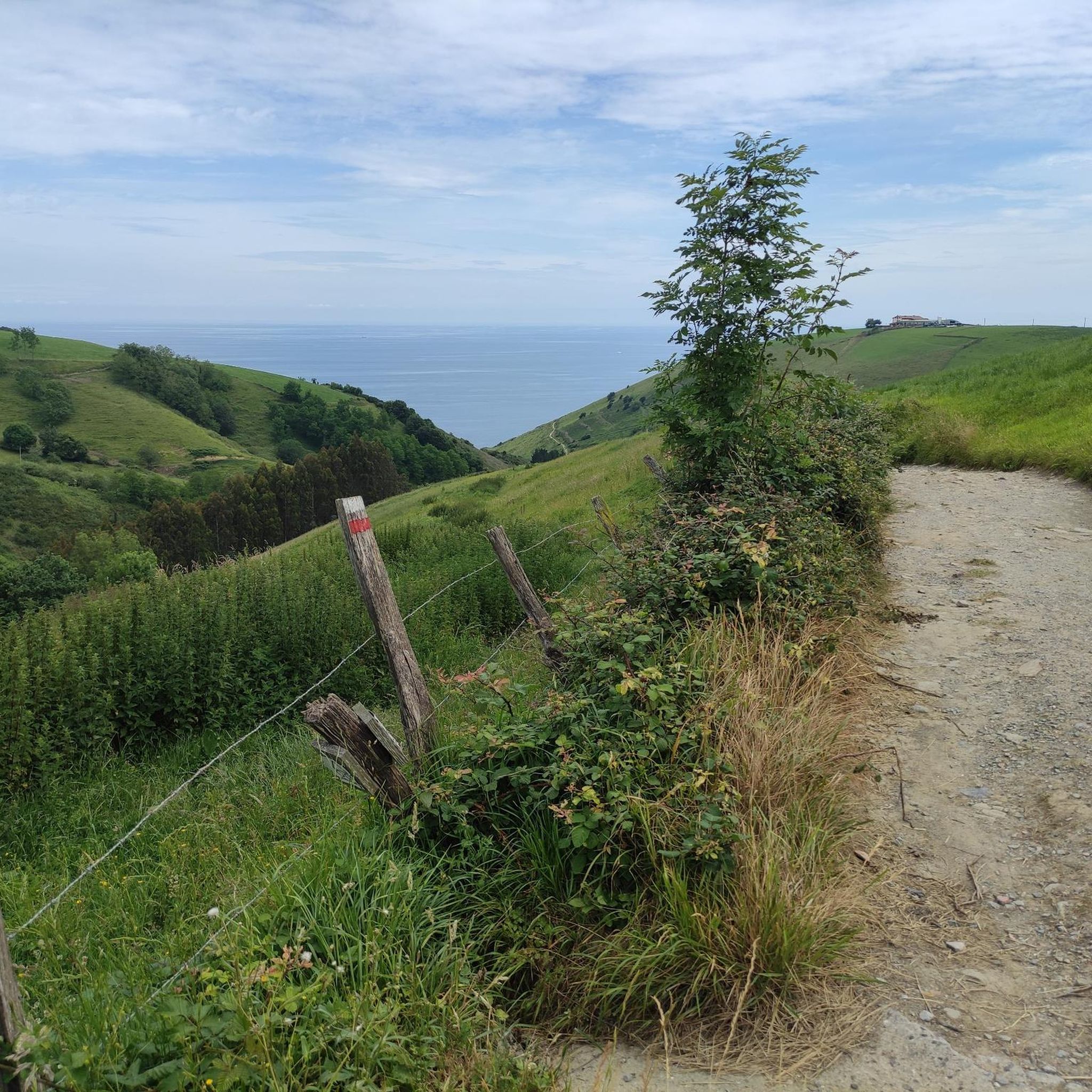
Mostly the area is windy especially due to topography. Do not forget to carry water with yourself. Enjoy the Bay of Biscay
2
0

Amazing views of much of the coast where you can see the flish
1
0


Spectacular route along the Cantabrian cornice enjoying the famous flich dating back 50 million years and its small hermitage with 8 Basque surnames.
3
0
Frequently Asked Questions
What types of landscapes can I expect to see while hiking in Zestoa?
Zestoa offers a diverse range of landscapes. You'll find the green, undulating hills of the Izarraitz Massif, tranquil paths along the Urola River, and the unique geological formations of the nearby Flysch Route, which showcases millions of years of Earth's history. The region also features interesting karst formations like caves and pinnacles.
How many hiking trails are available around Zestoa?
There are over 290 hiking routes around Zestoa, catering to various preferences and skill levels. This includes a good mix of easy, moderate, and difficult trails.
Are there options for different difficulty levels?
Yes, Zestoa offers a wide range of trails for all abilities. Approximately 74 routes are considered easy, 146 are moderate, and 73 are difficult, ensuring there's a suitable path for every hiker.
What natural landmarks or points of interest can I explore near Zestoa?
Beyond the stunning Flysch cliffs, you can explore several interesting points. The Zelatun Pass and Borda (mountain hut) is a notable spot, as are other mountain passes like Aittola-Zar Pass and Azkarate Pass. For a cultural experience, the replica of the UNESCO World Heritage Ekain Cave, Ekainberri, is nearby, showcasing ancient cave paintings.
Are there any family-friendly hiking trails in Zestoa?
Yes, Zestoa has several easy routes suitable for families. For instance, the route from Zestoa to Ibañarrieta offers a comfortable walk through fertile riverside agricultural lands, and a section of the Zestoa - Endoia trail follows the old Urola railway line, which is mostly flat and suitable for all ages. An easy option is the San Telmo Hermitage – Algorri Flysch loop from Zumaia, which is 4.7 km long.
Are there any circular hiking routes in Zestoa?
Many trails in the Zestoa area are designed as loops, allowing you to start and end at the same point. Examples include the challenging Algorri Flysch – Portutxiki Viewpoint loop from Zumaia, or the moderate Gazume Summit – Zelatun Pass and Borda (mountain hut) loop from Aztuimendi.
What is the best time of year to go hiking in Zestoa?
The Basque Country generally enjoys mild weather, making hiking pleasant for much of the year. Spring and autumn offer comfortable temperatures and vibrant scenery, while summer can be warm but still suitable for early morning or late afternoon hikes. Winter hiking is also possible, though some higher elevation trails might require more preparation.
What do other hikers say about the trails in Zestoa?
The hiking routes around Zestoa are highly regarded by the komoot community, with an average rating of 4.5 stars from over 1,900 reviews. Hikers often praise the diverse terrain, from coastal views to mountain paths, and the well-maintained trails.
Are there any challenging hikes for experienced hikers?
Absolutely. For experienced hikers, the region offers several difficult routes. The Algorri Flysch – Portutxiki Viewpoint loop from Zumaia is a demanding 25 km trail with significant elevation gain. Another challenging option is the Pagoeta Cross (676 m) – Murugil Summit (717 m) loop from Urdaneta.
Are there any historical or cultural sites accessible via hiking trails?
Yes, Zestoa is rich in history. The 16th-century Gothic Lili Palace is located on the outskirts and can be incorporated into walks. The area also has numerous archaeological sites like Idiakaitz and Erralla, attesting to human presence since the Paleolithic era. The Ekainberri replica cave, with its ancient art, is a must-visit cultural highlight near the trails.
Where can I find parking when hiking in Zestoa?
Parking is generally available in Zestoa town center and at various trailheads. Specific parking information for individual routes can often be found in the route descriptions on komoot, or by checking local signage near popular starting points.
How can I get to the hiking trailheads in Zestoa using public transport?
Zestoa is accessible by public transport, primarily bus services connecting it to larger towns in the Basque Country. From the town center, many trailheads are within walking distance. For routes further afield, local bus services might connect to smaller villages that serve as starting points. It's advisable to check current bus schedules for specific destinations.
Most popular attractions around Zestoa

Get inspired with the komoot mobile app


Explore more
Browse the best Hikes in other regions.
