The best road cycling routes around Villanueva De Algaidas
4.6
(5)
1,143
riders
92
rides
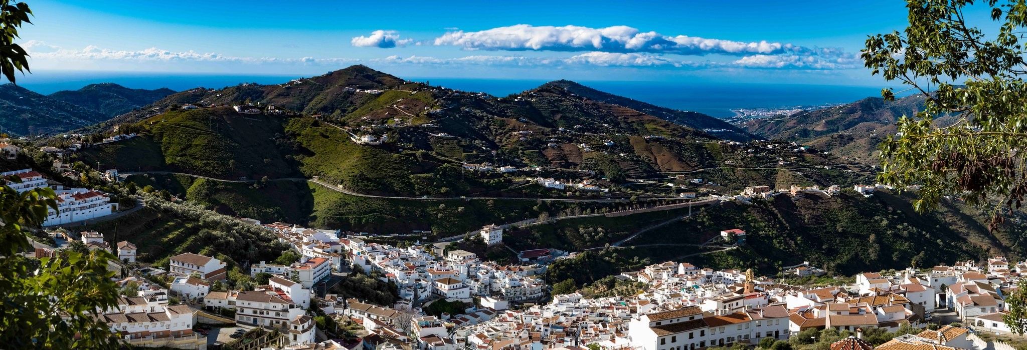
Road cycling around Villanueva De Algaidas offers diverse landscapes in the northwest of the Málaga region. The terrain primarily features hills and ridges covered with olive groves and cereal fields, providing a mainly flat landscape suitable for cycling. To the south, the Sierra de Arcas and Sierra de Pedroso mountain ranges introduce more varied terrain. The region also provides views of the Antequera Plain and the River Genil Valley, making for scenic road bike trails Villanueva De Algaidas.
Best road…
Last updated: October 28, 2026
24
riders
Moderate road ride. Good fitness required. Mostly well-paved surfaces and easy to ride.
25
riders
98.7km
04:53
1,520m
1,520m
Hard road ride. Very good fitness required. Mostly well-paved surfaces and easy to ride.

18
riders
Moderate road ride. Good fitness required. Some segments of this route may be unpaved and difficult to ride.
36
riders
62.9km
02:47
490m
490m
Moderate road ride. Good fitness required. Mostly well-paved surfaces and easy to ride.
10
riders
101km
05:14
1,710m
1,710m
Hard road ride. Very good fitness required. Mostly well-paved surfaces and easy to ride.
Get access to more routes and recommendations from other explorers.
Already have an account?
Our route recommendations are based on thousands of hikes, rides, and runs completed by other people on komoot.
Start today with a free account
Your next adventure awaits.



Other adventures around Villanueva De Algaidas

Tips from the Community


The Laguna de Fuente de Piedra provides an important habitat for large flamingo colonies and is one of the most significant breeding grounds for this bird species in Europe. The shallow salt lagoon offers ideal conditions for the birds, allowing them to be observed there in large numbers, especially during the warmer months.
2
0
The Mirador offers a sweeping panoramic view of the surrounding hills at the foot of the El Torcal Natural Park. From here, one can see across rolling hills, olive and almond groves, and the expansive valley stretching below the village. In the background, striking rock formations rise, while the village itself is picturesquely nestled into the landscape.
1
0
At the end of the steady climb, where a sign reads El Torcal, you reach the pass, which runs along the western edge of the mountain range of the same name. Just a few kilometers further on, a separate road branches off to the El Torcal de Antequera Natural Park and its visitor center. From here, a sweeping view opens up across the surrounding mountain ranges. The pass lies directly on the main road connecting Antequera and Villanueva de la Concepción, making it a prominent landmark. Many mistake it for the natural park itself, but it actually marks the highest point of the road on the edge of the impressive karst mountains.
1
0

about 5,600 years ago 😮 1,140 tons 😲
4
0
The Conjunto Arqueológico Dólmenes de Antequera is an important historical landmark in Andalusia. The site consists of three ancient stone tombs – Menga, Viera, and El Romeral – as well as the natural monuments Peña de los Enamorados and El Torcal. It has been a UNESCO World Heritage site since 2016. The largest part of the site is the Dolmen de Menga. It was built between 3800 and 3600 BC using massive stones. A unique feature is that it is aligned with the Peña de los Enamorados rock. Nearby lies the Dolmen de Viera, which was created between 3500 and 3000 BC. It is constructed so that sunlight shines into the tomb during the equinox. The third part, Tholos de El Romeral, is located about four kilometers away. It was built around 2500 BC and has a circular shape with a special stone ceiling.
2
0
The city gate of Antequera was built in 1749 in the Baroque style, demolished in the 19th century, and faithfully reconstructed in the 1990s. Today, the Puerta de Estepa is a symbolic gateway to the city.
3
0
Fuente de Piedra is a charming village whose name derives from an ancient spring believed to possess healing powers. The area was already settled in Roman times, and the spring was then referred to as "Fons Divinus." In the Middle Ages, a small settlement grew up around the spring, which later acquired its present name. During the 18th and 19th centuries, Fuente de Piedra was a renowned spa town thanks to its mineral waters, until the spring dried up. Today, the village's name evokes this past, while its history remains closely intertwined with the use and veneration of the water.
1
0
Frequently Asked Questions
What kind of terrain can I expect when road cycling around Villanueva de Algaidas?
The region primarily features rolling hills and ridges covered with extensive olive groves and cereal fields, offering a mainly flat to undulating landscape. To the south, the Sierra de Arcas and Sierra de Pedroso mountain ranges introduce more varied and challenging terrain, providing scenic views of the Antequera Plain and the River Genil Valley.
How many road cycling routes are available in the Villanueva de Algaidas area?
There are nearly 100 road cycling routes around Villanueva de Algaidas, catering to various preferences. These routes are part of an extensive network, including sections of the Sierra Norte de Málaga Bike Territory.
Are there any easy road cycling routes suitable for beginners in Villanueva de Algaidas?
While the area is known for its diverse terrain, the routes around Villanueva de Algaidas are generally classified as moderate or difficult. There are no routes specifically rated as 'easy' in our current selection, but many moderate routes offer manageable gradients for cyclists with some experience.
What are some notable natural features I can see while cycling in the region?
You'll encounter lush olive groves, white farmhouses, and views of the Antequera Plain and River Genil Valley. The Burriana Stream (Arroyo Bebedero) flows through a riparian forest, and further afield, the Iznájar Reservoir, Andalusia's largest, offers scenic beauty. A challenging route like Iznájar Dam and Reservoir – Benamejí loop from Villanueva de Algaidas will take you towards this impressive reservoir.
Are there any historical landmarks or viewpoints along the road cycling routes?
Yes, the region is rich in history and scenic spots. You can explore ancient sites like the Los Alcaides Necropolis or the 9th-century Mozarabic cave chapels. For panoramic views, consider visiting El Cedrón Viewpoint, which offers vistas of three Andalusian provinces. The ruins of the 16th-century Convent of Nuestra Señora de la Consolación also provide a glimpse into the past.
What is the best time of year to go road cycling in Villanueva de Algaidas?
The region generally enjoys a mild climate, making spring (March to May) and autumn (September to November) ideal for road cycling. During these seasons, temperatures are pleasant, and the landscape is vibrant. Summers can be very hot, and winters can be cooler with occasional rain, so checking the weather forecast is always recommended.
Can I find circular road cycling routes in Villanueva de Algaidas?
Yes, many of the routes in the area are designed as loops, allowing you to start and finish in the same location. For example, the popular Fuente de Piedra – Fuente de Piedra Lagoon loop from Villanueva de Algaidas is a moderate 45.2-mile (72.8 km) circular trail.
What do other cyclists say about road cycling in Villanueva de Algaidas?
The routes in Villanueva de Algaidas are highly rated by the komoot community, with an average score of 4.5 stars from over 6 reviews. Cyclists often praise the diverse landscapes, the quiet roads through olive groves, and the challenging climbs in the more mountainous sections.
Are there any family-friendly road cycling options in the area?
While there are no 'easy' routes, families with older children or those accustomed to moderate distances and some elevation gain can enjoy routes like Benamejí – Encinas Reales loop from Villanueva de Algaidas. The region's mainly flat sections and numerous cycle paths can be adapted for a family outing, but be prepared for some hills.
Is there parking available for road cyclists in Villanueva de Algaidas?
As a charming village, Villanueva de Algaidas typically offers various public parking options within or on the outskirts of the town, making it convenient to park your vehicle before starting your cycling adventure. Specific parking areas are usually well-marked.
What is the typical length and difficulty of road cycling routes around Villanueva de Algaidas?
Routes vary significantly in length and difficulty. You'll find moderate routes around 30-45 miles (50-70 km) with moderate elevation, such as the Avenida de los Cipreses loop from Villanueva de Algaidas. More challenging routes can extend to nearly 60 miles (95 km) with significant elevation gains, like the Molino Jabonero - Learn everything about Olives loop from Villanueva de Tapia.
Are there cafes or places to stop for refreshments along the routes?
Villanueva de Algaidas and the surrounding villages you'll pass through on your rides offer local cafes, bars, and restaurants where you can stop for refreshments, a meal, or to refill your water bottles. These establishments are often found in the village centers.
Most popular routes around Villanueva De Algaidas
Most popular attractions around Villanueva De Algaidas

Get inspired with the komoot mobile app


Explore more
Browse the best Road cycling routes in other regions.
