The best running trails around Pepino
3.7
(20)
1,090
runners
87
runs
Jogging around Pepino offers a variety of routes across its landscape. The region features routes that often traverse plains and areas around reservoirs, providing generally flat to gently undulating terrain. These paths are suitable for consistent running without significant elevation changes. The network of trails allows for exploration of the local environment, including open spaces and natural features.
Best jogging routes around Pepino
- The most popular jogging route is La Portiña Reservoir loop from Embalse de La Portiña, a…
Last updated: July 2, 2026
4.0
(3)
47
runners
6.51km
00:47
20m
20m
Moderate run. Good fitness required. Mostly paved surfaces. Suitable for all skill levels.
4.0
(3)
47
runners
6.57km
00:47
20m
20m
Moderate run. Good fitness required. Mostly paved surfaces. Suitable for all skill levels.

Sign up for free
9
runners
6.35km
00:39
10m
10m
Moderate run. Good fitness required. Mostly paved surfaces. Suitable for all skill levels.
8
runners
6.85km
00:47
60m
60m
Moderate run. Good fitness required. Mostly paved surfaces. Suitable for all skill levels.
9
runners
13.7km
01:26
50m
50m
Moderate run. Good fitness required. Mostly paved surfaces. Suitable for all skill levels.
Get access to more routes and recommendations from other explorers.
Sign up for free
Already have an account?
Our route recommendations are based on thousands of hikes, rides, and runs completed by other people on komoot.
Start today with a free account
Your next adventure awaits.
Login or Signup


Other adventures around Pepino

Tips from the Community

A section of approximately 2 km. The "Camino de Segurilla – Atalaya de Segurilla" route is ideal for hiking or cycling. The route begins at the Glorieta de los Tres Olivos roundabout in Talavera de la Reina. From there, access the "Camino de Segurilla" heading north, passing under the railway line and continuing along a paved or dirt track. There is also an option from Mejorada: Plaza de la Constitución, following the "Camino Mejorada–Segurilla" to the watchtower.
18
0
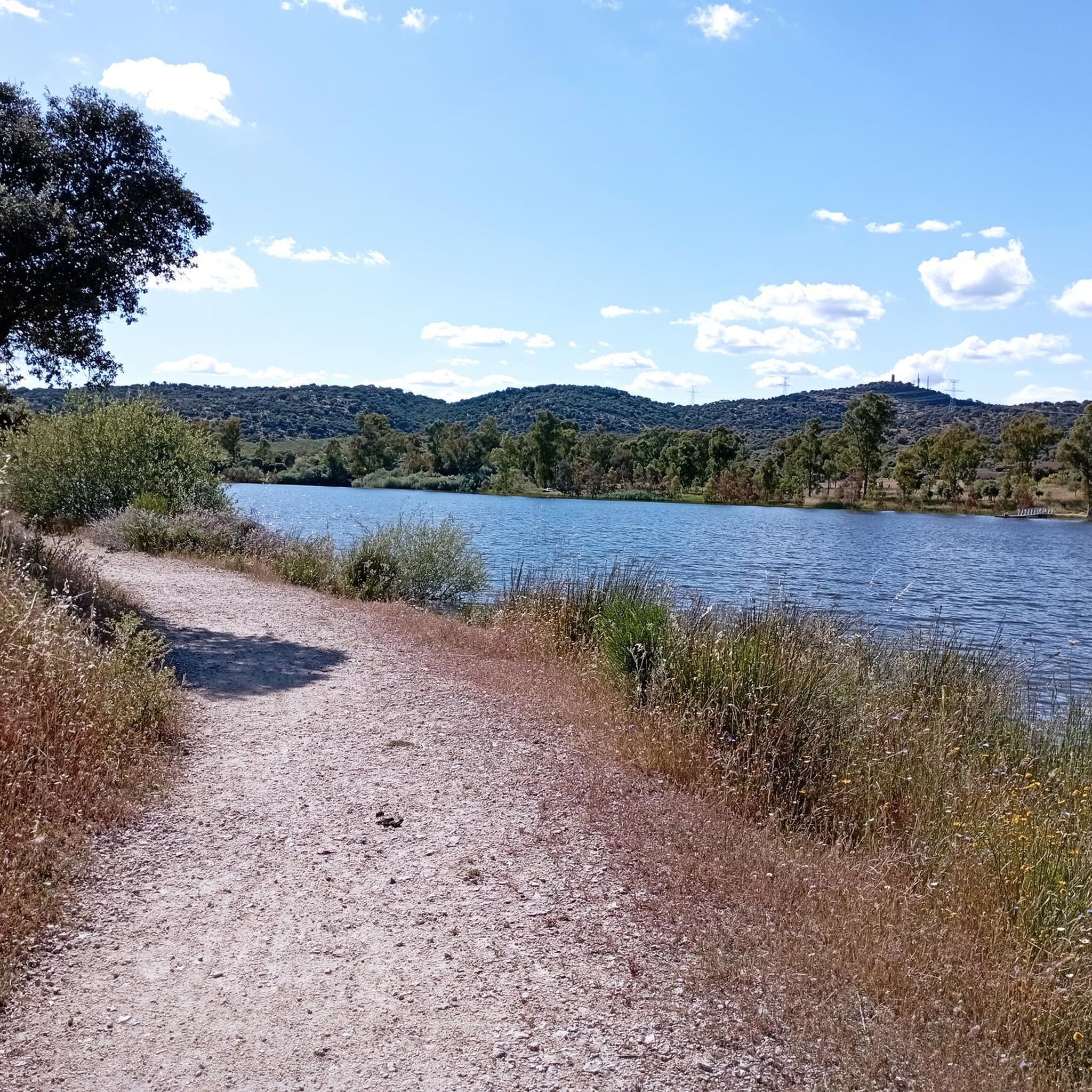
La Portiña is a small water reservoir located north of Talavera de la Reina on the Portiña stream and next to the natural environment of the Berrocal mountain range.
9
0

Small, but very beautiful Talavera de la Reina reservoir. There are trails to go around it on foot or by mountain bike. The Portiña Reservoir is a suitable place to relax in the shade, eat (it has a picnic area), fish and walk along the water.
2
0

All flat looking for Don Quixote
5
1
Frequently Asked Questions
How many running routes are available around Pepino?
There are over 90 running routes documented around Pepino on komoot, offering a wide variety of options for joggers of all levels.
What types of terrain can I expect on jogging routes in Pepino?
Jogging routes around Pepino primarily feature plains and paths around reservoirs. The terrain is generally flat to gently undulating, making it suitable for consistent running without significant elevation changes. You'll find open spaces and natural features along these paths.
Are there any easy or beginner-friendly jogging routes in Pepino?
Yes, Pepino offers several easy routes perfect for beginners. For example, the La Portiña Reservoir loop from Embalse de La Portiña is a moderate 4.0-mile (6.5 km) trail with minimal elevation gain, ideal for a steady run.
Can I find circular running routes in Pepino?
Absolutely. Many of the routes in Pepino are designed as loops, offering convenient circular paths. Popular options include the La Portiña Reservoir loop from Embalse de La Portiña and the Castilla-La Mancha Plains loop from Talavera de la Reina.
What do other runners think about the trails in Pepino?
The running routes in Pepino are highly rated by the komoot community, with an average score of 3.6 stars from more than 10 reviews. Over 1000 runners have used komoot to explore Pepino's varied terrain, often praising the accessible reservoir loops and open plains.
Are there any interesting landmarks or sights to see while running in Pepino?
While jogging around Pepino, you might encounter various points of interest. Nearby attractions include the historic city of Talavera de la Reina, the impressive Castilla-La Mancha Bridge, and the Reina Sofía Bridge. You can also find the El Salvador Meeting and Culture Center and the San Vicente Hill (1320m) in the wider area.
What is the typical length and duration of running routes in Pepino?
Most jogging routes in Pepino are moderate in length, typically ranging from 4 to 8 miles (6 to 13 km). For instance, the La Portiña Reservoir loop from Cortijo de Valdelafuente is 4.1 miles (6.6 km) and takes about 47 minutes, while the Atalaya loop from Lago Chaparral is a longer 8.5 miles (13.7 km) route.
Are there any running routes that offer viewpoints?
While the routes primarily traverse plains and reservoir edges, offering open vistas, the wider region includes features like the San Vicente Hill, which provides higher vantage points. Many routes around the reservoirs offer scenic views of the water and surrounding landscape.
Are there any longer running trails for more experienced runners?
Yes, for those looking for a longer challenge, the Atalaya loop from Lago Chaparral is a moderate 8.5-mile (13.7 km) route that provides a more extended running experience through the area.
What are the most popular running routes in Pepino?
Among the most popular running routes are the La Portiña Reservoir loop from Embalse de La Portiña and the La Portiña Reservoir loop from Cortijo de Valdelafuente, both offering scenic views around the reservoir. The Castilla-La Mancha Plains loop from Talavera de la Reina is also a local favorite.
Are there any running routes that start from Talavera de la Reina?
Yes, you can find running routes that start from Talavera de la Reina, such as the Castilla-La Mancha Plains loop from Talavera de la Reina, which is a 3.9-mile (6.3 km) trail through open plains.
Most popular attractions around Pepino

Get inspired with the komoot mobile app


Explore more
Browse the best Running Trails & Routes in other regions.
