The best walks and hikes around Santa Ana De Pusa
5.0
(2)
11
hikers
5
hikes
Hiking around Santa Ana De Pusa offers access to diverse natural landscapes within the Montes de Toledo and the scenic Pusa valley. The region features rugged terrain with granite formations, abundant holm oaks, and various scrublands. The Pusa River is a central feature, flowing through the area and forming the Gorges of the Pusa River, which are accessible via several trails. This varied environment provides a range of hiking experiences.
Best hiking trails around Santa Ana De Pusa
- The most…
Last updated: May 27, 2026
5.0
(1)
6
hikers
8.58km
02:22
150m
150m
Moderate hike. Good fitness required. Easily-accessible paths. Suitable for all skill levels.
5.0
(1)
1
hikers
16.7km
04:28
200m
200m
Moderate hike. Good fitness required. Easily-accessible paths. Suitable for all skill levels.

Sign up for free
4.58km
01:15
70m
70m
Easy hike. Great for any fitness level. Easily-accessible paths. Suitable for all skill levels.
7.67km
02:08
140m
140m
Moderate hike. Good fitness required. Easily-accessible paths. Suitable for all skill levels.
Easy hike. Great for any fitness level. Easily-accessible paths. Suitable for all skill levels.
Our route recommendations are based on thousands of hikes, rides, and runs completed by other people on komoot.
Start today with a free account
Your next adventure awaits.
Login or Signup
Popular around Santa Ana De Pusa

Tips from the Community

A town located in a very picturesque environment, on the slopes of the Montes de Toledo, in the Pusa valley that I recommend you see.
1
1
A place to enjoy the waters of the Pusa river and cool off before continuing on the road.
0
0
Views of the Pusa river, with Montes de Toledo in the background. A quiet place for nature lovers.
0
1
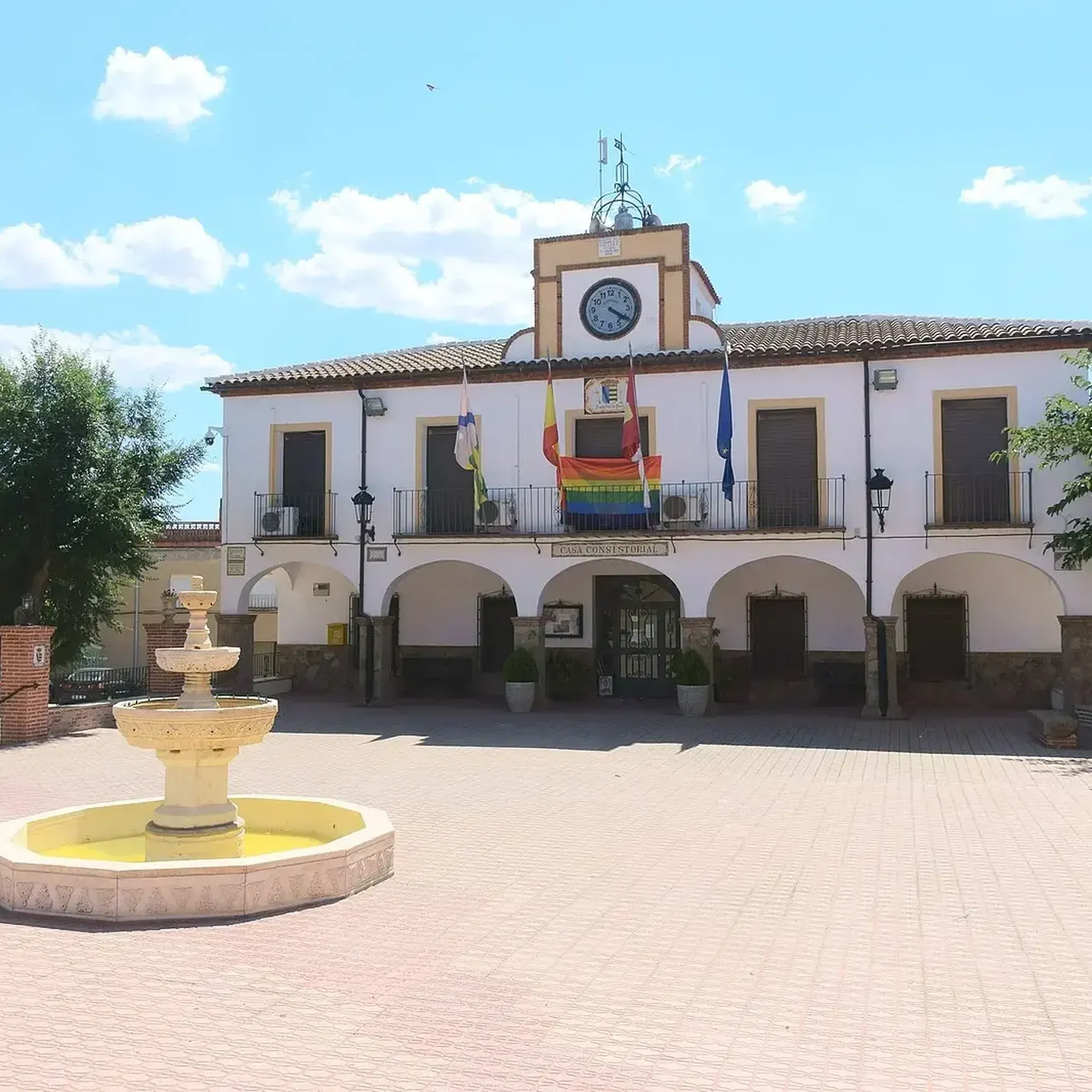
Among the monuments of the town, the parish church of San Bartolomé and the town hall stand out. We can also see a powder magazine from the Civil War, which is a military construction, which was also used as an air raid shelter.
2
0
This section of the PR-TO 35 trail passes along the banks of the Sangrera River. We can enjoy the richness of the vegetation and the company of waterfowl.
2
0

The weir or old Jabonero dam was used to power the mills that were built on the banks of the Pusa River. They are currently a site visited for its scenic beauty since the riverbed through these sectors is very picturesque.
3
0
This area of the Pusa river known as the "Narrowness" has been used in the past with mills that, although they are currently in ruins, I recommend visiting them since the landscape is very picturesque.
2
0
Frequently Asked Questions
How many hiking trails are available in Santa Ana de Pusa?
Santa Ana de Pusa offers a selection of 4 hiking routes, ranging from easy to moderate difficulty. These trails allow you to explore the diverse landscapes of the Pusa valley and the Montes de Toledo.
What kind of terrain can I expect when hiking in Santa Ana de Pusa?
The region is characterized by rugged terrain with granite formations, abundant holm oaks (encinas), and various scrublands. Many trails follow the picturesque Pusa River, offering a mix of riverside paths and woodland sections.
Are there easy hiking options suitable for beginners or families?
Yes, there are easy hiking options. For instance, the Malpasillo Bridge and Estrechura del Pusa Loop is an easy 4.6 km trail that takes about 1 hour 15 minutes to complete. Another accessible option is the Jabonero Dam – Estrechura of the Pusa River loop from Santa Ana de Pusa, an easy 6.9 km loop starting directly from the town.
Are there any circular hiking routes in Santa Ana de Pusa?
Yes, several routes in the area are circular. The Río Pusa from Los Navalucillos — circular is a popular moderate option, and the Presa del Jabonero – circular from Retamoso de la Jara via the Pusa river also offers a moderate circular experience.
What are the best times of year to go hiking in Santa Ana de Pusa?
The spring and autumn months are generally ideal for hiking in Santa Ana de Pusa. During these seasons, the temperatures are milder, and the natural scenery is particularly vibrant, with blooming wildflowers in spring and rich colors in autumn. Summers can be hot, so early mornings or late afternoons are recommended if hiking during that time.
Can I see any historical or natural landmarks while hiking?
Yes, the area features notable landmarks. The Pusa River itself is a central natural feature, with dramatic sections like the 'Hoces del Río Pusa' (Gorges of the Pusa River). You can also visit the historic Jabonero Dam, an old weir on the Pusa River that once powered local mills and is integrated into several hiking paths.
Are the trails in Santa Ana de Pusa suitable for dogs?
Many trails in natural areas like Santa Ana de Pusa are generally dog-friendly, but it's always advisable to keep dogs on a leash, especially in areas with wildlife or near livestock. Ensure you carry enough water for your pet, particularly on longer routes or during warmer months, as water sources may be limited.
What do other hikers enjoy the most about hiking in Santa Ana de Pusa?
The area is highly rated by the komoot community, with an average score of 5.0 stars. Hikers often praise the serene river paths, the unique granite formations, and the immersive experience of walking through holm oak forests.
Are there any trails that offer views of the Pusa River?
Absolutely. The Pusa River is a defining feature of the region, and many trails follow its course. The Sangrera River Valley Trail, for example, provides extensive views of the river valley and its varied terrain.
What should I bring for a day hike in Santa Ana de Pusa?
For a day hike, it's recommended to bring sufficient water, snacks, appropriate footwear for varied terrain, sun protection (hat, sunscreen), and a map or GPS device. Depending on the season, layers of clothing are also advisable due to potential temperature changes.
Are there any longer, more challenging hikes available?
While there are no routes classified as 'difficult' in our current selection, the Sangrera River Valley Trail is a moderate 16.7 km path that offers a longer excursion, taking approximately 4 hours 28 minutes to complete. This route provides a more extensive exploration of the river valley.
Most popular routes around Santa Ana De Pusa
Most popular attractions around Santa Ana De Pusa

Get inspired with the komoot mobile app


Explore more
Browse the best Hikes in other regions.
