The 20 Most Amazing Peaks around Es Bòrdes
Best mountain peaks around Es Bòrdes serve as a gateway to the Val d'Aran region of the Spanish Pyrenees. This area offers a diverse range of mountainous experiences, from challenging ascents to picturesque hikes. The surrounding landscape features alpine environments, lush forests, and dramatic cliffs. Its strategic location makes it an ideal base for exploring a significant portion of the central Pyrenees.
Best mountain peaks around Es Bòrdes
- The most popular mountain peaks is Salvaguardia Peak, a summit that…
Last updated: May 10, 2026
Picada Pass
Highlight • Mountain Pass
very beautiful, with unbeatable views of the north face of Maladeta.
The path is well defined …
Translated by Google •
Tip by

Pico de Aneto Summit
Highlight • Summit
Translated by Google •
Tip by

Sign up now to discover places like this
Get recommendations on the best single tracks, peaks, & plenty of other exciting outdoor places.
Sign up for free
Montcorbison Peak
Highlight • Summit
Translated by Google •
Tip by

Salvaguardia Peak
Highlight • Summit
To Puerto de Benasque good trails. Also suitable for …
Translated by Google •
Tip by

Mahoma Pass
Highlight • Climb
Translated by Google •
Tip by

Sign up for free to discover even more peaks around Es Bòrdes.
Sign up for free
Already have an account?
Start today with a free account
Your next adventure awaits.
Login or Signup


Tips from the Community

The highest peak in the Pyrenees mountaineering region.
1
0

The highest peak in the Pyrenees and the one everyone wants to climb. Its demands are more physical than technical, with the exception of the Mahoma Pass, not suitable for those with vertigo, and the Aneto Glacier, which is recommended to avoid in the middle of summer when the hard centuries-old ice is exposed and landslides increase due to melting. At the top you will find a gigantic metal cross, a statue of the Virgen del Pilar and a small bust of San Marsial, patron saint of Benasque. Each of them installed by different groups that want to make their own a piece of this colossus that, although it is difficult to believe, went unnoticed for centuries in the shadow of the apparently more prominent Tuca de la Maladeta (from the Occitan "Mall Hita", the 'high peak').
1
0

Aneto is the highest peak in the Pyrenees and the second highest in the Iberian Peninsula, with an altitude of 3,404 meters above sea level. It is located in the Posets-Maladeta Natural Park, in the Spanish municipality of Benasque, province of Huesca, autonomous community of Aragon. It is part of the Maladeta massif and, located in the Benasque valley, is made up of Paleozoic terrain of granitic nature and Mesozoic materials. On its northern face, starting at approximately 2810 m, is the largest glacier in the Pyrenees, with about 100 hectares of surface, which is, like many in the world, in clear regression as a consequence of climate change (it is estimates that in the last 100 years it has lost more than half of its surface, and that in 30 or 40 years it may disappear).
2
0

The Aneto, roof of the Pyrenees and watchtower over the park, is a symbol and a challenge for mountaineers who come to this natural park to climb to 3404 meters high. The most frequented routes are the one on the north side from Besurta, and the one on the south side from the Coronas bridge to Vallibierna.
3
0
A horizontal passage of 40 meters in length and with considerable verticality on both sides, separates the summit from the summit. It is also the last difficulty we will have to overcome before reaching Aneto. Albert de Franqueville, one of the first men to summit the Aneto, was the one who gave this name to this part of the mountain: "Fineer than a hair and sharper than a saber", that is the bridge of Muhammad according to the legend: the entrance to Paradise, at the top of the Aneto, for the eyes of Franqueville. The factors for which this step is dangerous are: - The verticality on both sides of the step and the inevitable feeling of vertigo. A fall is fatal. - In some sections you have to use your hands to move forward. - The possible density of people crossing the pass. All mountaineers who climb Aneto must cross this pass twice: to go there and to return. There are points on the Muhammad Bridge where two people cannot cross. Be patient. - The possible presence of water, ice and snow, which can make the passage slippery. - Vulnerability to lightning strikes in the event of a storm. For these reasons, it is not necessary to do this section of the ascent if it is not completely safe, nor to force anyone to go through it. Accumulated fatigue and nerves are a bad combination that can end in fatality.
3
1

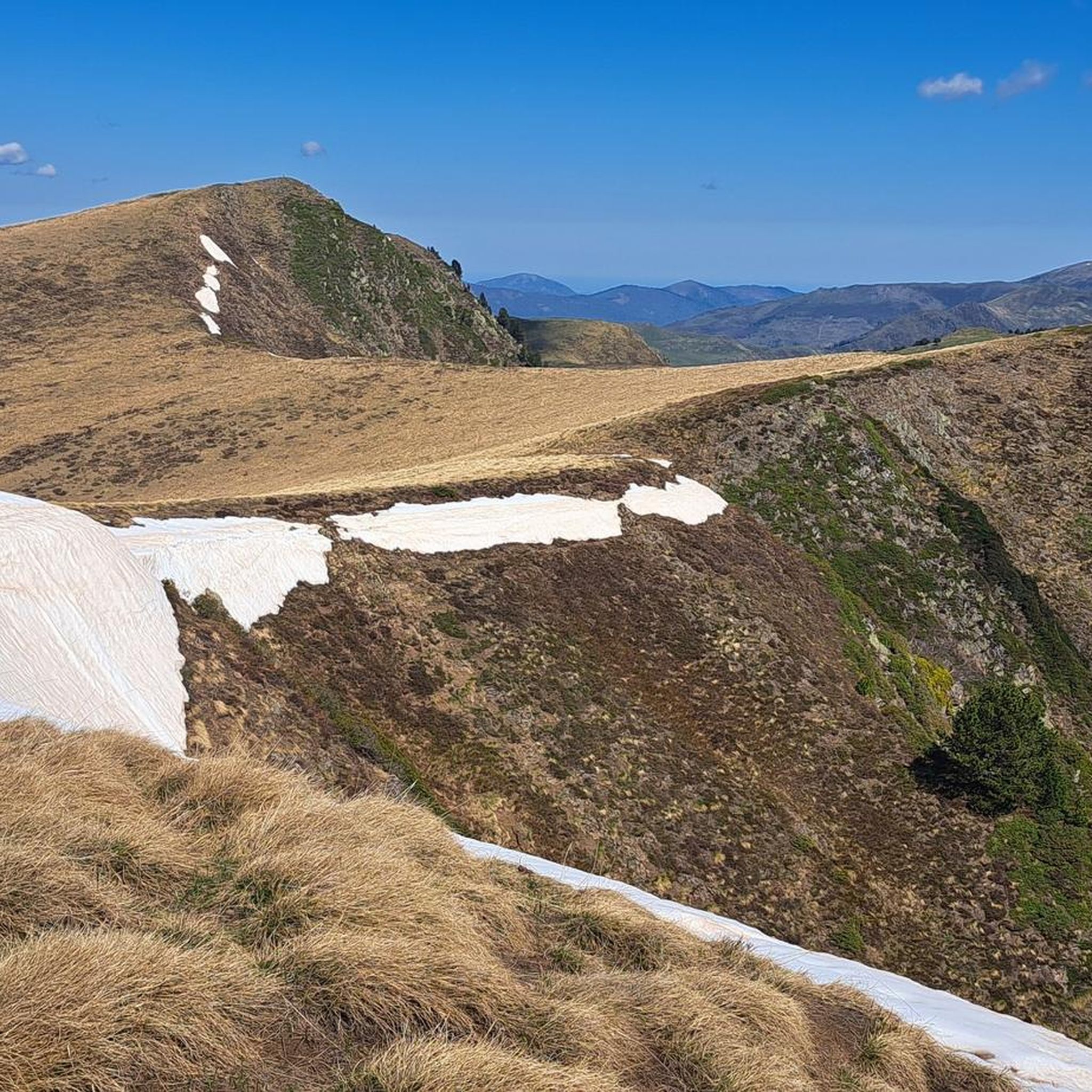
From the Benasque Hospital to Puerto de la Picada, it is a simple and very beautiful, with unbeatable views of the north face of Maladeta. The path is well defined and marked by milestones until reaching Port de la Picada itself. It goes up gently in a zigzag pattern until it reaches the Basetas del Portillón, small lakes that can sometimes be found dry. From here, we turn right, looking for an easterly orientation to overcome the last slope that leaves us at Port de la Picada. On the other side, you can see small lakes called Bom des Clòts de Lunfèrn and the Valley that descends towards Artiga de Lin (Vall d'Aran).
1
0

Montcorbison is a mountain of 2,172 meters that is located in the municipality of Vielha e Mijaran, in the region of Vall d'Aran. This peak is included in the list of the 100 peaks of the FEEC
3
0

An easy climb gives access to the top of Aneto
2
0
Frequently Asked Questions
What are some of the most prominent mountain peaks accessible from Es Bòrdes?
From Es Bòrdes, you can access a range of impressive peaks in the Val d'Aran. Notable summits include Tuc de Molières, the highest peak within the Val d'Aran, and Malh des Pois (Forcanada), an emblematic mountain visible from the Artiga de Lin valley. Other significant peaks are Montarto and Montcorbison, known for their various hiking routes and views.
Which mountain peaks offer the most challenging ascents near Es Bòrdes?
For experienced mountaineers seeking a challenge, the Pico de Aneto Summit is the highest peak in the Pyrenees and a significant ascent. Its demands are more physical than technical, with the exception of the Mahoma Pass. Tuc de Molières also offers an exhilarating challenge with an alpine atmosphere and panoramic views.
Are there any family-friendly natural attractions or easier mountain experiences near Es Bòrdes?
Yes, the Artiga de Lin valley is highly recommended for its picturesque landscape and accessibility, offering diverse hiking opportunities suitable for various levels, including families. Within this valley, the Uelhs deth Joeu (Eyes of the Joeu) is a must-visit natural phenomenon, featuring an impressive waterfall and an easy circular hike ideal for families.
What unique natural features can I explore in the mountains around Es Bòrdes?
Beyond the peaks, the region boasts unique natural features. The Uelhs deth Joeu is geologically significant, as it's where water from the distant Aneto glacier resurfaces. The Colomers cirque, home to Pico de Ratera, is the largest glacial cirque in the Pyrenees, featuring over 30 glacial lakes, offering a truly spectacular setting.
What kind of panoramic views can I expect from the mountain peaks in the Val d'Aran?
The mountain peaks around Es Bòrdes offer breathtaking panoramic views. From Tuc de Molières, you can see the entire Val d'Aran and the distant Aneto massif. Montcorbison provides expansive views over Vielha and the Aneto massif. Additionally, Salvaguardia Peak offers a phenomenal panoramic view of Luchon and the great mountains of the Valle de Benasque.
What are some popular hiking routes near Es Bòrdes that explore these mountain areas?
Several popular hiking routes allow you to explore the mountain areas near Es Bòrdes. An easy and very beautiful route is from Benasque Hospital to Picada Pass, offering unbeatable views of the north face of Maladeta. For a family-friendly option, consider the 'Artiga de Lin y Uelhs deth Joeu / Eyes of the Devil' trail. You can find more hiking options in the Hiking around Es Bòrdes guide.
What is the highest peak in the Pyrenees accessible from this region?
The highest peak in the Pyrenees, accessible from this region, is the Pico de Aneto Summit. Standing at 3,404 meters, it is the third highest peak in Spain and offers a significant challenge for mountaineers, particularly due to the Mahoma Pass near its summit.
What makes the Artiga de Lin valley a significant area to visit near Es Bòrdes?
The Artiga de Lin Valley is considered one of the most beautiful areas of the Val d'Aran, surrounded by rugged mountains like Malh des Pois (Forcanada), Malh dera Artiga, and Tuca Blanca de Pomèro. It's a highly appreciated spot for hikers and mountain bikers, and it's the gateway to the unique natural phenomenon of the Uelhs deth Joeu.
What other outdoor activities, besides hiking, can be done around the mountain peaks near Es Bòrdes?
Besides hiking, the region around Es Bòrdes offers excellent opportunities for cycling and gravel biking. You can explore routes like 'Bassa d'Oles – Garonne River loop' for cycling or 'Arres Viewpoint – Bossòst loop' for gravel biking. For more details, check out the Cycling around Es Bòrdes and Gravel biking around Es Bòrdes guides.
What is the best time of year to visit the mountain peaks around Es Bòrdes?
The best time to visit the mountain peaks around Es Bòrdes generally depends on your activity. For hiking and mountaineering, late spring to early autumn (June to September) offers the most favorable weather conditions, with less snow and more stable temperatures. Some higher routes, like the ascent to Aneto, might require specific gear and experience even in summer due to glaciers.
Are there any specific ridges or mountain ranges worth exploring near Es Bòrdes?
Yes, the Serra des Neres, including Tuc de Neres (2,582m), forms an impressive mountain backdrop visible from the Artiga de Lin valley. This area is known for its diverse flora and fauna, offering a rich natural experience alongside the towering peaks.
What do visitors enjoy most about the mountain peaks and natural areas around Es Bòrdes?
Visitors consistently praise the stunning scenery, which blends alpine landscapes, lush forests, and dramatic cliffs. The diverse hiking opportunities, from easy walks to challenging ascents, are also a major draw. The panoramic views from summits like Salvaguardia Peak and the unique geological wonders like the Uelhs deth Joeu are frequently highlighted as memorable experiences.
Most popular routes around Es Bòrdes
Most popular attractions around Es Bòrdes

Get inspired with the komoot mobile app


Explore more
See even more amazing summits around Es Bòrdes with these guides:
