The best cycling routes around Almogía
4.5
(358)
6,069
riders
125
rides
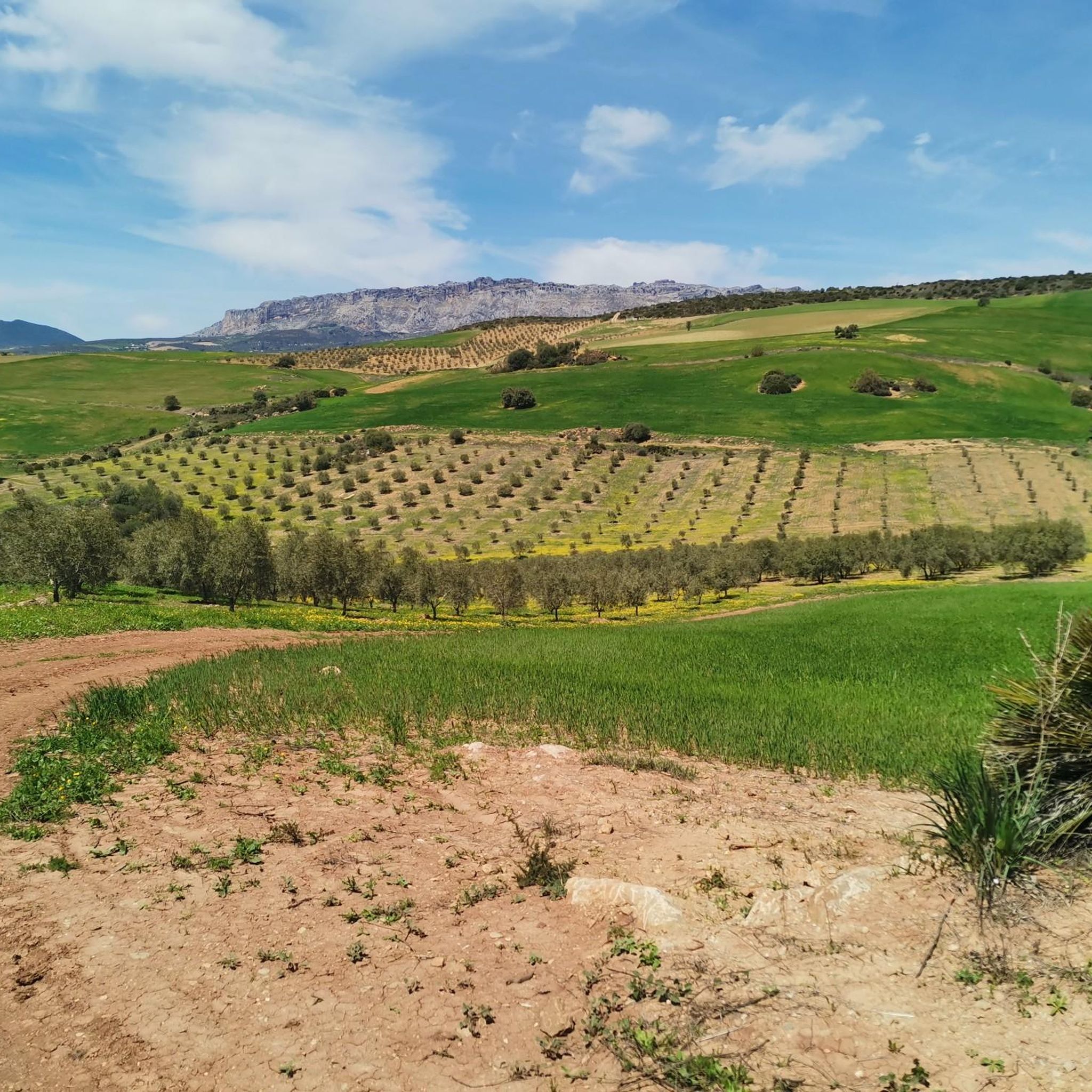
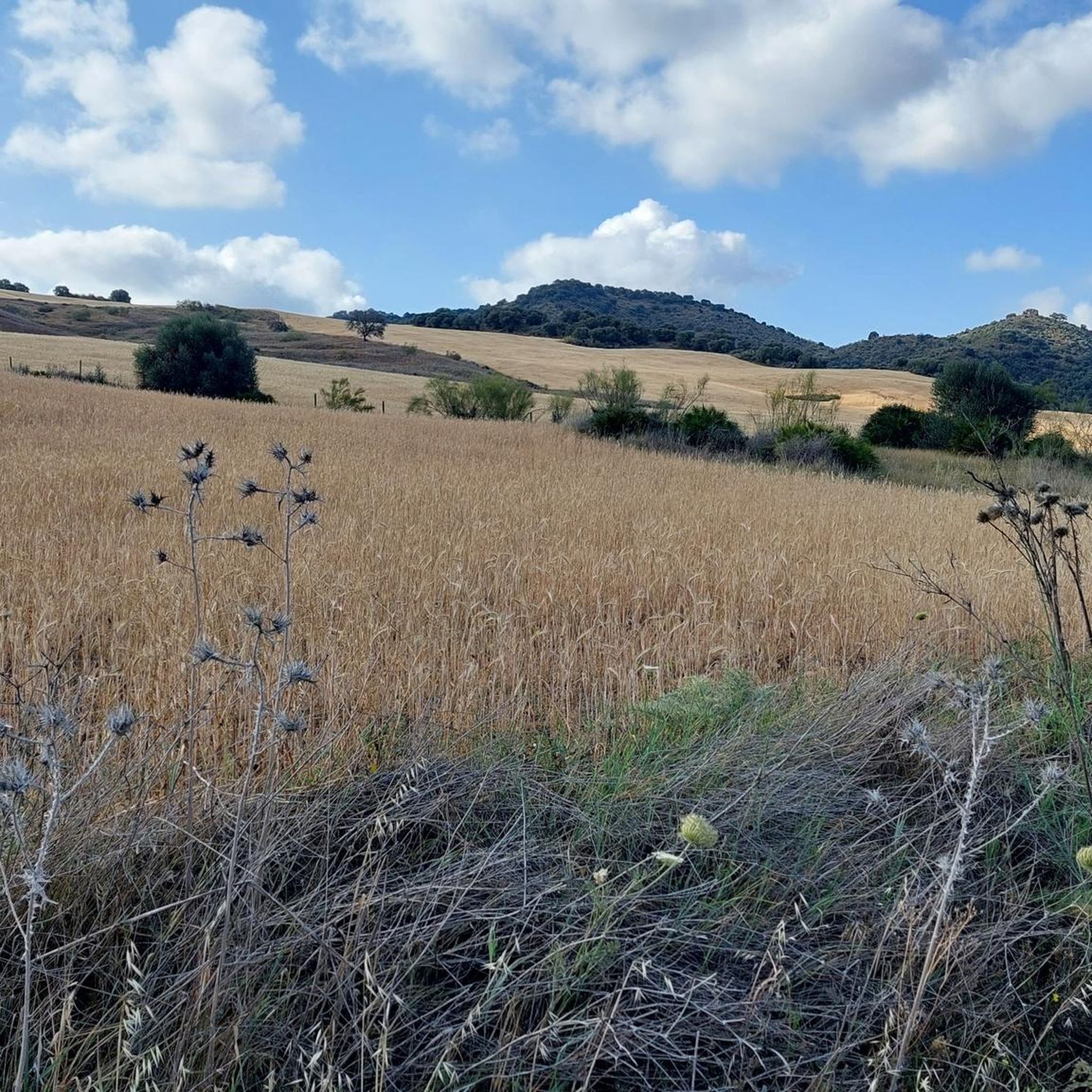
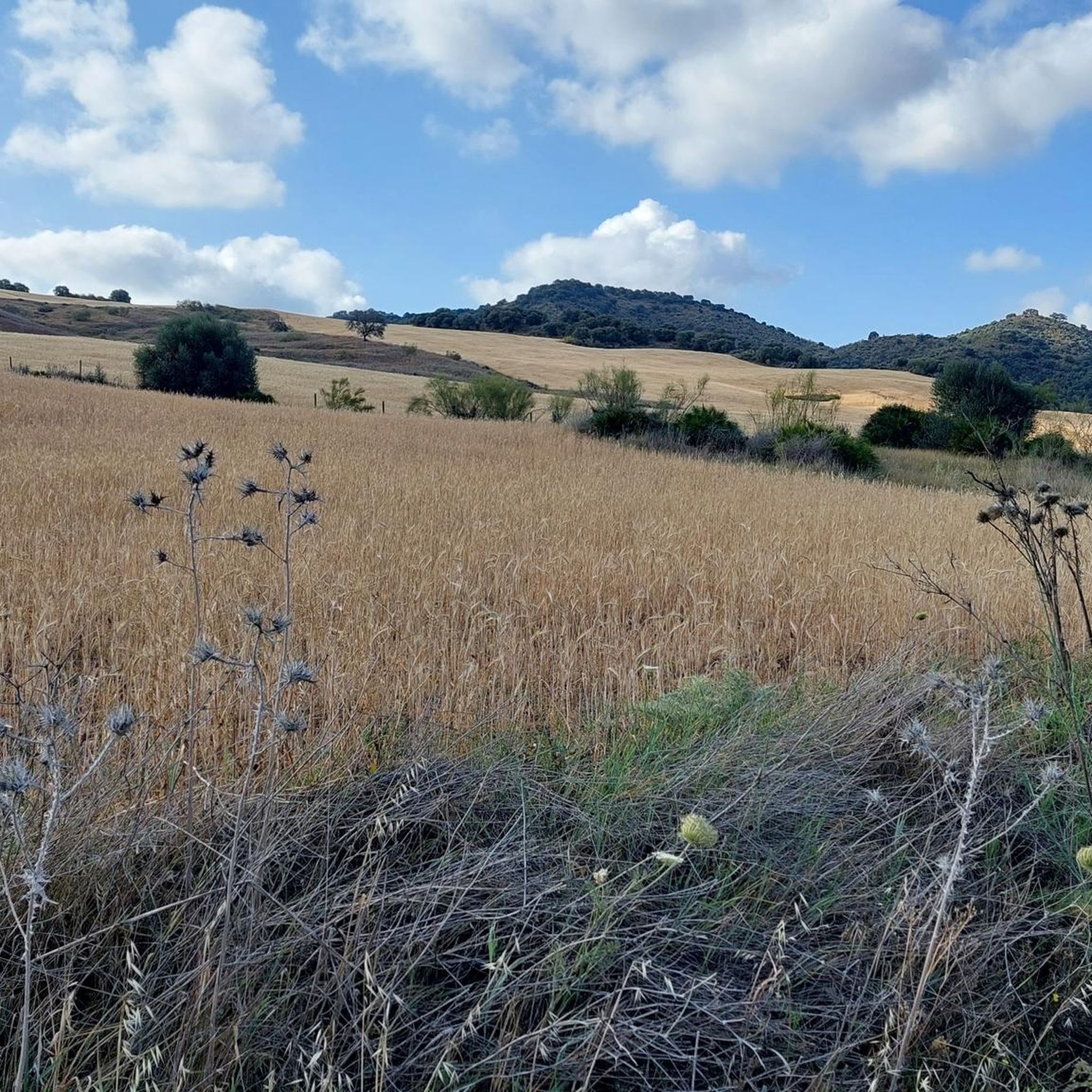
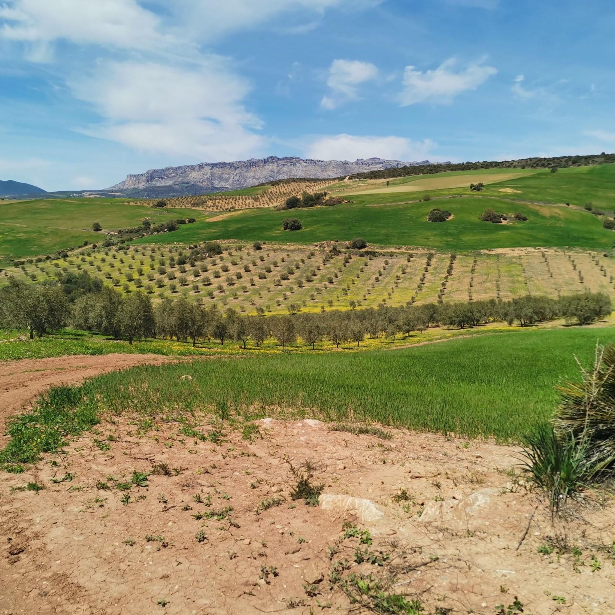
Touring cycling routes around Almogía traverse a diverse landscape characterized by mountainous terrain, extensive olive and almond groves, and significant natural features. The region, nestled in the Guadalhorce Valley, offers continuous climbs and descents, providing wide-open countryside views. Key natural landmarks include the scenic Casasola Reservoir and its dam, as well as proximity to the distinctive limestone formations of El Torcal Natural Park. These routes often feature quiet roads, making them suitable for exploring inland Andalusia.
Best touring cycling routes…
Last updated: August 15, 2026
4.5
(4)
49
riders
Moderate bike ride. Good fitness required. Mostly paved surfaces. Suitable for all skill levels.
4.3
(3)
50
riders
58.2km
04:21
1,330m
1,330m
Hard bike ride. Very good fitness required. Mostly paved surfaces. Suitable for all skill levels.

Sign up for free
5.0
(2)
42
riders
60.5km
03:42
520m
520m
Hard bike ride. Very good fitness required. Mostly paved surfaces. Suitable for all skill levels.
4.0
(1)
13
riders
18.0km
01:43
520m
530m
Hard bike ride. Very good fitness required. Mostly paved surfaces. Suitable for all skill levels.
16
riders
33.1km
03:39
1,160m
1,160m
Hard bike ride. Very good fitness required. Mostly paved surfaces. Suitable for all skill levels.
Get access to more routes and recommendations from other explorers.
Sign up for free
Already have an account?
Our route recommendations are based on thousands of hikes, rides, and runs completed by other people on komoot.
Start today with a free account
Your next adventure awaits.
Login or Signup

Tips from the Community

Restaurant and museum with an incredibly rich and interesting collection of agricultural and household appliances. Housed in a former factory hall and well-attended.
0
0

Impressive views. It must be done by bike but be careful with people walking.
0
0

At the end of the steady climb, where a sign reads El Torcal, you reach the pass, which runs along the western edge of the mountain range of the same name. Just a few kilometers further on, a separate road branches off to the El Torcal de Antequera Natural Park and its visitor center. From here, a sweeping view opens up across the surrounding mountain ranges. The pass lies directly on the main road connecting Antequera and Villanueva de la Concepción, making it a prominent landmark. Many mistake it for the natural park itself, but it actually marks the highest point of the road on the edge of the impressive karst mountains.
1
0
The railway bridge near Cártama Station, also known as the Puente de Hierro, spans the Guadalhorce River and is a defining structure of the area. It was built between 1927 and 1931 to ensure a rail connection between Cártama Station and the town center. The iron structure is a prime example of early 20th-century engineering and remains part of the regional railway infrastructure. Over the years, the bridge has undergone several maintenance and modernization projects. A comprehensive restoration was carried out in 2001, followed by the installation of architectural lighting in 2006, which further emphasizes its significance as a technical structure and local landmark. The bridge continues to be used today, vividly connecting transportation history with the landscape of the Guadalhorce Valley.
1
0
The Puerto de El Torcal is the highest point on the road that leads from Villanueva de la Concepción up to Antequera (Carretera de Málaga a Antequera por Villanueva de la Concepción). At the end of the steady climb, where a sign reading El Torcal stands, you reach the pass, which runs along the western edge of the mountain range of the same name. Just a few kilometers further, a separate road branches off to the El Torcal de Antequera Natural Park and its visitor center. From here, a sweeping view of the surrounding mountain ranges opens up. The pass is located directly on the main road between Antequera and Villanueva de la Concepción and is therefore a prominent feature in the landscape. Many mistake it for the natural park itself, but it actually marks the highest point of the road at the edge of the impressive karst mountain range.
1
0
A little refreshment on warm days and an ideal opportunity to refill your water bottles on your bike ride – especially practical and welcome after a climb!
0
0
The Puente del Horcajo in Villanueva de la Concepción is a historic 18th-century stone bridge that formed part of the Royal Road of Carlos III. It was built between 1787 and 1789 to carry traffic over the Horcajo stream gorge and provide a safe connection between Antequera and the newly established settlements at the foot of the Torcal de Antequera. Its construction was part of the major infrastructure project of King Charles III, who aimed to modernize the roads of Andalusia and promote trade between Madrid and the southern Spanish ports. The bridge was built under the direction of the engineer Carlos Lemaur, one of the most important master builders of the time. It is made of local limestone and features typical late 18th-century construction, with robust rounded arches that blend harmoniously into the landscape. The Puente del Horcajo is a striking example of the engineering prowess and the Enlightenment spirit of the era of Charles III, which combined technology, functionality, and aesthetics. Originally, it served as an important crossing point for traders, travelers, and stagecoaches on the route between Madrid, Córdoba, and Málaga. Today, it is a listed monument and part of the Mozarabic Way of Santiago, which intersects the historic Camino Real at this point. The bridge commemorates a time when Spain began to grow together through modern transport routes and also stands as a silent witness to the history of Villanueva de la Concepción and the Torcal region.
0
0
The Torcal de Antequera Natural Park is an impressive nature reserve, one of the most famous karst landscapes in Europe. The spectacular rock formations were formed around 150 million years ago, when the area was still covered by the sea. Tectonic movements lifted the limestone, and over time, wind, rain, and frost shaped it into the bizarre forms visible today, reminiscent of animals, figures, or towers. The landscape appears almost surreal. In addition to its unique geology, the Torcal is home to a rich flora and fauna. A visit to the Mirador de las Ventanillas and Mirador del Torcal Alto viewpoints is particularly worthwhile, offering magnificent views of the mountains and the vast Andalusian landscape. The Torcal is also a popular destination for cyclists, as the access road to the nature reserve offers a challenging but extremely scenic bike ride. The climb is steep, with numerous curves, but the view of the surrounding hills and the impressive rock massif rewards every effort. The Torcal de Antequera is a fascinating natural experience that offers insights into the earth's geological history while simultaneously providing tranquility, expansiveness, and breathtaking views.
1
0
Frequently Asked Questions
How many touring cycling routes are available in Almogía?
There are over 100 touring cycling routes around Almogía, offering a wide range of options for different skill levels and preferences. The komoot community has highly rated these routes, with an average score of 4.5 stars.
What kind of terrain can I expect on touring cycling routes around Almogía?
Touring cycling routes in Almogía traverse a diverse landscape characterized by mountainous terrain, extensive olive and almond groves, and significant natural features like the Casasola Reservoir. You can expect continuous climbs and descents, providing wide-open countryside views. While many roads are paved, some segments may be unpaved and more challenging.
Are there any easy touring cycling routes for beginners in Almogía?
Yes, Almogía offers a few easier touring cycling routes suitable for beginners. There are 6 routes classified as easy, allowing you to enjoy the scenic landscapes without extreme difficulty. For example, routes around the Guadalhorce Valley often feature less elevation gain.
What are some challenging touring cycling routes for experienced cyclists?
Almogía is well-known for its challenging routes, with 61 classified as difficult. These routes often feature significant elevation gains and longer distances. A notable example is the León Pass – View of Málaga from El Mirador loop from Casabermeja, a 42.2-mile (67.9 km) trail with substantial climbing, offering panoramic views of Málaga.
What natural features or landmarks can I see along the touring cycling routes?
Many routes offer views of the scenic Casasola Reservoir and its dam. You can also explore areas near the distinctive limestone formations of El Torcal de Antequera, such as The Torcal of Antequera or The Cathedrals of El Torcal. The region is also close to the Montes de Málaga Natural Park, offering further natural beauty.
Are there any circular touring cycling routes in the Almogía area?
Yes, many touring cycling routes around Almogía are designed as loops, allowing you to start and end in the same location. An example is the Casasola Reservoir – Almogía Cycling Viewpoint loop from Casabermeja, which takes you through the reservoir area.
When is the best time of year to go touring cycling in Almogía?
The spring and autumn months are generally ideal for touring cycling in Almogía. The weather is milder, making the continuous climbs and descents more enjoyable. Summers can be very hot, while winters are generally mild but can have cooler temperatures at higher elevations.
Where can I find parking for touring cycling routes in Almogía?
Almogía is a cyclist-friendly village, and you can typically find parking within the village itself or at designated starting points for routes. Many routes are accessible from various points around the region, including nearby towns like Casabermeja or Cártama, which also offer parking options.
Can I reach Almogía's cycling routes using public transport?
Almogía is accessible from Málaga, and while public transport options exist, bringing a bicycle on buses can sometimes be restricted or require specific arrangements. It's advisable to check local bus schedules and policies regarding bicycle transport in advance if you plan to use public transport.
What do other cyclists say about touring cycling in Almogía?
The touring cycling routes around Almogía are highly rated by the komoot community, with an average score of 4.5 stars from over 170 reviews. Cyclists often praise the quiet roads, spectacular views of the sierra and olive groves, and the diverse terrain that caters to various fitness levels.
Are there specific viewpoints worth visiting on a touring cycling route?
Absolutely. The region offers numerous viewpoints that reward cyclists with stunning vistas. Highlights include El Pastor, the Repeater viewpoint, and the Boar Viewpoint. The climb to Almogía via the old road by the Casasola Lake also offers particularly enjoyable views.
Are there amenities like cafes or places to refill water along the routes?
Almogía itself is a traditional village with amenities where you can find cafes and places to refuel. The village also provides cyclist-friendly features such as a podium for cyclists and a water source to refill bottles. While some routes pass through other villages, it's always a good idea to carry sufficient water and snacks, especially on longer or more remote sections.
Most popular attractions around Almogía

Get inspired with the komoot mobile app


Explore more
Browse the best Cycling routes in other regions.
