The best walks and hikes around La Hiruela
4.6
(146)
1,035
hikers
12
hikes
Hiking around La Hiruela offers exploration within the Sierra del Rincón Biosphere Reserve, characterized by diverse natural environments. The region features ancient oak forests, birch groves, and mountainous terrain, with the Jarama River and its tributaries shaping the landscape. Hikers will encounter varied topography, from riverine paths to traditional meadows and valleys. This area provides a blend of natural beauty and cultural heritage, making it suitable for various outdoor activities.
Best hiking trails around La Hiruela
- The most popular hiking route is La Hiruela – Molino de La Hiruela loop from La Hiruela, a 7.3 miles (11.8 km) trail that takes 3 hours 24 minutes to complete. This moderate route follows the Jarama River, passing by traditional mills.
- Another top favourite among local hikers is Molino de La Hiruela – La Hiruela loop from La Hiruela, a difficult 10.5 miles (17.0 km) path. This trail features significant elevation gain and offers expansive views of the surrounding mountains.
- Local hikers also love the Pico Porrejón – La Hiruela loop from La Hiruela, a 7.1 miles (11.5 km) trail leading through varied terrain with notable elevation changes, often completed in about 4 hours 36 minutes.
- Hiking around La Hiruela is defined by diverse forests, the Jarama River basin, and mountainous terrain within a protected biosphere. The network offers options for different ability levels, from easy strolls to more challenging treks.
- The routes in La Hiruela are highly rated by the komoot community with an average score of 4.6 stars from over 100 reviews. More than 1000 hikers have used komoot to explore La Hiruela's varied terrain.
Last updated: July 1, 2026
4.8
(9)
72
hikers
11.8km
03:24
250m
250m
Moderate hike. Good fitness required. Mostly accessible paths. Sure-footedness required.
5.0
(4)
39
hikers
17.0km
05:01
470m
470m
Hard hike. Very good fitness required. Mostly accessible paths. Sure-footedness required.

Sign up for free
4
hikers
11.5km
04:36
600m
600m
Moderate hike. Good fitness required. Mostly accessible paths. Sure-footedness required.
2.5
(2)
7
hikers
9.11km
03:14
390m
390m
Moderate hike. Good fitness required. Mostly accessible paths. Sure-footedness required.
8
hikers
5.16km
01:30
130m
130m
Moderate hike. Great for any fitness level. Mostly accessible paths. Sure-footedness required.
Get access to more routes and recommendations from other explorers.
Sign up for free
Already have an account?
Our route recommendations are based on thousands of hikes, rides, and runs completed by other people on komoot.
Start today with a free account
Your next adventure awaits.
Login or Signup



Tips from the Community

Recreational area on the banks of the Jarama River and the old Hiruela Mill.
0
0
Charcoal is no longer used, but this facility is a typical place where this product was generated.
0
0
Countless ancient Pyrenean oak trees make this forest an enchanting place. You can take hundreds of photos.
0
0

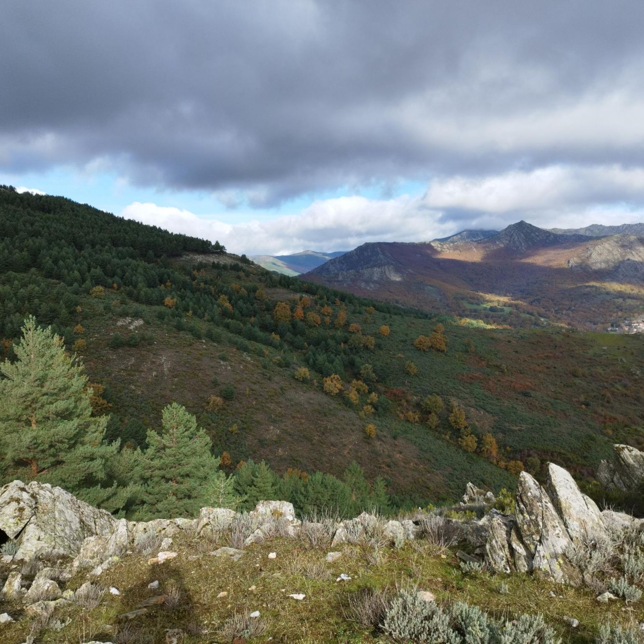
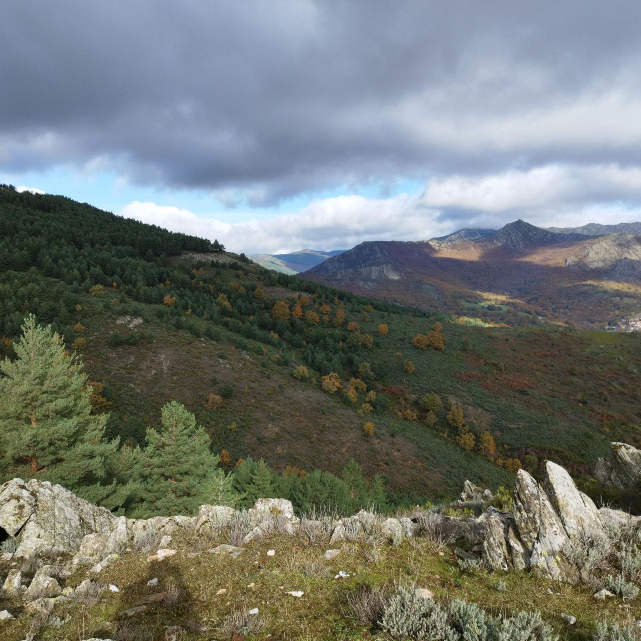
This point on the ridge is a privileged spot for taking in the views. The green vegetation contrasts with the sharp slate slabs.
0
0
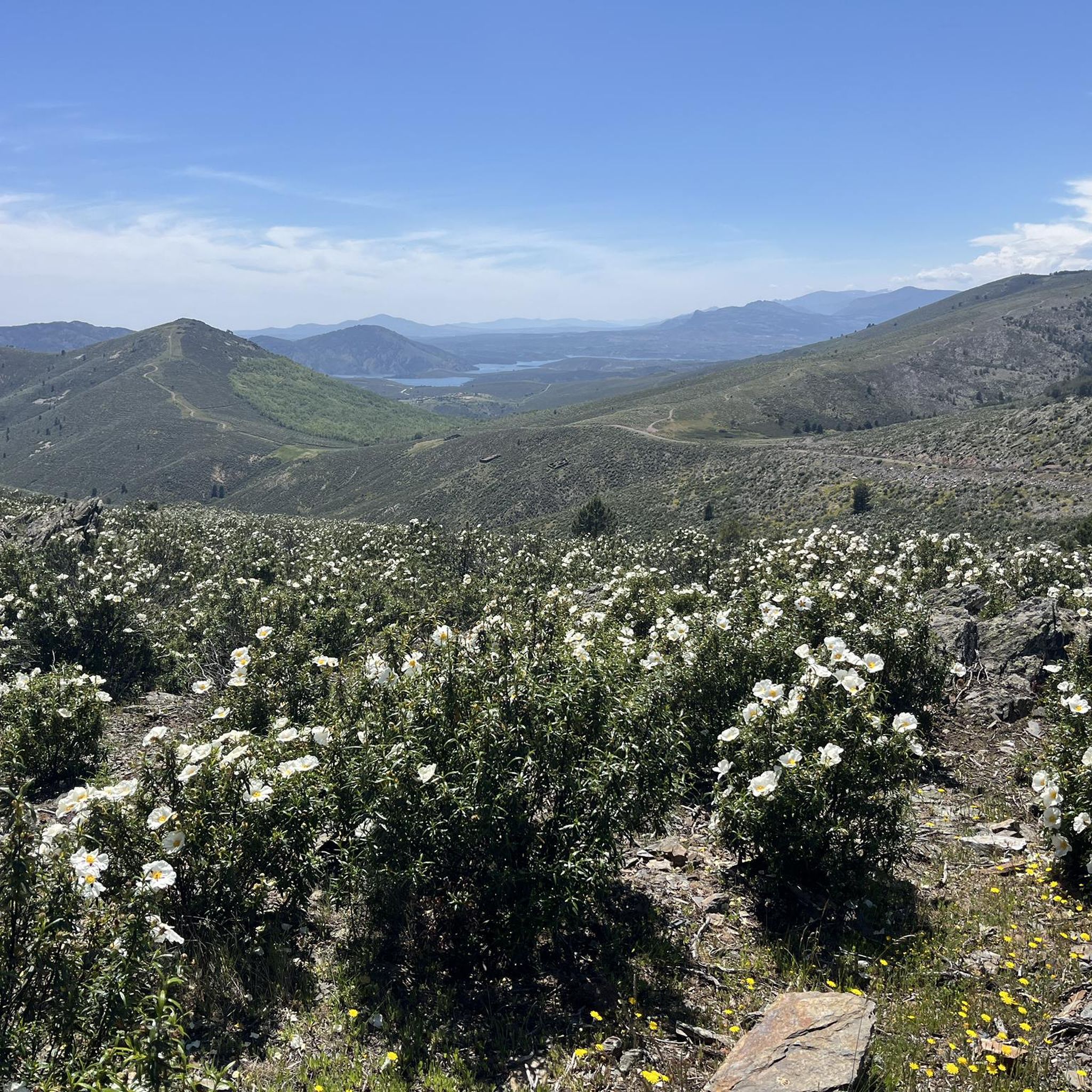
The landscape of the El Cardoso Pass is very typical of the Central Mountain System. Its pass separates the oak forest that thrives on one side and the pine trees that spread across the other. It also has extensive alpine meadows from which the rest of the mountain range can be seen.
0
0

This port serves as an ideal baptism for those who begin to climb ports: easy, without traffic and with charm. But it also serves as an aperitif before other ports such as La Hiruela or La Puebla, with which you can easily connect to do much harder routes. Although it only reaches 1,358 meters, it is a natural border of very different landscapes, with oak trees on one side and pine trees on the other, and a fantastic gateway to the cycling paradise that exists on the Madrid-Guadalajara border. It serves as an indication that it is the necessary previous step to reach the famous Hayedo de Montejo. El Puerto del Cardoso via El Cardoso de la Sierra is a climb in the Castilla-La Mancha region. It has a length of 10.2 kilometers and a climb of 277 vertical meters with a slope of 2.7% on average, which implies a difficulty level of 134. The top of the climb is located at 1353 meters
0
0

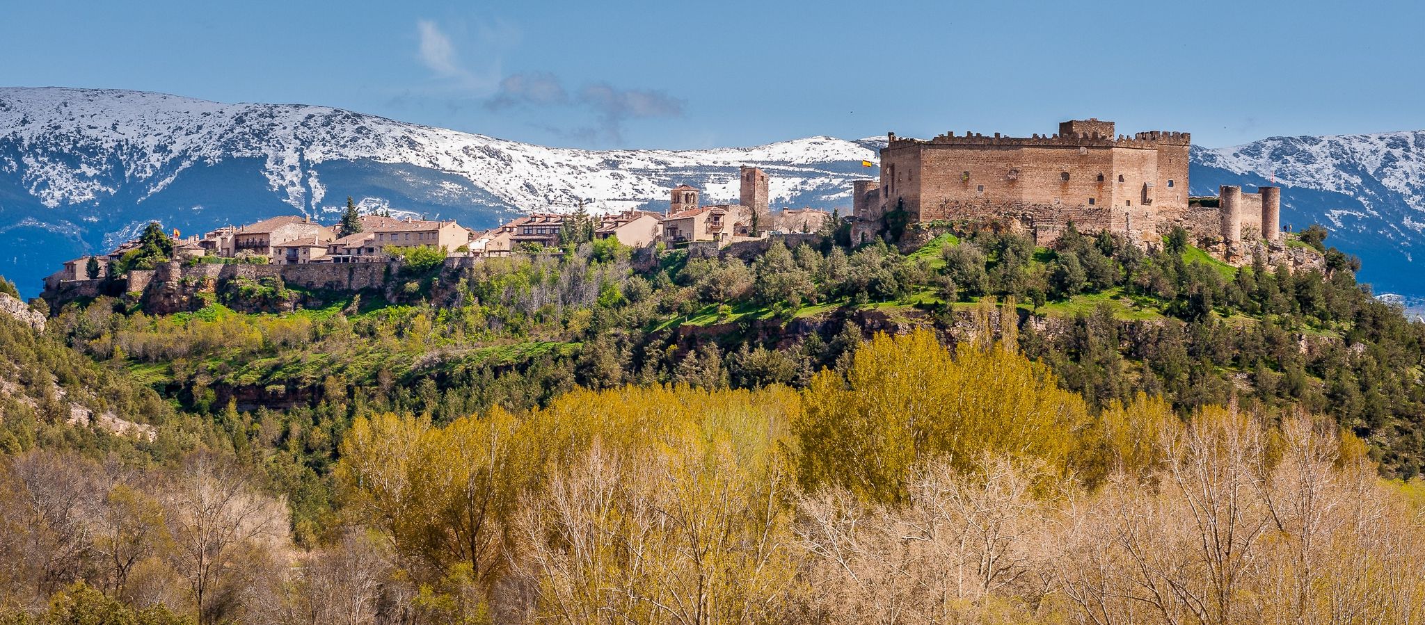
On the way is the traditional apiary of the population surrounded by a stone wall to prevent the entry of animals. The use of clay, wood, quartzite, slate and other materials from the terrain produces a mimetic architecture, fully integrated into the environment to the point of going unnoticed because it is part of the rural landscape. The most characteristic auxiliary constructions of black architecture are the sheds, the farrowing pens and the fences, in most cases they serve to control the cattle and defend the mowing pastures, the apiaries and the fruit crops, but they also serve to delimit the traditional paths and the old roads that the inhabitants of the towns of the mountain valleys have used for centuries to communicate. The herrenes or fenced plots between the oak meadows are built using walls of rough slate blocks, alternating with large slate slabs or raft boats, finishing off the fence with other horizontal slabs or covering boats, giving the construction a primitive and megalithic appearance. . The hives are made of hollow oak trunks, covered with slate slabs and sealed with tin sheets and adobe. On the way to the town you can also see the reproduction of a traditional coal cellar, a reminder of the old lifestyles and trades of other times. On one side of the building there is an interpretive panel of the charcoal burner's trade.
0
0
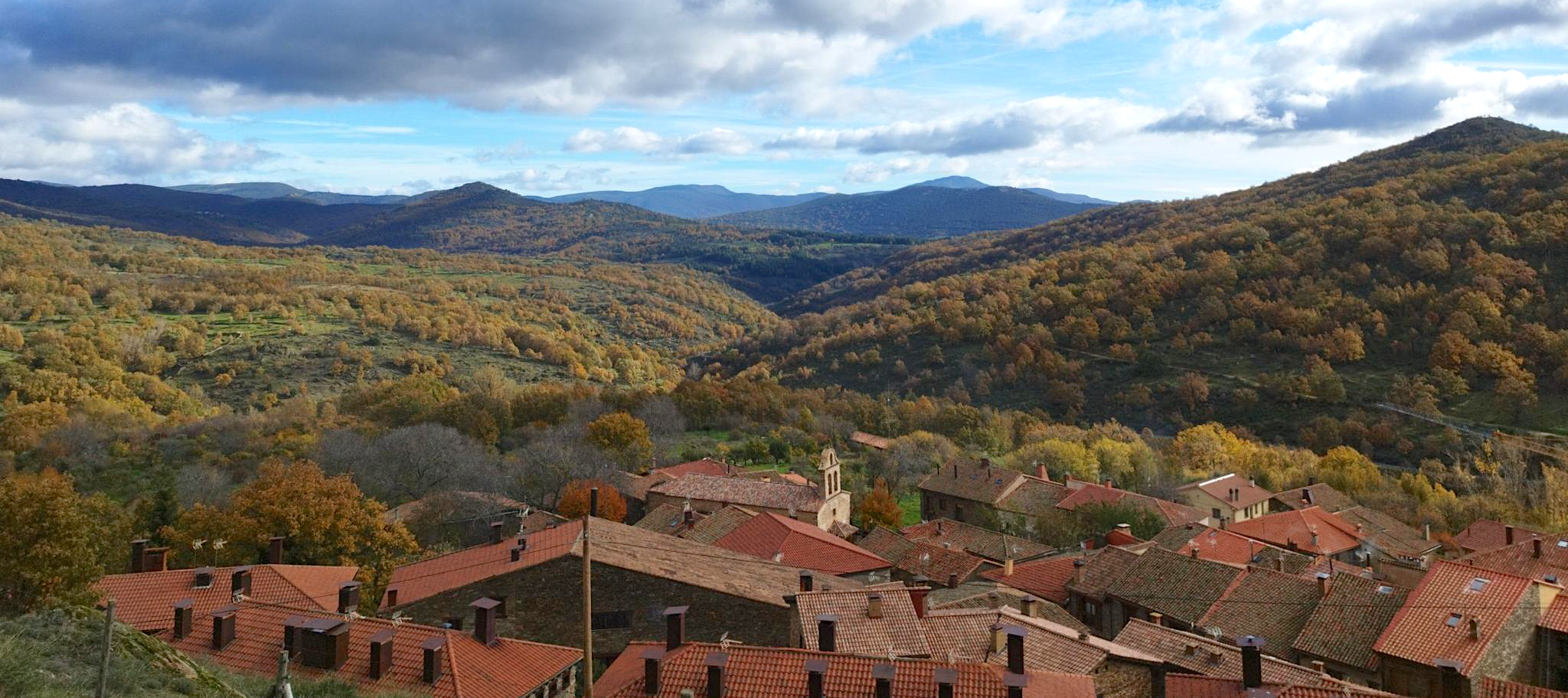
La Hiruela is a mountain town that suffered a dramatic population abandonment in the first decades of the 20th century. The isolation and remoteness of the main communication routes, together with the scarcity of resources in a thankless mountain range, caused a constant emigration of the population towards the big cities to leave a territory where rural life was difficult. The region of the black towns of Madrid and Guadalajara was known as the “sierra pobre”, in comparison with the “sierra rica” of upper Lozoya and the upper basin of the Manzanares and Guadarrama rivers. The rise of active tourism and recreational activities in the environment have caused a resurgence of a new lifestyle dedicated to active leisure and rural tourism products. Crafts, gastronomy, ethnography, hiking, mountain biking, landscape interpretation or nature photography, among many other things, make up an interesting range of attractions that inevitably seduce travelers who visit La Hiruela and the rest of the towns and natural landscapes of Sierra del Rincón, declared a Biosphere Reserve in 2005 by UNESCO.
1
0
Frequently Asked Questions
How many hiking trails are available in La Hiruela?
La Hiruela offers a selection of 12 hiking trails, catering to various preferences and fitness levels. You'll find options ranging from easy strolls to more challenging treks through the Sierra del Rincón Biosphere Reserve.
What kind of terrain and difficulty can I expect on hikes around La Hiruela?
The trails around La Hiruela feature diverse terrain, from riverine paths along the Jarama River to mountainous sections with notable elevation changes. You can find 1 easy route, 10 moderate routes, and 1 difficult route, ensuring there's something for every hiker. For a challenging experience with expansive views, consider the Molino de La Hiruela – La Hiruela loop from La Hiruela.
Are there any family-friendly hiking options in La Hiruela?
Yes, La Hiruela offers routes suitable for families. The area's diverse forests and traditional landscapes provide engaging environments for younger hikers. While specific 'easy' routes are available, many moderate trails can also be enjoyed by families looking for a pleasant outing. The La Hiruela loop from La Hiruela is a moderate option that is shorter in distance.
Can I bring my dog on the hiking trails in La Hiruela?
La Hiruela is generally dog-friendly, with many trails passing through natural landscapes like forests and meadows. It's always recommended to keep your dog on a leash, especially in protected areas like the Sierra del Rincón Biosphere Reserve, to protect local wildlife and ensure a pleasant experience for all hikers.
What natural features or landmarks can I see along the hiking trails?
Hiking in La Hiruela allows you to discover a rich natural environment. You can explore ancient oak forests, birch groves, and the scenic Jarama River. Notable natural attractions include the beautiful Chorrera de los Litueros Waterfall and the Aljibe Waterfall. For panoramic views, consider routes that pass by Pico Porrejón or the Vultures' Viewpoint.
Are there any circular walks available in La Hiruela?
Yes, many of the trails in La Hiruela are designed as circular routes, allowing you to start and end in the same location. For example, the La Hiruela – Molino de La Hiruela loop from La Hiruela is a popular circular path that follows the Jarama River and passes traditional mills.
What is the best time of year to go hiking in La Hiruela?
La Hiruela offers distinct beauty throughout the year. Spring brings lush greenery and wildflowers, while autumn is particularly stunning with vibrant colors in the diverse forests, including the nearby Hayedo de Montejo (beech forest). Summer is pleasant, especially along river routes, and winter can offer serene, snow-dusted landscapes, though some higher trails might require appropriate gear.
Is there parking available for hikers in La Hiruela?
Yes, La Hiruela, as a popular hiking destination, provides parking facilities for visitors. It's advisable to arrive early, especially during peak seasons or weekends, to secure a spot, as the village can get busy.
What do other hikers enjoy most about hiking in La Hiruela?
The area is highly rated by the komoot community, with an average score of 4.6 stars from over 100 reviews. Hikers often praise the well-preserved natural environment, the diversity of forests, the historical elements like old mills and traditional apiaries, and the varied terrain that offers both gentle river walks and more challenging mountain ascents.
Are there any historical or cultural points of interest along the trails?
Absolutely. Many trails in La Hiruela incorporate elements of the area's rich history and traditional rural life. You can find routes that lead past old flour mills, some of which have been restored, and traditional apiaries. The village itself is well-preserved, with traditional architecture and a 17th-century Baroque church, offering a glimpse into the region's heritage.
Are there any waterfalls to see in La Hiruela?
Yes, La Hiruela is home to several beautiful waterfalls. You can visit the Chorrera de los Litueros Waterfall, the Aljibe Waterfall, and the Cañamar Waterfall, all of which are accessible via hiking routes and offer picturesque natural sights.
What kind of forests can I expect to hike through in La Hiruela?
La Hiruela is known for its diverse and lush forests. You'll hike through ancient oak forests, vibrant birch groves, and areas with holly and yew trees. The region's vegetation changes with elevation, offering a variety of woodland experiences, especially beautiful during autumn.
Most popular attractions around La Hiruela

Get inspired with the komoot mobile app


Explore more
Browse the best Hikes in other regions.
